El Niño danger could create 'perfect storm' of coastal flooding in Canada

The powerful El Niño is raising ocean levels, and when combined with the seasonal king tides, it could create a perfect storm for coastal flooding in parts of Canada
Most Canadians associate El Niño with milder winter temperatures.
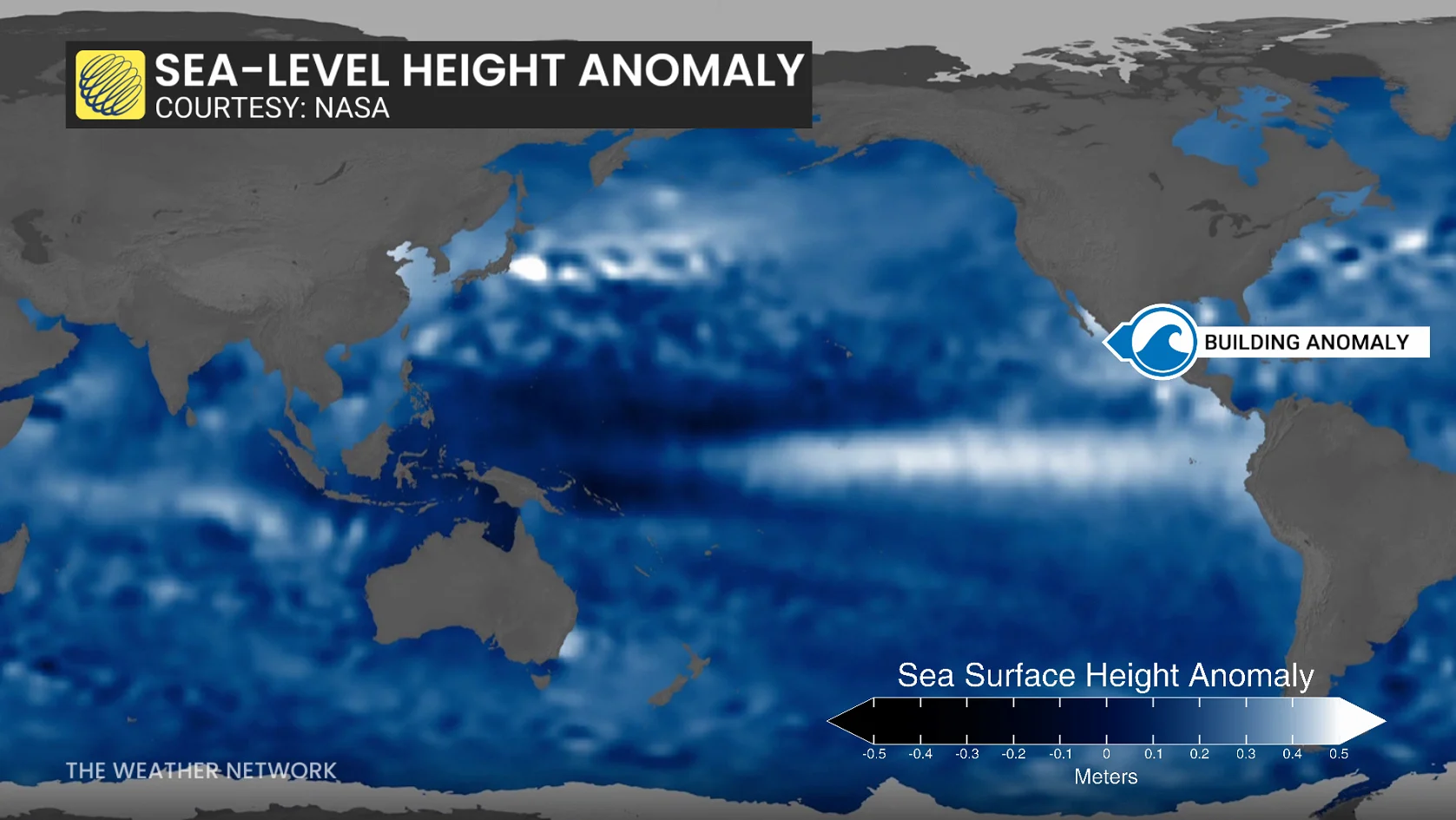
But this year’s exceptionally strong event may have another impact along the Pacific Ocean: Temporarily elevated ocean levels.
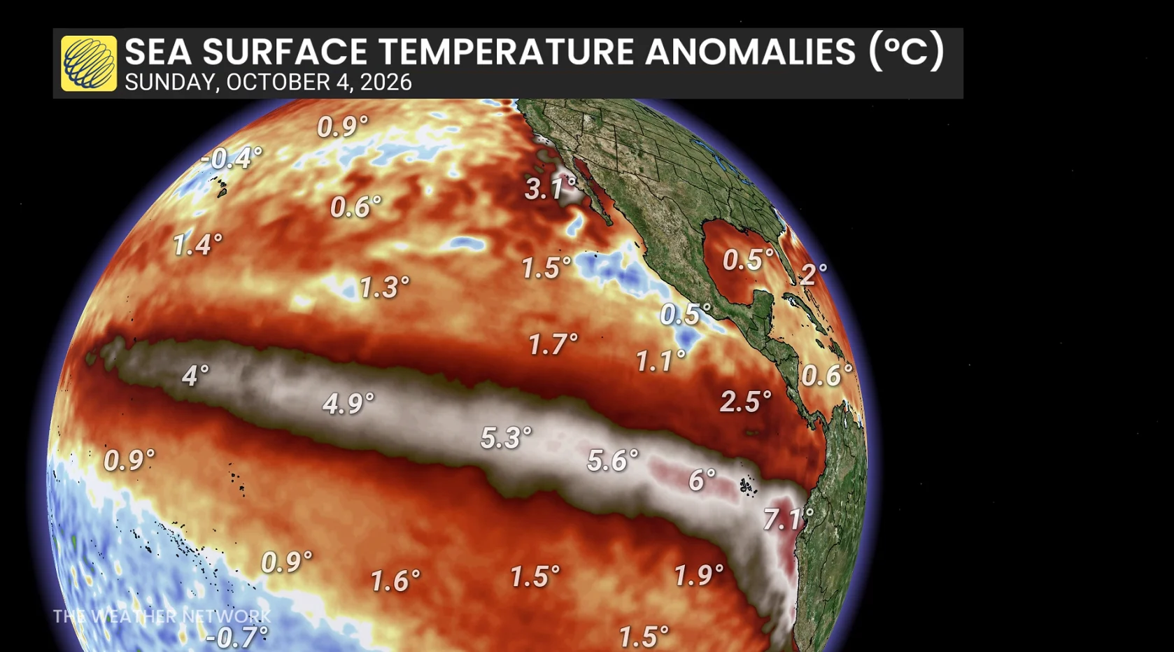
A massive pulse of unusually warm water, known as a planetary-scale Kelvin wave, has been propagating eastward from the equator.
Once that energy reaches the Americas, some of the energy will be directed northward along the coast from California, eventually reaching the coastal waters of British Columbia.
For B.C., the hazard isn’t massive by itself: The risk is maximized because the peak rise is forecast during the traditionally stormiest months of the year.
How much could sea levels rise in B.C.?
The sea level rise gradually weakens as you head north from the tropical eastern Pacific, so we can’t take the forecast of a 15-30 cm sea level rise from California and directly apply it to B.C.
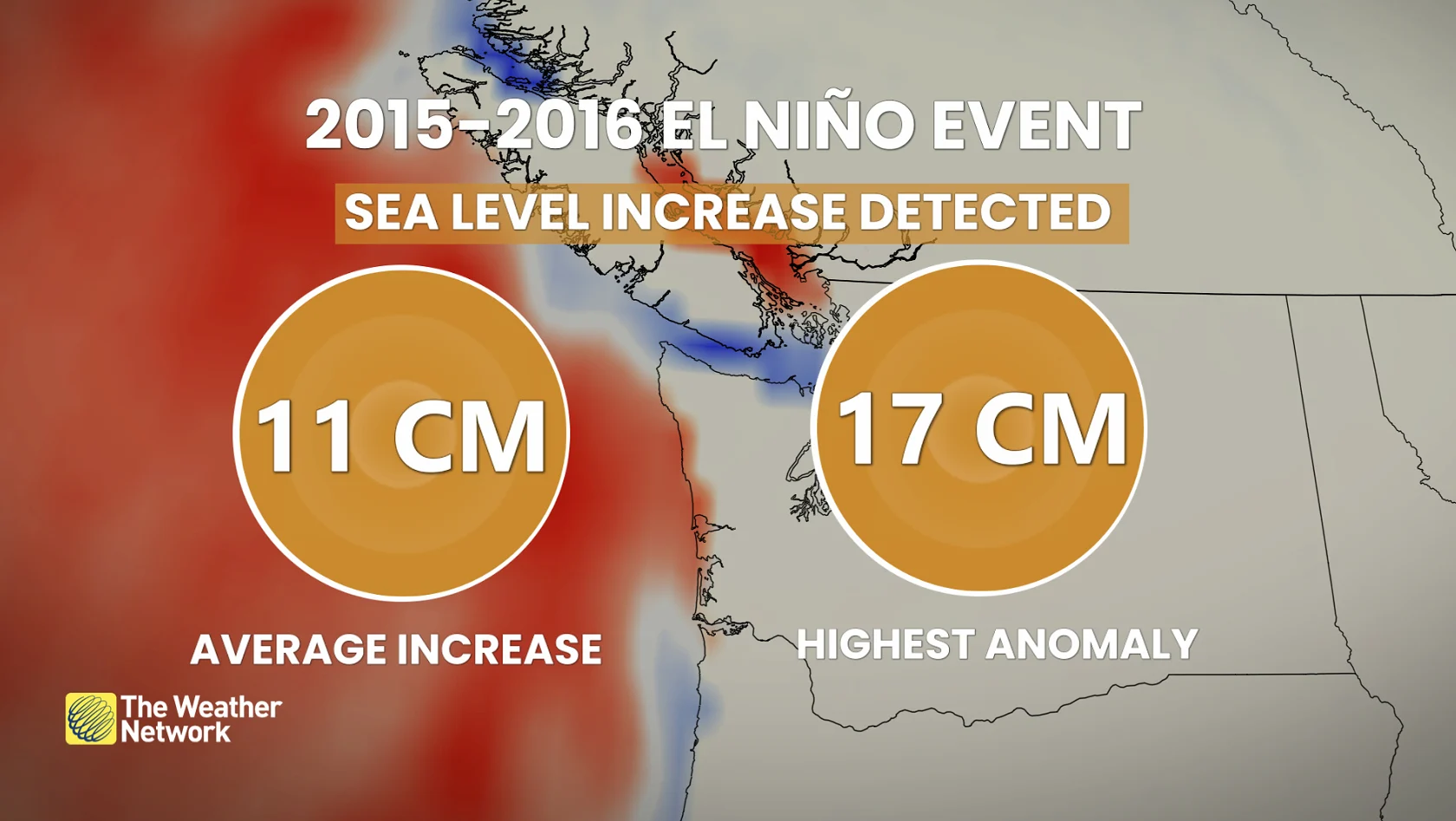
But, we have the 2015-16 strong El Niño event as a benchmark. Scientists observed significant, positive sea level anomalies along western Vancouver Island. The Fisheries and Oceans Canada-led study highlighted significant sea-level anomalies during the 2014-16 warm blob and Niño episode in the Tofino, B.C., area.
Some of the peak sea level rise observed during this event averaged 11 cm along the U.S. west coast, with a maximum of 17 cm recorded along the Oregon coast.
Your intuition is probably right. Warm water readily expands, with these impacts magnified along coastal sections.
A benchmark of a 10- to 20-cm increase in sea level rise can be expected this season for the South Coast, with even larger, local anomalies possible.
And, normally this isn’t a problem--that is, until a storm arrives.
Hazard stacking
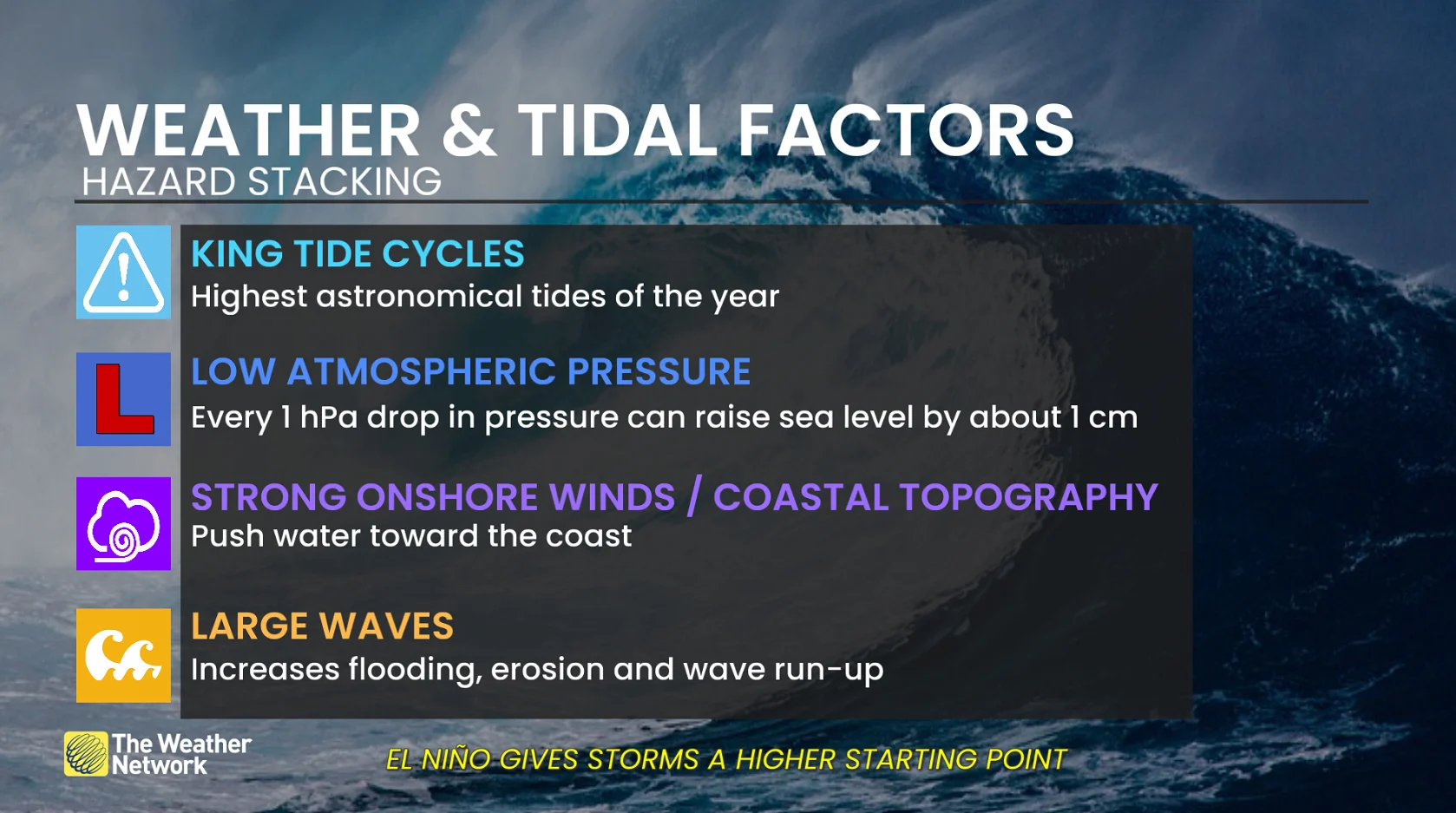
You can think of the El Niño-driven, sea-level increase as an elevated, background layer increasing the foundation for every coastal storm this winter. It lowers the threshold to achieve flooding and coastal erosion impacts.
WATCH: El Niño and king tides: A perfect storm for coastal B.C.?
Weather and tidal factors
Low, atmospheric pressure equals storm surge
Strong, onshore winds
Large waves
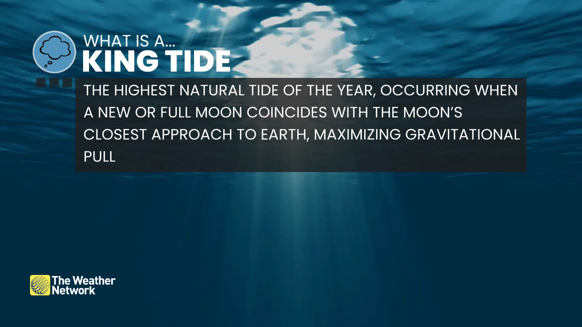
King tides
The B.C. coast has generally avoided the strongest of storms during king tidal events in recent years, but this year poses an enhanced risk.
At Point Atkinson, one of the most notable, historical events occurred during the strong 1982-83 El Niño.
On Dec. 16, 1982, water levels reached 5.61 metres:
4.71-metre astronomical tide
0.9-metre storm surge
That remained the station record for decades.
The current Point Atkinson record is slightly higher, at 5.7 metres, set on Dec. 27, 2022. This event occurred during a weak La Niña, with the station pressure falling to an exceptionally low 975 hPa. It’s a reminder that when low pressure and storm surge line up with high tide, extreme water levels can occur.
At Victoria Harbour, the record-high water level is 3.71 metres, set on Jan. 2, 2003 during a moderate El Niño:
3.14-metre astronomical tide
0.57-metre storm surge
Since king tides are entirely predictable, here are the highest risk windows to mark on your calendar:
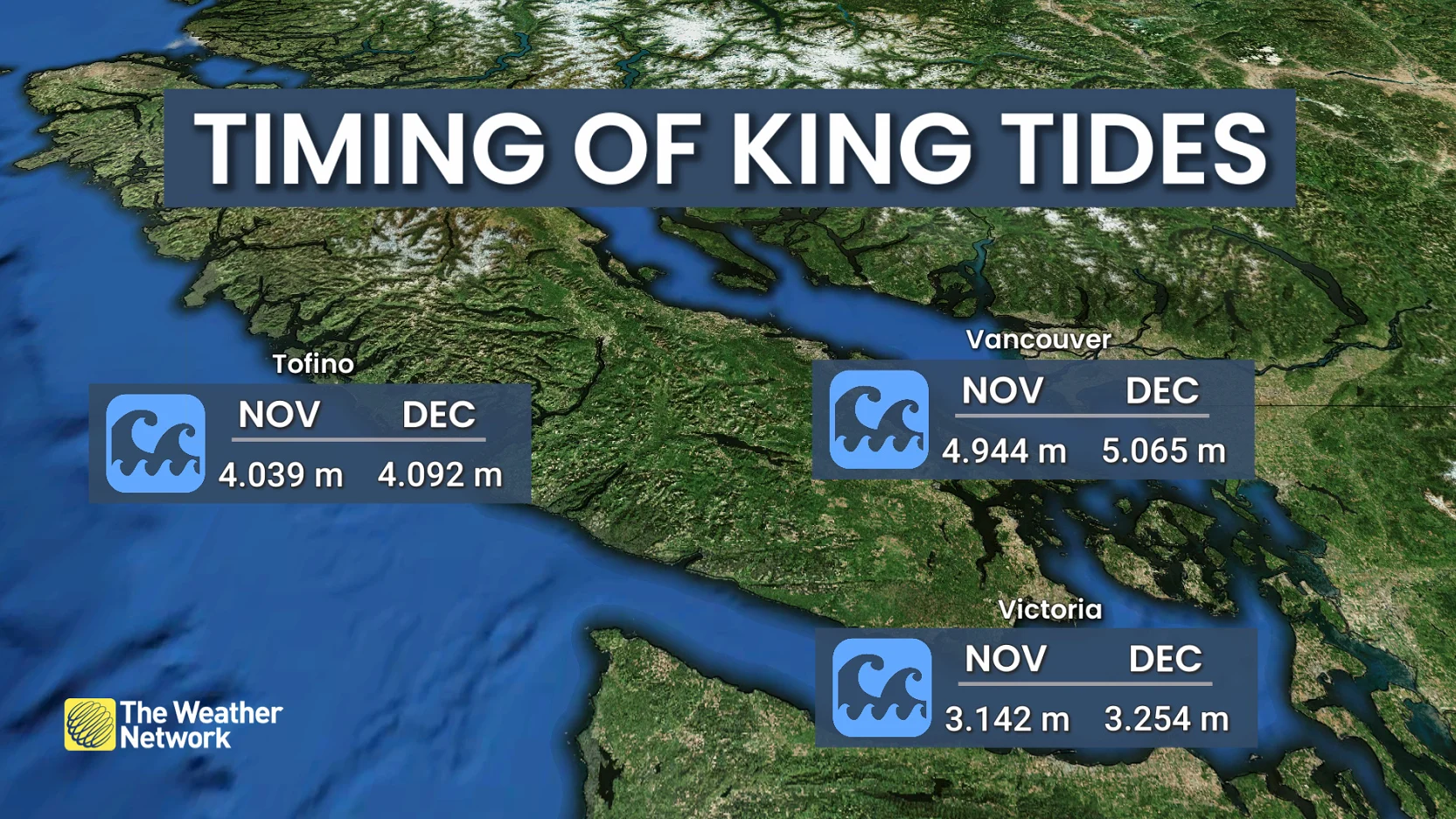
Late-November peak
Nov. 23-29
Late-December peak
Dec. 22-29
Where is coastal B.C. most vulnerable?
The local shape of the coastline, the exact track of an area of low pressure, and the direction of the winds, swell and timing of the tidal cycle will matter enormously for local impacts.
Boundary Bay or any Fraser River delta community becomes especially susceptible to sea level increase.
Regions along southern Vancouver Island, the Strait of Georgia, and exposed west-coast Vancouver Island locations are also at higher risk
The risk ahead
It’s likely that the worst-case scenario doesn’t materialize this year, and B.C’s existing coastal water-level records remain intact.
But if a powerful Pacific storm arrives during a wrong time, on top of a king tide and an El Niño-elevated ocean, it suddenly matters a lot.
Meteorologists will be carefully watching the hazard stacking this storm season, as records are rarely broken by a single ingredient.