What is a 'planetary-scale Kelvin wave', and why is California worried?

Ocean levels along the west coast could rise anywhere from six inches to as much as a foot in the months to come, increasing the risks of flooding and coastal erosion.
An immense wave of warm water will soon reach the west coast of North America, and California has already proclaimed a state of emergency ahead of its arrival. So, what is this 'planetary-scale Kelvin wave' that's making news headlines at the moment?
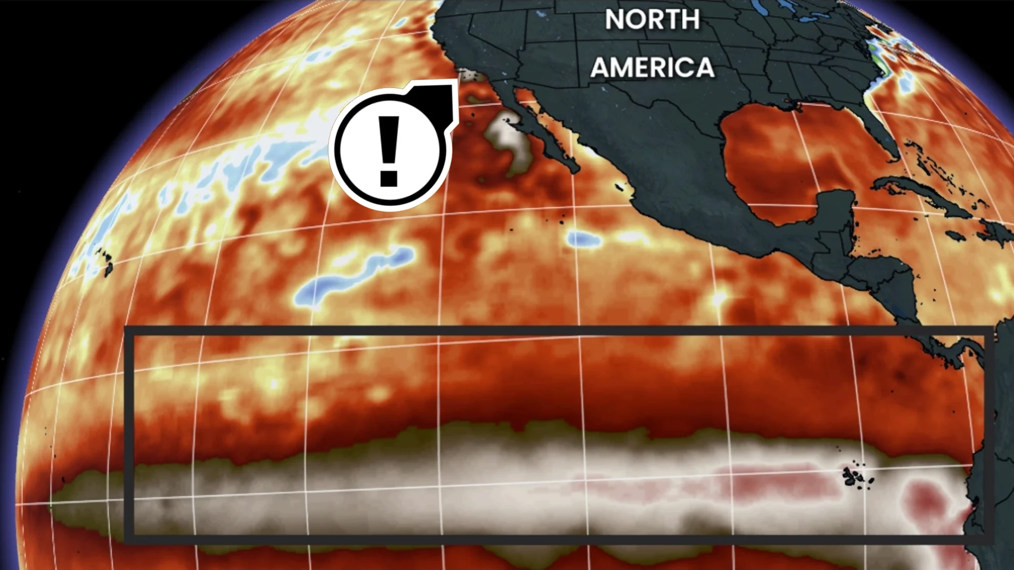
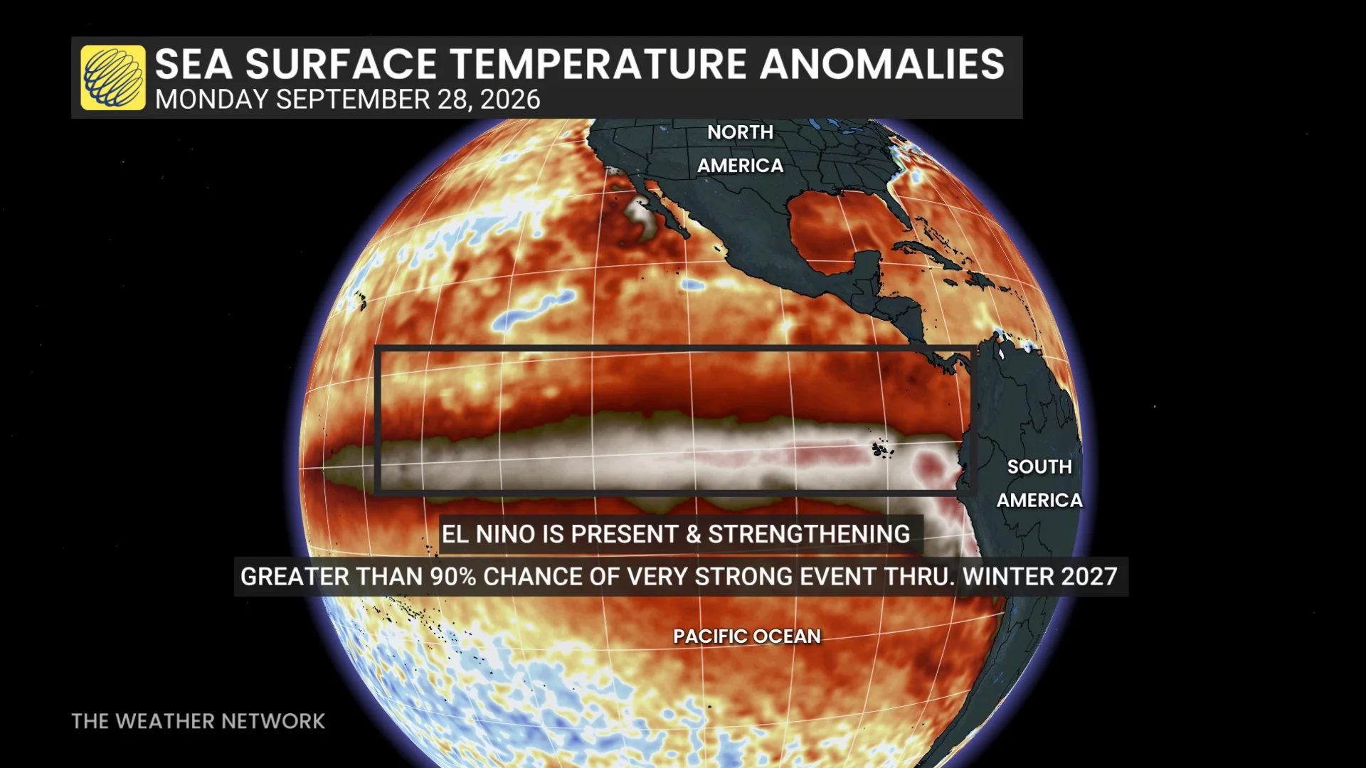
Right now, in the equatorial Pacific Ocean, we are seeing a record-breaking El Niño event. Already, even before it reaches its peak in the months to come, it has surpassed the events seen in 2023-2024 and 2018-2019. It is also strengthening faster than the super El Niño that occurred in 2015-2016, and could end up being the strongest one on record so far.
When we have normal conditions across the equatorial Pacific — so neither El Niño nor its opposite, La Niña — strong winds blow from east to west above the sea surface. This consistent flow of air pushes on the water, causing it to 'pile up' in the west, resulting in a blob of warm water around the Philippines, Indonesia, and northeastern Australia. Meanwhile, in the eastern Pacific, cooler waters well up from the deeper ocean along the northwestern coast of South America.
During an El Niño year, that strong, consistent wind flow breaks up into a bunch of smaller convective cells. Without the persistent push towards the west, the warm blob of water sloshes back towards the east.
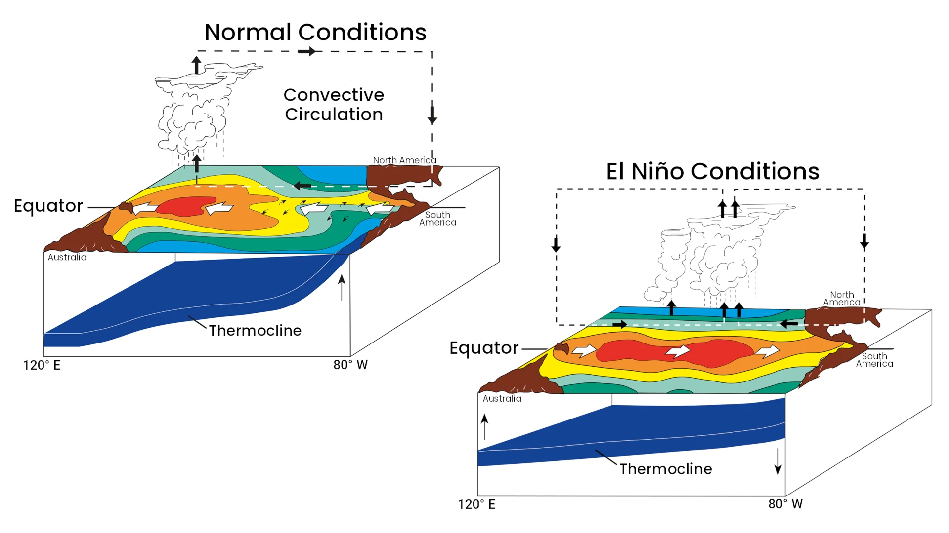
Normal conditions in the Pacific vs El Niño conditions. (NOAA)
As that water sloshes back, it shows up in ocean plots as a massive warm wave, thousands of kilometres wide, slowly traversing the ocean from west to east along the equator.
This is the planetary-scale Kelvin wave that is making headlines at the moment.
It is called 'planetary-scale' simply due to its immense size, and this type of wave was first discovered by the British mathematician, physicist, and engineer, Lord Kelvin.
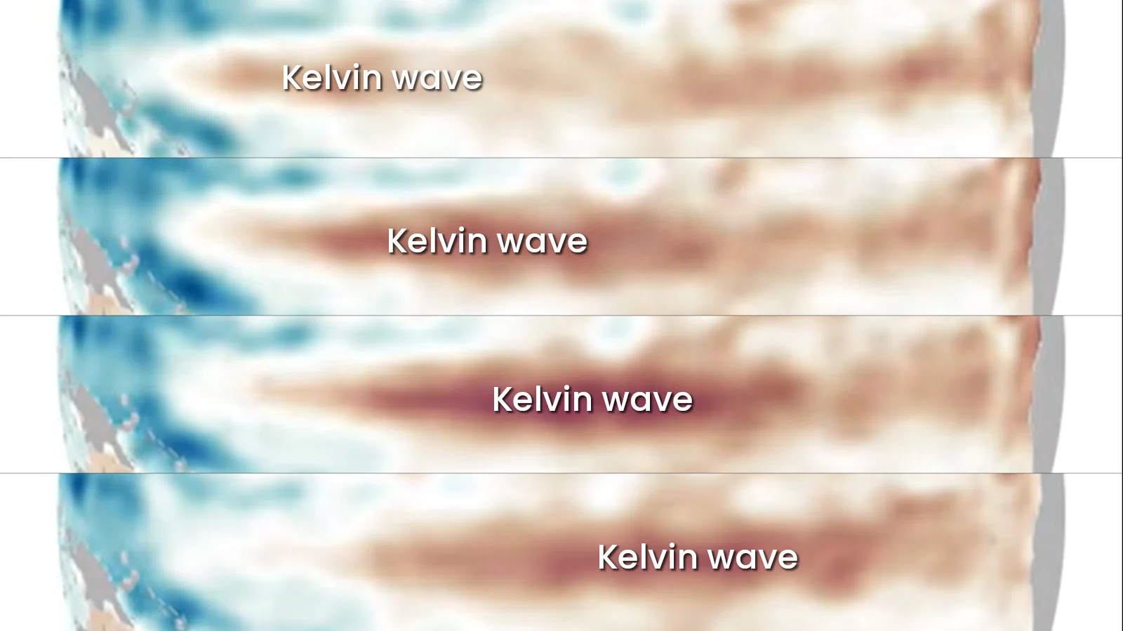
The motion of an equatorial Kelvin wave during the development of an El Niño pattern in the Pacific Ocean. (NASA)
Why the concern?
These planetary-scale Kelvin waves are completely normal and natural. We see them every time we have a developing El Niño.
With the speed at which conditions are intensifying this year, this particular Kelvin wave could be larger than ones we've seen in the past, and it might even be crossing the ocean faster than previous ones that have occurred. However, these aren't the factors that have been raising concerns.
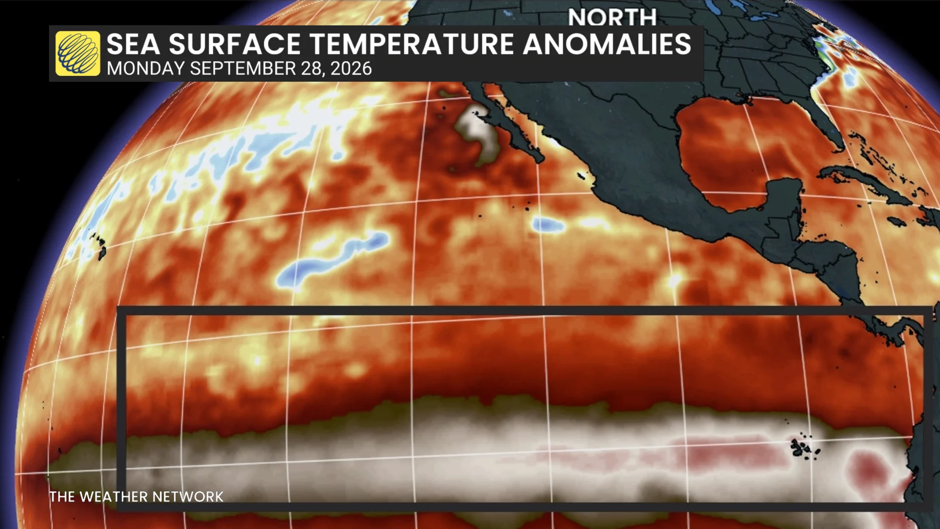
The issue with this wave is the temperature of the ocean water contained within, and because warm water takes up more space than cooler water, the increased sea surface height that comes with it.
As with the temperature increase, most of the surge in sea level rise from this wave is around the equator. However, when an equatorial Kelvin wave reaches the west coast of South America, it gets deflected by the continental shelf.
While some of the wave bounces back along the equator, the rest spreads out to the south and north, along the west coasts of South America and North America.
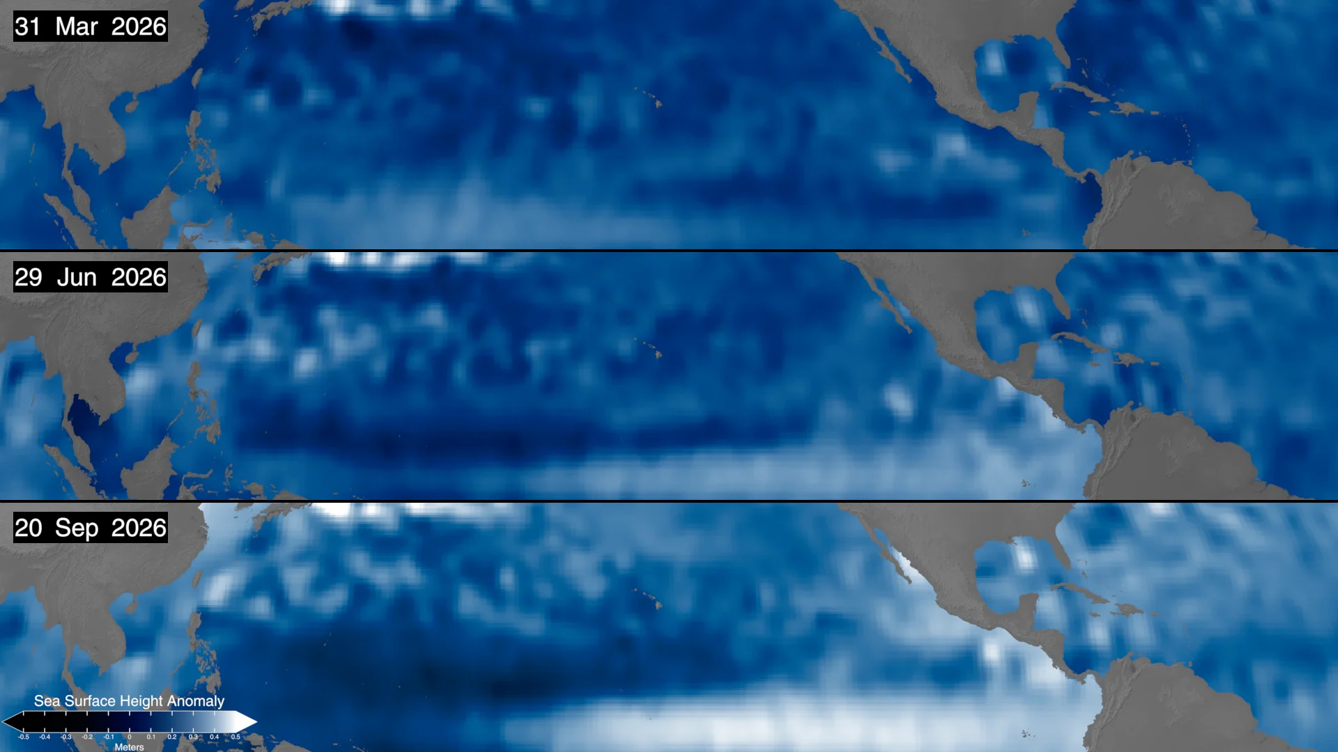
Sea Surface Height Anomalies over the Pacific Ocean, north of the equator, on March 31, June 29, and September 20, 2026 (top, middle, and bottom). Sea surface height has increased dramatically in the eastern Pacific due to the increase in water temperature from El Nino, which is also pushing up the west coast of North America. (NASA/Scott Sutherland)
As shown in the maps above, as of September 20, 2026, sea level heights have increased by up to half a metre in some areas. And that pulse is expected to continue to move north along the coast. As a result sea levels along the west coast could rise by six inches, at least, and as much as a foot in the months to come.
Additionally, with each Full Moon occurring closer to perigee right now (the closest point in the Moon's orbit to Earth), there will be supermoons towards the end of November and December.
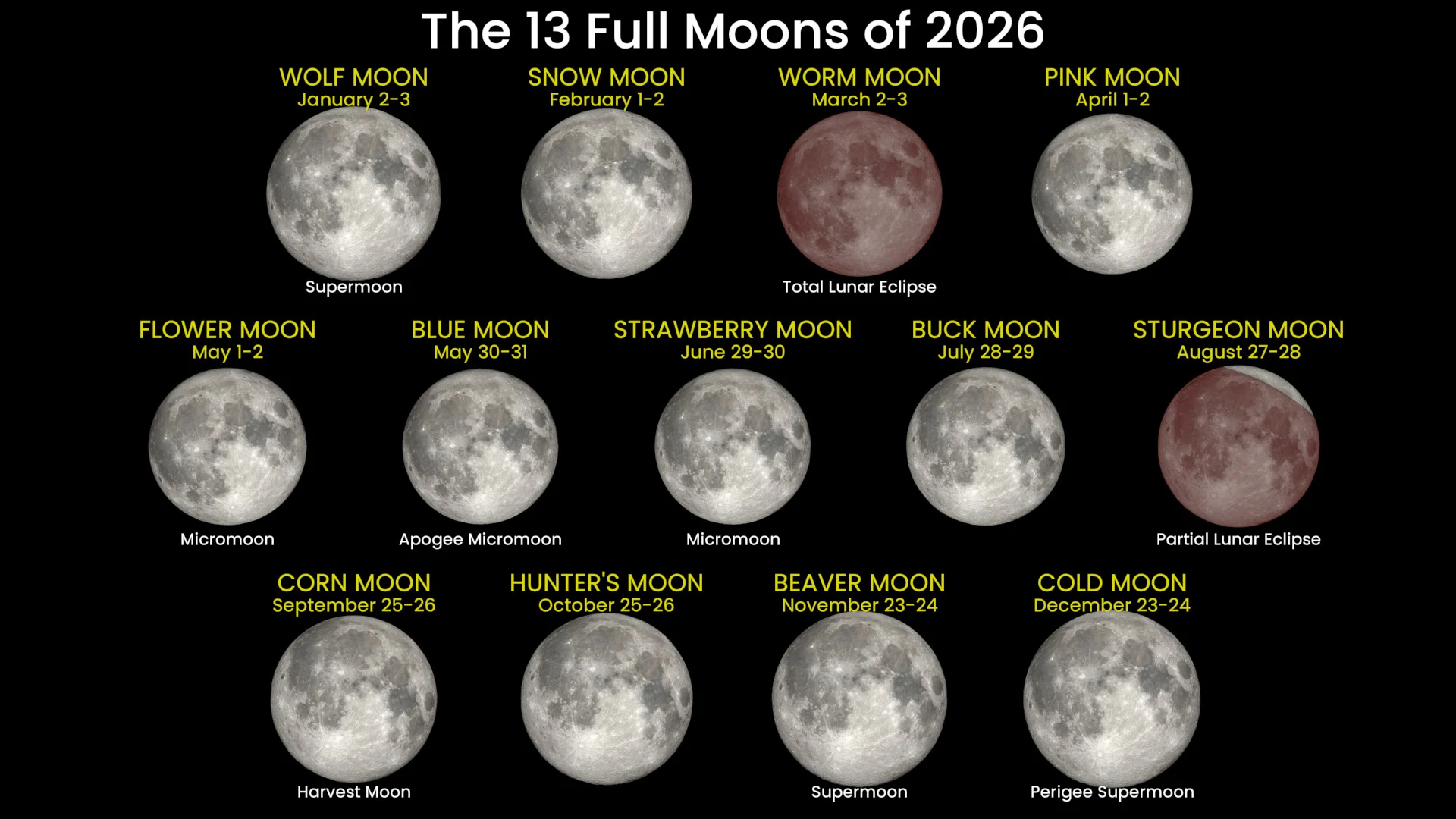
The 13 Full Moons of 2026, including their popular names, dates, and remarkable aspects (micromoon, supermoon, harvest moon, eclipses, etc). (NASA SVS/Fred Espenak/Scott Sutherland)
That means we'll be seeing the next king tides at those times, which will further increase the water levels along the west coast, bringing even greater risk of flooding and coastal erosion.
On September 21, California's Governor Gavin Newsom declared a state of emergency to help officials at different levels of the government better coordinate their response to the situation.
"We are not waiting for this season's storms to be on our doorstep," Caroline Thomas Jacobs, the director of the California Governor's Office of Emergency Services, said in a press release. "By planning early and coordinating resources ahead of El Niño, we are working to ensure communities and first responders have the personnel, equipment, and support they need to prepare for severe weather, respond quickly when conditions change, and protect lives and property across California."