
Typical spring setup brings northern Ontario a thunderstorm and wintry threat
A potent Colorado low will drive the thunderstorm threat into northwestern Ontario to start the week before a drastic temperature drop replaces it with snow
A classic, late-spring setup is projected on Monday in northern Ontario as a developing Colorado low sweeps in.
A threat of thunderstorms and heavy rain will be accompanying the stateside low for election day, so bring an umbrella and dress accordingly when heading to the polls.
DON’T MISS: Canada’s election day forecast holds storms and sunshine
Stay aware of potential watches and warnings in your community. Conditions can change rapidly as strong storms bubble up.
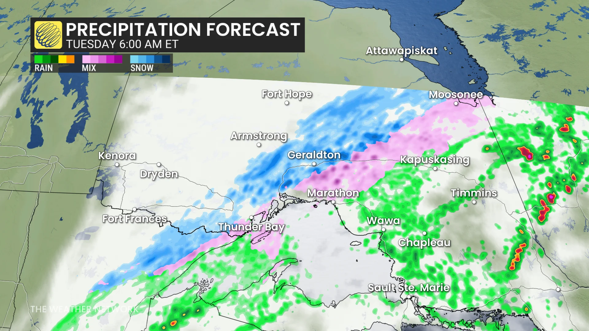
By Tuesday morning, spring will take a step back as the region sees a sign of the former season--with a threat of a wintry mix on the table as temperatures take a tumble. Expect a tricky commute with any slippery road conditions that ensue.
Monday could be a stormy election day in northern Ontario, followed by wintry weather
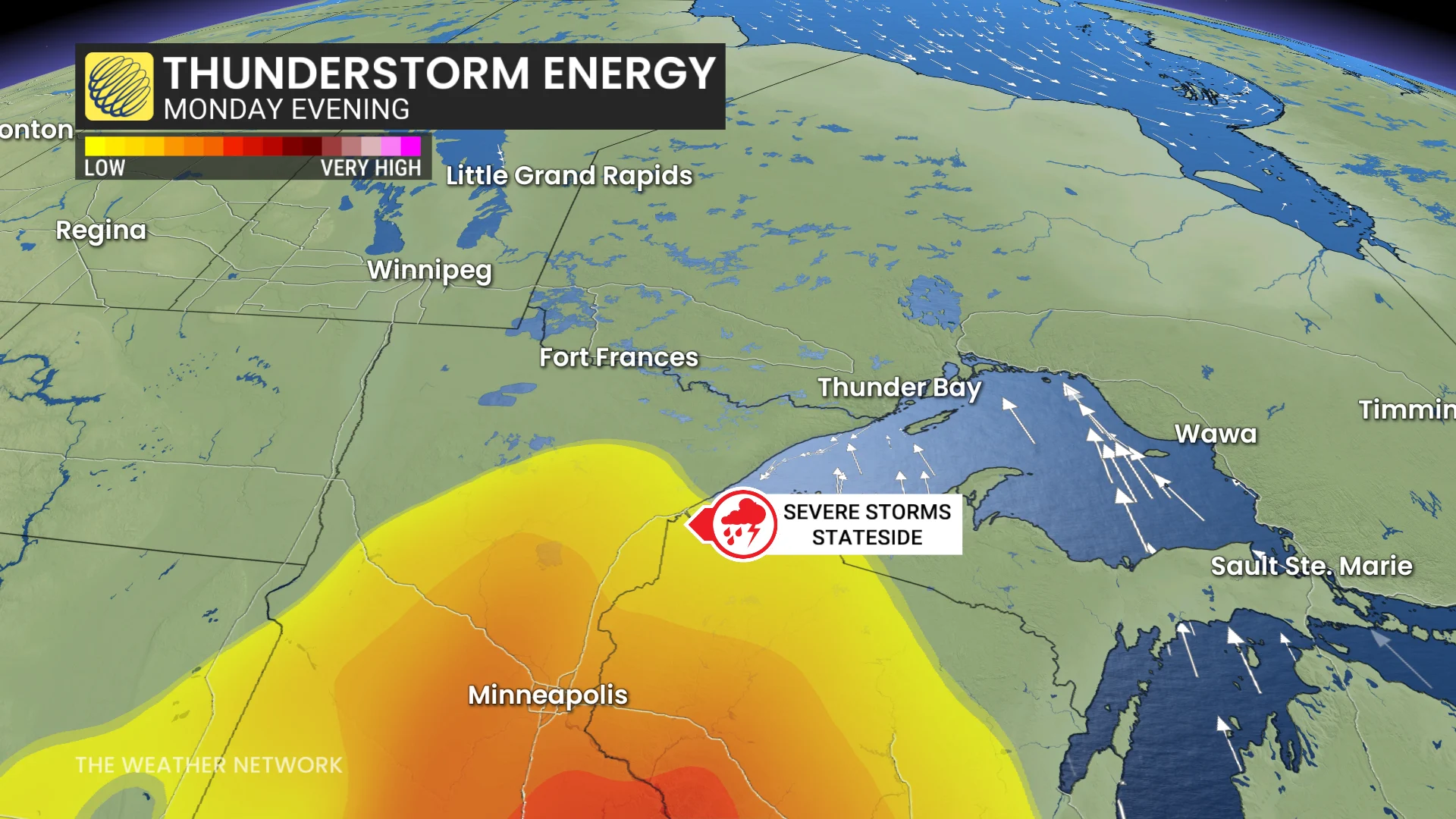
Widespread heavy rain will envelop northwestern Ontario for election day on Monday with the risk of thunderstorms, as well.
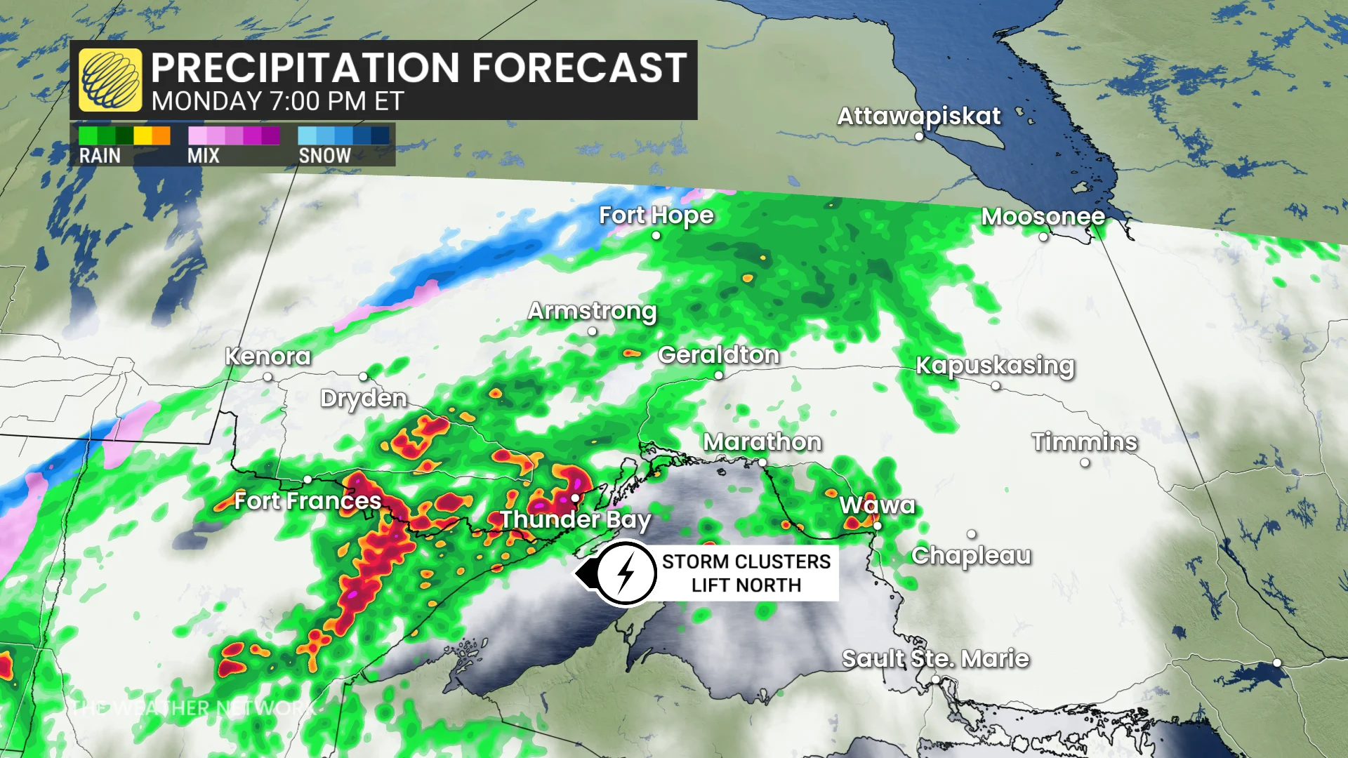
A warm front will lift north across the region, providing rounds of heavy showers and embedded thunderstorms.
Thunderstorms will be elevated in nature, but will still trigger heavy rainfall rates through the late-morning period.
The atmosphere will be highly moisture-laden, particularly for late April, with 30 mm of moisture packed into the atmosphere above us. The most extreme instability will remain stateside in Minnesota and Wisconsin, limiting severe thunderstorm potential for northern Ontario.
However, localized flooding is possible with multiple rounds of heavy showers and thunderstorms training over the same locations.
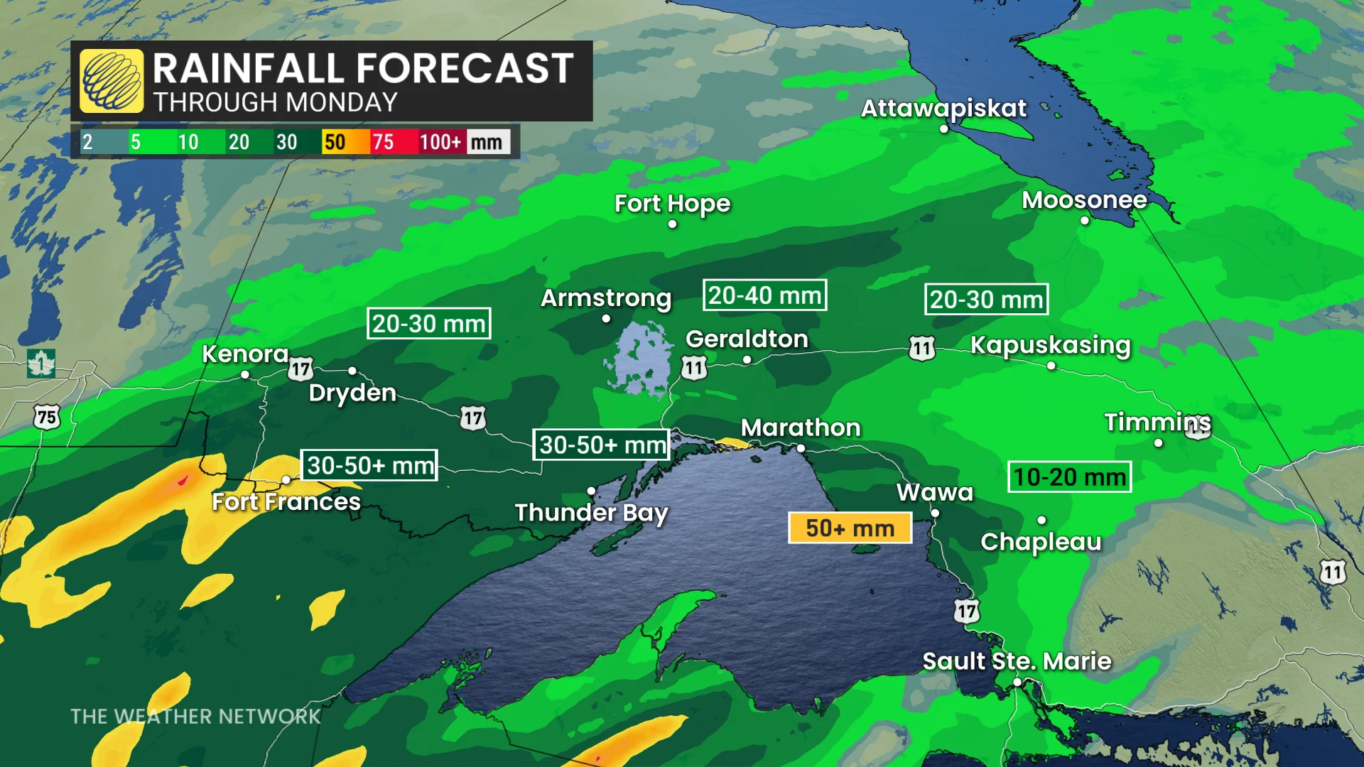
Rainfall projections:
Thunder Bay: 30-50 mm
Fort Frances: 30-50 mm
Wawa: 30-50 mm
Geraldton: 20-40 mm
Monday afternoon and evening will see heavy rain continue as waves of moisture continue to ride northeast.
And then, by Monday evening and overnight, a cold front slides across the area bringing a threat of a wintry mix by Tuesday morning. Expect tricky travel with any slippery road conditions that ensure.
Cooler-than-seasonal conditions expected during early May with a couple rounds of showers, but a warmer pattern is expected as we get deeper into the month.
Be sure to check back for all the latest on your forecast across northern Ontario.
Thumbnail courtesy of Getty Images/Revolu7ion93/263562386-170667a.