
Summer sneak peek: Canada's warm season goes on cruise control

Spring has been a letdown for millions of Canadians, so will summer make up for the lacklustre weather so far this season? We give you an early look at what could transpire this summer
Still waiting for that real spring feel? You’re not alone.
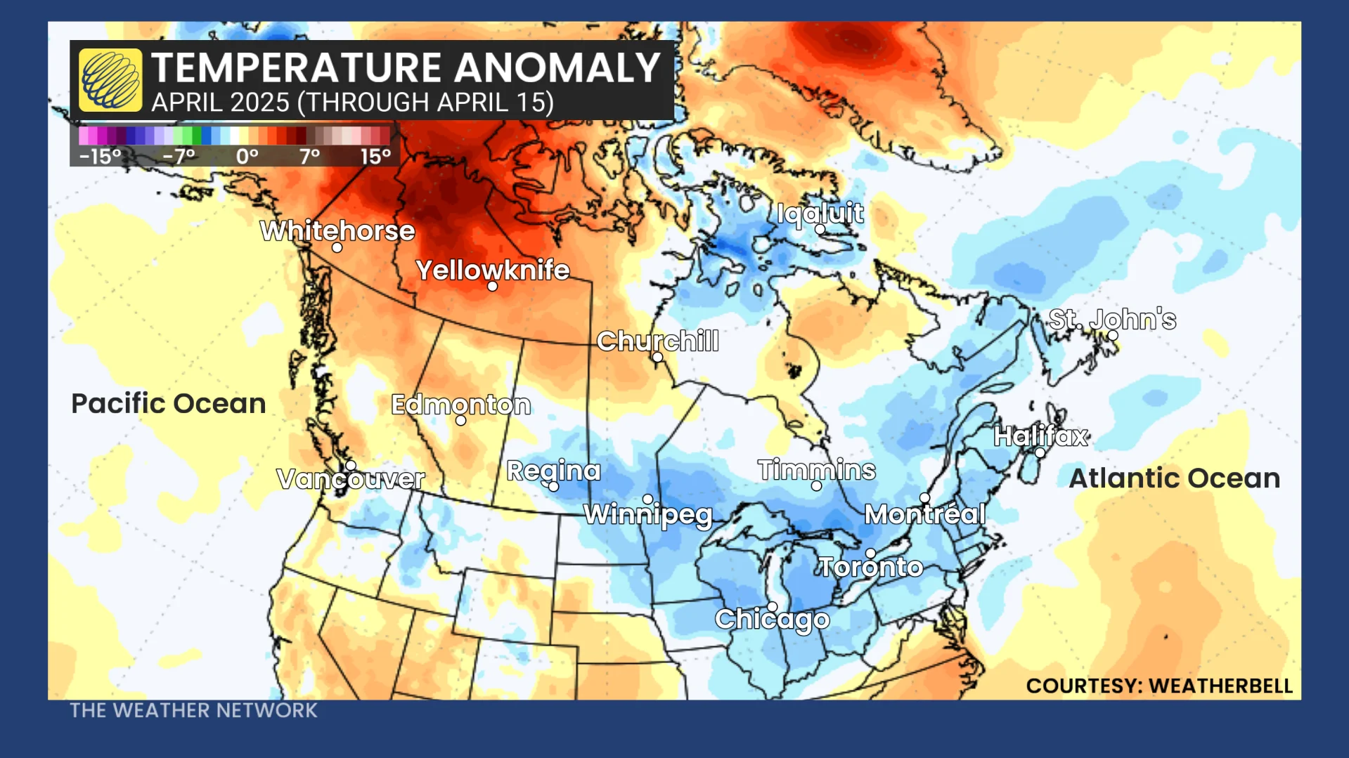
April has been off to a sluggish start across many parts of the country, with persistent, cool anomalies and delayed signs of seasonal warmth.
DON'T MISS: Get to know the hidden gems across Canada
The April anomaly map tells the story:
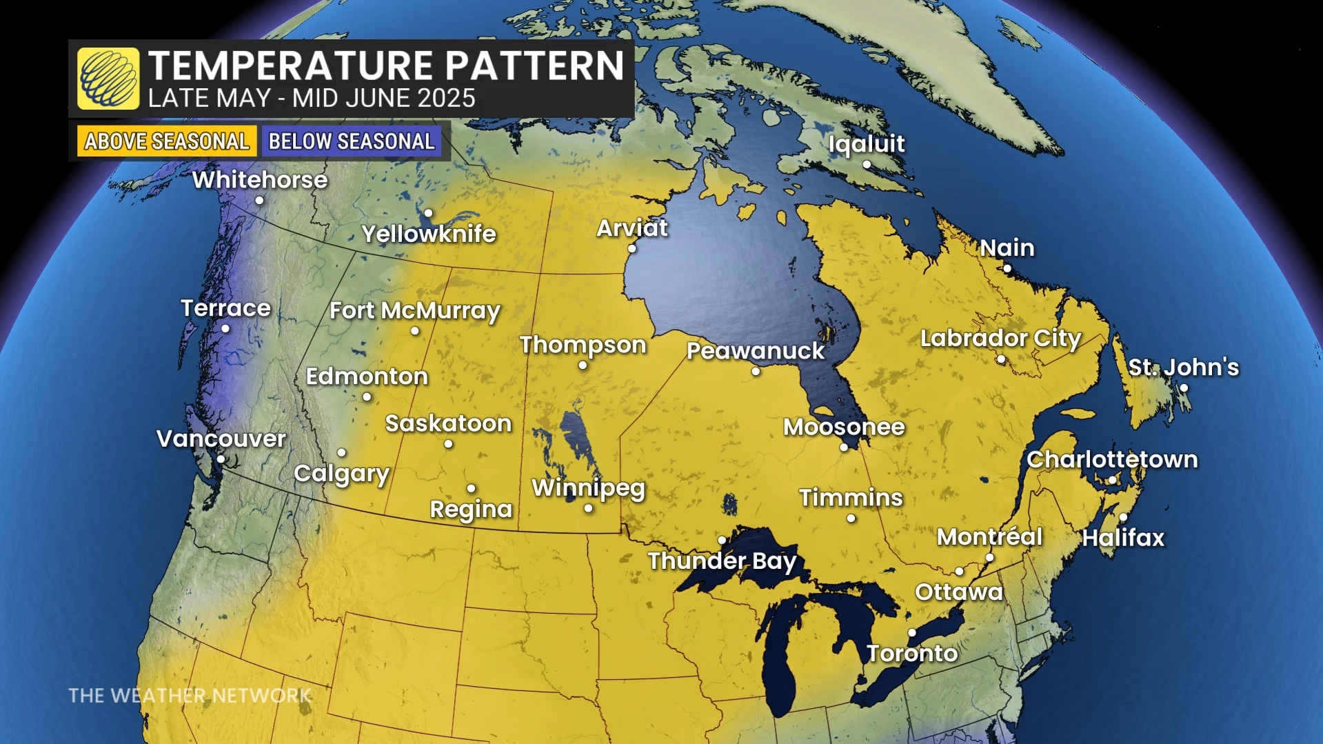
But here’s the good news: That doesn’t mean summer will follow suit. Much of Canada is expected to see a seasonal flip as we close out spring.
No strong pattern driver means the sun takes the wheel
What makes this summer tricky to predict is also what makes it intriguing. There's no dominant global pattern—-like El Niño or La Niña—-calling the shots. In this kind of neutral setup, the sun becomes the default driver--and that often means widespread heat, especially over the continent’s interior.
Central U.S. heat dome sets the stage
A persistent ridge over the central U.S. is expected to become the defining feature of summer.
That would set the stage for a hot, stagnant pattern over the central U.S. with the risk for the heat to surge north into Southern Canada and increasing the risk of drought across the south end of the Prairies.
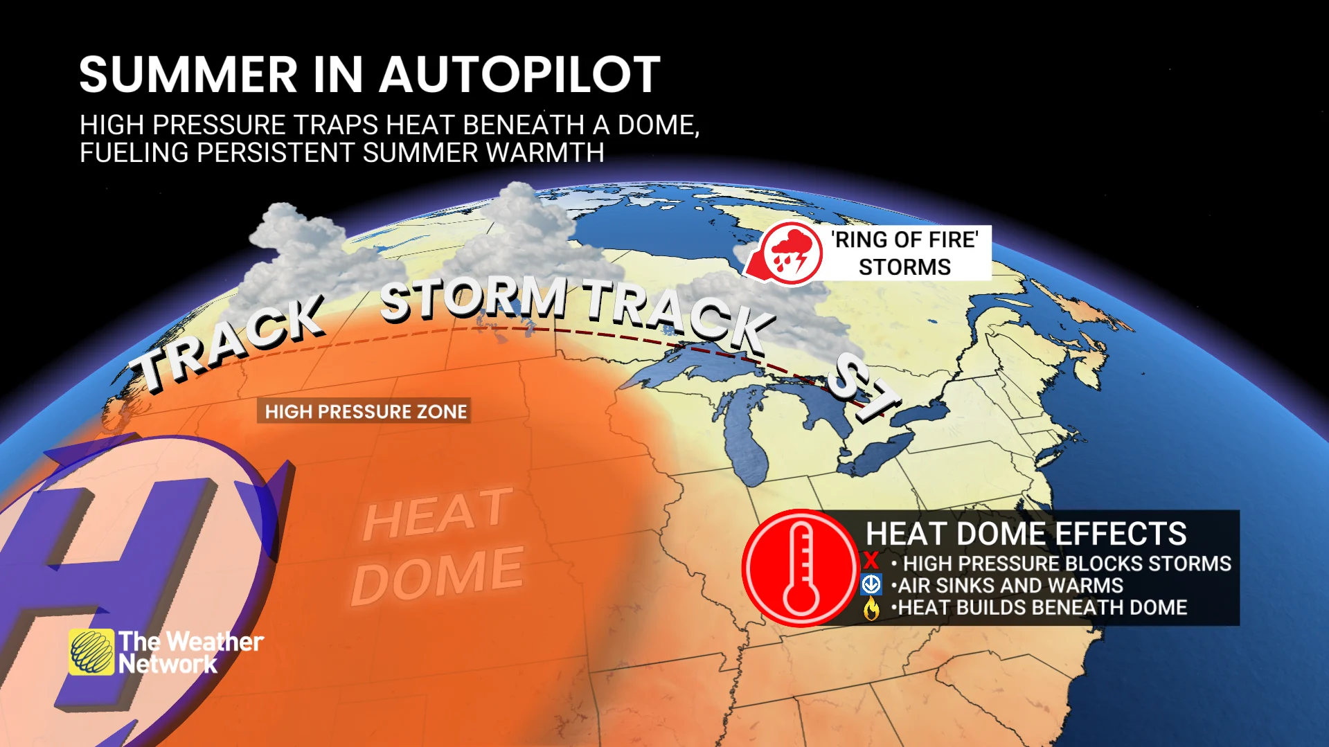
Once this pattern takes hold, it often becomes self-reinforcing, as drought breeds drought.
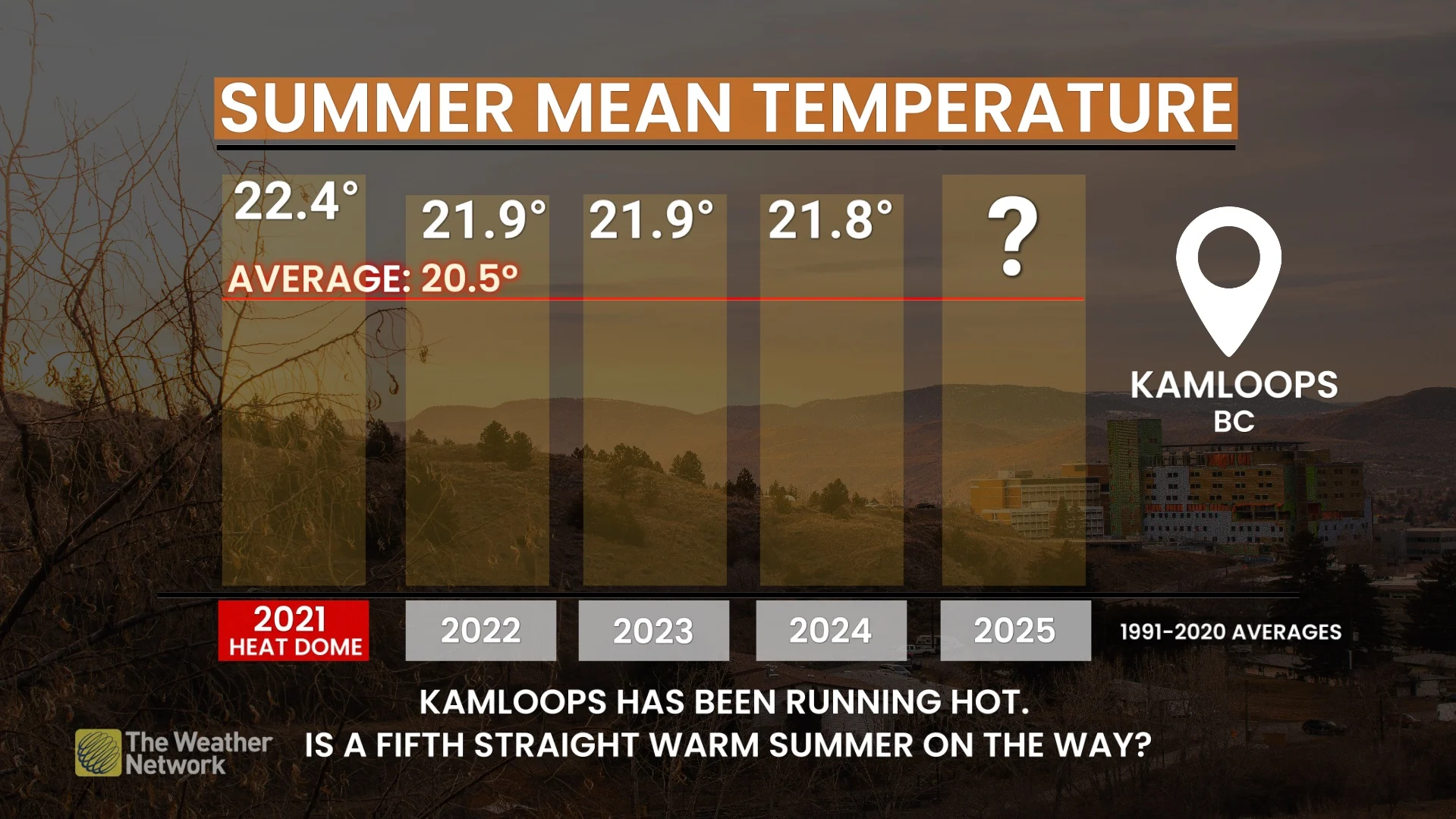
B.C.: A fifth warm summer?
Could B.C. make it five summers in a row above seasonal?
The answer depends on which pattern wins out. If a trough lingers offshore, a cooler, onshore flow could take the edge off. But if that ridging pattern pushes more northwest, expect another hot and drier-than-normal season--though this isn’t shaping up to be another 2021.
Prairies: May and June are pivotal months
Current drought conditions in the southern Prairies are much better than last spring, but late-spring and early summer rainfall will be critical.
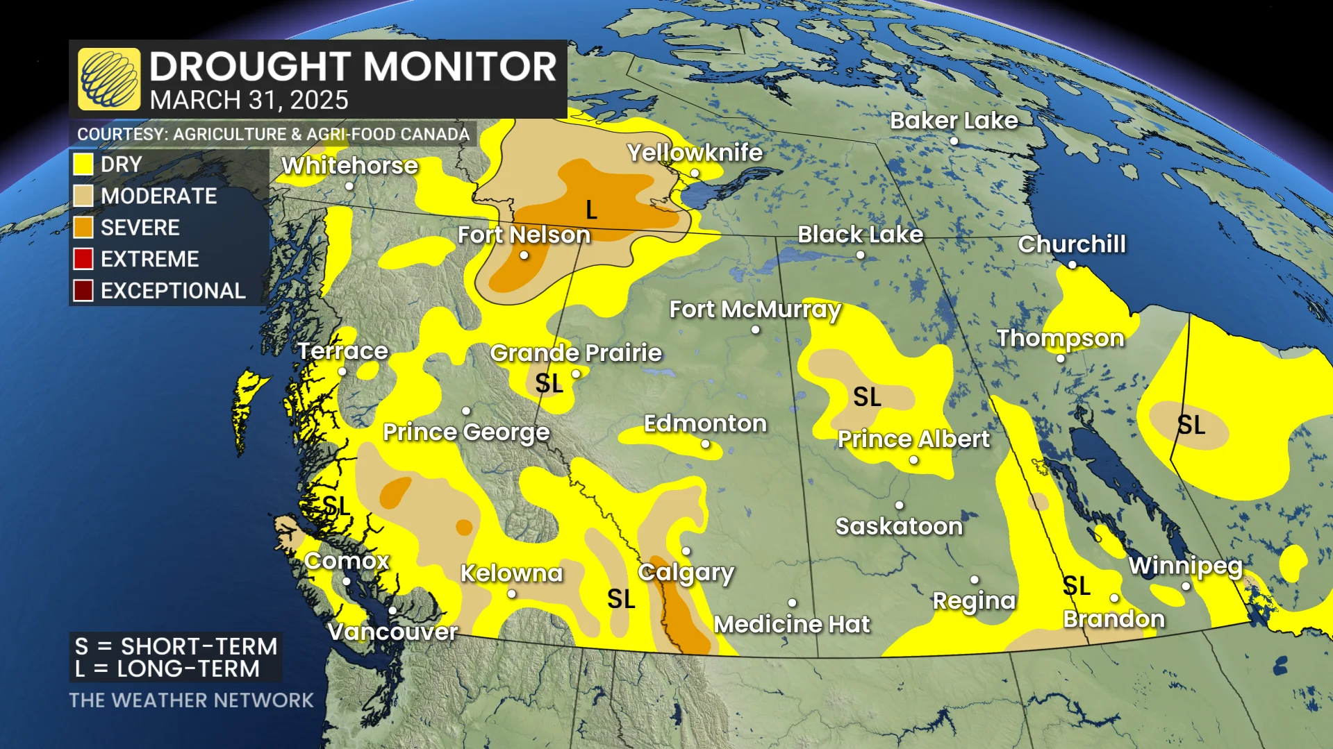
If storms fall short in May and June, the heat dome could expand north, locking in a dry, stressful summer for farmers and ranchers alike.
WATCH: Alberta’s new tech could be a game changer for wildfire season
Ontario and Quebec: Warm...but
Southern Ontario and Quebec may not be the core of the heat this summer, but that doesn’t mean they’ll miss out. Our current thinking is that daytime highs could end up near normal, but elevated humidity and warm nights could tip the seasonal averages to the warm side of normal.
However, there is still a lot of uncertainty about whether the active storm track will cut across the region or stay south of the border, and that will have a significant impact on temperatures and how this summer is remembered. More details to come when we release our official forecast.
Atlantic Canada: Could be the seasonal winner (unless...)
With no drought concerns and the potential for some favourable jet stream positioning, Atlantic Canada could be the quiet winner of summer.
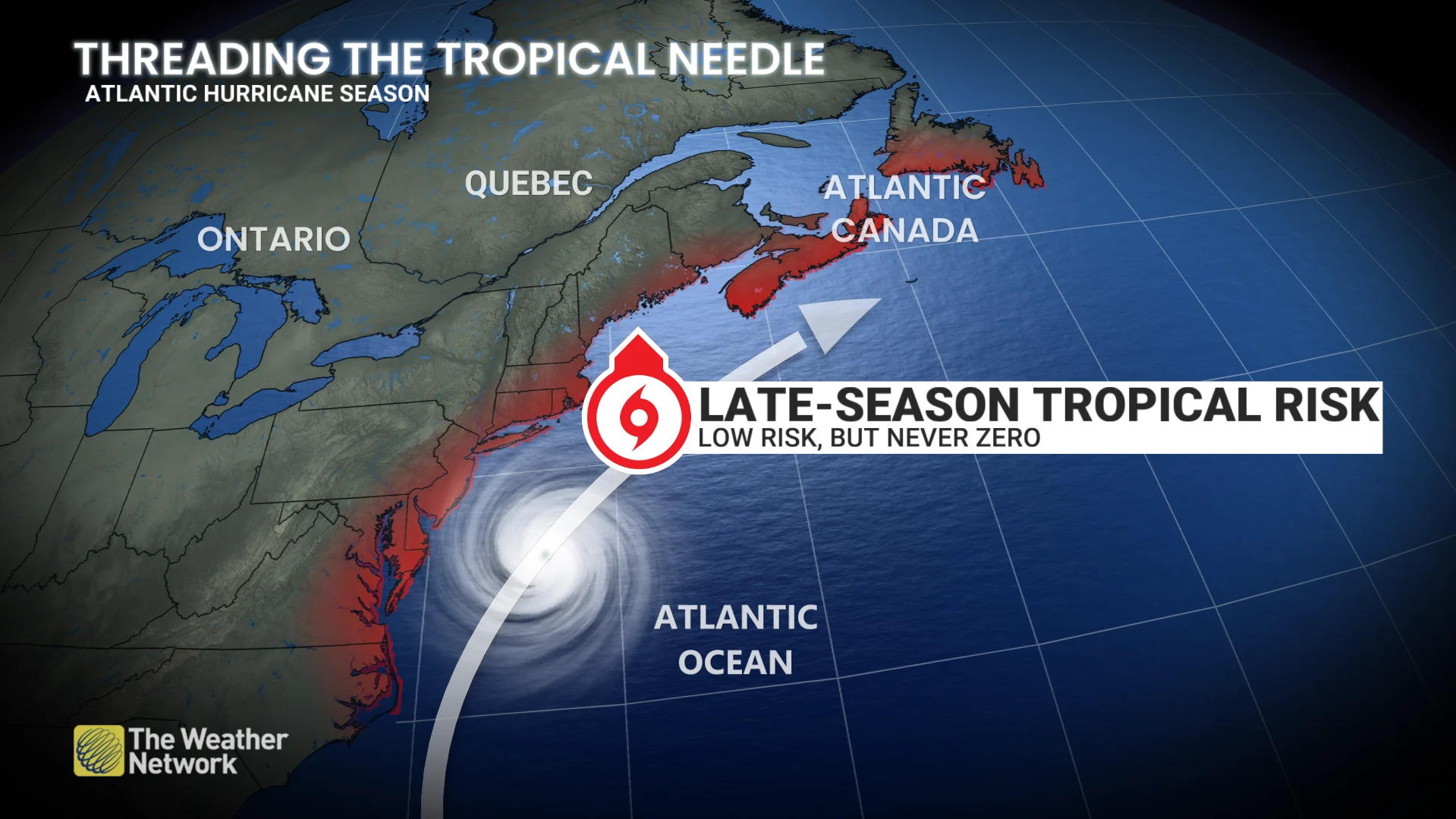
The wild card? An increased risk of late-season tropical systems curving north. As Atlantic Canada knows all too well, all it takes is one.
Final word: The heat’s coming, but who’s steering?
With no single driver in control, summer may arrive on atmospheric autopilot. That means heat over the continent’s heart, uncertainty along the edges, and a summer shaped by how May and June unfold. One thing we can say: Cooler-than-normal summers are becoming less common, and 2025 doesn’t look like it’ll buck that trend.
The full picture is coming soon
Our official Summer Forecast will be released on May 28, offering a detailed breakdown of temperature and precipitation trends across Canada. With pattern drivers in flux, it’s shaping up to be a season where local details will matter most, so stay tuned!