
Storm risk stays in Manitoba as tornado potential shifts into NW Ontario

A tornado risk will shift into northwestern Ontario on Tuesday as a favourable setup for severe weather continues to move east
The week got off to a stormy start on parts of the eastern Prairies, and that potential will stick around on Tuesday.
The chance for severe weather will stick around in parts of southern Manitoba, mainly along the border with northwestern Ontario. The main area to watch will be in the latter region, where a tornado threat will be present.
SEE ALSO: Scud clouds are scary tornado lookalikes – how to tell them apart
Keep an eye out for local weather alerts and approaching storms on Tuesday.
Severe storm, tornadic threat shifts east on Tuesday
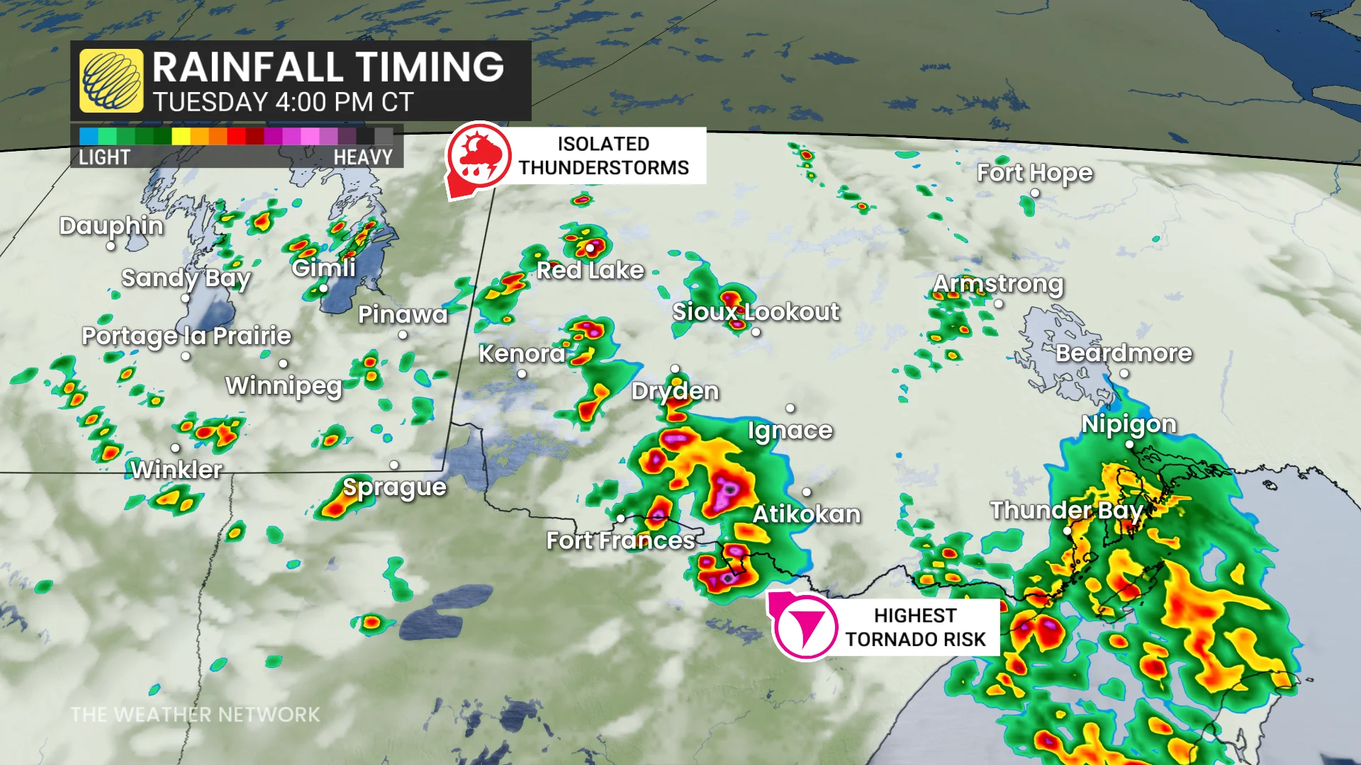
Widespread rain and embedded thunderstorms will track west to east across northwestern Ontario on Tuesday afternoon, well west of Lake Superior.
The unsettled weather will continue through Wednesday and into Thursday morning for some areas.
DON'T MISS: Rare hazard: This town saw an earthquake during a tornado warning
A large low pressure system with a moist and unstable atmosphere is creating conditions for rounds of thunderstorms on Tuesday, starting from morning into the evening.
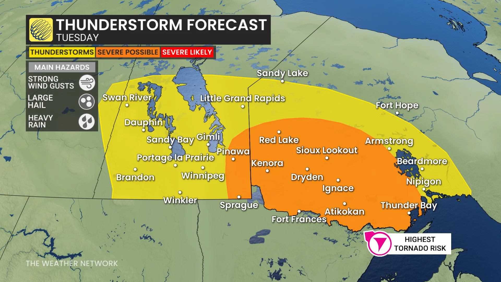
The main area of concern on Tuesday will be northwestern Ontario, from Thunder Bay to the Manitoba border. Conditions will be conducive for a tornado or two within the orange area of northwestern Ontario in the map posted above.
Aside from a tornado risk, the main hazards will be strong wind gusts, large hail and hevy downpours.
However, thunderstorms will be possible in southern Manitoba still, with a severe risk east of Winnipeg that extends to the northwestern Ontario border.
Environment and Climate Change Canada (ECCC) has recently switched to a localized weather warning system, which means that if a warning is issued for your area, the storm threat is actually nearby and imminent.
Be sure to heed any alerts or warnings you receive.
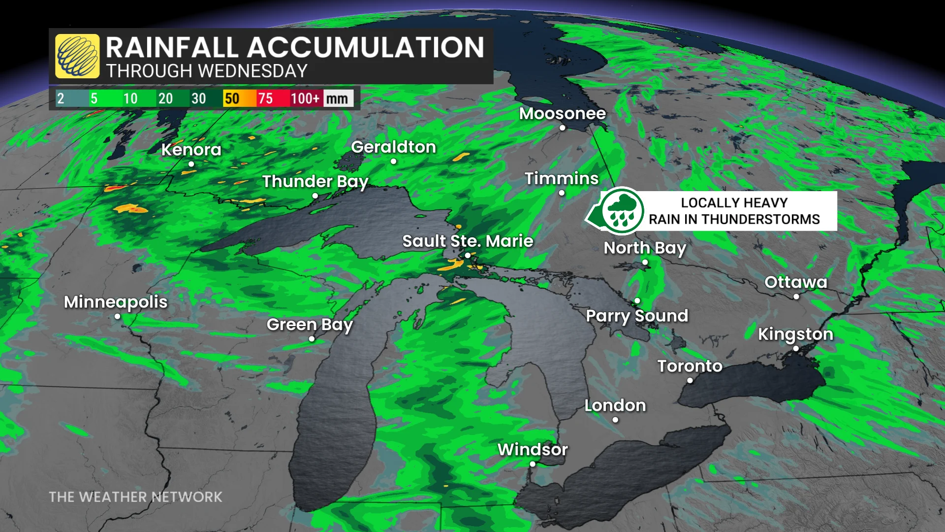
More rain is expected throughout Wednesday, as the same low pressure system moves across Lake Superior overnight.
Northeastern Ontario can expect more thunderstorms, some of which could be severe, and areas under persistent storms could see over 50mm of rain from Wednesday.
Keep up-to-date with The Weather Network about the latest forecasts and updates for your weather across the eastern Prairies and northwestern Ontario.