What fuelled one of Vancouver’s most remarkable storms in years?

Remarkable thunderstorms pummeled the South Coast on Saturday night
One of the South Coast’s greatest thunderstorm events this century unfolded across parts of the Lower Mainland and Vancouver Island late Saturday evening.
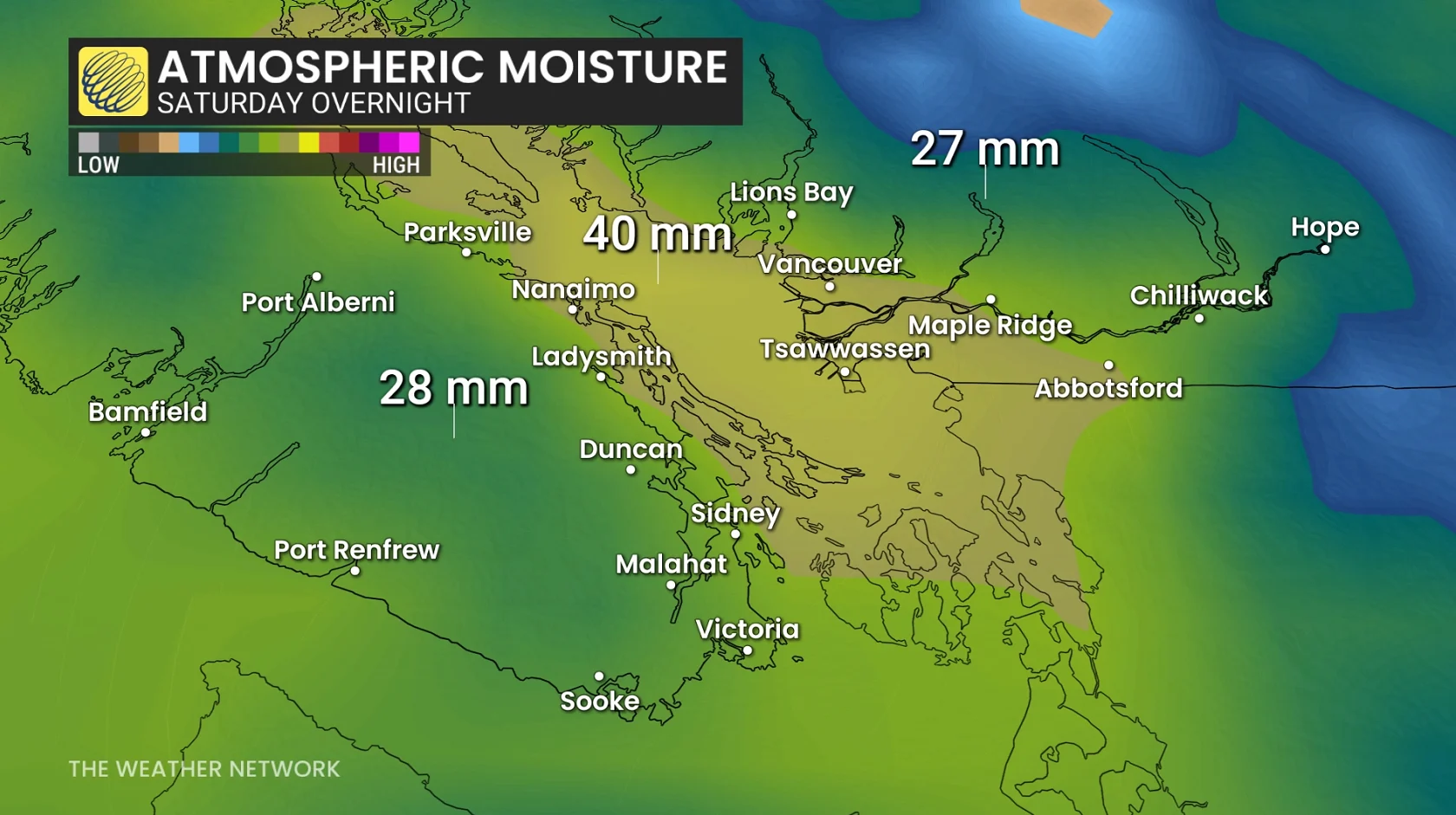
Vancouver International Airport reported more than 40 mm of rain and thunderstorm activity for a whopping 5 hours and 39 minutes. Even more impressive is that intense lightning lasted for roughly three hours.
This wasn’t a classic setup like we’d see on the Prairies or in southern Ontario. Rather, this stunning storm was the result of a rare coastal recipe of atmospheric ingredients.
DON’T MISS: Tornadoes can happen anywhere, and cities aren't immune
A timeline of remarkable thunderstorm activity
Thunderstorms were already active across southern Vancouver Island around 9:00 p.m. local time. Convection expanded into the Strait of Georgia by 10:00 p.m., with lightning stretching from around Ladysmith toward Howe Sound and the Sea-to-Sky corridor.
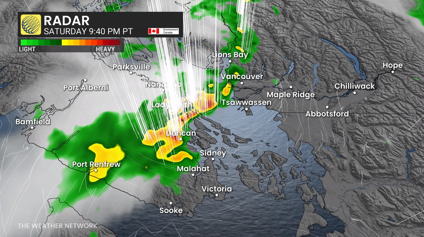
A small, weak low-pressure system appears to have become established near the central Strait and Metro Vancouver starting at 11:00 p.m. and lasting through 2:00 a.m., with convection continuing to regenerate around the centre of circulation.
The ingredients that powered a generational storm
Unusually deep moisture was key to the storm’s formation and maintenance. Muggy dew point values approached 20°C at YVR in the days leading up to Saturday night’s storms. Weather models showed very rich moisture throughout the atmosphere over the South Coast into the first half of the weekend.
A potent upper-level trough provided the instability needed to spark and fuel thunderstorms. Despite surface temperatures below 20°C, a sharp contrast with cold air aloft allowed air to continuously rise and feed thunderstorm updrafts.
Residents noted vivid lightning with these storms. Lightning doesn’t depend on storm energy alone. Much of a thunderstorm’s electrical charge separation occurs in a region of the storm with temperatures around -10°C to -20°C, where supercooled water, ice crystals, and graupel coexist and can collide with each other.
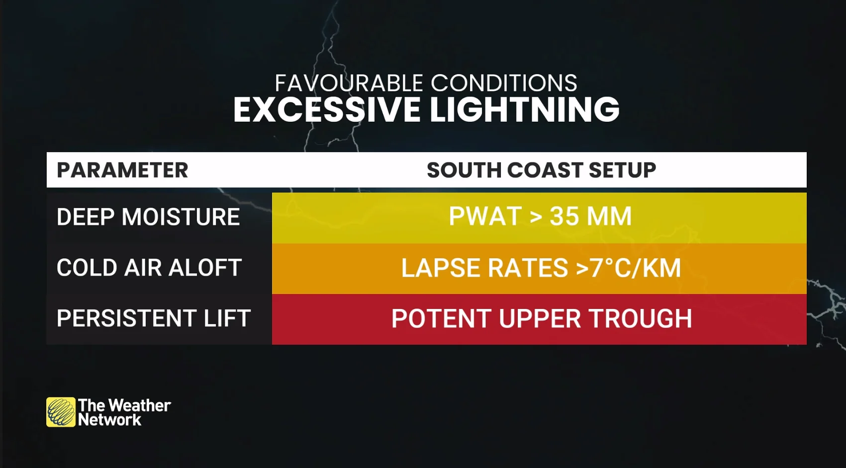
Saturday night’s storms reached more than 9 km high, with a freezing level hovering around 3.2 km. Persistent updrafts produced an excellent environment for lightning, allowing ice crystals and graupel to repeatedly collide and separate electrical charges within the storm to produce frequent lightning.
One wildcard was the feedback loop we witnessed with this setup. One particularly interesting element of this event is that the thunderstorms appear to have enhanced the pressure changes and wind flow around the small centre of low pressure, which may have led to a feedback cycle that helped storms persist and regenerate for hours on end.