Burst of lake-effect snow keeps Ontario on a spring roller-coaster ride
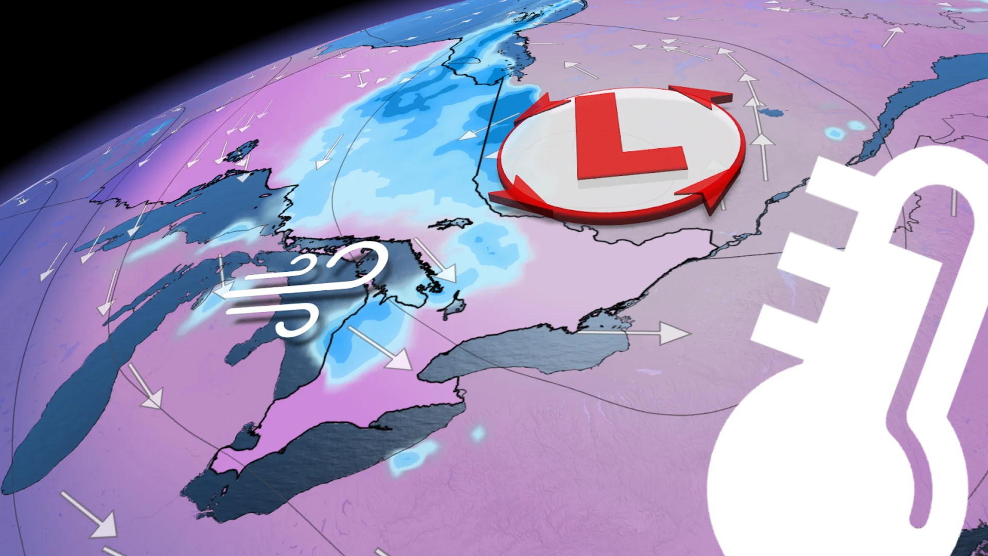
Southern Ontario took one step forward to saying goodbye to wintry weather to start the week, but then took two steps back Tuesday after cold air and blustery winds funnelled in lake-effect snow for some areas
After a pleasant start to the week, southern Ontario joined its counterparts in the north with its turn for a fresh round of wintry weather on Tuesday.
Cold air quickly replaced the warmth in the region over the last couple of days, leading to a new burst of lake-effect snow for some regions on Tuesday. More widespread were the gusty winds, expected to reach anywhere from 50-70 km/h.
RELATED: Canada snags its first tornado of the year and the credit goes to...
While the lake-effect snowfall wasn't as much as what northern areas saw through Monday, the accumulations were enough to create tricky travel in parts of the snowbelt regions. Totals should remain on the lower end, with potentially 5 cm or more locally around the Lake Huron shores and less than 3 cm for locales around Georgian Bay.
Be sure to monitor local weather alerts and check highway conditions before heading out to start the week.
Winter chill and lake-effect snow returned to southern Ontario
As the cold front departs, cold air brought in gusty conditions and lake-effect snowfall until Wednesday morning. The trough on the back end kick-started lake-effect along the shores of Lake Huron and Georgian Bay. Up to 5 cm of snow could accumulate over parts of the escarpment with this system.

DON’T MISS: Canada's capital plummets to a new (chilly) low
Wind gusts across southern Ontario were forecast to reach 50-60 km/h, while exposed regions along Lake Huron were forecast to see up tp 70 km/h. Winds peaked around the late afternoon and evening.
The spring chill seeped its way into the Greater Toronto Area (GTA), as well, as we will again see highs in the single digits on Wednesday.
DON'T MISS: Get to know the hidden gems across Canada
Colder weather for Easter weekend, but closely watching the end of April for some warmth
Temperatures will gradually begin to recover near the end of the week. However, a rainy system will move into the province late Friday afternoon, putting a damper on the start of the weekend and sticking around as spotty showers into Saturday.

There's the potential for a period of warmer weather as we head into the final week of April, and while this won’t flip the switch on the season, several days of much warmer conditions would be such a welcome break after a few weeks of chilly April weather.
Remember, it is not uncommon to get snow in southern Ontario in April, especially in the traditional snowbelts regions, as lake-effect snow can continue this time of year. Even Toronto has recorded many snow days in April, and even two days in May.
Stay with The Weather Network for all the latest on conditions across Ontario.