National cooldown will be a fall teaser for many Canadians next week

Most of Canada will see temperatures fall to or below seasonal next week.
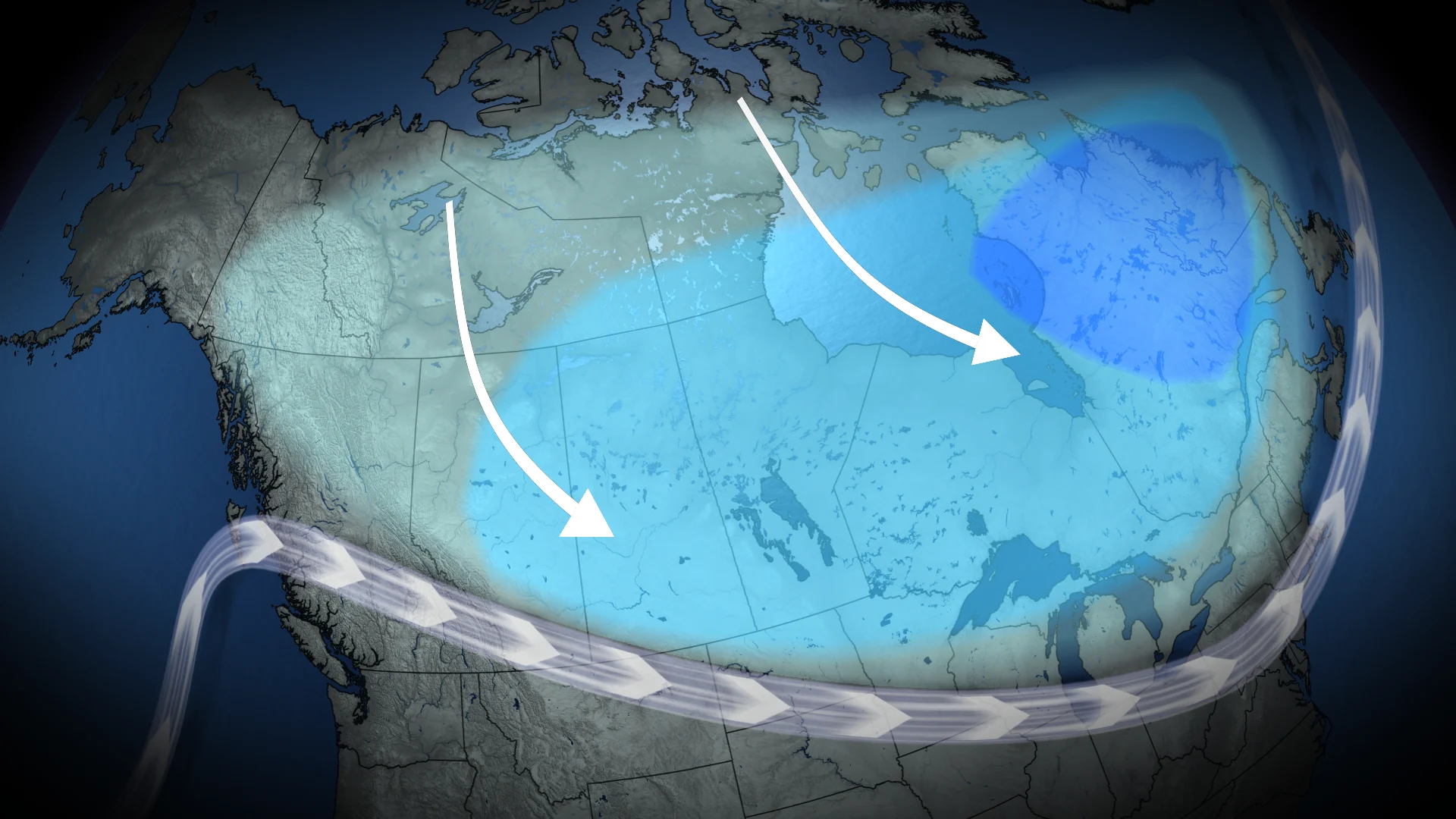
No, summer is not over yet, but many Canadians may feel a slight chill in the air next week as a large trough stretches across the country, pulling down cooler temperatures from the north.
With the exception of Canada's coastal provinces, which are in the midst of their own heat waves, temperatures are forecast to gradually begin cooling across the country over the weekend, starting from the Rockies and moving eastward.
SEE ALSO: Temperatures soaring as extraordinary El Niño intensifies
For folks who see temperatures sink below seasonal, it may feel a bit more like October than mid-August. Despite the fall-like temperatures, though, an active summer storm track is still on tap for some.
Prairies to feel the most "fall-like," dreary rains included
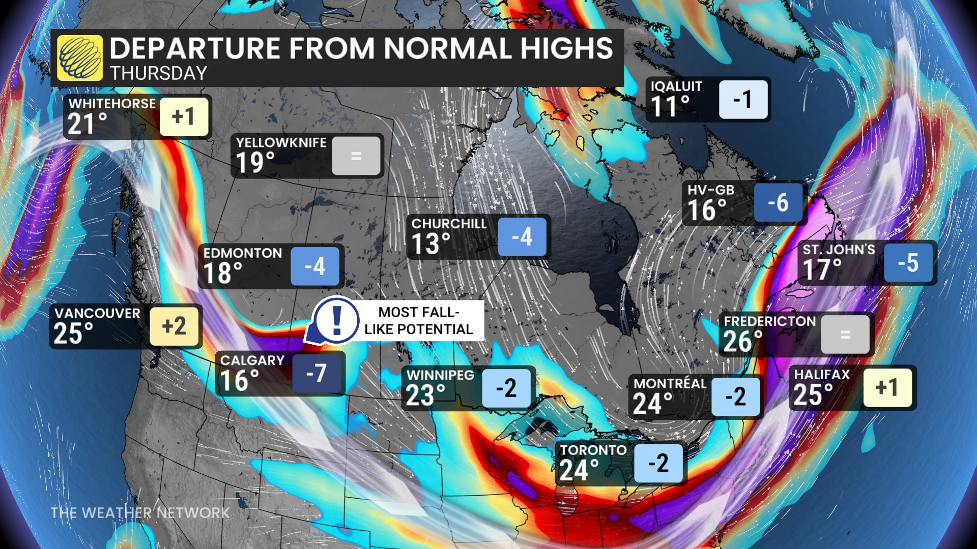
With the exception of extreme southern Alberta, the Prairies have already been trending on the slightly cooler side of the forecast. This trend will continue through the weekend and next week as some areas may see temperatures fall up to seven degrees below normal.
An active storm track over the next week is forecast to bring significant rainfall to Alberta, which will be welcome in the dry south. Unfortunately, the rainfall risk does extend in to the Edmonton area, where we've already seen multiple rounds of storms batter the city and surrounding area with flooding rains this summer.
The rain will actually help to make Alberta and parts of Saskatchewan feel the most fall-like; however, as high temperatures are forecast to stay below 20 degrees over the coming days.
Ontario and Quebec get a much-needed break from the humidity
Next week is forecast to begin on the warm side as the cool air makes its way east from the Prairies, but will see the thermometer begin to dip by the end of the week and into next weekend.
DON'T MISS: Where are Canada's mosquito hotspots?
Temperatures will only dip to around seasonal levels, with highs forecast in the low to mid-20s. It will feel noticeably cooler, though, as we finally see a break in the humidity that has held onto much of the provinces over the past several days.
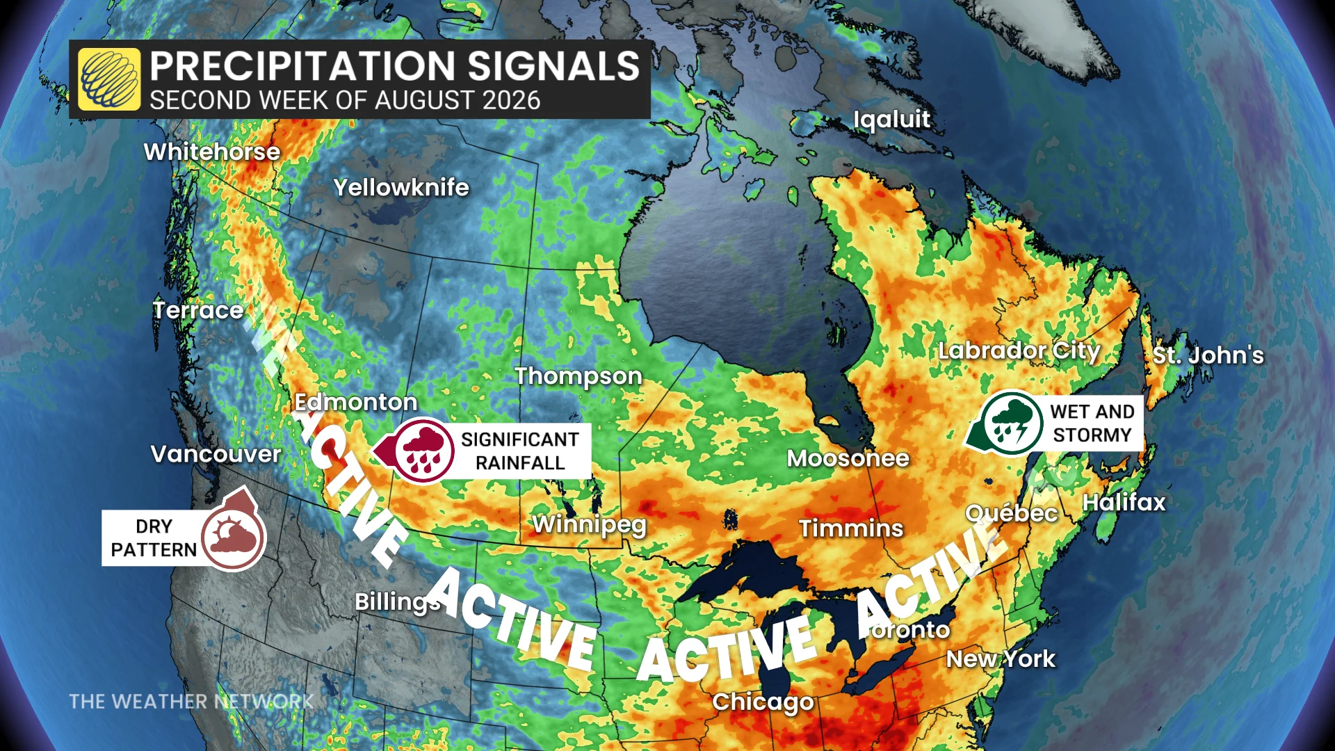
Unfortunately, models are still predicting a wet and stormy pattern over much of Eastern Canada, including the Laurentians in Quebec and Niagara Region in southern Ontario, where we recently saw flooding rains cause widespread damage.
Meanwhile, Atlantic Canada can expect to come out of the ongoing heat wave early in the week. An unsettled and stormy pattern will gradually usher in cooler temperatures by next weekend.
WATCH: El Niño continues to intensify, waters near record-breaking warmth
Stay with The Weather Network for the latest on your forecast across Canada.