Travel not advised as winter storms batter northeastern B.C.
Mounties in northeastern B.C. are urging the public to avoid unnecessary travel as winter storm conditions continue to cause havoc on local highways.
The warning comes after two men from Alberta were killed in a head-on crash between two semi-trucks on the Alaska Highway between Fort St. John and Fort Nelson earlier this week, and as Environment Canada predicts another long week of heavy snowfall ahead for the region.
"Northern driving must be given the respect it deserves in the winter," said Cpl. Michael McLaughlin with B.C. Highway Patrol. "We've had this snow, this cold temperature snap. It is causing issues on our roads."
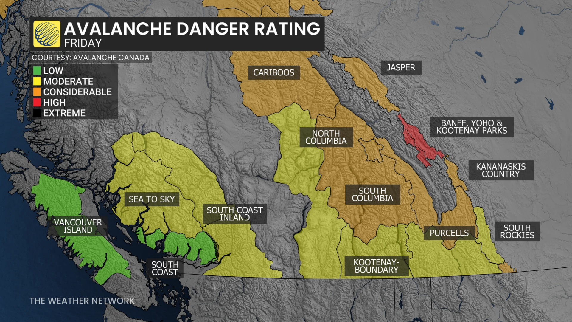
Avalanche risk on Friday, Dec. 12. (The Weather Network)
RELATED: Weekend atmospheric river aims for B.C. amid ongoing flooding
A 74-year-old man and a 21-year-old man died in the crash on Monday, while a third passenger was injured and flown to hospital in Vancouver, RCMP said. Blowing snow, limited visibility and poor road conditions were factors in the crash.
In Dawson Creek, RCMP responded to five collisions in 24 hours, according to local media reports.
Fort St. John RCMP say officers have also been responding to a higher number of crashes due to the weather.
"If you don't have to go anywhere, don't drive.... Snow of this sort is not to be trifled with," McLaughlin said.
"Police are very busy and we don't want to be busier having to help you if you get into trouble."
DON'T MISS: Check highway conditions here before heading out
Communities in the region have seen more than 30 centimetres of snow over the last week as moisture from the Pacific moves over the Rocky Mountains and mixes with a surge of Arctic air that has settled over the Peace region.
Heavy snow closed a mountainous section of Highway 97 between Chetwynd and Prince George earlier this week due to avalanche danger, where close to 100 centimetres of snow has fallen.
"The longer we get it, the more duration, I think it's going to be fairly impactful and fairly significant as we move through the weekend into the upcoming work week," said Environment Canada meteorologist Brian Proctor.
"I wouldn't be surprised to see some snowfall records."
Though the region has seen a reprieve the past two days, snow forecast over the next week could bring another 30 centimetres, Proctor said.
He says the biggest impacts could be felt on Tuesday and Wednesday as another atmospheric river hits southern parts of the province, and moves over the Rockies.
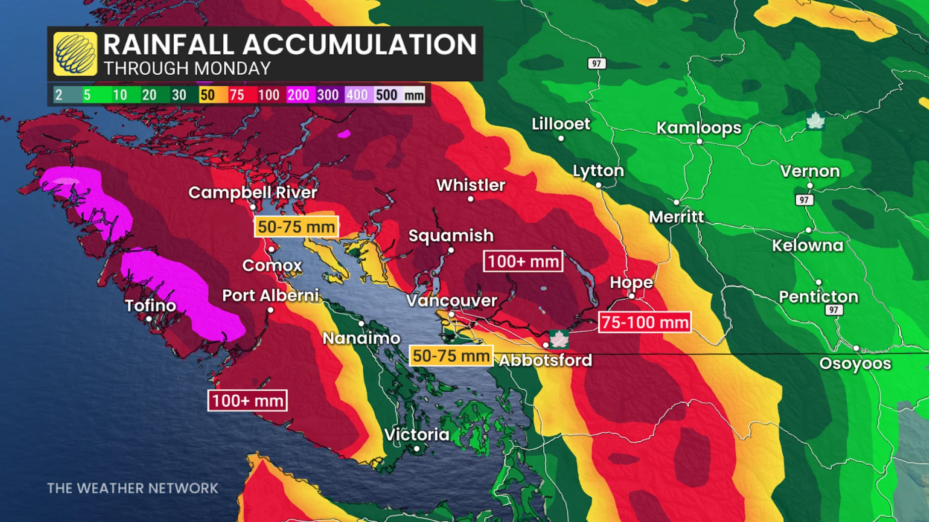
(The Weather Network)
"Really looking quite dynamic and potential for a very vigorous, very active day or two of weather," he said.
The region is currently under a cold warning, with windchills pushing -45 C. Similar temperatures and warnings are also expected next week.
McLaughlin is reminding motorists to ensure their vehicles are equipped with good winter tires, a snow shovel and warm winter clothing.
This article, written by Matt Preprost, was originally published for CBC News.
WATCH: What makes the Coquihalla dangerous in the winter?
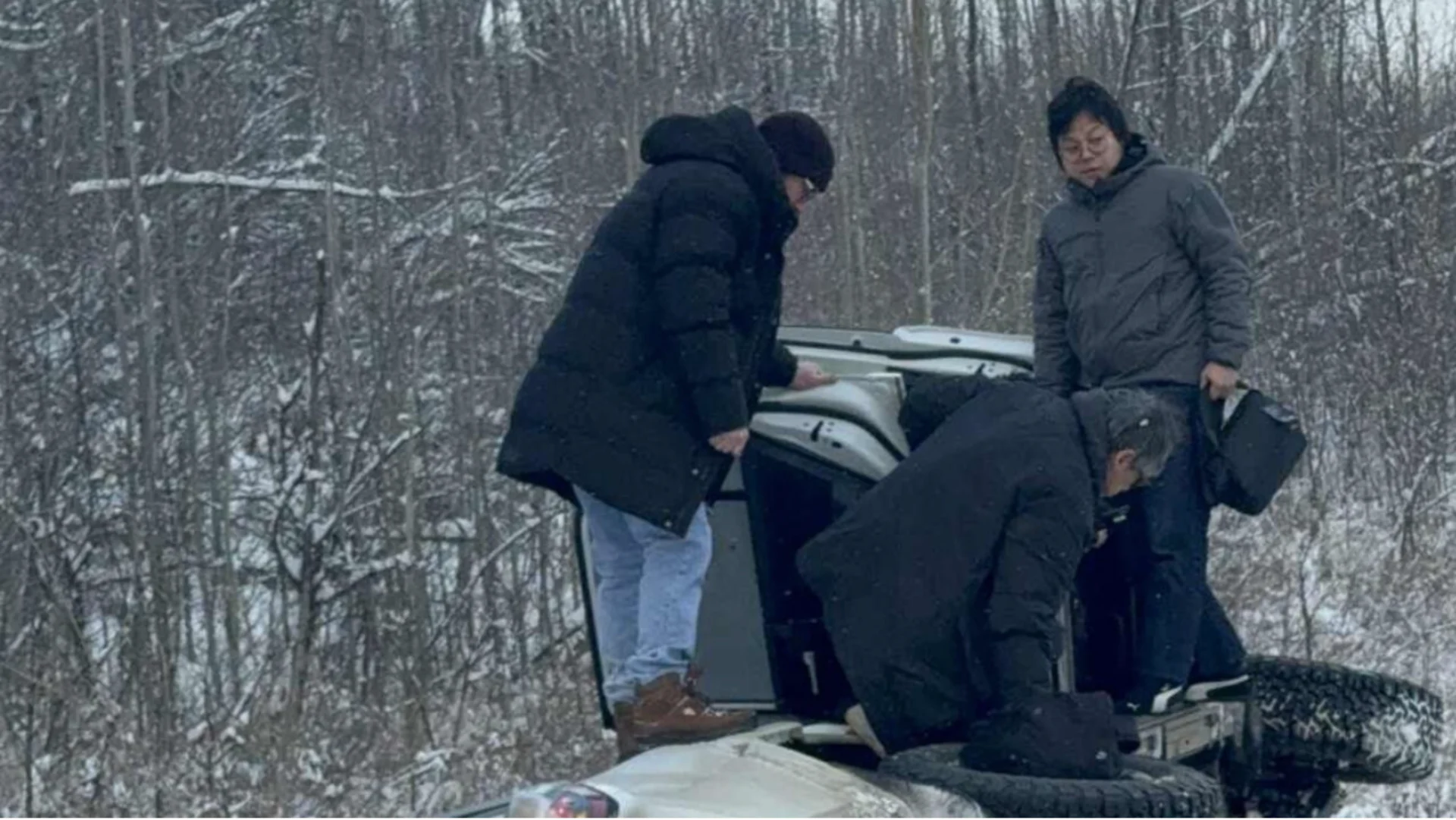
Header image shows Dean Haché helping rescue a group of travellers who went off the road on the highway between Chetwynd and Dawson Creek earlier this week. Courtesy of Dean Haché, submitted to CBC News.