Heat, wildfire smoke and severe storm risk shape Ontario's Wednesday

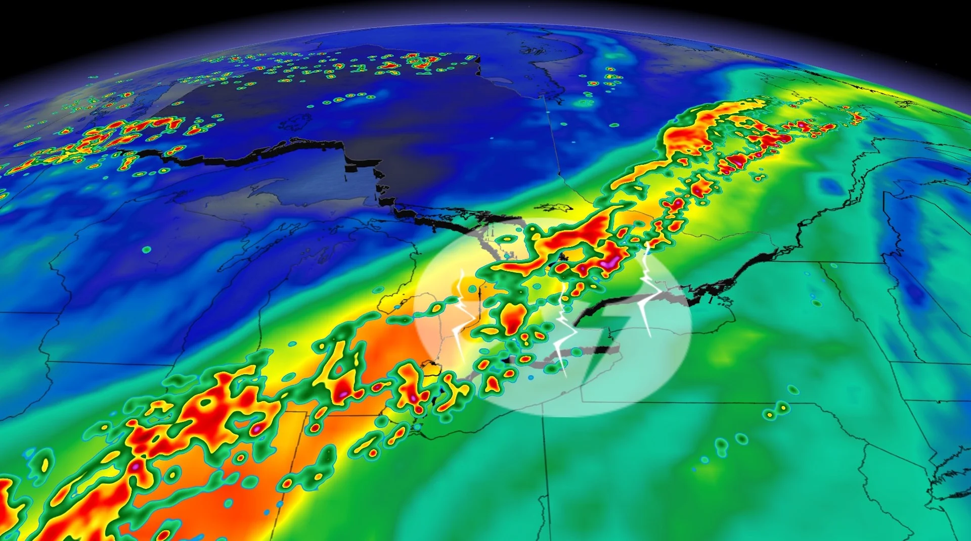
A strong front may trigger severe thunderstorms through parts of Ontario on Wednesday, but wildfire smoke and the timing of the system could limit the development
Southern Ontario folks will need to stay weather-aware on Wednesday as a cold front could trigger thunderstorms, with a chance of some could turn severe for portions of the region.
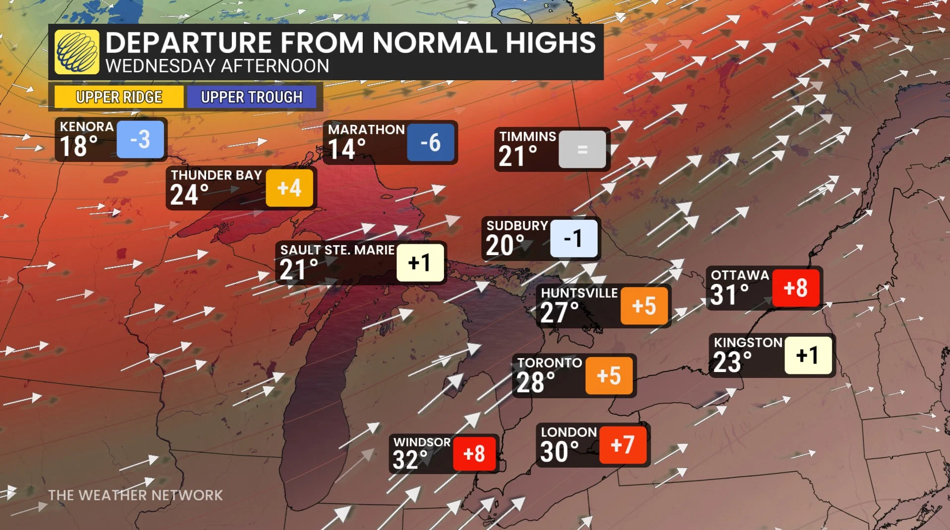
On top of the storm threat, the region will be dealing with heat--potentially giving some major cities their first 30-degree reading this year--and wildfire smoke, which will make for some hazy skies and red sunsets and sunrises.
DON'T MISS: The Weather Network's wildfire hub
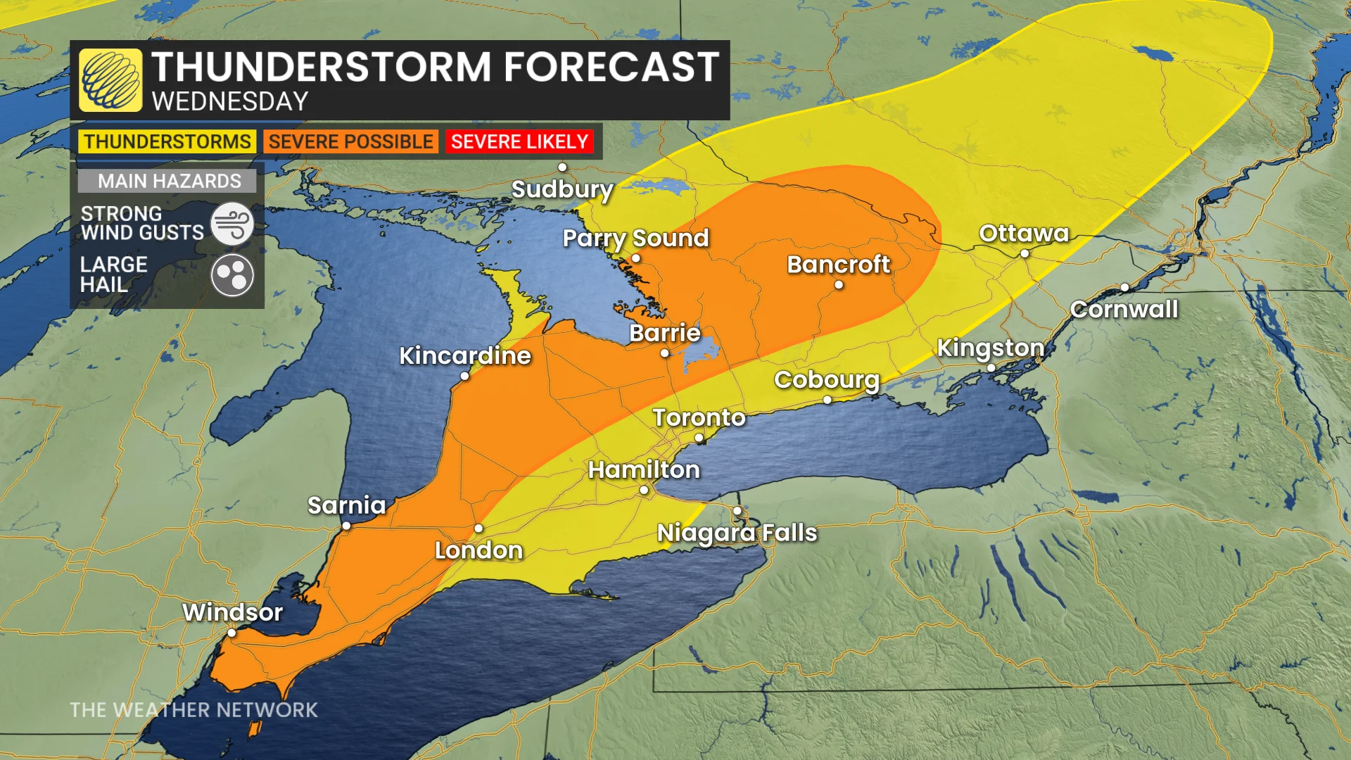
The storms on Wednesday afternoon and evening will have the potential to produce wind gusts of 80–100 km/h, heavy downpours and quarter-sized hail. However, some uncertainty of the storm development and how strong they will get exists because of the wildfire smoke and timing of the front.
Keep an eye on local weather alerts for your area before heading out Wednesday, and be prepared to adjust any outdoor plans.
Thunderstorm threat shifts south on Wednesday
The ongoing wildfires in Western Canada have produced smoke that stick around in the air aloft on Wednesday. That means parts of Ontario could be experiencing lightning displays and hazy, smoke-filled skies simultaneously.
By Wednesday, the risk of showers and thunderstorms will move south into central and southern Ontario. The heat will make things more unstable as these regions will be sitting in a hot and muggy air mass, with the high 20s forecast by the afternoon.
Increased energy in the region could fuel wind gusts reaching 80–100 km/h, with a risk of quarter-sized hail and heavy downpours.
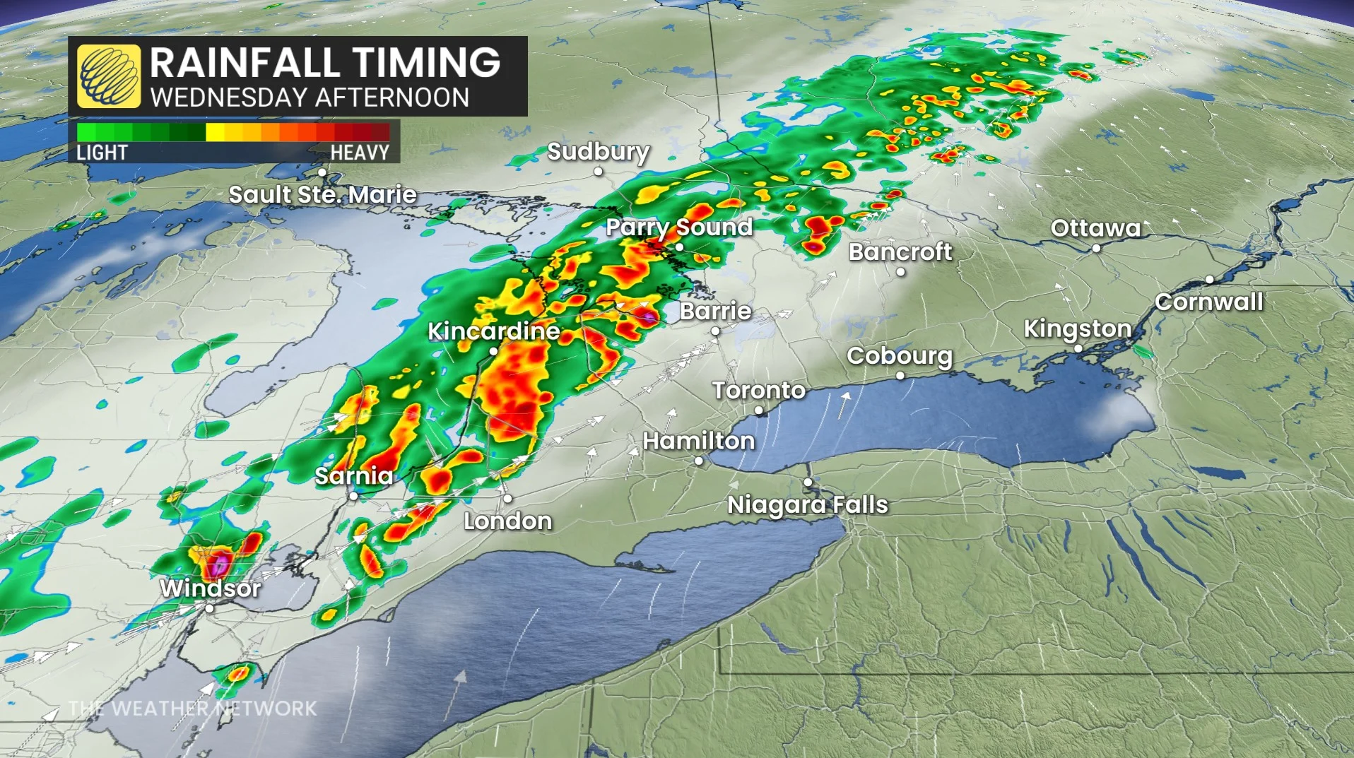
While much of the day is expected to remain dry along the Highway 401 corridor, there is potential for storms to develop later in the evening.
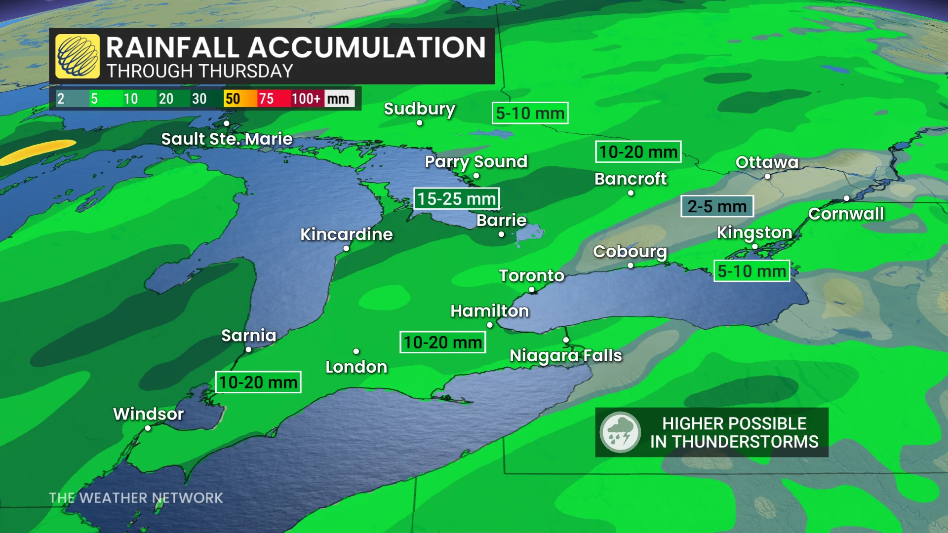
Forecasters are watching for storms to trigger from 4 p.m. to 7 p.m. EDT in regions stretching from Sarnia to Barrie, Ont.
There is some uncertainty with timing of the incoming front and some unpredictability with how far south the severe storms will track. Storms should move over similar regions, one after another, raising risks for localized flooding.
However, wildfire smoke and the timing of the cold front could limit the storm development.
Rising temperatures will also contribute to heightened instability in the area.
WATCH: Wildfires this year could put the brakes on stormy weather
Continue to follow The Weather Network for the latest weather updates across Ontario.