'That's the worst I've ever seen it': Spring snowstorm slams Saskatchewan
Some communities in Saskatchewan are digging out after an Alberta clipper blasted through the province on Tuesday, leaving an abundance of snow in its wake.
"Meadow Lake had the most significant report so far at 37 centimetres," said Danielle Desjardin, who is a meteorologist with Environment and Climate Change Canada.
Prince Albert saw about 18 centimetres of snow, while Saskatoon had 16 centimetres and Nipawin had 15 centimetres, she said.
Travel was not recommended on several highways around these communities on Wednesday morning, according to Saskatchewan's Highway Hotline.
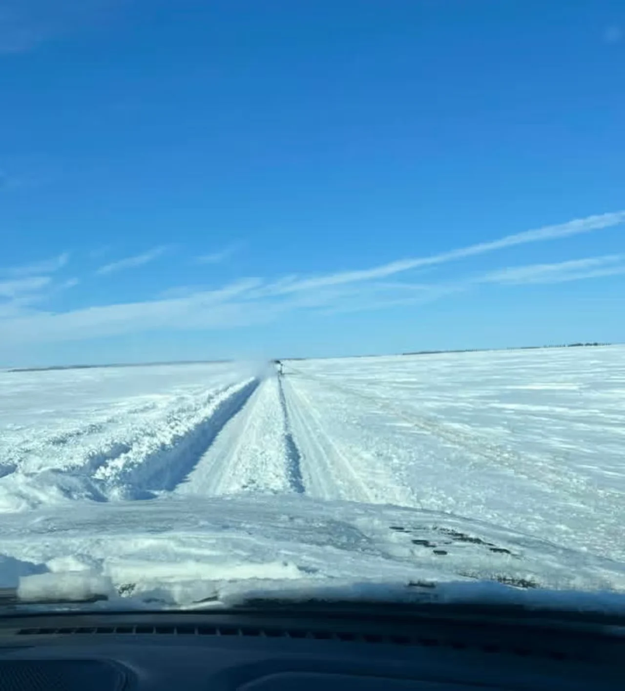
Highway 41 from Melfort, Sask., before the St. Breuix turnoff. (Landon Placsko /Facebook)
"On Highway 41 from Melfort going towards Saskatoon … the snow is probably about two to three feet deep," said Landon Placsko, a psychology student at the University of Saskatchewan, on Wednesday morning.
He faced gruelling, snow-covered roads while traveling to Saskatoon for classes from his acreage just outside Melfort.
"There [were] cars in the ditch everywhere. There's semis in the ditch. There's cars stuck on the highway," he said.
"That's the worst I've ever seen it since I've been driving."
Placsko said it took him nearly two hours to get to Wakaw, and even at Yellow Creek traffic was at a standstill with cars and semis stuck on the road and in the ditch.

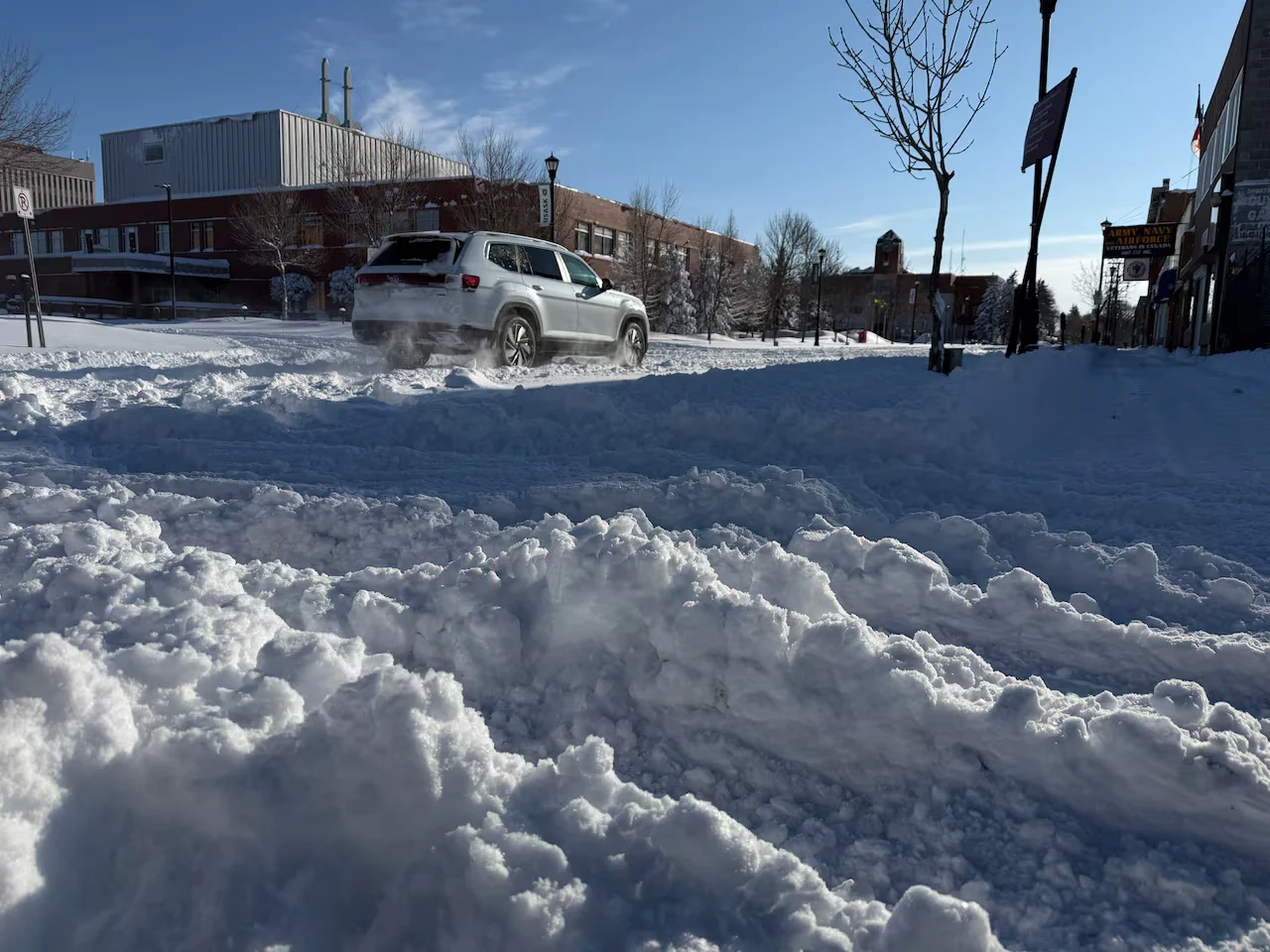
Snow covers Highway 3 on April 8 near Beatty, Sask. (Submitted by Brent Yeske)
He advised other drivers to stay home unless travel is absolutely necessary, particularly those without a truck, because even his 4x4 truck had some difficulty navigating the conditions.
"I was just one of the lucky ones to get through."
The heavy snow "significantly affected travel inside and outside city limits" in Prince Albert, according to a news release from the city.
"The duration and volume of snowfall have resulted in delays to transit, garbage, and recycling services."
Warmer temps won't be consistent for a while
Meteorologist Desjardin said the weather system has now made its way out of the province and into Manitoba. Temperatures should rise into the end of the week, but then the wintry weather might return.
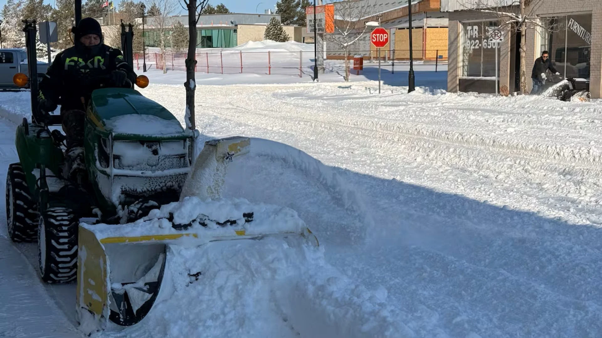
The snowfall from the Alberta clipper which passed through the province on April 8. (Lisa Risom/CBC)
"We're in for a bit of a roller-coaster into the weekend, we're looking at another system tracking in later in the weekend, Sunday through Monday," she said.
Desjardin said it likely won't be until the third or fourth week of April when seasonal temperatures start to show, especially in the southern part of the province.
"It really isn't uncommon to see these types of systems well into April," she said. "The chances become much less in May and pretty, pretty rare in June."
That means a few more weeks of chilly — possibly snowy — weather before warmer temperatures become consistent, she said.
Thumbnail courtesy of Lisa Risom/CBC.
The story was originally written by Darla Ponace and published for CBC News.