Summer drought puts GTA among the highest fire danger risk in Canada
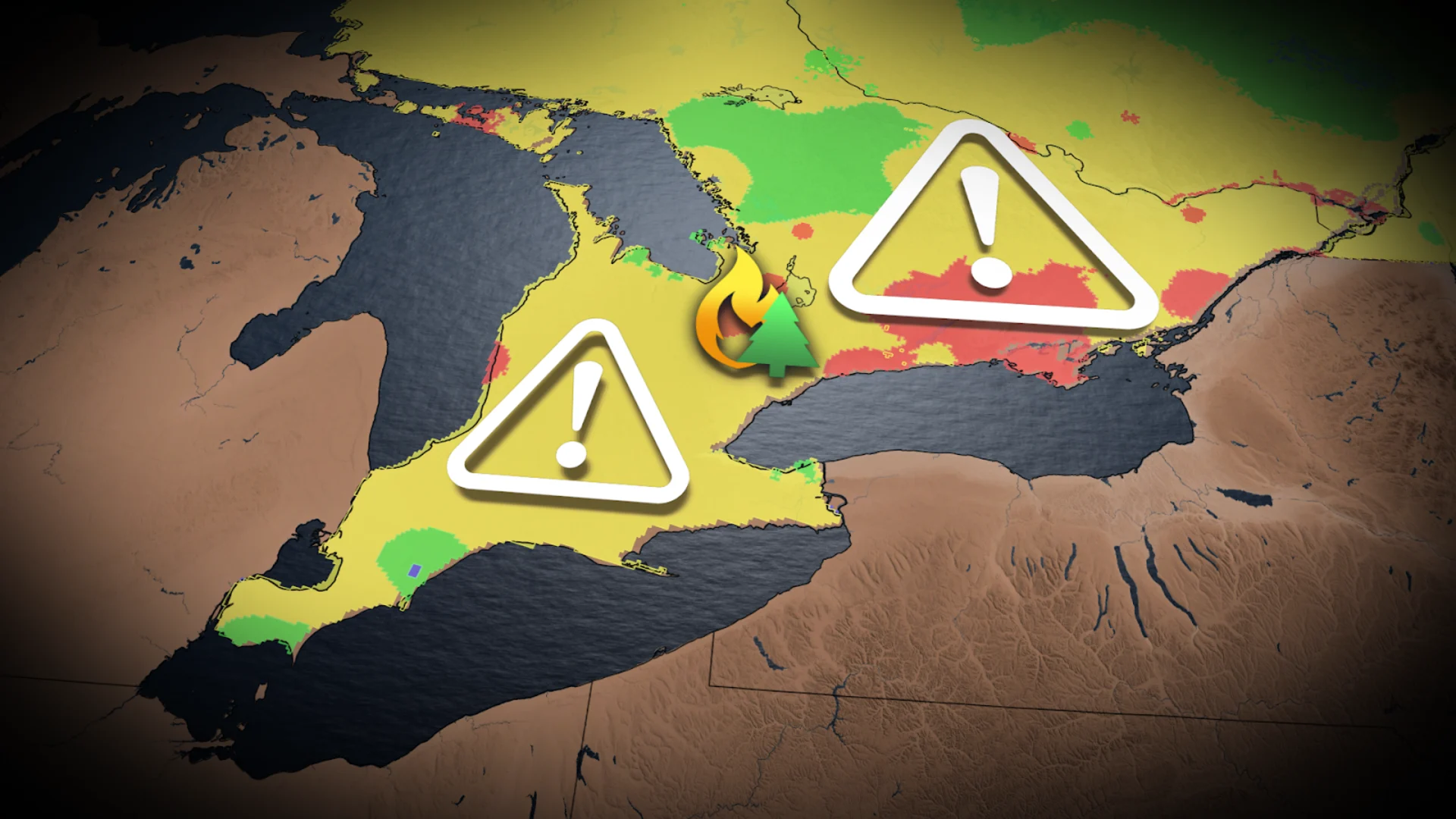
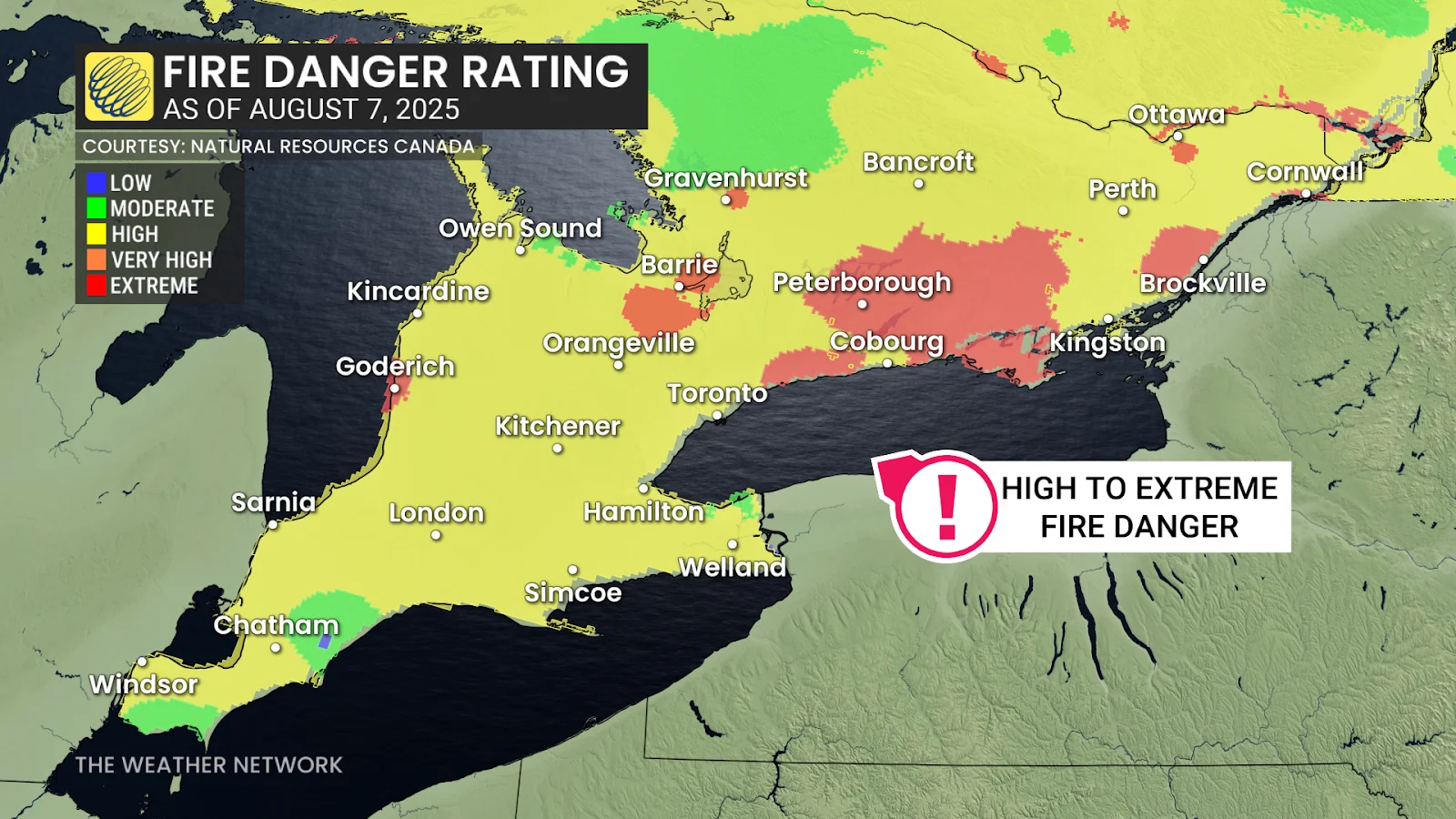
Parts of the Greater Toronto Area are in the extreme fire danger rating thanks to a persistent drought.
If you think this summer has been drier than normal, it's not just you. A moderate drought emerged east of Toronto in June and spread across most of southern and eastern Ontario by the end of July.
Rain has been pretty hit-or-miss this summer, with some storms popping up and dropping over 30+ mm of rainfall in one region and absolutely nothing in the next.
SEE ALSO: From Canada to Europe: Wildfire smoke makes a 5,000-km journey across Atlantic
This and the brutally hot temperatures have resulted in most of southern and eastern Ontario being at a high fire danger rating, but we are now also seeing pockets of extreme fire danger in parts of the Greater Toronto Area (GTA) and toward Ottawa.
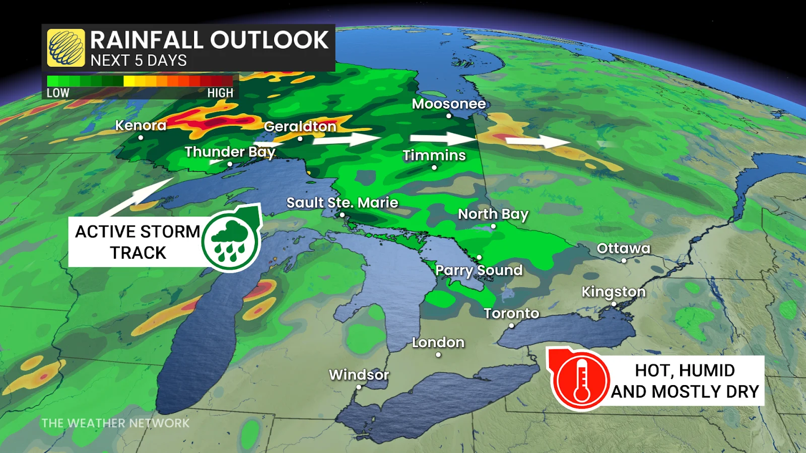
Is there any rain in sight to provide some relief from this drought? Sadly, no. The hot, humid, and sunny conditions are expected to stick around while the rainy and active weather pattern stays over northwestern Ontario for the next week.
An incoming ridge of high pressure over southern Ontario will keep the rain away and trigger yet another heat wave over the weekend that will last well into next week.
RELATED: Widespread heat wave set to scorch Ontario and Atlantic Canada
With fire danger across the region being high to extreme, numerous provincial parks and regions have issued complete fire bans. As of Aug. 7 complete fire bans include:
Kawartha highlands
Devils Glen
Lions Head
Mono Cliffs
Ottawa river
Petawawa
Rideau River
Severn River
Turkey Point
Wasaga beach
Folks out camping or just wanting to enjoy a backyard fire can expect these bans to last well into the next few weeks as we wait for a pattern change to come and bring in some much-needed rain.
Stay with The Weather Network for more information and updates on your weather across Ontario.