Softball size hail possible as marathon severe storms continue

Parts of the U.S. have seen softball size hail, intense winds, and tornadoes over the past couple of days
Parts of the United States will face the risk for hailstones as large as softballs on Friday as a prolonged stretch of severe weather continues into this weekend.
The severe storms have extended into Canada at times, prompting the year’s first tornado warning in southern Ontario on Wednesday morning.
DON’T MISS: Tornado warning safety: Here’s what you should do
Many reports of very large hailstones this week
Repeated rounds of severe thunderstorms have hit the northern and central United States since this past Tuesday.
The U.S. Storm Prediction Center (SPC) has received more than 700 reports of hail at least the size of a quarter so far this week, including more than 250 reports of hail the size of golf balls or larger.
A swath of extremely large hail fell in southern Wisconsin on Tuesday evening. One trained spotter near the city of Madison reported a hailstone measuring around 10 cm (4 inches) in diameter, likely making it one of the largest hailstones on record for the region.
This same batch of storms continued moving east and reached southern Ontario during the overnight hours, prompting Canada’s first tornado warning of the year early Wednesday morning. Several communities in the region are staving off rising floodwaters exacerbated by the heavy rainfall.
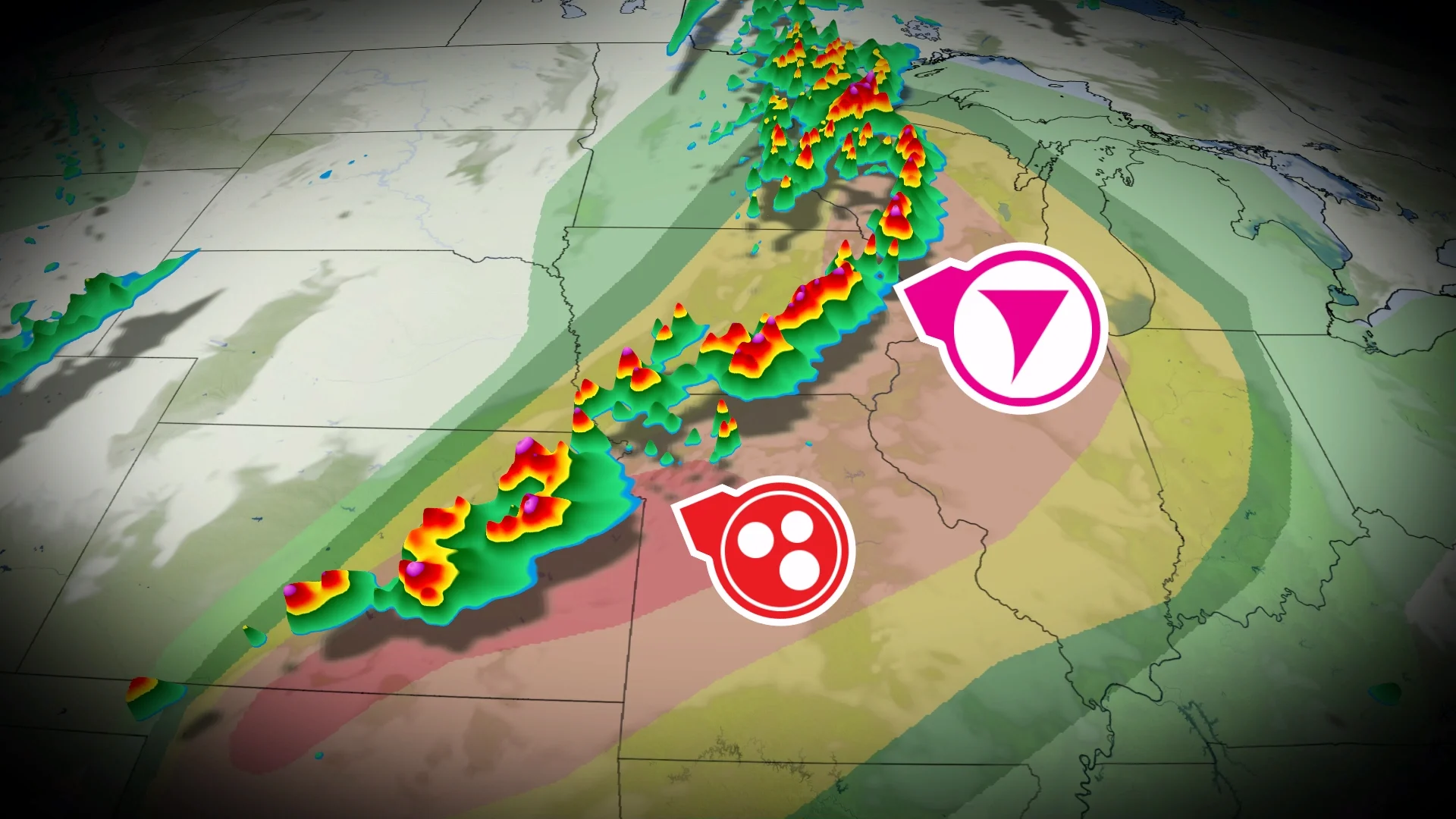
Risk peaks Friday with widespread dangerous storms
Another widespread severe weather event is unfolding on Friday, with a level 4 out of 5 (moderate) risk for severe weather in effect for portions of the Plains states.

Far-reaching tornado watches spanned the central U.S. through Friday evening, advising those in the region of potentially strong tornadoes, hailstones as large as softballs, and very strong wind gusts possibly in excess of 115 km/h.
It’s rather unusual to have so much sustained severe weather across the northern U.S. this early in the season.

Intense severe thunderstorms usually remain in the southern tier of the U.S. during the early spring months. We'd expect the bulk of tornado activity to unfold in Mississippi or Alabama this time of year. Based on climatology, hailstones larger than 5 cm (2 inches) are usually concentrated in northern Texas and Oklahoma during the middle of April.
A normal severe weather season would typically see the core of thunderstorm activity migrate north toward the Upper Midwest by the heart of the summer months.