See the aftermath of Canada’s prolific fires from space

This year’s wildfire activity rivals some of the worst seasons in the past 40 years
Canada is in the midst of its second-worst wildfire season in the past 40 years as fires continue to burn from coast to coast.
The aftermath of the blazes is easily visible from space—and high-resolution satellites even caught some of the fires as they raged.
STAY SAFE AND INFORMED: The Weather Network's wildfire hub
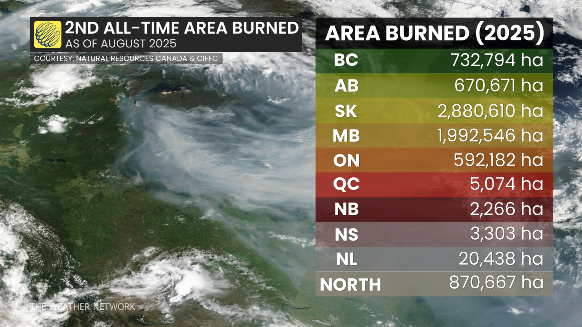
Wildfires nationwide have burned a total of 7,810,899 hectares of land through Aug. 22, marking the second-highest total since the Canadian Interagency Forest Fire Centre’s data began in the early 1980s.
The awful 2023 wildfire season remains firmly in the top spot, during which more than 17.3 million hectares of land burned across the country.
It’s easy to see the damage from space.
RELATED: Canada's fire bans and danger ratings explained
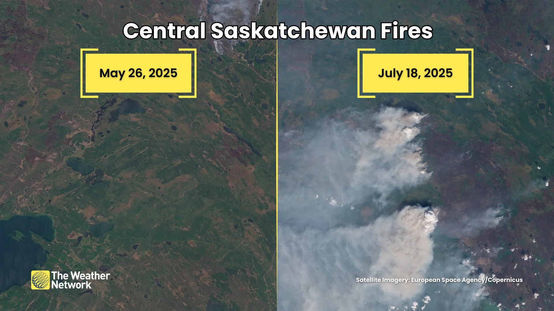
This pair of satellite images from central Saskatchewan tells the story across the region. High-resolution imagery reveals the extent to which vast swaths of forest have burned near Montreal Lake, about 140 km north of Prince Albert.
Most of this year’s significant blazes occurred in Saskatchewan and Manitoba.
The two provinces combined account for more than 62 per cent of the total land burned across Canada through the middle of August. Saskatchewan alone has seen nearly 2.9 million hectares burned so far this season.

Crews have battled significant fires elsewhere throughout the country. Hundreds of people were evacuated on Newfoundland’s Avalon Peninsula as the Kingston Fire grew to consume more than 10,000 hectares as it destroyed hundreds of structures.
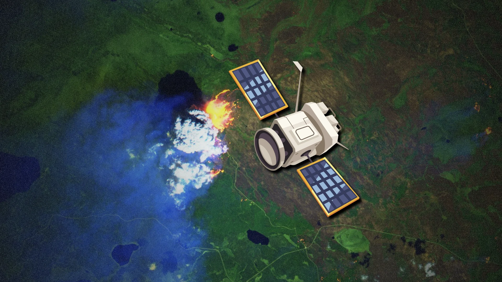
The European Space Agency’s Sentinel-2 satellite caught a high-resolution view of the blaze on an otherwise clear afternoon on Aug. 13. A false colour composite—designed to highlight different land features—clearly revealed the extent of the flames themselves.
Officials recently announced that the active wildfires across the country could continue “well into autumn,” Reuters reported on Aug. 18.
Header image created using graphics and imagery from Canva and the European Space Agency/Copernicus.