PHOTOS: Toronto's snowiest day on record, 40-50+ cm reported

A significant winter storm hit southern Ontario on Sunday with widespread heavy snowfall and gusty winds
A high-impact and historic winter storm hit southern Ontario on Sunday with widespread heavy snowfall and gusty winds that reduced visibility to near-whiteout conditions at times.
The storm produced the most snow ever reported at Pearson International Airport in a single day.
The snow arrived as part of a larger system affecting much of the U.S. and Eastern Canada. South of the border, more than one million customers lost power Sunday and airlines cancelled more than 10,000 flights.
Pearson International Airport reported hundreds of flight cancellations due to the snow on Sunday. Widespread travel issues were also reported on area highways due to rapid snow accumulation and low visibility.
Many school districts cancelled classes for Monday, including:
DON'T MISS: Car stuck in a snow pile? Proceed with caution
Heavy snow accumulations reported
Easterly winds gave rise to a band of lake-enhanced snowfall off Lake Ontario, which blew over the Greater Toronto Area with intense snowfall rates of 3-5+ cm per hour.

Here are some unofficial snowfall reports as of 6 a.m. local time on Monday:
Downtown Toronto: 56 cm
Milton: 53 cm
Toronto (YYZ): 46 cm
Trenton: 37 cm
London: 17 cm
Ottawa: 8 cm
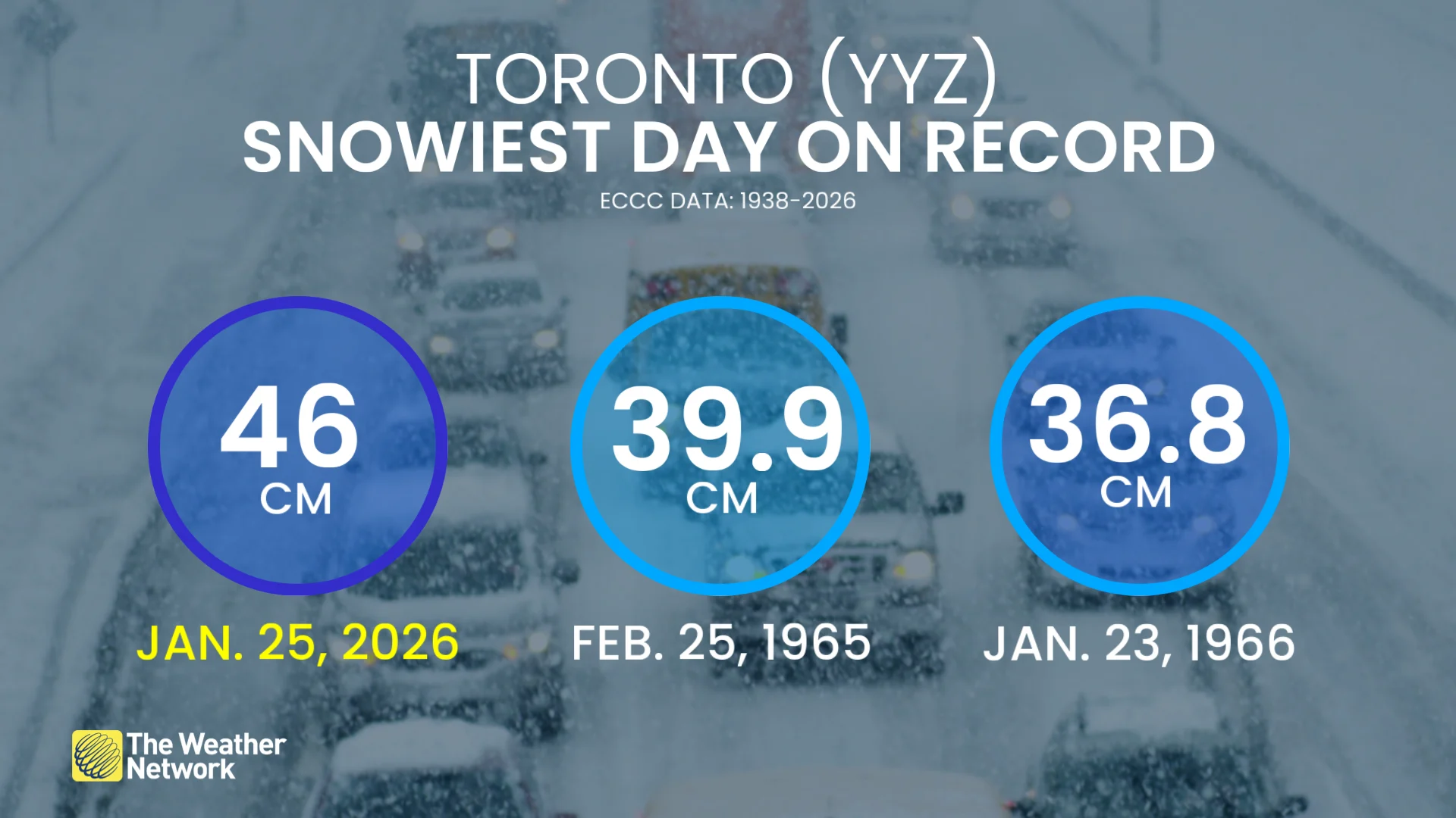
This is now the all-time snowiest day ever reported at Toronto airport, where records stretch back to 1938. The previous single snowiest day was 39.9 cm on Feb. 25, 1965.
To put that record into perspective, Toronto saw more snow in six hours on Sunday (32 cm) than the airport typically picks up on average during an entire January (31 cm).
See some of the visuals from the major winter storm across southern Ontario, below.

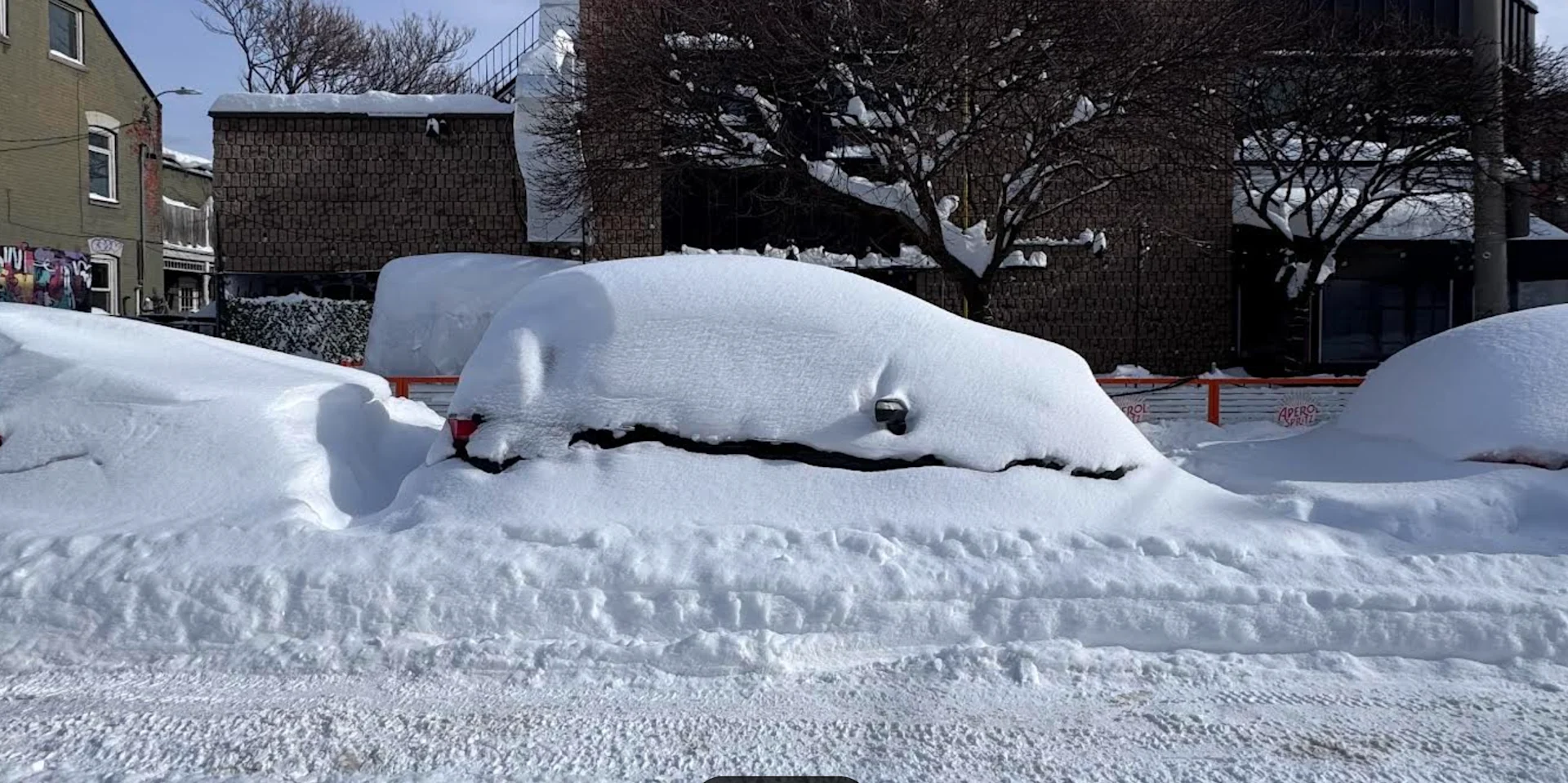
Toronto, Ontario. (Chris Rowe/Provided)

East York, Toronto. (The Weather Network)

East York, Toronto. (The Weather Network)

Oakville, Ontario. (The Weather Network)

Toronto, Ontario. (The Weather Network)

Highway. 7 and Dufferin St. in Vaughan, Ont. Vehicle lost control on a curve and crashed into a guardrail. Emergency crews on scene, no major injuries, but very heavy snow falling at the time. (Provided)

Highway 7 and Dufferin St. in Vaughan, Ont. Vehicle lost control on a curve and crashed into a guardrail. Emergency crews on scene, no major injuries, but very heavy snow falling at the time. (Provided)

Highway 7 and Dufferin St. in Vaughan, Ont. (Provided)
WATCH: Heavy snow blankets southern Ontario on Sunday
(Header image: Vehicle covered in heavy snowfall. Toronto, Ont., on Jan. 26. Chris Rowe/Provided)