Overland flooding triggers evacuation alert in locale southeast of Fort McMurray
A northern Alberta community southeast of Fort McMurray has been placed on evacuation alert as the thawing Clearwater River begins to overflow its banks.
In an evacuation alert Tuesday, emergency officials said everyone in the community of Draper, Alta., should be prepared to leave on short notice due to increased overland flooding.
In an advisory issued shortly after 8:30 a.m. Tuesday, municipal officials with the Regional Municipality of Wood Buffalo said the alert has been issued due to the potential of an ice jam flooding event along the Clearwater River.
An ice jam on the Athabasca River near Fort McMurray is causing water levels along the Clearwater River to rise, officials said.
Water levels could impact egress and access on Garden Lane and River Bend Close, the advisory warned. As of Tuesday morning, some sections of Garden Lane were already washed out, submerged in icy water.

A trailer and shipping container sit almost completely submerged in downtown Fort McMurray as river levels rise. April 28, 2026. (Jamie Malbeuf/CBC)
Draper, a small rural neighbourhood in the Regional Municipality of Wood Buffalo, has a population of 137 residents and is located about 12 kilometres southeast of Fort McMurray along the Clearwater River.
It is among a handful of neighbourhoods across the Fort McMurray region that have been bracing for possible flood damage as spring thaw triggers ice jams which threaten to trigger flooding as ice in local rivers flows north.
'Just shocking'
Kelton Stanowitch said he noticed the surging river during his drive home from work and decided to go for supplies, including a fresh bag of food for his cat, just in case conditions worsen.
He said he and his partner are also planning to pull some valuables up from their basement and pack an emergency bag.
Stanowitch, who spoke with CBC from the edge of Snye Point Park in Fort McMurray, said residents are on edge as they watch waterfront streets wash out and riverside parks become lakes.
He said that despite the municipality’s recent flood mitigation efforts, he doesn't believe damage from powerful ice jam flooding can be fully prevented.
“You're not gonna stop nature,” he said. “I mean, this is just shocking.”

Flooded sections of Garden Lane, located south of Fort McMurray in the neighbourhood of Draper, on April 28, 2026. (Vincent Mcdermott/CBC)
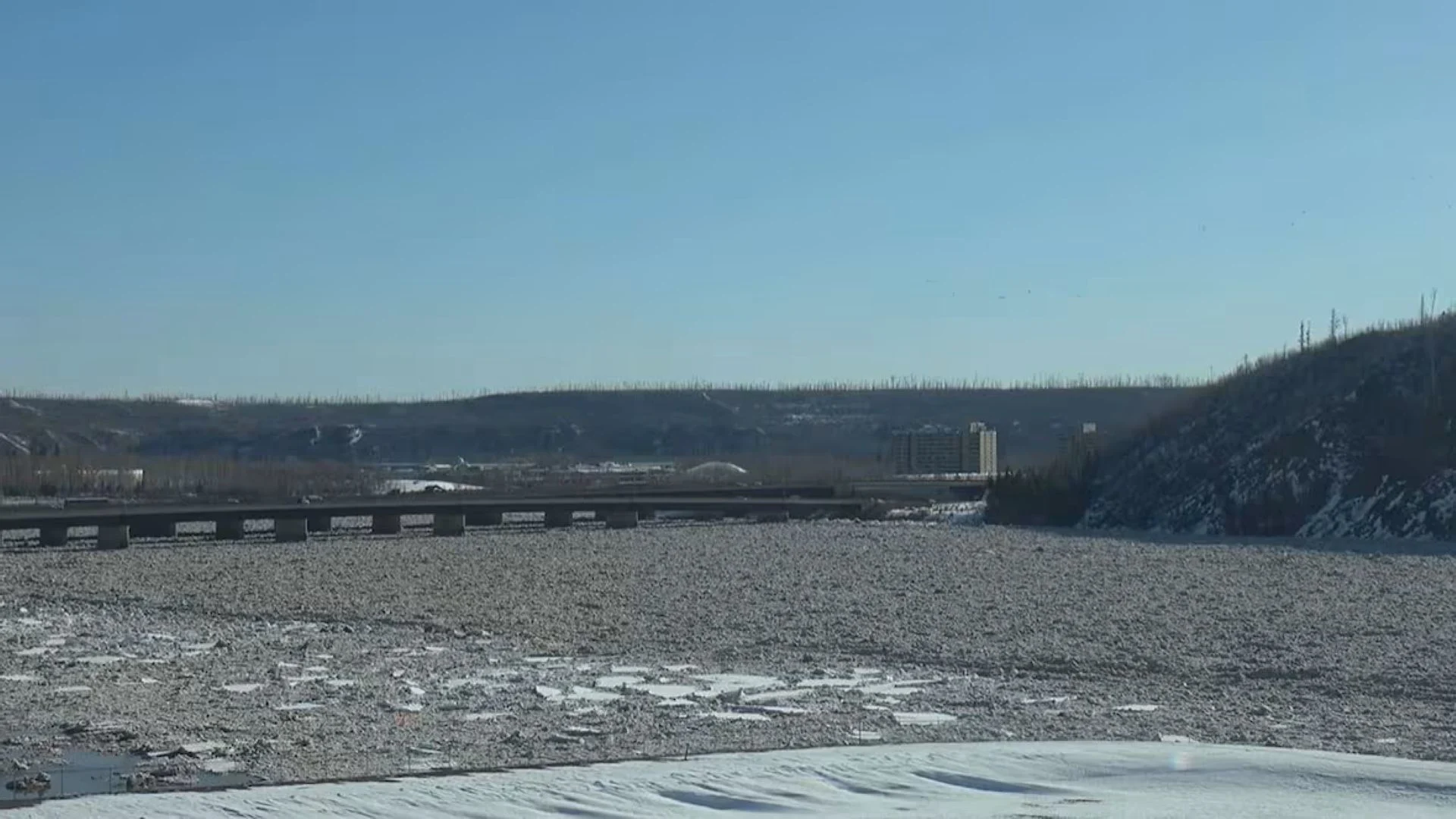
According to the latest provincial ice jam watch advisory issued at 8 a.m. Tuesday, river breakup began in Fort McMurray on Monday evening. An ice jam formed through town around 11 p.m., causing water levels to rise about 5.5 metres on the Athabasca River and 4.5 metres on the Clearwater River. Municipal officials are expected to provide an update on the latest conditions at 1 p.m. MT.
The rise in water levels is being closely monitored on the rivers. Provincial river forecasters have issued an ice jam watch.
Everyone in Draper is advised to prepare a 72-hour emergency kit , make an emergency plan and closely monitor emergency advisories issued by local emergency officials.
Officials urged residents in the area to review their home insurance policies and to notify emergency responders if they are aware of any neighbours who may need assistance evacuating.
River breakup each spring often brings the risk of flooding, and emergency officials have been watching closely in recent days as the Clearwater and Athabasca Rivers have begun to swell.
A series of ice jams in the region is being closely monitored by helicopter and drone, including an ice jam approximately 20 kilometres long which has formed in the Athabasca River upstream from the Thickwood area of Fort McMurray.
In an advisory issued Monday, RMWB officials cautioned ice conditions may change with little warning in the coming days, especially as temperatures warm.
A history of flooding
Fort McMurray has a long history of flooding, primarily caused by ice jams at the confluence of the Athabasca and Clearwater rivers. While the region has recorded many floods over the decades, the flood of April 2020 was considered the most damaging in more than a century.

That spring, a massive 25-kilometre ice jam on the Athabasca River caused water levels to rise dramatically, temporarily displacing about 13,000 residents and damaging more than 1,200 structures in the downtown area.
Stewart Jones, who has lived in Fort McMurray for decades, is no stranger to flooding and recalls seeing people in canoes "float" through downtown during previous evacuations. He said he remains hopeful that the jam will clear without major damage.
“I’ve got a bad feeling ... There’s been a lot of snow this year so it might be a little tough to get it to go up north, “ he said of the ice jam that’s formed upstream of Fort McMurray. “But that's what we want. That’s all we want.”
Stanowitch said previous floods have come with little warning. He said he is thankful that, this time, they have the benefit of time.
He urged other residents to focus on their personal safety in the days ahead.
“The only thing that's valuable is yourself, your loved ones, your friends, your family,” he said.
“But really, it's all you have is yourself and the people around you. And luckily we're able to witness it. We're able to see it. We're able to have time to get ready and prepared.”
Thumbnail courtesy of RMWB via CBC News.
The story was originally written by Wallis Snowdon and published for CBC News. It contains files from Jamie Malbeuf and Vincent McDermott.