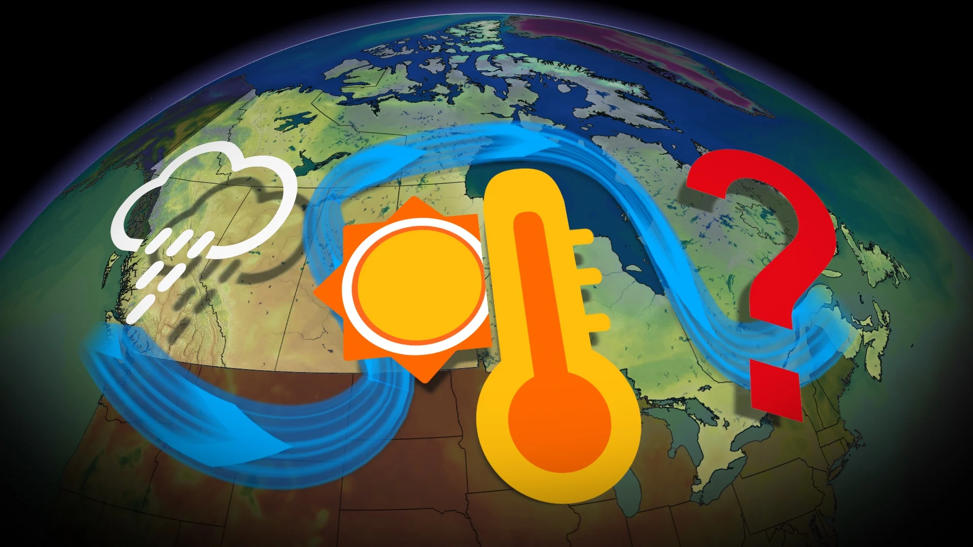
Pleasant or foul weather? Omega block parked in Canada for a few days
An Omega block pattern will narrate the weather in Canada for the next few days. We break down what that means for both sides of 'nature's traffic jam.'
An Omega block will be the bringer of good weather for some in Canada this weekend, and the bearer of unpleasant conditions for others.
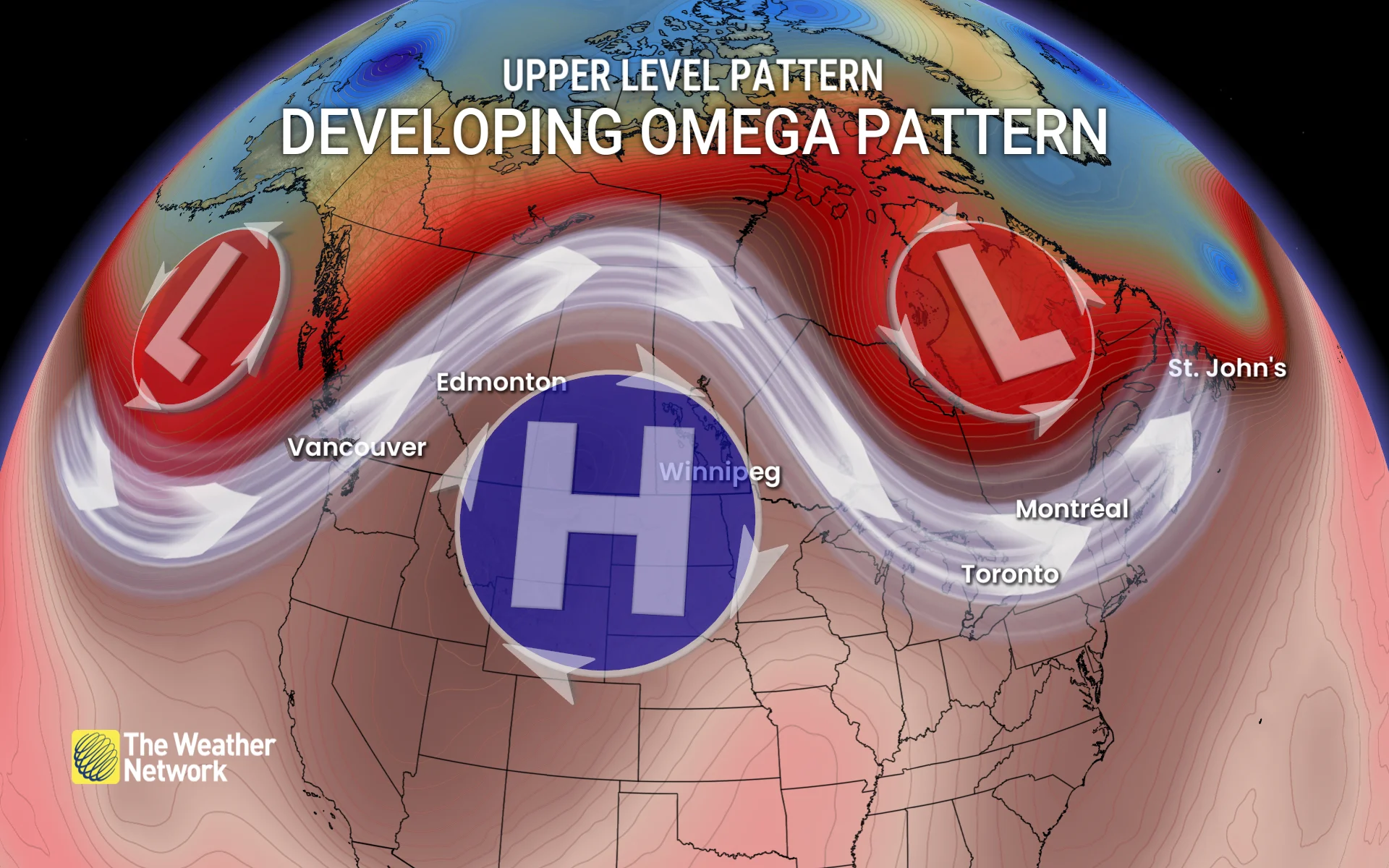
In a nutshell, an Omega block is nature’s version of a traffic jam. The classic setup occurs when a ridge of high pressure finds itself stuck between two lows--with troughs on each side of it.
Visit our Complete Guide to Fall 2025 for an in depth look at the Fall Forecast, tips to plan for it and much more!
Here's what that means for Canada's weather this weekend.
Nature's traffic jam in motion
A blocking pattern in the upper levels of the atmosphere is similar to a traffic jam on a highway.
The jet stream tends to move along at hundreds of kilometres per hour. Long-distance flights heading from west to east can save serious time and fuel by hopping into a healthy jet stream at cruising altitude.
So, the Omega blocks the usual west-to-east progression of weather. That spells great news for some and a plan-ruiner for others.
Who wins? Who loses?
The subpar weather will be found on the coasts, especially the West Coast, with cooling temperatures and a developing atmospheric river for the weekend.

The trough on the Atlantic coast won’t put any major systems ashore, thanks to the storm track remaining offshore. However, temperatures will cool but only dropping back to seasonal for the Maritimes but below seasonal for Newfoundland.
The winners will be from Alberta to Quebec.
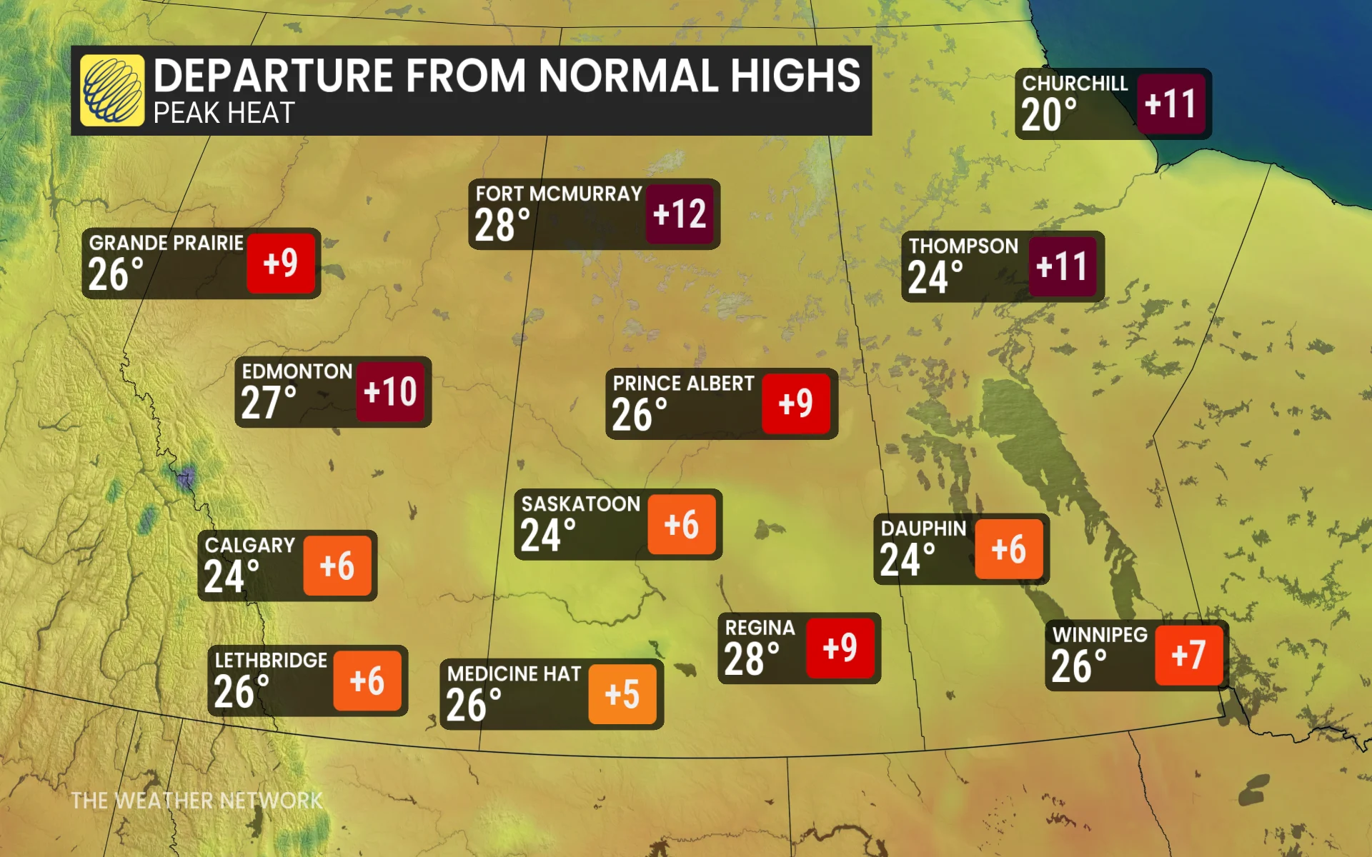
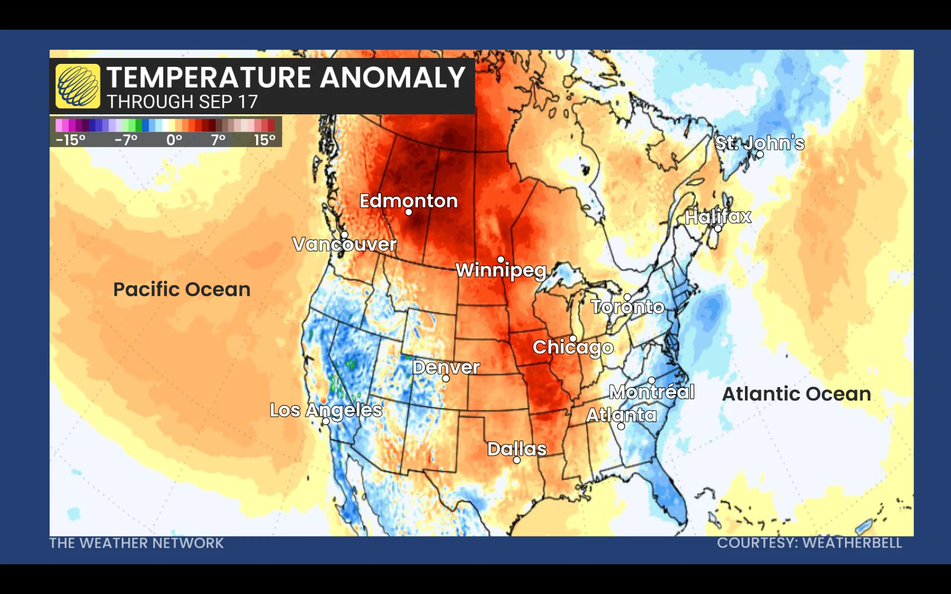
Heat will be drawn up the backside of the ridge onto the western Prairies and Northern Canada, where temperatures will be more than 10°C above normal for many areas, potentially reaching 30°C.
If that occurs in Fort McMurray, Alta.,it will be on of the latest occurrence of 30-degree temperatures on record for the community.

The eastern side of the ridge won’t see the same significant warmth, but will bask in ample sunshine and calm winds––a rare occurrence as we head into fall.
For Ontario, the ridge's influence means light winds, afternoon lake breezes, ample amounts of sunshine and seasonably mild temperatures.
Wiht files from Tyler Hamilton and Kevin MacKay, meteorologists at The Weather Network, and Dennis Mersereau, a digital journalist and weather specialist at The Weather Network.