Drought relief: Soaking rains hit Newfoundland, chance for 75+ mm
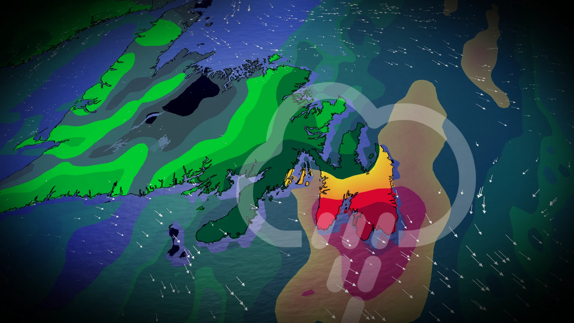
Significant rainfall will spread across eastern Newfoundland as a cold front pulls in subtropical moisture. While the rain will help alleviate the region's dry conditions, it may also result in localized flooding in some areas
A moisture-laden system is set to bring significant rainfall to parts of Atlantic Canada, offering relief to areas in Newfoundland grappling with extreme drought conditions. Periods of rain will impact the eastern half of the island through Saturday.
DON'T MISS: Winter-proof your home with a heat pump that even works in -30°C
Some areas could receive over 75 mm of rainfall before the system dissipates, and while the rain will assist with dry conditions, localized flooding is possible in the hardest-hit areas.

The precipitation is very much needed in Newfoundland as the latest update of the Canadian Drought Monitor found that 99 per cent of Atlantic Canada started October abnormally dry or in a drought, including 100 per cent of the region’s agricultural lands.
Rainfall to ease dry conditions but may cause localized flooding
A cold front sweeping across Newfoundland on Thursday will bring the risk of showers and embedded thunderstorms to the Avalon Peninsula, contributing to high local rainfall totals.

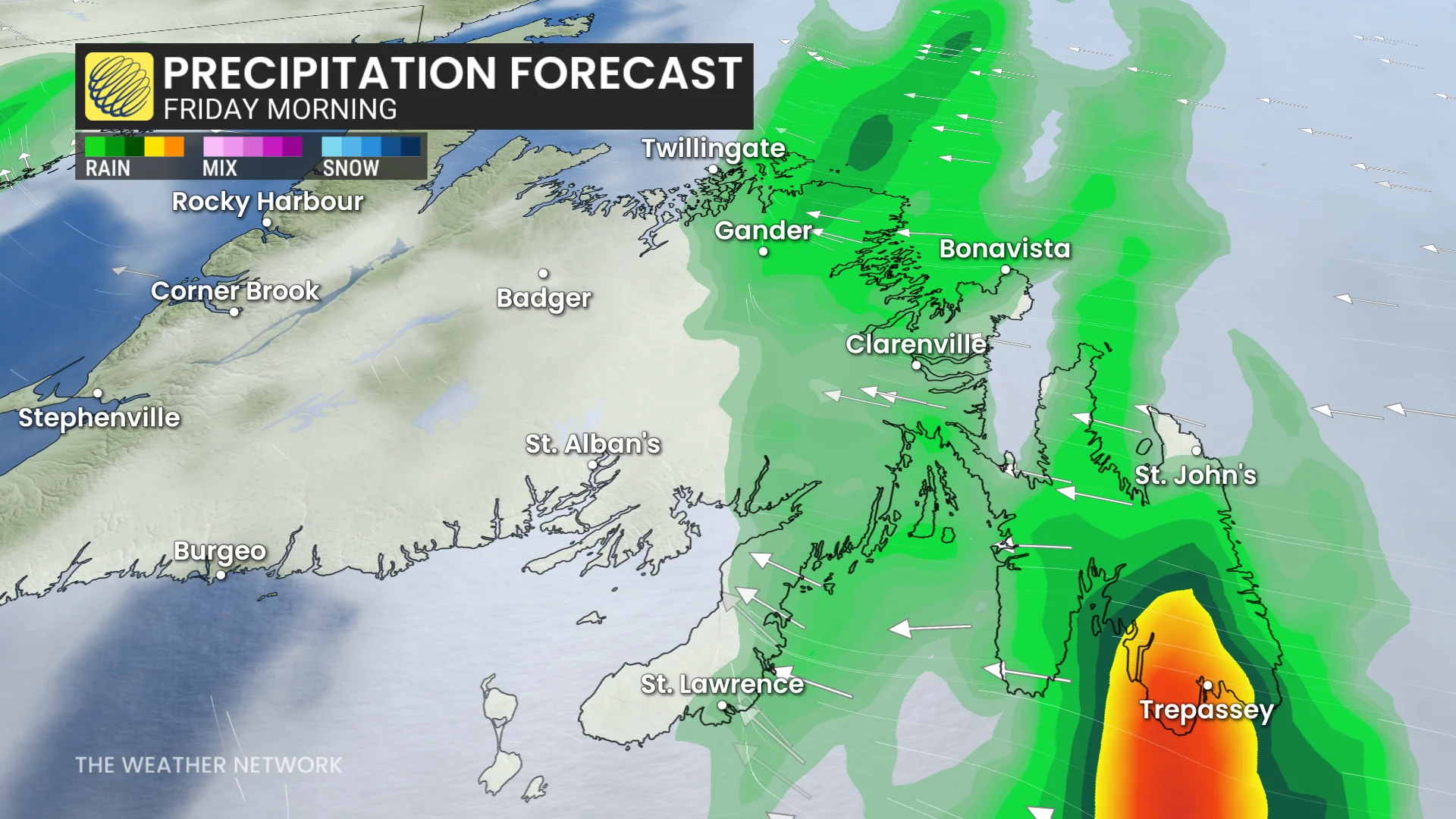
By Friday morning, a strong low pressure system will move into Newfoundland, bringing additional heavy rainfall.
The Avalon Peninsula is set to experience over 48 hours of persistent rain, with conditions easing by late Saturday as the system exits.

A high pressure system over the Atlantic is limiting the eastward progression of the low, keeping it stationary and driving repeated rounds of rainfall over the same areas. The heaviest rainfall is expected across southern Avalon on Friday morning, tapering off through the day.
However, a secondary low-pressure system arriving Friday evening will bring yet another wave of heavy rain into Saturday. Subtropical moisture along the cold front could push rainfall totals past 75 mm in some regions.

St. John's abnormally dry October
St. John’s typically sees an average of 158.1 mm of rain in October. However, as of October 21, only 35.8 mm has been recorded, marking a notably dry month for the region.

An additional 30-40 mm of rain is forecast by Saturday, offering some relief to below-seasonal precipitation levels. Many areas in the eastern part of the province have received less than half of their usual October rainfall.
Episodes of rain were few and far between
While recent rains offered some short-term improvements, we’ve failed to see any significant relief from the worsening aridity across Atlantic Canada. The region is now experiencing North America’s worst drought conditions east of the Rocky Mountains.
Worsening drought has taken a toll on the region’s agricultural industry. Crops are stressed and farmers are facing reduced yields due to the lack of rainfall. Some of the crops hit hardest, according to the Canadian Drought Monitor, include apples, corn, blueberries, pumpkins, and potatoes.
RELATED: What is a state of emergency? How these orders help in a crisis
The community of Hughes Brooks, N.L., recently declared a state of emergency due to its water levels running critically low.
A more unsettled pattern is expected towards Halloween and continuing through the first week of November, with the potential for a classic fall storm or two with windy and wet conditions. However, it is much too early to have confidence in the timing and impacts this far out.
