
The Prairies blizzard that caused 12-metre snow drifts

A historic blizzard in March 1966 swept through the eastern Prairies, building snow drifts so deep that they covered windows and doors
Extreme snow drifts buried cars and reached to the eaves of homes in some communities during a historic blizzard that struck the eastern Prairies in March 1966.
Residents who lived through the ordeal still remember the storm as the benchmark against which all future storms would be judged.
DON’T MISS: What turns a snowstorm into a raging blizzard?
A Colorado low turns into a Winnipeg blizzard
A low-pressure system that developed over southeastern Colorado on Wednesday, Mar. 2, 1966, would grow into one of the eastern Prairies’ most memorable blizzards.
All the ingredients came together as the system tracked toward Minnesota over the next couple of days. Plenty of cold air to the north combined with ample moisture from the south to create widespread heavy snowfall.
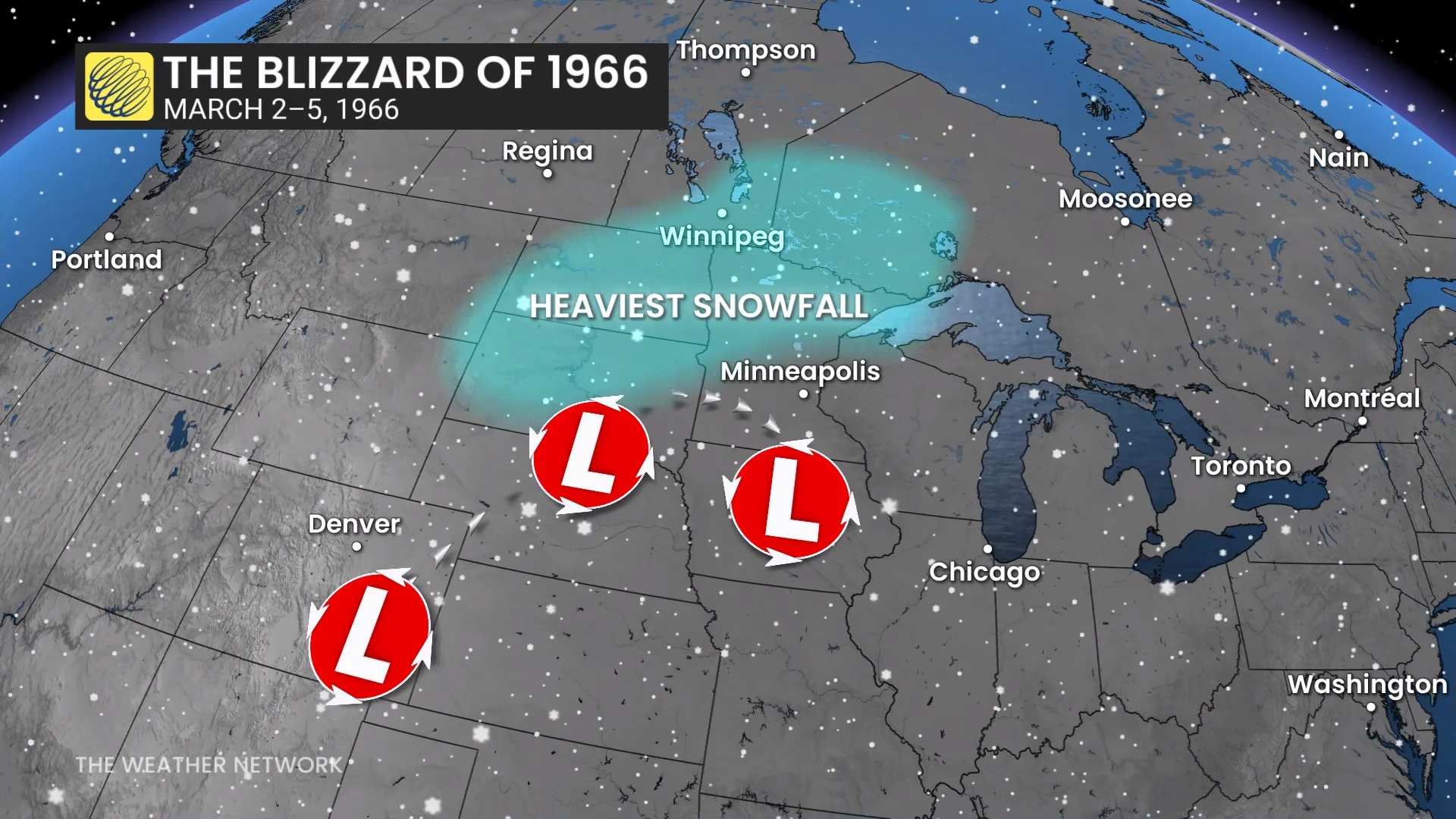
A blocking pattern over Ontario forced the storm to slow to a crawl, dragging out the high winds and heavy snowfall for several days in portions of the Dakotas and Minnesota.
Heavy snow began in Winnipeg at 1:00 a.m. on Friday, Mar. 4, and continued almost uninterrupted for the next 24 hours.
Blizzard conditions existed for the entire duration of the storm. The airport reported zero visibility between 4:00 a.m. and 6:00 p.m. Winds gusted to 113 km/h at one point.
Intense accumulations shuttered communities for days
Many communities across southern Manitoba and northwestern Ontario picked up 20-30+ cm of snow by the end of the storm.

Winnipeg officially picked up 35.6 by the time skies cleared out on Saturday, Mar. 5. Kenora, Ont., recorded an impressive 53.4 cm of accumulation, while Thunder Bay only saw around half as much.
Even heavier totals were reported south of the border. Grand Forks, North Dakota, saw 70.6 cm of accumulation over the course of four days. Observers in the state capital of Bismarck measured 56.9 cm of snow.

But it was the unforgiving winds that turned this into a historic ordeal. Snow drifts in the hardest-hit parts of North Dakota were reportedly 9 to 12 metres (30 to 40 feet) high in open areas.
Mounds of snow clogged streets and sidewalks across Winnipeg, burying cars to the point that it was tough for residents to find them. The few clear sidewalks were surrounded on either side by walls of snow taller than most pedestrians. Drifts swept up the sides of homes, often covering doors and windows and sometimes reaching up to the eaves.
Header image courtesy of NOAA/Collection of Dr. Herbert Kroehl, NGDC.