
The heat burst that sent readings to 38°C at midnight

A rare phenomenon roasted the Wichita area just after midnight on June 9, 2011
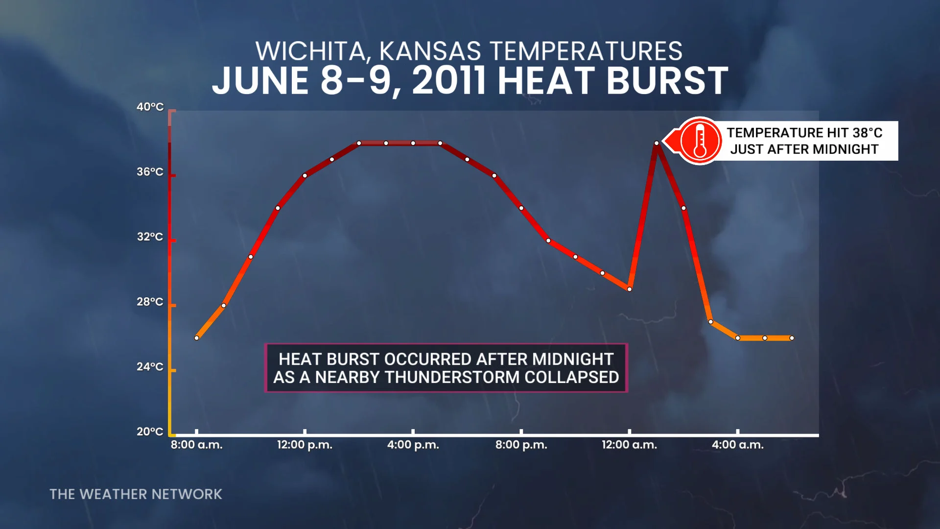
Thunderstorms rumbling across Kansas during the overnight hours on June 9, 2011, sent a rare heat burst surging through the city of Wichita.
Temperatures rose to unbelievable heights, pushing midnight readings higher than the hottest temperature ever recorded in many Canadian cities.
DON’T MISS: CAPE is the potent fuel that powers a thriving thunderstorm
Severe thunderstorms are a common sight on the Plains during the opening days of meteorological summer. Even the strongest storm eventually fizzles out. But sometimes it’s the dying storms that cause the biggest headaches.
Temperatures climbed to 38°C in Wichita, Kansas, on the afternoon of June 8, providing enough fuel for clusters of thunderstorms to bubble up across the region.
RELATED: Microbursts can turn a gentle storm into a harrowing ordeal
One of those nearby thunderstorms dissipated around midnight as dry air began evaporating the rainfall within. Evaporation is a cooling process. This batch of cooler air began rapidly sinking out of the storm, warming up and drying out as it descended toward the ground.
By the time it reached the ground, this sudden downrush of hot, dry winds reached speeds of 100 km/h. Temperatures soared and humidity plummeted as the heat burst unfolded.
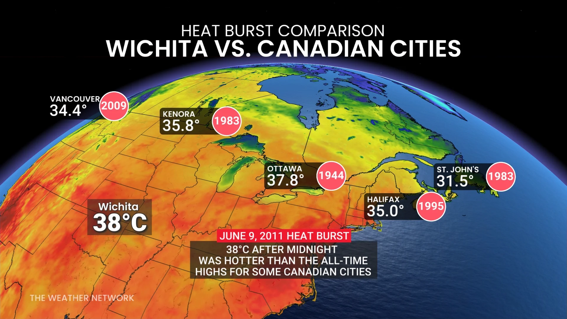
Wichita’s main airport saw readings spike from 29°C to 38°C shortly after midnight. This middle-of-the-night temperature is hotter than the hottest readings ever observed in:
Ottawa (37.8°C on Aug. 11, 1944)
Halifax (35.0°C on Aug. 1, 1995)
Vancouver (34.4°C on Jul. 30, 2009)
St. John’s (31.5°C on Jul. 6, 1983)
Wichita’s dew point plunged from a muggy 19°C to a bone-dry -3°C at the same time, briefly making the city feel like Las Vegas on a summer afternoon.
Heat bursts don’t last long. The temperature in Wichita recovered within two hours of the event, settling back into the mid-20s during the pre-dawn hours.
WATCH: Why these clouds are often confused for a tornado
Header image created using graphics and imagery from Canva.