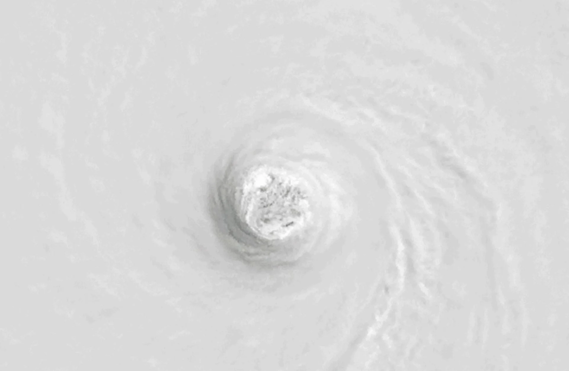
WATCH: Inside the eye of Polo as it grows into a historic hurricane

The stunning footage, captured by NOAA's Hurricane Hunters, shows the massive Polo as it intensified into a record-breaking, Category 5 powerhouse.
While Hurricane Polo has lost some of its power, the storm remains dangerous as it tracks towards a projected Monday landfall on the Baja California Peninsula in northwestern Mexico.
Earlier this week, NOAA's Hurricane Hunters recorded footage from inside the eye of Polo, now the second-most intense storm (by pressure standards) ever documented in the eastern Pacific basin.
In response to the rapid strengthening, NOAA's U.S. National Hurricane Center (NHC) called the intensification process “truly remarkable.”
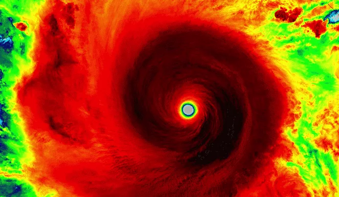
NOAA-20 infrared and visible instrument captured Hurricane Polo on Sept. 22. (NOAA/Visible Infrared Imaging Radiometer Suite)
A near-historic El Niño fuelled the perfect setup for the hurricane to approach the upper limit of how strong a tropical cyclone can grow.
Polo underwent rapid intensification, growing from a tropical depression into a Category 5 hurricane in about 40 hours. It obtained a peak instensity om Tuesday, Sept. 22, with maximum, sustained winds of over 285 km/h, according to the NHC.
As well, on Tuesday, Polo recorded a minimum, central pressure of 892 millibars, considerably lower than the standard, atmospheric pressure at sea level (1013 millibars), experiencing the second-fastest drop on record in the eastern Pacific.
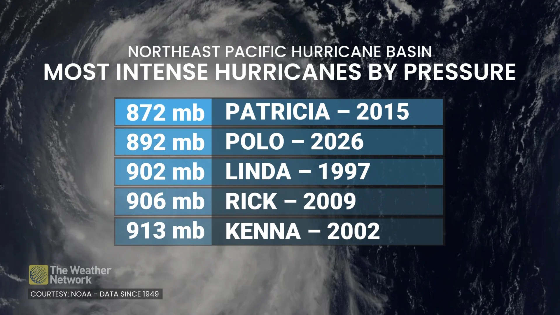
According to NOAA, Polo’s minimum, central pressure dropped by 88 mb in 24 hours, only ranking second to Hurricane Patricia in 2015. That storm saw an approximate, 100-mb drop in 24 hours.
Hurricane Polo has generated 37.2 units of accumulated cyclone energy (ACE), a measure that combines a storm’s intensity and duration. That’s more than four times the ACE generated by the entire Atlantic hurricane season so far.
With files from Dennis Mersereau, a digital journalist and weather specialist at The Weather Network, and Tyler Hamilton, a meteorologist at The Weather Network.
Thumbnail courtesy of NOAA/Visible Infrared Imaging Radiometer Suite (VIIRS).