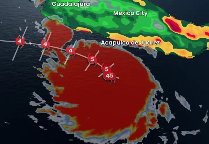
Hurricane Polo intensifies to Category 5 strength off Mexico's Pacific coast

Hurricane Polo, Category 5 strength, is forecast to bring heavy rain and potential flooding to Mexico's Pacific coast, prompting warnings for Guerrero, Michoacán, Oaxaca, Colima, and Jalisco.
Hurricane Polo reached Category 5 intensity early Tuesday, with sustained winds of 260 km/h, according to the U.S. National Hurricane Center (NHC). The storm was positioned 355 km south of the tourist town of Zihuatanejo, and 580 km south-southeast of Manzanillo.
Polo is forecast to move slowly along Mexico’s Pacific coast over the next few days, bringing significant rainfall.
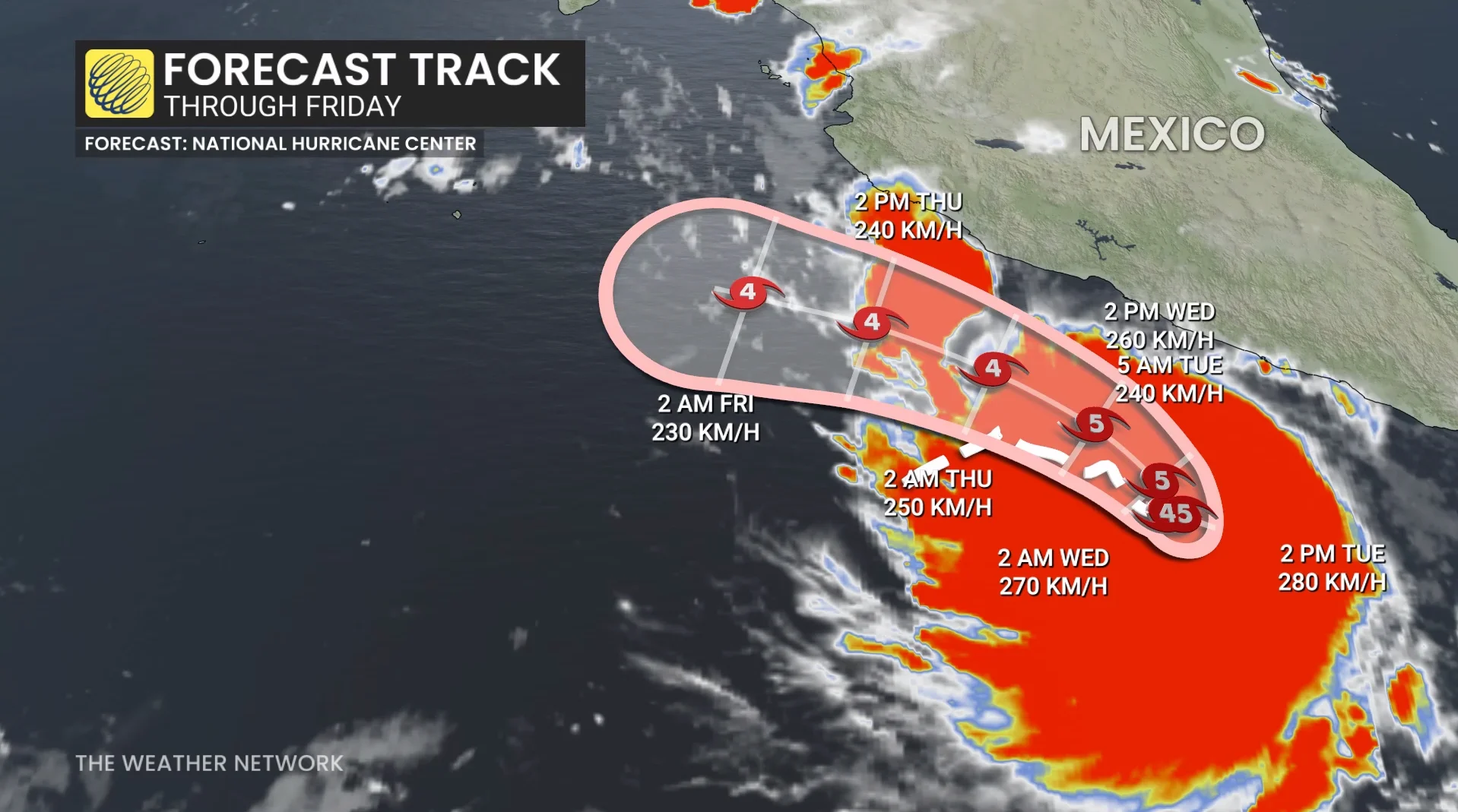
The NHC predicts 100 to 200 mm of rain for coastal areas of Guerrero and Michoacán, with isolated totals reaching 300 mm through Thursday. Oaxaca, Colima, and Jalisco could see rainfall between 75 and 150 mm during the same period. This level of precipitation may trigger life-threatening flooding and mudslides.
DON'T MISS: From Hawaii to Halifax, why is this hurricane season so bizarre?
Authorities in Mexico have issued warnings about potential river overflows in affected regions. The national civil protection agency urges residents to avoid flooded streets and secure outdoor objects that could become hazards in strong winds.
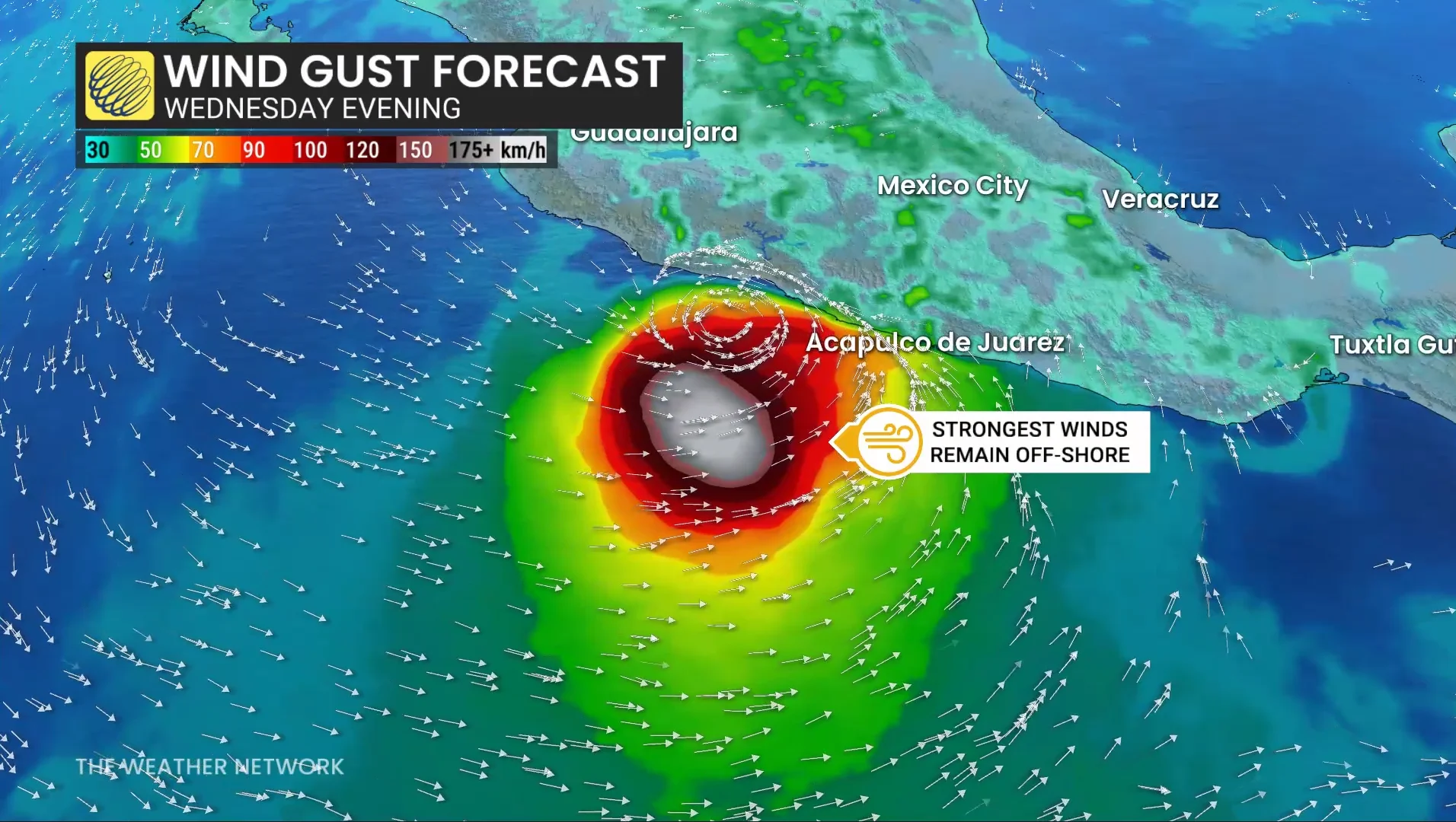
Stay informed as the situation evolves, and follow local advisories if located in areas forecast to be impacted by Hurricane Polo.
No hurricanes reported in the Atlantic by September 21, a first since 1914
Meanwhile, with just over two months remaining in the Atlantic hurricane season, which ends on Nov. 30, no hurricanes have been recorded so far. This unprecedented delay has already set a record for the latest start to the season, should a hurricane eventually form.
DON'T MISS: Atlantic's hurricane-free streak in jeopardy. Could Fay be the first?
Multiple factors may be contributing to the lack of hurricane development. One key influence is the ongoing “super” El Niño. El Niño patterns are known to increase wind shear across the Atlantic basin, hindering hurricane formation by disrupting the structure of developing storms.
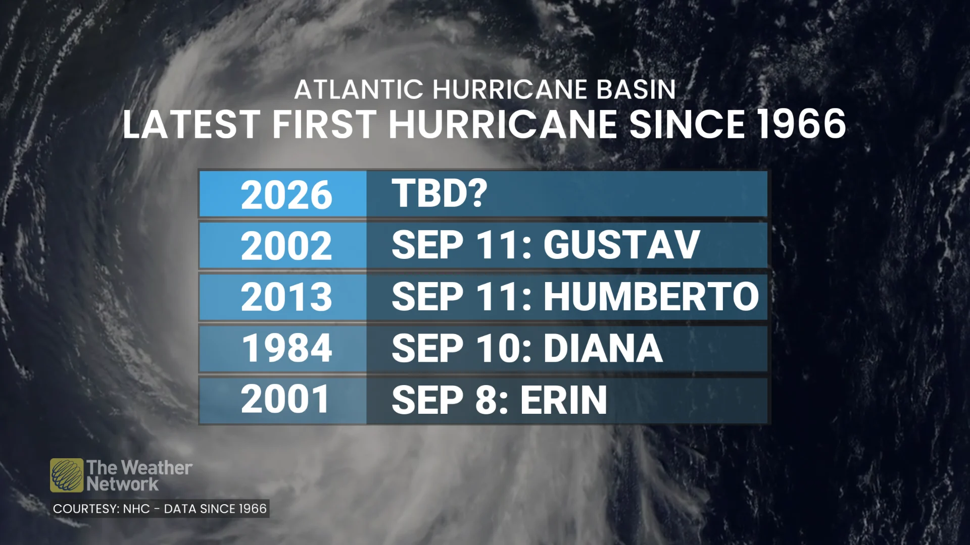
Since 1851, only two years—1907 and 1914—have passed without any hurricanes forming in the Atlantic basin.
With the climatological peak of hurricane season now behind us, the continued lack of activity raises the possibility that 2026 could become the first hurricane-free Atlantic season in the satellite era if no hurricanes develop in the coming weeks.