Flood risk rises as sluggish storms push through southwestern Ontario
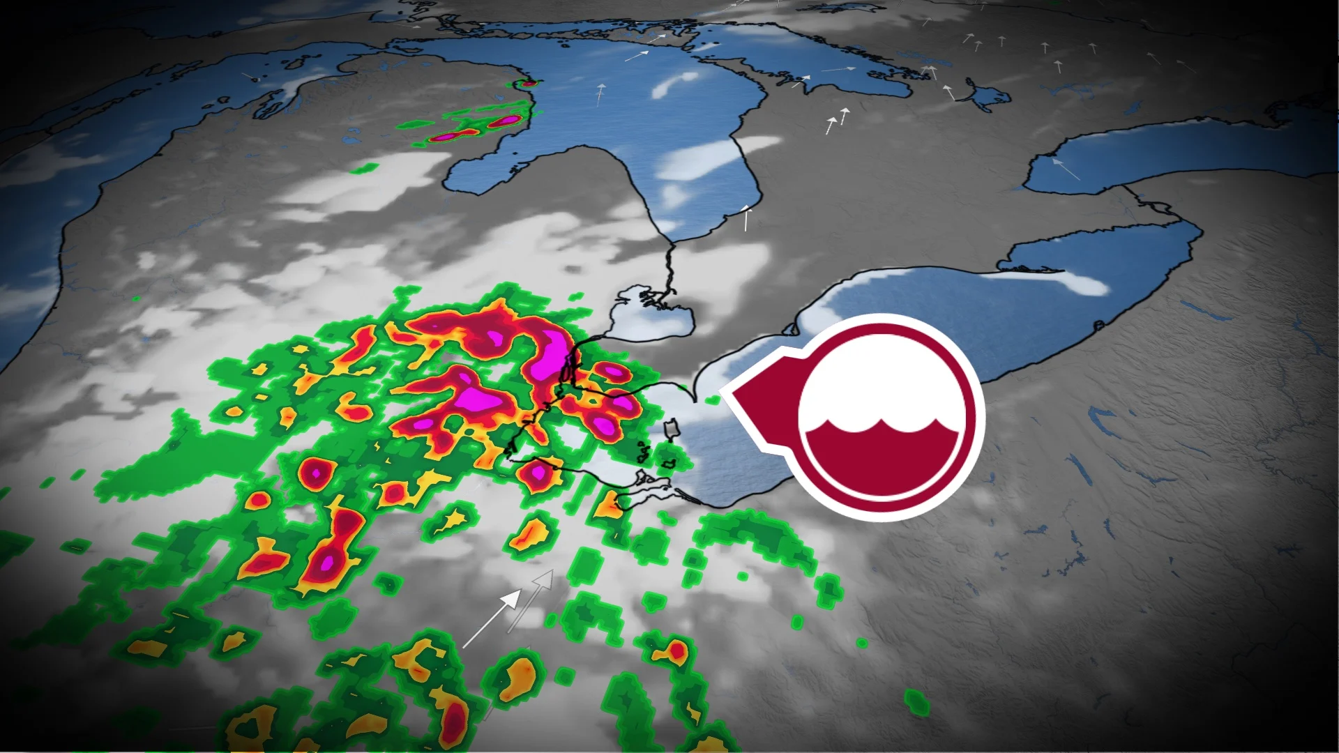
Folks in southwestern Ontario should pay close attention to the weather on Monday as slow-moving, severe thunderstorms raise the threat of localized flooding from heavy downpours
The final days of July could get off to a hot and stormy start in parts of southwestern Ontario as severe weather could push through Monday afternoon and evening, at a sluggish speed.
A severe thunderstorm watch is in effect in southwestern Ontario, with forecasters keeping an eye out stateside on Monday afternoon and evening for storms that could produce local rainfall amounts possibly exceeding 50 mm and wind gusts up to 90 km/h. With the slow movement of the storms and high rainfall amounts in a short time period, localized flooding is a concern.
PHOTOS: Large hail and 'serious winds' batter parts of Ontario, Quebec

Heavy rain can cause flash flooding and significant reductions to visibility. Strong wind gusts can damage trees, buildings and overturn vehicles.
Make sure you keep an eye on the radar––especially if you have outdoor plans––and stay aware of any severe weather watches or warnings issued in your area.
Monday: Flood threat with sluggish storms in southwestern Ontario
Slow-moving thunderstorms are ongoing stateside on Monday afternoon just south of the border. A severe thunderstorm watch is in place for Windsor-Leamington-Essex County.
DON'T MISS: From nuisance to nightmare: Huge hail is an extreme danger
"Driving conditions may be difficult. Local utility outages are possible," Environment and Climate Change Canada (ECCC) said in the watch. "Heavy rain can cause flash flooding and significant reductions to visibility."
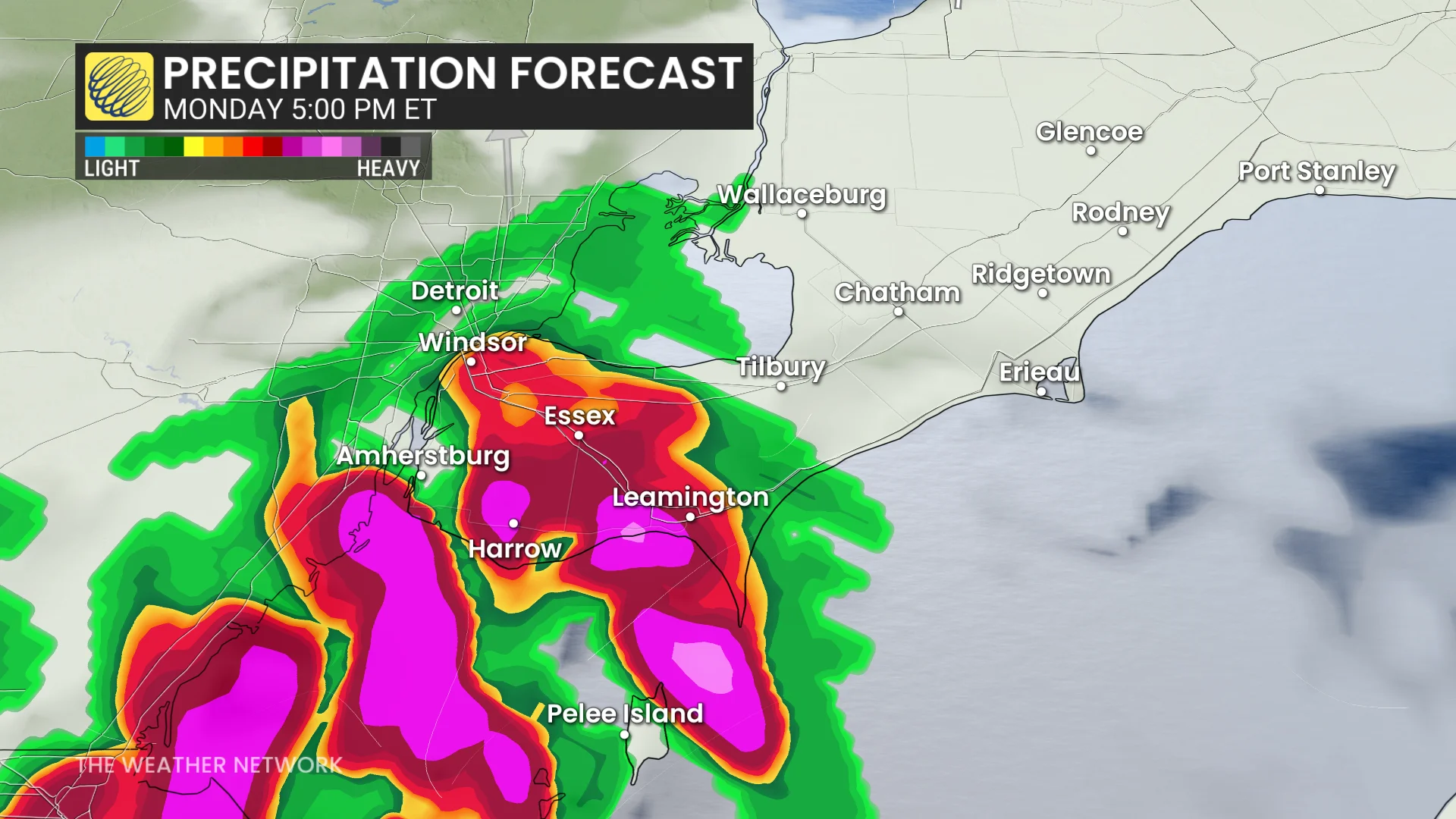
The storms are forecast to move east-southeast, impacting Windsor later Monday afternoon and evening.

With a very humid air mass in place, torrential downpour impacts are possible. Paired with slow storm movement, it may lead to localized flooding--creating a difficult evening commute, especially on Highway 401 corridor, east of Windsor, and Highway 3, from Windsor to Leamington, Ont.
Totals of 50+ mm of rain and wind gusts up to 90km/h may impact the extreme southwest, including Windsor.

Pop-up thunderstorms may also impact the same region on Tuesday afternoon.
Stay tuned to The Weather Network for the latest forecast updates in southwestern Ontario.
Thumbnail image courtesy: Todd @todd2428.