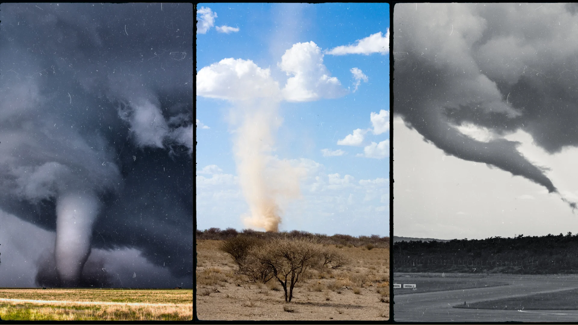
Tornado, waterspout, landspout, gustnado: what’s the difference?

Not all whirlwinds are built the same
Air spiralling around in circles makes the weather downright fascinating. From a mammoth tornado that can destroy neighbourhoods to a dust devil that pops up in a parking lot, swirling currents of air come in all shapes and sizes.
What’s the difference between them all? Here’s a look at six different types of whirlwinds and what makes each one unique.
DON'T MISS: Scud clouds are scary tornado lookalikes – how to tell them apart
Tornadoes are the most dangerous
Responsible for some of the worst damage and the greatest phobias, tornadoes are capable of some of the world’s strongest wind gusts.
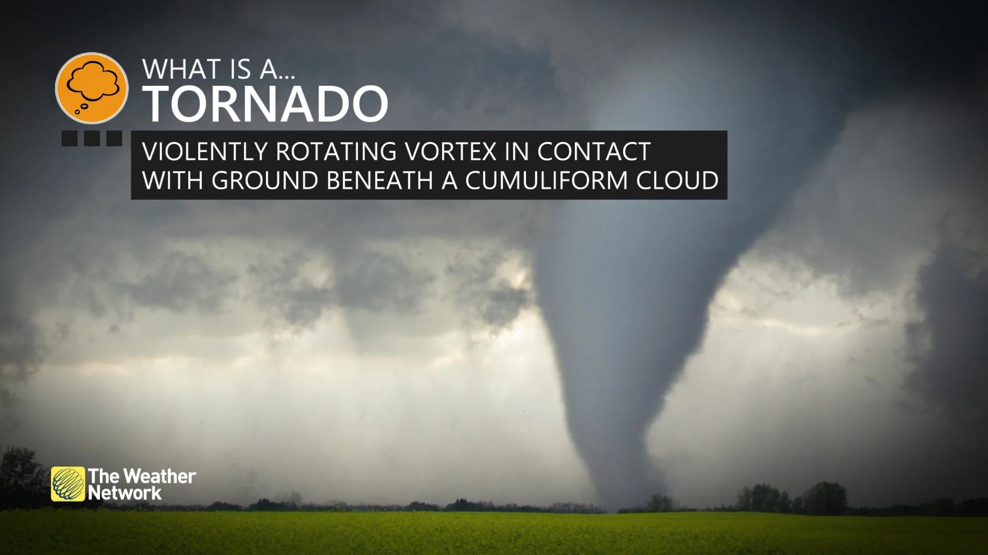
Tornadoes are rapidly rotating columns of air that stretch from the base of a cumulus or cumulonimbus cloud to the ground. Spawned by rotation within a thunderstorm itself, a tornado can range in width from a few metres to a few kilometres. The strongest tornadoes can pack winds in excess of 320 km/h.
The visible portion of a tornado is called the condensation funnel, which develops when water vapour condenses due to low air pressure within the tornado itself. A twister’s damaging winds can extend far beyond this visible condensation funnel—and sometimes no funnel is visible at all.
Funnel clouds are often a precursor to tornadoes
A funnel cloud is a rotating column of air that extends from the base of a cumulus or cumulonimbus cloud, but doesn’t come in contact with the ground.
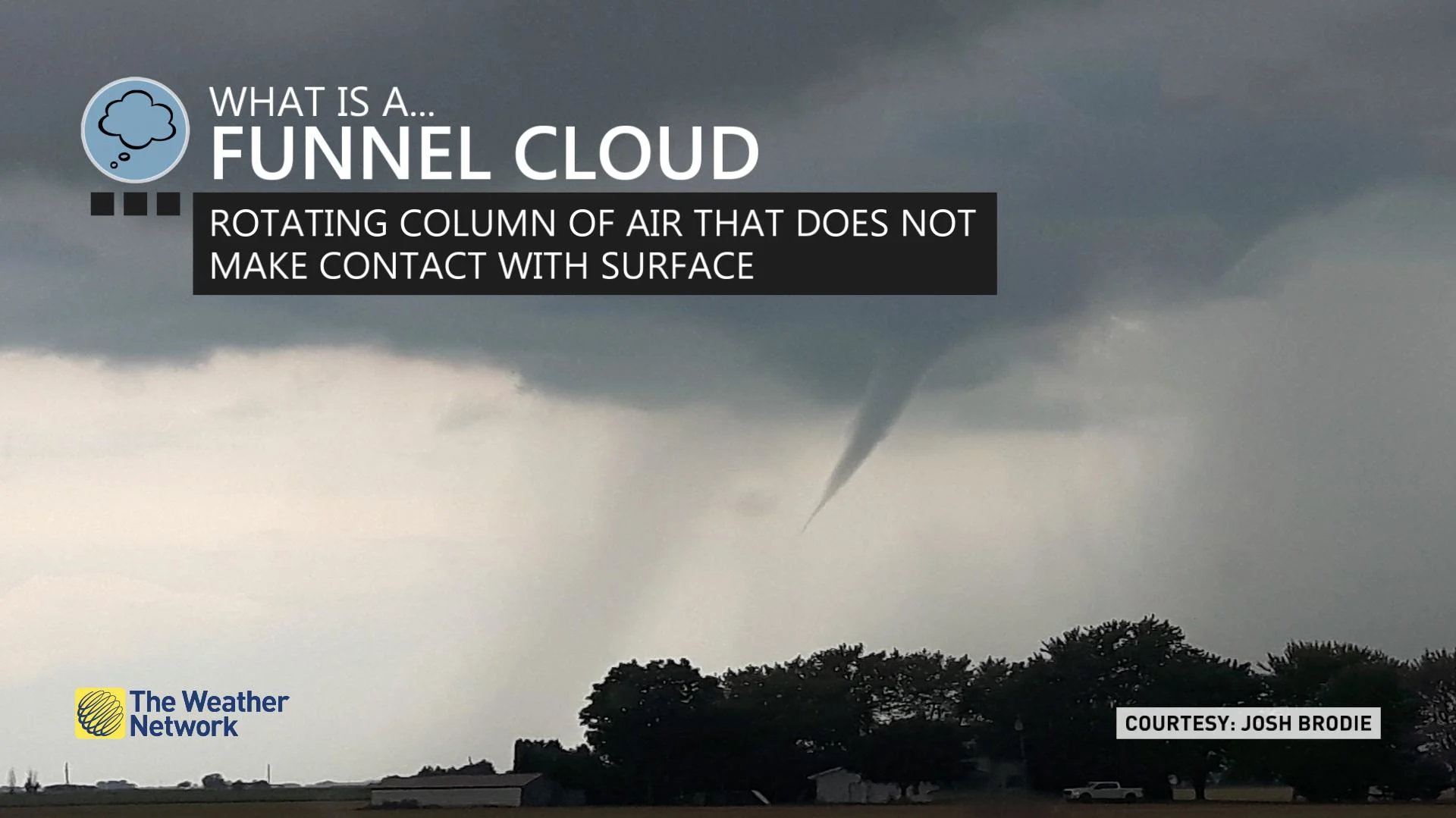
Many tornadoes start as funnel clouds, so it’s wise to head to safe shelter immediately if you ever spot a funnel cloud nearby.
We can also see cold-core funnel clouds, which form when showers or thunderstorms develop in an environment with very cold upper-level temperatures. The temperature contrast can induce rising motions that encourage funnel clouds to form. These cold-core funnels rarely reach the ground, but they can produce damage if they manage to touch down.
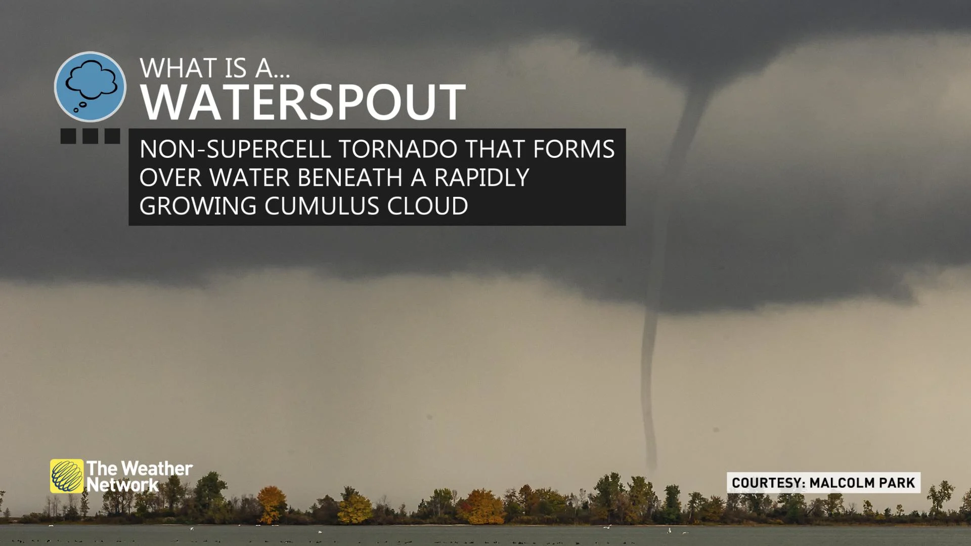
Waterspouts pose a hazard to boats, beaches
Waterspouts can develop as air rises into a developing cumulus or cumulonimbus cloud over the water. If the rising air begins spinning, it can swirl faster as it stretches vertically toward the cloud. Waterspouts are different from tornadoes in that they don’t need a rotating thunderstorm—or a thunderstorm at all—in order to form.
MUST SEE: Here's what you should do during a tornado warning
A waterspout usually develops from the bottom up. This gradual motion gives waterspouts their characteristic smooth and tubular appearance.
Most waterspouts are relatively weak and harmless, though gusty winds can pose a hazard to boaters. Occasionally, a waterspout can move ashore and cause minor wind damage.
There are also tornadic waterspouts, which are simply tornadoes that form over water instead of land.
WATCH: The science behind waterspout formation
Landspouts form like waterspouts over land
As their name suggests, landspouts form in a very similar manner to waterspouts.
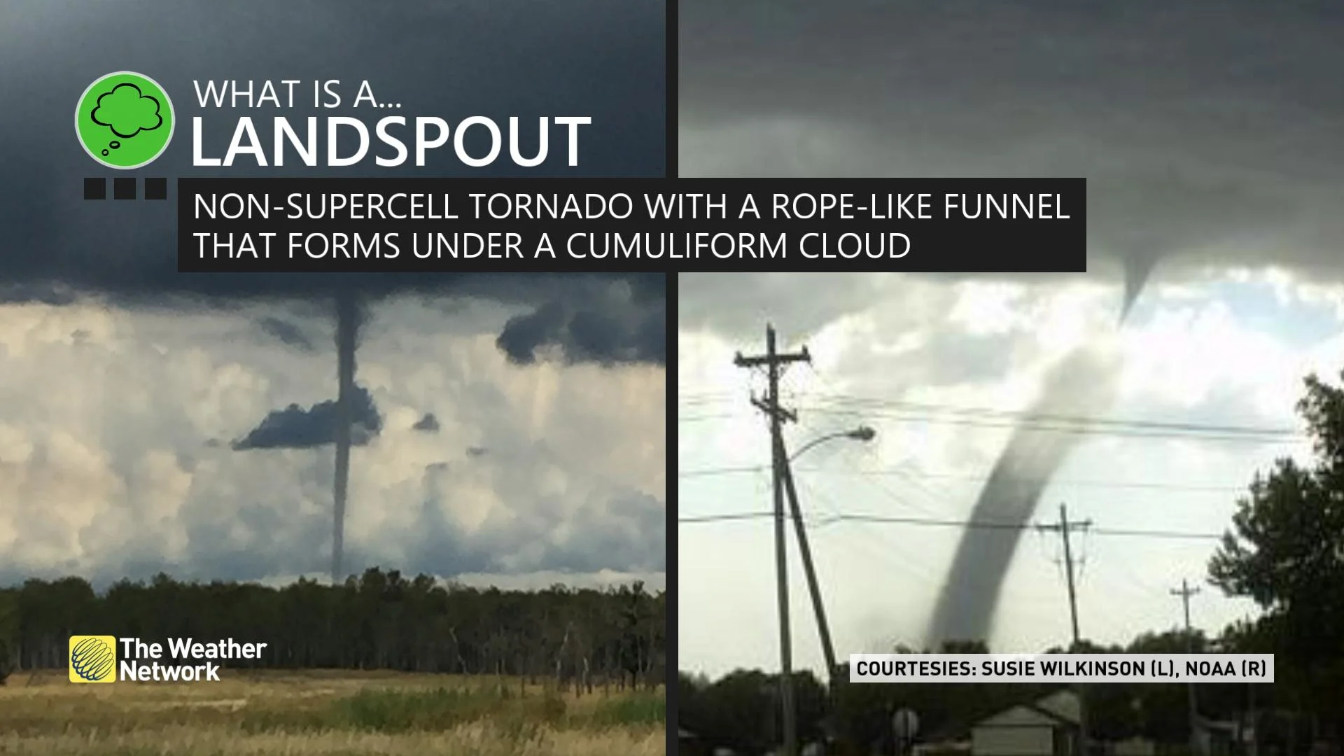
Most common in drier climates such as Western Canada and the western United States, a landspout forms as air stretches while rising into cumulus or cumulonimbus clouds—most commonly the fast updraft of a developing thunderstorm.
Even though they form through different processes, meteorologists often consider landspouts to be tornadoes because they can produce similar damage. While most landspouts are weak, some can cause significant damage and pose a serious threat to the safety of those nearby.
Gustnadoes are sudden spin-ups
The cold gust of wind you feel ahead of an approaching thunderstorm is called an outflow boundary or a gust front. Thunderstorms ‘exhale’ downdrafts of cold air as rain and hail plummet toward the ground.
Small eddies can build along the edges of that gust front, forming into tightly wound whirlwinds known as gustnadoes. It’s a similar principle to the little swirls that form along the tips of your fingers as you run your hand through a swimming pool or bathtub.
The enhanced winds and flying debris in a gustnado can cause minor damage and pose a hazard to those nearby.
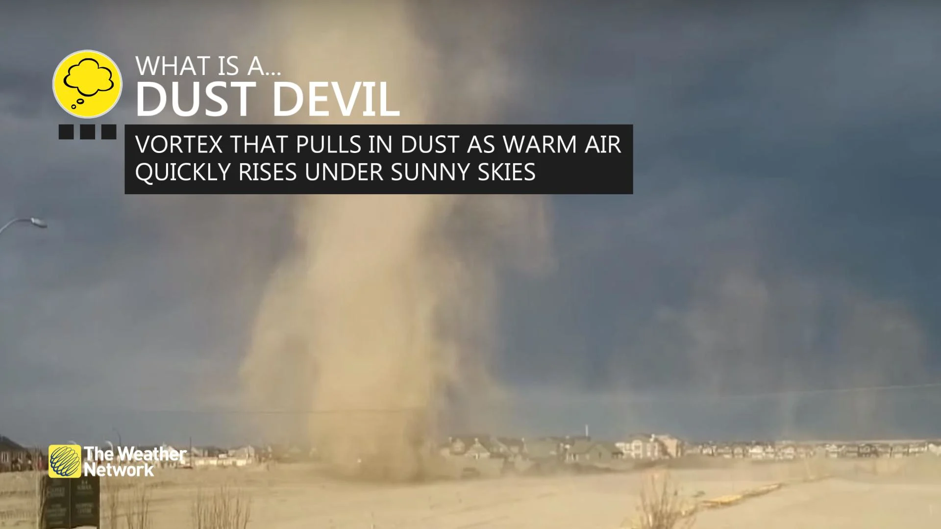
Dust devils are unexpected sights
The most common swirl on this list, dust devils are the phenomenon we’re most likely to encounter at some point in our lives.
RELATED: Steer clear of a ‘snownado’ if you see one on a cold, sunny day
A dust devil spins up when hot sunshine warms the ground, causing pockets of air to rise. If a gust of wind hits this rising air just right, the updraft can begin rotating as it rises. Spinning faster as the column of air stretches out, a narrow but fierce whirlwind develops, kicking up anything in its path—dust, dirt, hay, even trash and other loose objects.
Most dust devils are harmless and fun to watch, but some can grow large and strong enough to cause minor damage and send dangerous debris flying through the air.
Header image created using graphics and imagery from Canva.