The Weather Network's new Fire & Smoke map helps you plan ahead and stay safe

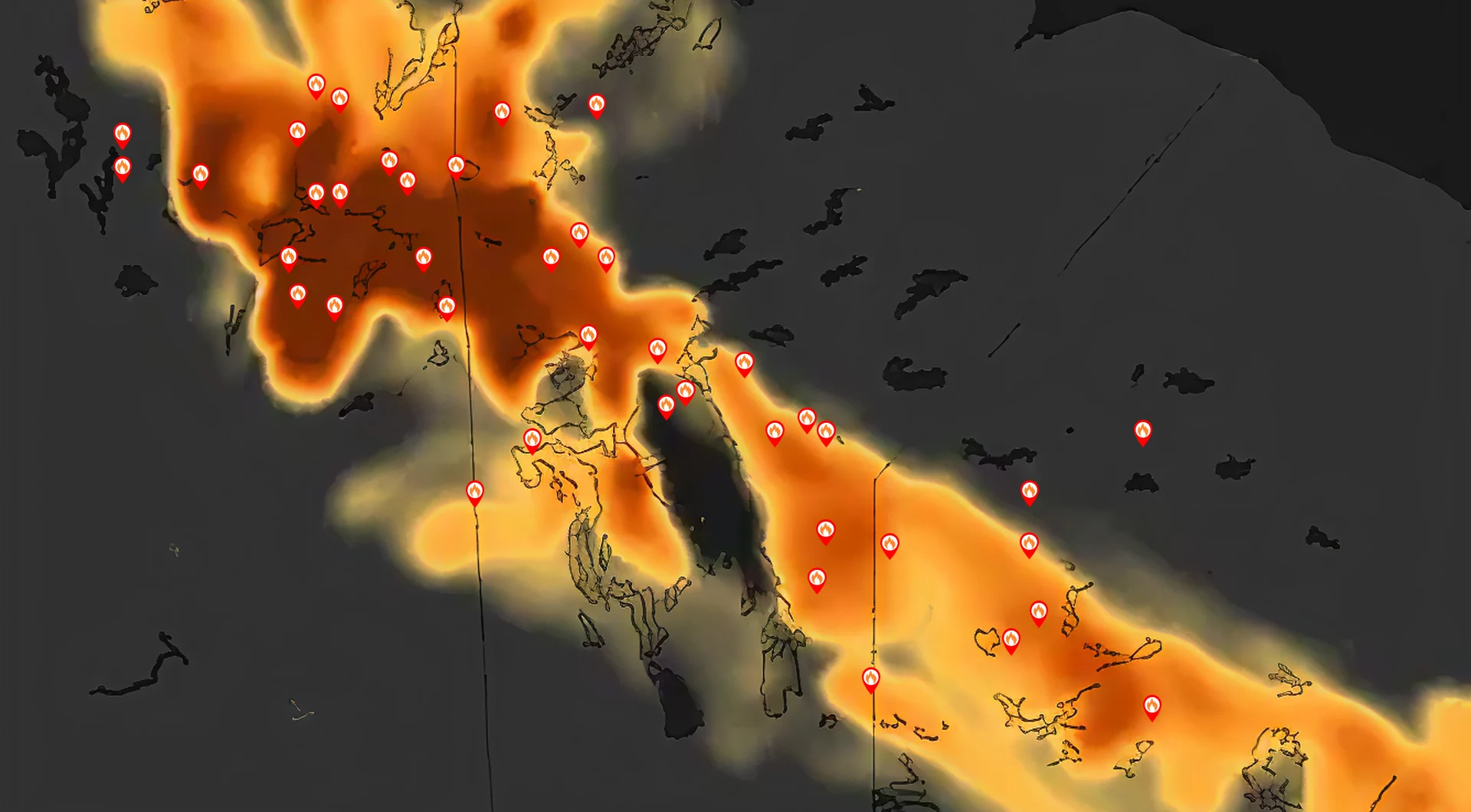
The 'Fire & Smoke' map provides you with real-time fire hotspots and 2-day forecasted smoke concentrations due to active wildfires across North America.
Are those clouds or wildfire smoke outside? Now you can easily tell the difference and see if they are close to your neighborhood with The Weather Network's new Fire & Smoke map layer!
This innovative feature displays real-time active fire locations and smoke concentrations across North America, utilizing data from Environment Canada to keep you informed about nearby wildfires and help you better plan outdoor activities safely.
This tool is especially beneficial for individuals with allergies and chronic respiratory conditions, such as asthma, allowing them to make informed decisions about spending time outdoors.
Remember, air quality can still be poor even if you can't see or smell wildfire smoke. With The Weather Network app and website, you can stay informed!
How to access it
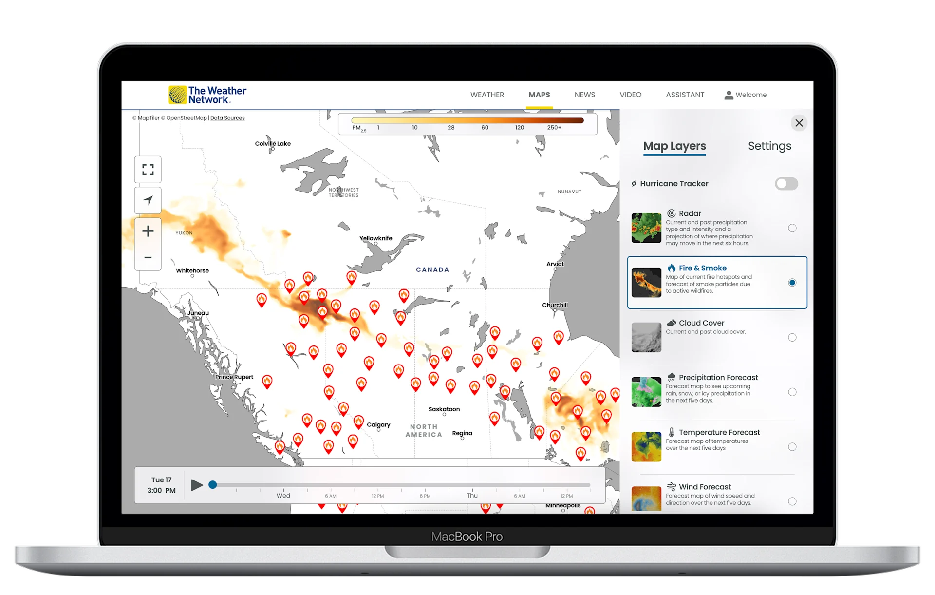
Open The Weather Network app or visit our website. Click here to check it out. In the map section, click on the icon that looks like a small box located on the right side of the screen.
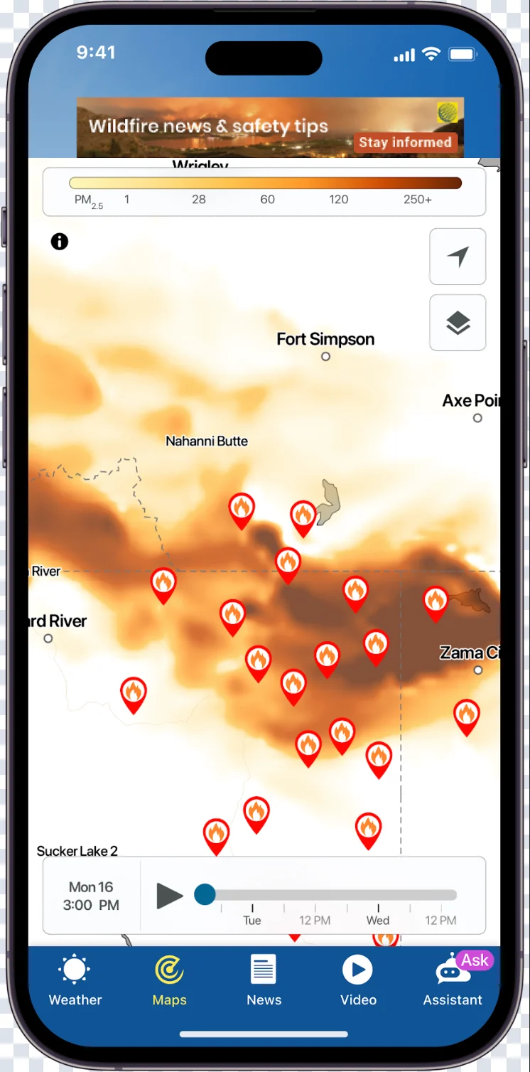
Several options will be available to you. Select the “Fire and Smoke” layer. Explore real-time smoke concentrations as well as symbols for active fires.
Wildfire News & Safety tips: Stay informed with the latest news on wildfires, including safety tips and impacts in your local area. Check out our dedicated page here.