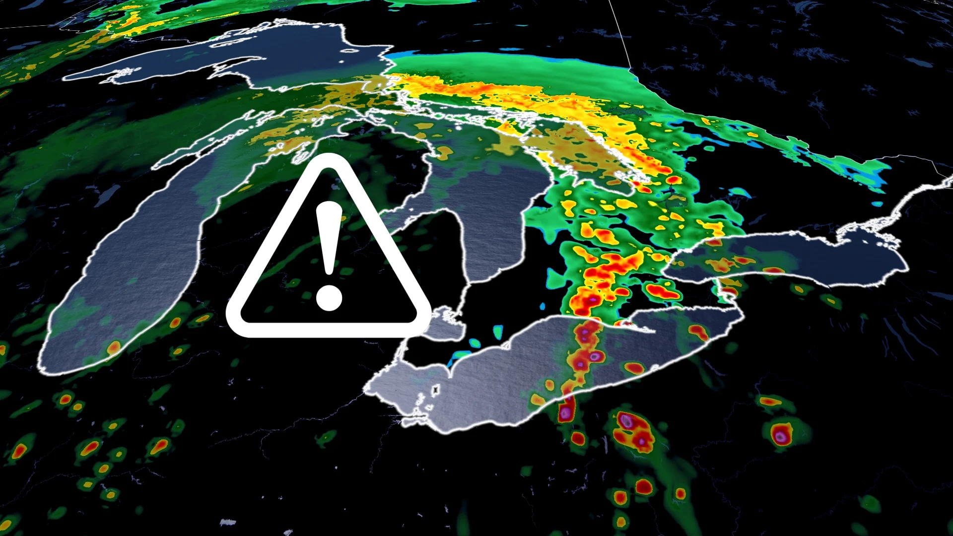
Severe storm risk with potent winds reappears in parts of southern Ontario
Folks in southern Ontario will need to keep an eye on the forecast and be weather-aware on Thursday, with another chance of thunderstorms popping up. Some locales, especially in southwestern Ontario and the Niagara region, may see severe storms
Southern Ontario will kick off May with another potent thunderstorm risk, just a couple days after a round of severe weather led to widespread power outages after trees and hydro poles were downed in parts of the region.
With Hydro One crews still out in "full force" restoring power after Tuesday’s severe winds knocked out electricity to thousands of customers, Mother Nature won't be giving southern Ontario much of a breather.
DON'T MISS: Could we see Canada reach this first summer threshold of the year this weekend?
Thursday will bring another opportunity for thunderstorms in southern Ontario, with a chance of severe storms confined to southwestern sections and the Niagara region. While the storms aren't expected to carry the same punch as the cells on Tuesday, the potential for strong winds could hinder restoration efforts for those without power still.
Be sure to keep an eye on local weather alerts throughout the day so you don't get caught in any of the stormy weather.
May kicks off with another round of stormy weather in southern Ontario
Southern Ontario's next system moves into the Great Lakes region on Thursday.
The morning hours could see cloudy skies, and off-and-on showers from Windsor to the Greater Toronto Area (GTA). There might even be a rumble in there, too.

The risk for severe thunderstorms will come in later in the day as the warm front that is associated with the system makes its way into the Great Lakes region.
A large temperature contrast could fuel severe storms. Lake Ontario's influence may help to enhance the storms tracking in from London to the Niagara Peninsula, with expected timing from 2 p.m. to 6 p.m.
A cold, easterly wind coming off Lake Ontario will collide with warmer air inland, providing more instability and lift for possible severe storms to develop.
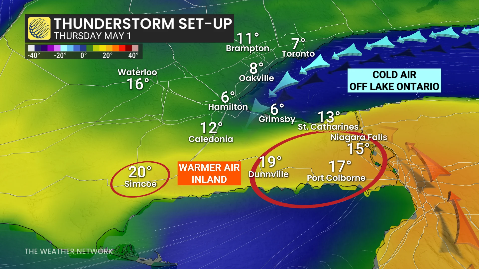
Grimsby, Ont., may only hit a daytime high of 4°C to 6°C while Niagara, Ont., warms to near 20°C.
PHOTOS: First taste of summer heat in southern Ontario brings severe storms
Large hail, around nickel size, as well as strong wind gusts of 80-90 km/h are the main threats with any severe storm that forms. However, they aren't forecast to be as strong as the damaging winds seen on Tuesday.

There is some uncertainty, however, with how severe the storms may get in the GTA. Expect thunderstorm disruptions for the evening commute and for the Maple Leafs Square gathering in Toronto.
Looking forward, after a changeable weekend, folks can expect a fantastic start to May with above-seasonal temperatures and below-seasonal precipitation.
Stay tuned to The Weather Network for the latest forecast updates for Ontario.