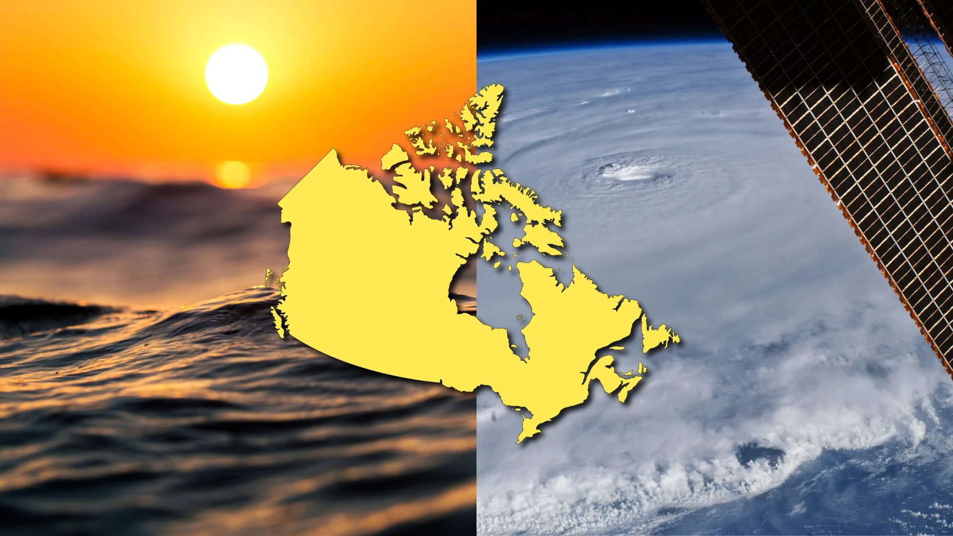
Heat and storms linger as August starts Canada’s slide out of summer

The longest days of summer slowly retreat to the south during a typical August, but high heat and rumbling storms linger across Canada
Blazing hot sunshine and the ubiquitous song of the cicada are telltale signs that we’re in the dog days of summer.
But the sun is slowly slipping toward the horizon with each passing day—and August represents Canada’s slow but steady slide out of the summer season.
What does a typical August look like across the country?
DON’T MISS: When is the hottest stretch of the year in your corner of Canada?
Sticky heat persists across Canada
The beginning of August often features some of the hottest days of the year, especially on the Prairies as powerful ridges of high pressure set up south of the border.

Overall, though, average temperatures generally begin to decline from summer’s peak across most of the country. August’s average daytime high in Toronto hovers around 26°C, with slightly cooler temperatures up the road in Ottawa and Montreal.

Average daytime temperatures in Calgary come in around 23°C with a reading of about 25°C in Brandon. A typical high in the low 20s is common for Vancouver and Edmonton, with daytime readings slipping into the teens across the territories up north.
Extreme heat is still possible well into August. After all, the hottest day ever recorded at Toronto-Pearson Airport was 38.3°C on August 25, 1948.
Rainfall heavily depends on pop-up thunderstorms
We’re still locked in a summertime regime across Canada throughout a typical August. Pop-up showers and thunderstorms remain common from the interior of British Columbia to the coasts of the Maritimes.
An average month sees Toronto pick up around 68 mm of precipitation, with Montreal following with about 93 mm of rainfall. Totals on the Prairies vary from just over 50 mm in Calgary to around 75 mm in Winnipeg. These are just averages, of course—a particularly heavy or slow-moving thunderstorm can drop an entire month’s rain in one afternoon.

MUST SEE: What’s the wettest month in your corner of Canada?
This remains a very dry time of year for folks in Vancouver, where the August average of 36.1 mm of rain represents the second-lowest total of the year behind July’s paltry total.
On the other hand, August is the wettest month of the year for some communities across the northern half of the country. This includes Churchill, Manitoba; Yellowknife, N.W.T.; as well as Iqaluit, Nunavut, which averages 61.7 mm of precipitation during a typical August.
Tornadoes and waterspouts are a hazard to watch
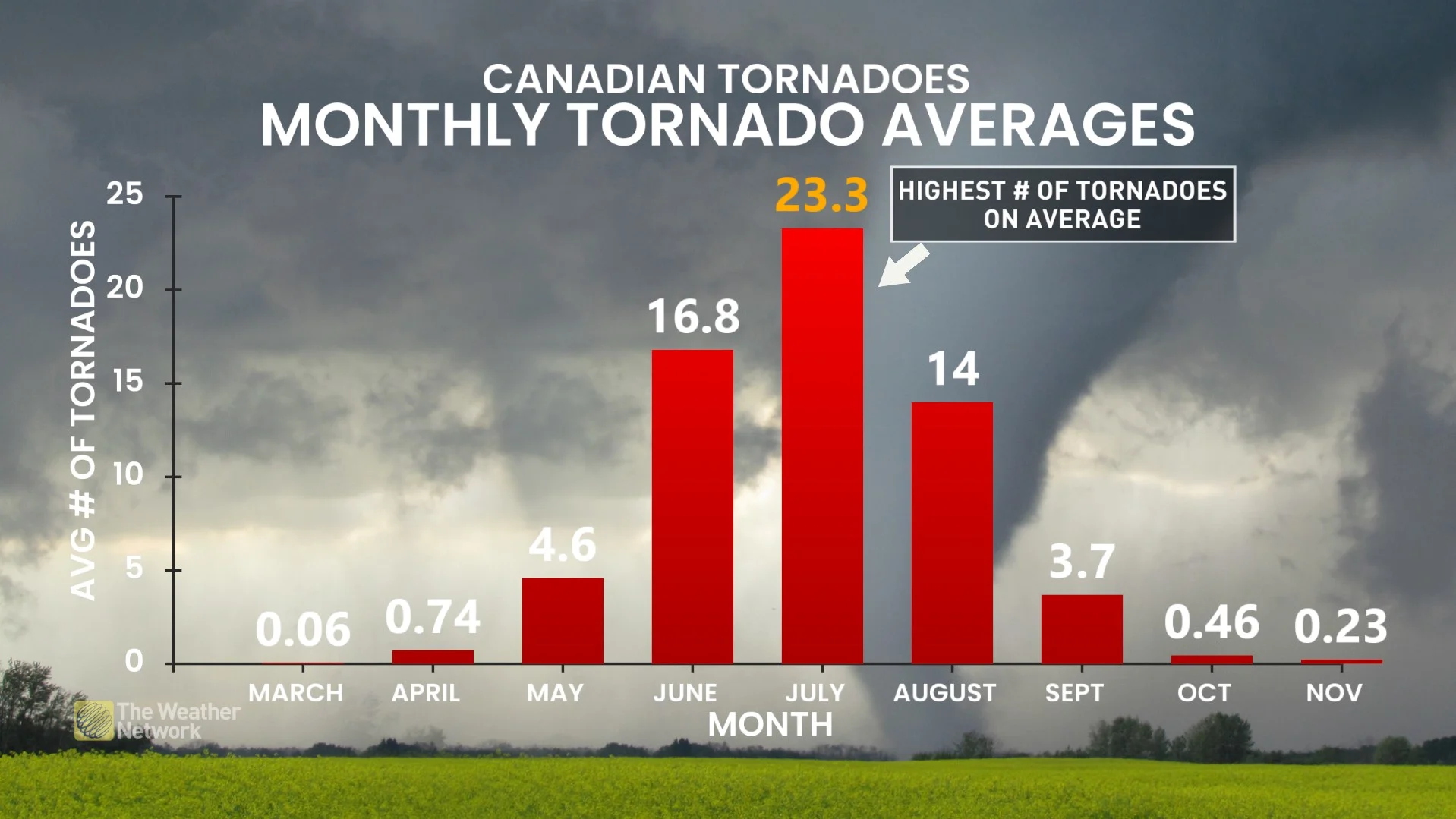
Strong to severe thunderstorms can sometimes begin to rotate. Tornadoes are a hazard across Canada during the month of August. The country typically records 65 tornadoes in an average year—nearly one-quarter of which touch down during the month of August.
August also marks the unofficial start of waterspout season on the Great Lakes. Waterspouts are rotating columns of air that form when air rises into a cumulus or cumulonimbus cloud over the water.
The Great Lakes typically achieve their warmest temperatures of the year in August, helping to fuel the instability needed to set waterspouts in motion. Conditions remain most favourable for waterspouts through the middle of autumn.
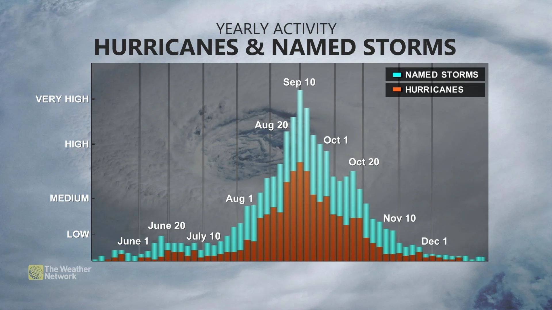
Hurricane season ramps up in a hurry
The month usually sees a significant uptick in Atlantic hurricane activity.
Warming ocean waters, disturbances rolling off Africa, and favourable atmospheric conditions are commonplace through the month of August. Some of the worst hurricanes on record have occurred around this time of year.
RELATED: Hurricane remnants can bring dangerous weather deep into Canada
Folks across Atlantic Canada should regularly check the forecast for potential tropical hazards through the late summer and autumn months and stay prepared well before a storm ever forms.
It’s not just the coast on notice. Tropical systems that hit the U.S. can continue north and bring flooding rains, high winds, and tornadoes to communities in Ontario and Quebec.
Header image created using graphics and imagery from Canva.