Dexter will soon be behind us, so what's up next in the Atlantic?
After a quiet stretch, the tropics are beginning to show signs of awakening. Several areas of interest in the Atlantic basin are being monitored for development as conditions grow more favourable for tropical activity.
While Tropical Storm Dexter poses no threat to land, it serves as a reminder that the peak of the hurricane season is still to come and folks in at-risk regions should be on alert and pay close attention to the forecasts.
With Dexter expected to become extratropical soon and its direction turning farther away from land, forecasters with the U.S. National Hurricane Center (NHC) are also keeping their eyes on two other areas of interest and potential development in the Atlantic over the coming days.
RELATED: One hurricane ever? Why the South Atlantic is a dead zone for hurricanes
Dexter keeps turning farther away from land, minimal impacts to Atlantic Canada
As of Tuesday afternoon, Dexter is moving toward the northeast at 19 km/h, and will see a gradual turn toward the east-northeast during the next few days.
Maximum, sustained winds are near 40 mph 65 km/h with higher gusts. Some strengthening is forecast during the next 48 hours as Dexter starts to become an extratropical cyclone.
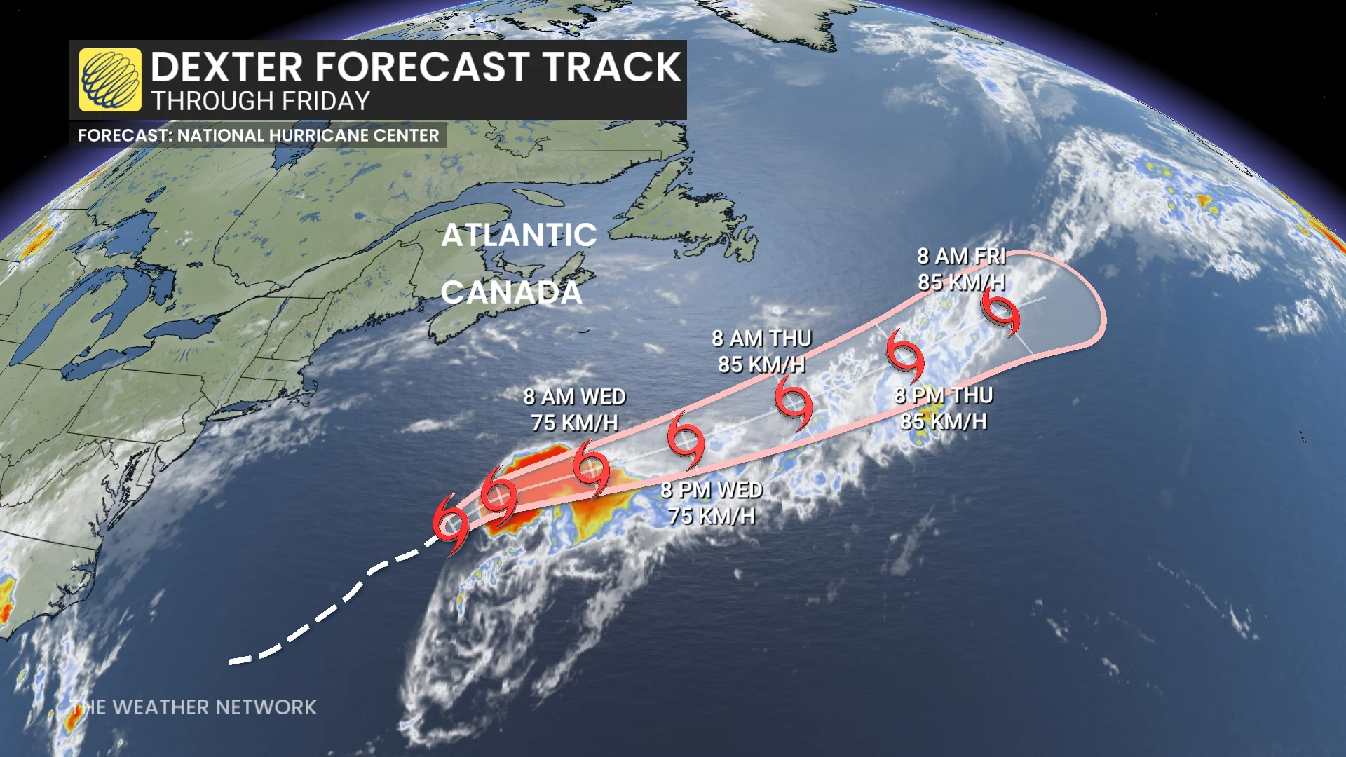
Tropical-storm-force winds extend outward up to 185 km from the centre.
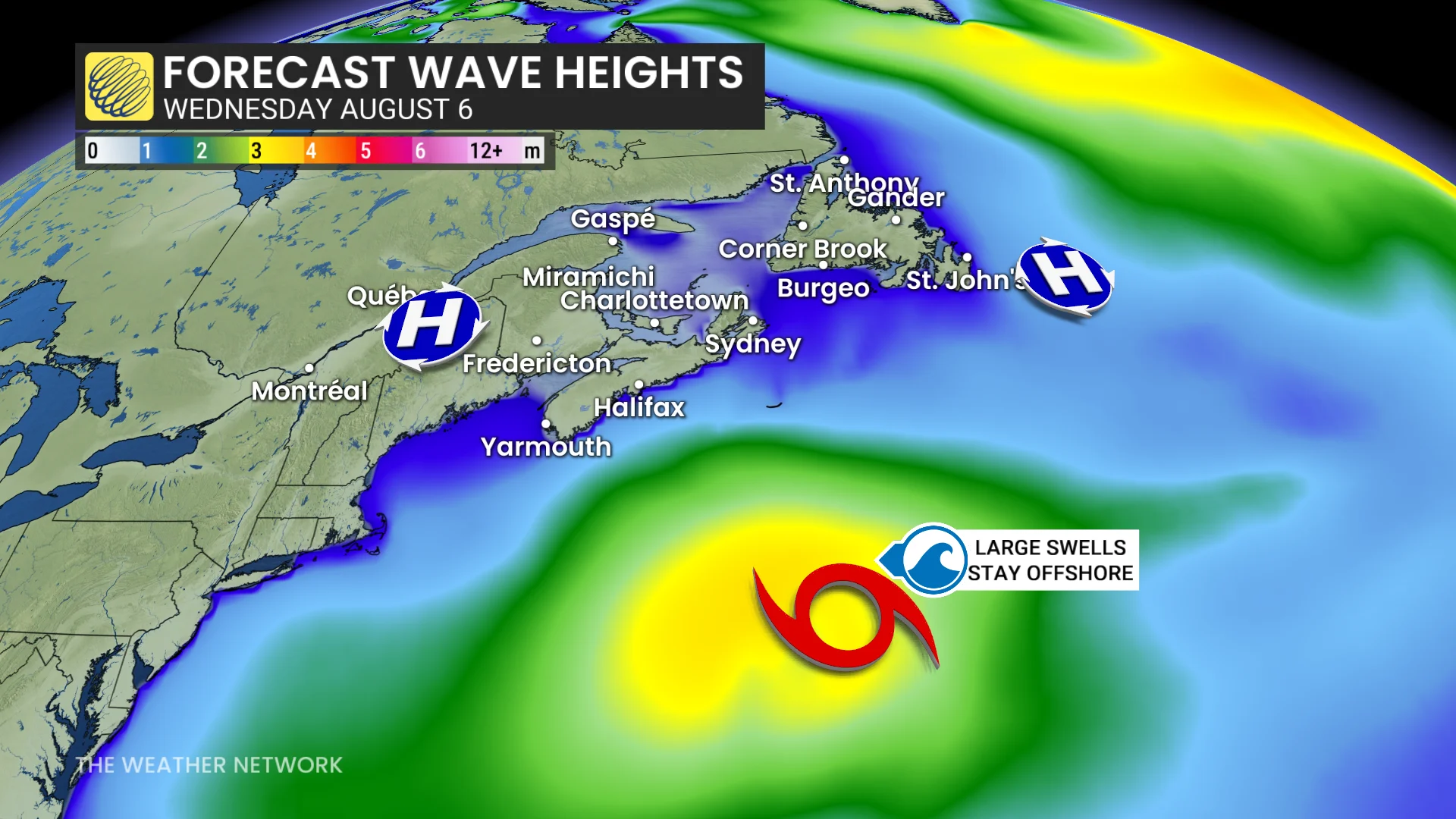
While Tropical Storm Dexter is not expected to bring direct impacts to Atlantic Canada, its effects may still be felt offshore. Forecasters say larger swells could push northward, generating hazardous surf and wave activity south of Sable Island.
Wave heights near the island may reach two to three metres, with seas farther offshore potentially building to four or five metres.
Two other areas of interest for possible subtropical or tropical formation
Meanwhile, NHC forecasters are monitoring two areas of interest in the Atlantic for potential development over the next seven days.
The first is situated in central tropical Atlantic. A tropical wave over the far eastern tropical Atlantic is currently producing a disorganized area of showers and thunderstorms.
Environmental conditions are forecast to be conducive for gradual development during the next few days, and a tropical depression could form late this week or over the weekend as the system moves generally west-northwestward across the central tropical or subtropical Atlantic.

Formation chance through the next seven days is 50 per cent (medium).
Next area of concern is off the southeastern United States coast. A weak surface trough located several-hundred kilometres off the coast of the southeastern United States, is producing scattered showers and thunderstorms. An area of low pressure is expected to develop from this system over the next day or so, where environmental conditions appear generally favourable for additional development.
A tropical depression could form by the latter portion of this week or weekend as the low starts moving slowly westward, but turns more northward by this weekend. Formation chance through the next seven days is 40 per cent (low).
The second week of September is the climatological peak of hurricane activity across the Atlantic, with an end date of Nov. 30.
WATCH: South American hurricanes: Fact or fiction?
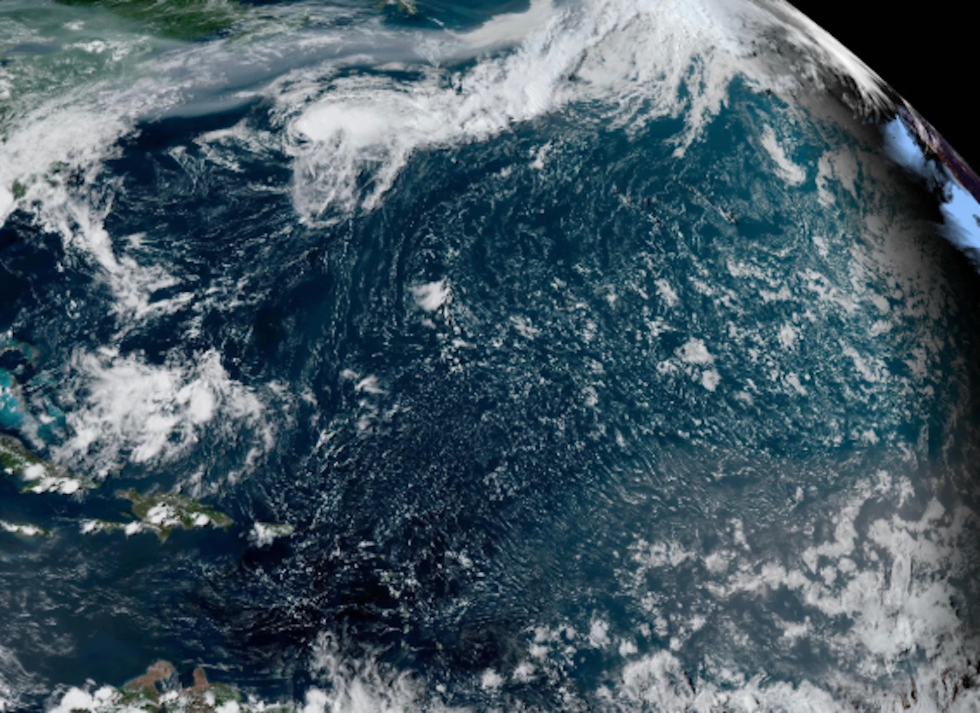
Thumbnail courtesy of NOAA.
Stay tuned to The Weather Network for the latest forecast updates for the Atlantic hurricane season.