Winter will finally loosen its frigid grip on Ontario this week
A burst of snow across Ontario on Tuesday will open up the province to a swell of seasonal air, bringing temperatures to above zero for many.
It has been a cold winter, Ontario. While this may be expected across the north, southern Ontario has faced an exceptionally cold stretch, with Toronto recording its coldest winter day since 2019 on Saturday.
In fact, over the weekend, Ontarians were breathing in cold air flowing directly from the North Pole!
SEE ALSO: Bermuda, Cuba both witness lowest temperatures ever recorded
Thankfully, we're finally seeing an end to the cold stretch, which has lasted in Toronto for 22 days in a row as of Feb. 8.
Burst of snow Tuesday opens Ontario to seasonal temperatures
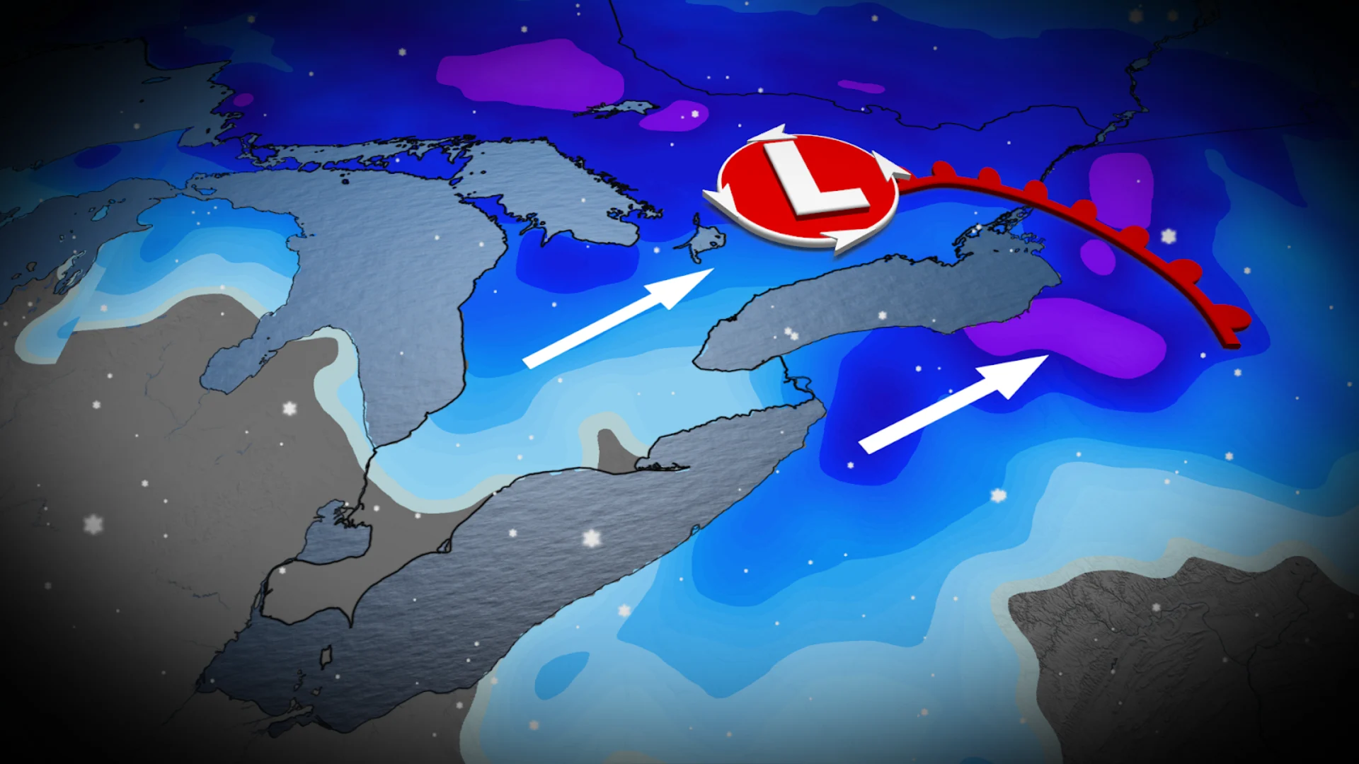
A clipper system is forecast to sweep across the province on Tuesday, bringing a burst of snow across the snowbelts and Golden Horseshoe throughout the morning hours. The snow could impact morning commutes for some, especially around the snowbelts where heavier snow is forecast.
The system will lift north into eastern Ontario, including Ottawa, by the afternoon. Folks can expect 10-15 cm of snowfall by Wednesday morning.
As the system lifts northward, we'll see a near-seasonal air mass lift into the province behind it.

Daytime temperatures on Tuesday are forecast to rise above zero on Tuesday for southwestern Ontario. Toronto may also see the thermometer rise above zero on Tuesday, ending the city's sub-zero cold streak.
DON'T MISS: Canada's 2025-26 winter report card: Did your province pass?
The rest of the province, including parts of northern Ontario, will also see a welcomed seasonal warmup. Temperatures will still be below zero but will be much more bearable for anyone spending time outdoors.
The warm-up will persist into Wednesday, but temperatures will still be cold enough for lingering flurries off of Lake Huron, bringing another 5-15 cm of snow to the snowbelts. The Golden Horseshoe could also see another coating of 3-5 cm of snow through Wednesday.

Looking toward the end of the week, we could see temperatures fall back into slightly below-seasonal territory. Forecasters are also keeping an eye on the potential for an active pattern to develop during mid- to late February.
Stay with The Weather Network for more information and updates on your forecast across Ontario.