El Niño may hand Western Canada a warm, dry summer

A risk for elevated temperatures and dry conditions may raise the potential for drought and wildfires this summer
Summer is fast approaching and all eyes are on the extended forecast to see what the upcoming season may offer across Western Canada.
All indications point toward a fast-growing El Niño in the Pacific Ocean, which will likely exert a significant influence on Canada’s summer ahead.
DON’T MISS: El Niño may split Canada’s summer in two
A potentially strong El Niño is right around the corner
Water temperatures are quickly warming up around the equator in the Pacific Ocean, a sign that we’re rapidly switching from La Niña to El Niño.

April kicked off with an El Niño watch, and forecasters see the potential for this event to grow quite strong by the summer months.
This pattern of warmer-than-normal ocean waters can have a significant influence on the atmosphere around the world, including right here in Canada.
Divided spring snowpack across Western Canada
Before diving into this summer, it’s helpful to look at what we’ve experienced so far this spring. Western Canada heavily relies on seasonal snowpack for water resources, as well as drought and wildfire prevention during the warm season.

British Columbia entered April with a healthy provincial average snowpack of 92 per cent. This number is slightly misleading, though, as there are stark differences in depths from one region to the next.
The snowpack is holding its own throughout portions of Alberta, as well. A station at Little Elbow Summit, about 100 km southwest of Calgary, started April with its second-deepest snowpack on record.

RELATED: The world is officially in its water bankruptcy era
We’re entering the middle of spring with drought conditions in place throughout B.C.’s Interior, as well as portions of the southern Prairies.
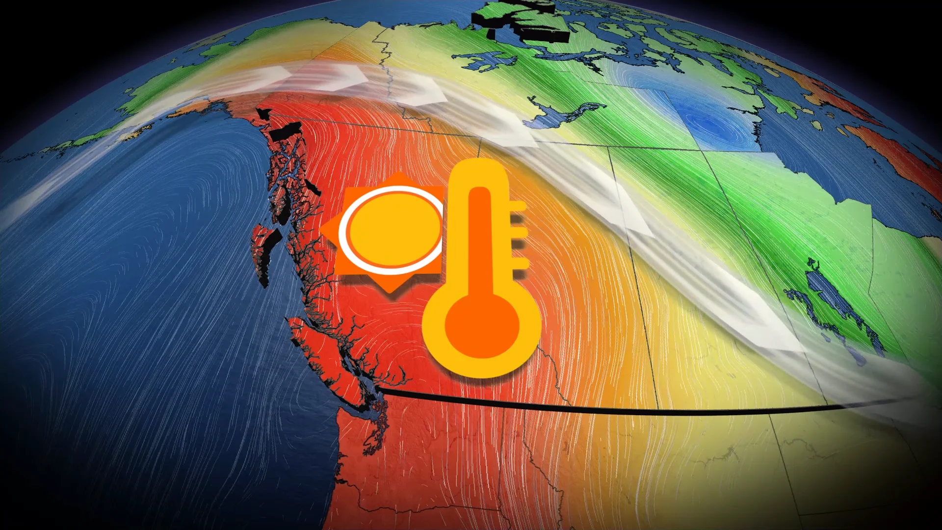
Summer’s start look warm and dry across the region
Where does that leave Western Canada heading into this summer?

Forecasters have higher confidence in a building heat signal as we round out spring and enter the opening stages of the summer season. Several analog years have featured this type of setup.
This pattern would entail large ridges of high pressure rising over Western Canada.

Air sinks beneath ridges, warming up as it descends toward the ground. We would likely see extended periods of warmer-than-normal temperatures when ridges reign supreme.
Such a pattern would also shunt the jet stream far into Northern Canada, deflecting any significant opportunities for precipitation along the West Coast, Rockies, and western portions of the Prairies. This is part of the same setup that may lead to cooler and more unsettled conditions across the eastern half of the country.

The combination of warmer temperatures, below-average precipitation, and drying vegetation will raise concerns for drought, wildfire ignition, and smoky skies heading into this upcoming summer.
As always, residents are encouraged to follow fire prevention advice. Folks throughout the region should have supplies and preparedness plans in place in case of a wildfire evacuation.
Stay tuned for your full summer forecast from The Weather Network on May 27th.