Weekend travel alert with high winds and snow in Alberta
Warm temperatures and strong winds in Alberta, with snow on the horizon
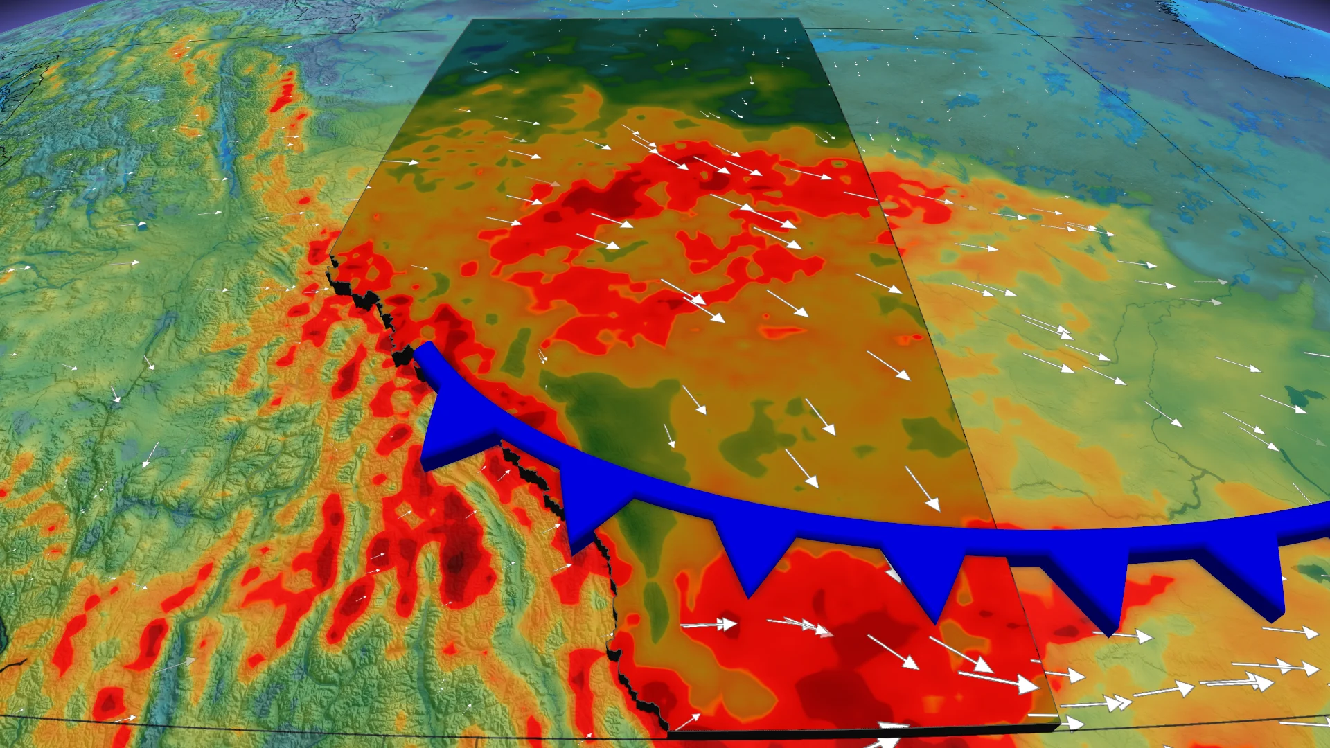
The Pacific weather pattern will return to the Prairies this weekend, bringing strong downsloping winds and significant temperature fluctuations. By Sunday, winds will shift with a cold front, leading to upslope snow tied to a developing clipper system.
RELATED: Deadly differences: The 'Snow Eater' vs the 'Devil Winds'
Drivers are urged to prepare for weekend travel risks with the winds, and snow-related disruptions.
Powerful winds whip in for Saturday
Wind gusts of 80-90 km/h are forecast along the foothills from Montana to northeast B.C., while gusts of 50-60 km/h are expected over the lowlands.

Temperatures south of Highway 1 could approach 20°C Saturday before cooling as the cold front moves in.
SEE ALSO: Canada to feel magnified March madness in the month ahead
The clipper will strengthen near the 60th parallel and mainly impact Manitoba by Sunday. However, the associated cold front will push south into Alberta, bringing gusty north winds of up to 80 km/h over central Alberta. Southern Alberta will stay warmer with downsloping westerly winds.

Snow band could impact Sunday travel
Sunday evening, upslope snow will develop along the southern foothills, with a snow band potentially spreading east into Saskatchewan. Snow accumulations could reach 10-15 cm near the foothills, while Calgary is expected to see closer to 5 cm. Fort McMurray could see up to 20 cm of snow from the initial clipper.

Weekend travellers should be cautious about strong winds, especially with light trailers. Snow could cause travel disruptions Sunday evening into Monday.
WATCH: Your 2026 Spring Forecast
Stay with The Weather Network for more information and updates on your weather across Alberta.