Warnings issued for Ontario's snow squalls and dangerous travel, risk of 20+ cm
Snow squalls continue in Ontario's snowbelt regions through Friday, with 20-40+ cm possible in some localized areas. Highway travel will be difficult
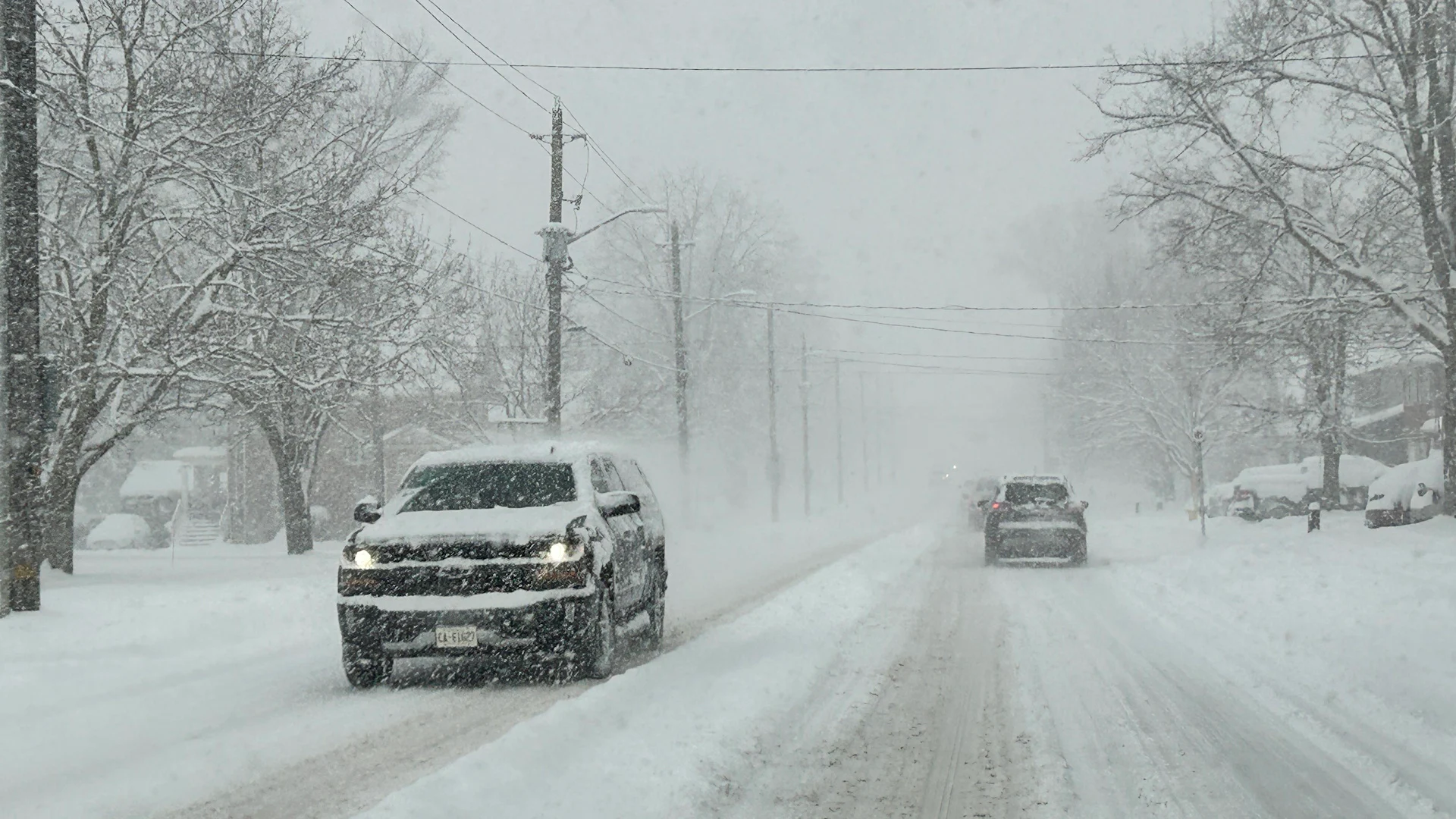
After a widespread snow system that caused numerous collisions across parts of southern Ontario Wednesday, snowbelt communities are now bracing for even heavier snowfall as lake-effect snow intensifies Thursday. Snow squall warnings are in effect.
Some of the harder-hit areas could receive 20-40+ cm of snow by Friday, depending on location and the duration of snow squalls.
RELATED: In Photos: Southern Ontario faces mid-week snowy blast
Travel will likely be challenging, if not hazardous. Roads and walkways will likely be difficult to navigate due to accumulating snow. Expect significant delays and possible road closures. Stay updated on any alerts as conditions change or deteriorate.
Thursday - Friday: Lake-effect snow ramps up across the snowbelts
Lake-effect snow will develop behind the mid-week clipper, targeting communities southeast of Lake Huron and Georgian Bay through Friday.
DON'T MISS: Why snow squalls are so tough to forecast
Snow squalls off Lake Huron will impact areas including London, Ingersoll, Exeter, Mitchell, Bayfield, and Goderich, with shifting conditions as the band moves back and forth. The squall will weaken and dissipate overnight.

A snow squall from Georgian Bay is more consistent, however, potentially leading to higher snowfall totals. On Thursday, it will primarily affect areas west of Barrie.
This squall will also weaken overnight but may redevelop north of Barrie Friday afternoon, with local snowfall amounts of 20-40+ cm possible.

Snow squalls are narrow bands of intense snowfall, meaning some areas can see clear skies while others experience heavy snow. Travellers on Highway 400 north of Toronto should prepare for disruptions.
By Friday evening, squalls will lift north and dissipate. A new system will bring widespread snowfall overnight into Saturday, with 2-5 cm expected.
DON'T MISS: Canada’s December outlook holds a strong, cold start to winter
White or green Christmas? It could be a nail biter forecast
Milder weather is expected to settle in across the region mid to late next week. However, uncertainty remains for the weather pattern leading up to Christmas. A surge of mild Pacific air may bring the potential for a significant December thaw. However, lingering Arctic air could counter this, creating an active pattern with fluctuating temperatures.
For areas outside the snow belts, whether Christmas will be white or green will likely depend on the paths of one or two weather systems in the final days before December 25. The precipitation type—rain, snow, or a wintry mix—could make all the difference.
Looking ahead, a more stable, colder pattern is anticipated to return after Christmas and continue into January.
WATCH: Heavy, wet snow fills Ontario streets ahead of colder air
Stay tuned to The Weather Network for the latest forecast updates in Ontario.