Volatile environment on the Prairies brings supercell threat
A severe thunderstorm environment is forecast on the Prairies Wednesday afternoon and evening. Stay alert to the changing conditions
The Prairies are set to face a heightened risk of severe weather midweek. Both Wednesday and Thursday bring the potential for severe thunderstorms across parts of the region.
These systems could produce large hail, heavy downpours, and strong winds.
DON'T MISS: From nuisance to nightmare: Huge hail is an extreme danger
Wednesday's conditions will be particularly conducive to supercell development for some areas, as well. While the likelihood of a funnel cloud or tornado remains low, it cannot be ruled out entirely.
It'll be important to remain weather-aware, and stay up-to-date on all of the latest watches and warnings as conditions change.
Wednesday: Severe storm threat lasts through the overnight
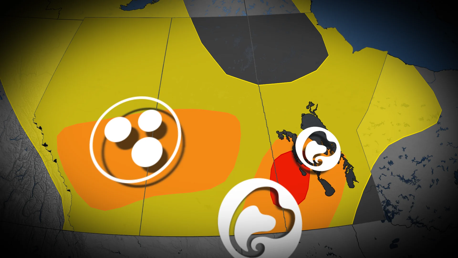
The Prairies are set for an active severe thunderstorm environment Wednesday afternoon through the overnight hours, with several areas at an elevated risk.

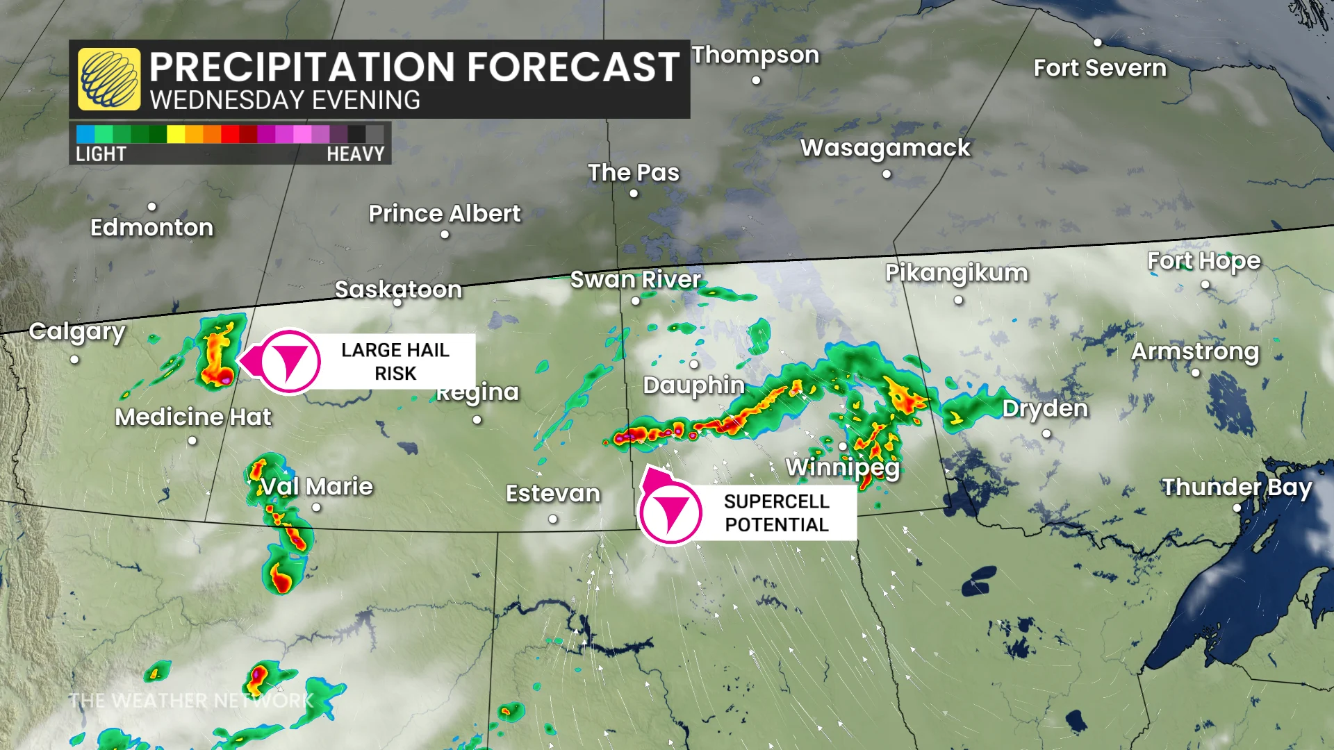
West of Calgary, Alta., conditions favour the development of a few supercells, tracking eastward toward Saskatoon, Sask. Elevated thunderstorms in these areas could produce hail ranging from 2 to 4 cm in size -- equivalent to Loonie- to golf-ball-sized). Southeastern Saskatchewan and southwestern Manitoba may also see supercell development later in the day.
A low pressure system interacting with higher wind shear and elevated CAPE levels will enhance the chances for strong storms. Damaging winds and large hail are the primary hazards, but there is also a heightened risk of rotating supercells in this environment.
The tornado risk remains low, but it is not entirely ruled out. The uncertainty stems from a warm air inversion, or "CAP," in the atmosphere. This CAP could inhibit storm development, though some models suggest pockets where the CAP may break, leading to a sharp increase in severe storm potential during the evening.
DON'T MISS: Get the latest wildfire news and safety tips to help you stay safe
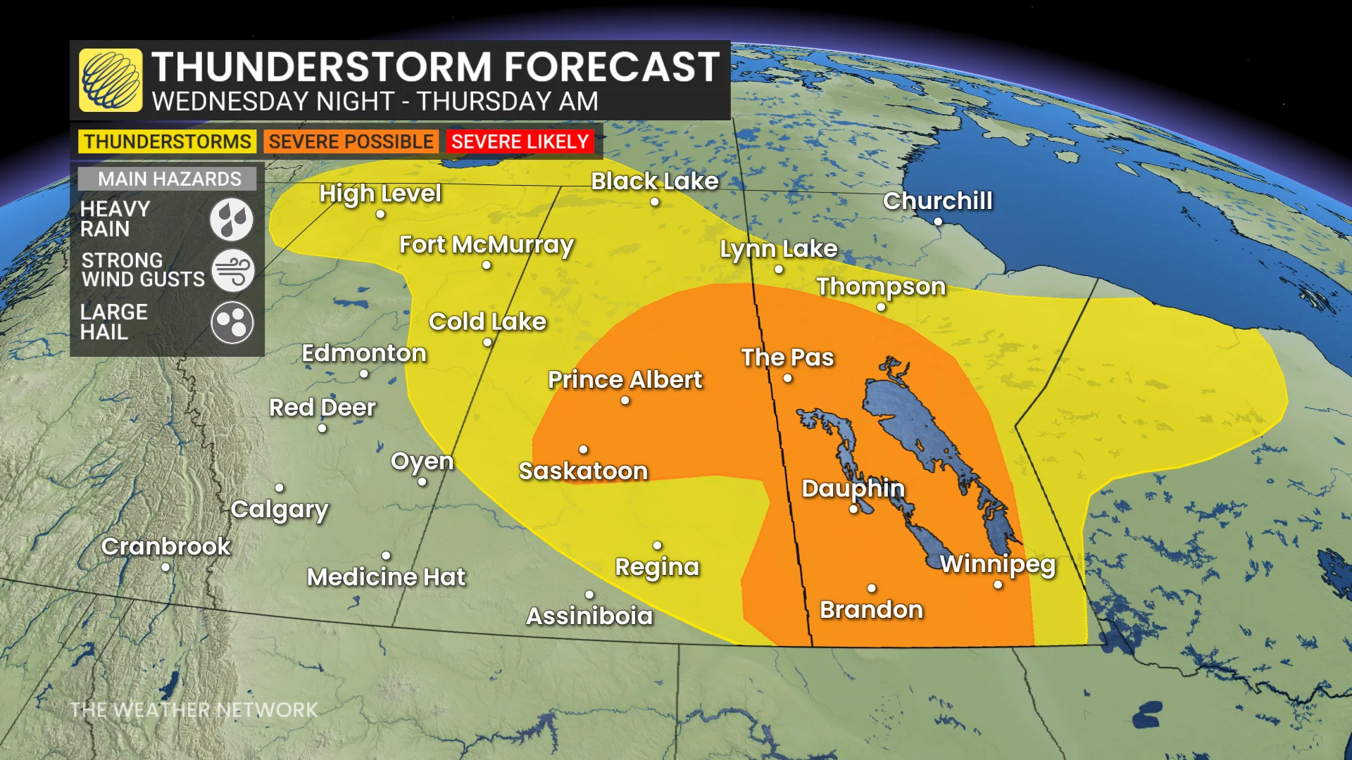
These storms are expected to continue into the overnight hours, extending the severe weather risk across Saskatchewan and Manitoba into early Thursday morning.
Thursday: Heavy rain and severe storm risk shifts eastwards
On Thursday, a large, organized low-pressure system will take shape over northern Saskatchewan and Manitoba, bringing a mix of widespread rain and severe weather risks.
DON'T MISS: 2025 is Canada's second-worst wildfire season on record for area burned
Northern regions will experience steady rainfall, while southern Manitoba and northwestern Ontario face the potential for severe storms along the system’s cold front. Areas near Winnipeg and Kenora, Ont., may be impacted by these stronger storms. Damaging winds, hail, and heavy downpours are possible.
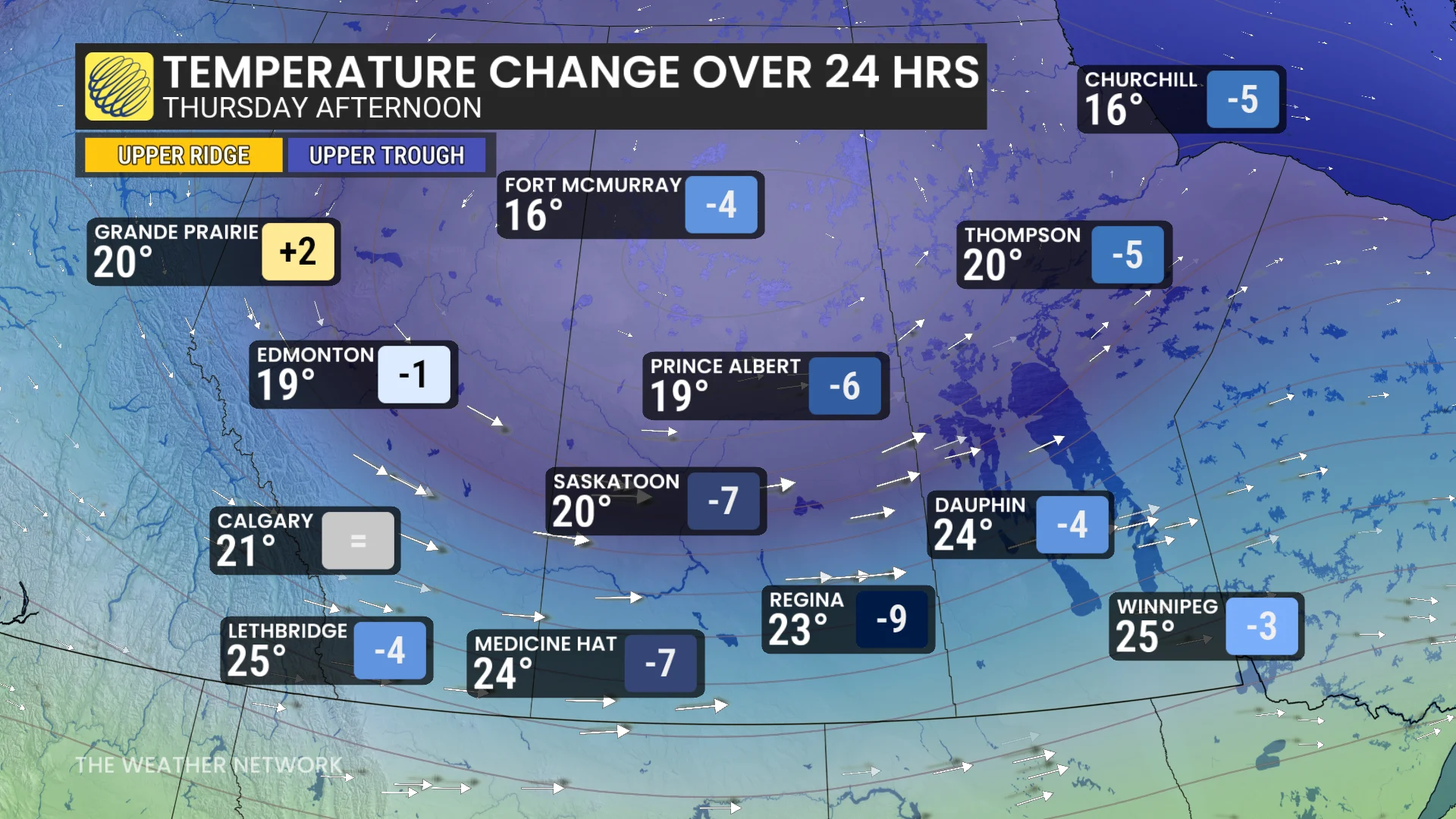
Cooler air will sweep into the western Prairies on the backside of the low pressure system. In Regina, Sask., temperatures are expected to drop sharply from 32°C on Wednesday to 23°C by Thursday.
Be sure to check back for the latest updates across the Prairies.