Typhoon remnants and strong Pacific jet bring heavy rain, wind, and snow to B.C.
Heavy rain, snow, and strong winds hit B.C. as remnants of Typhoon Nakri move onshore this weekend
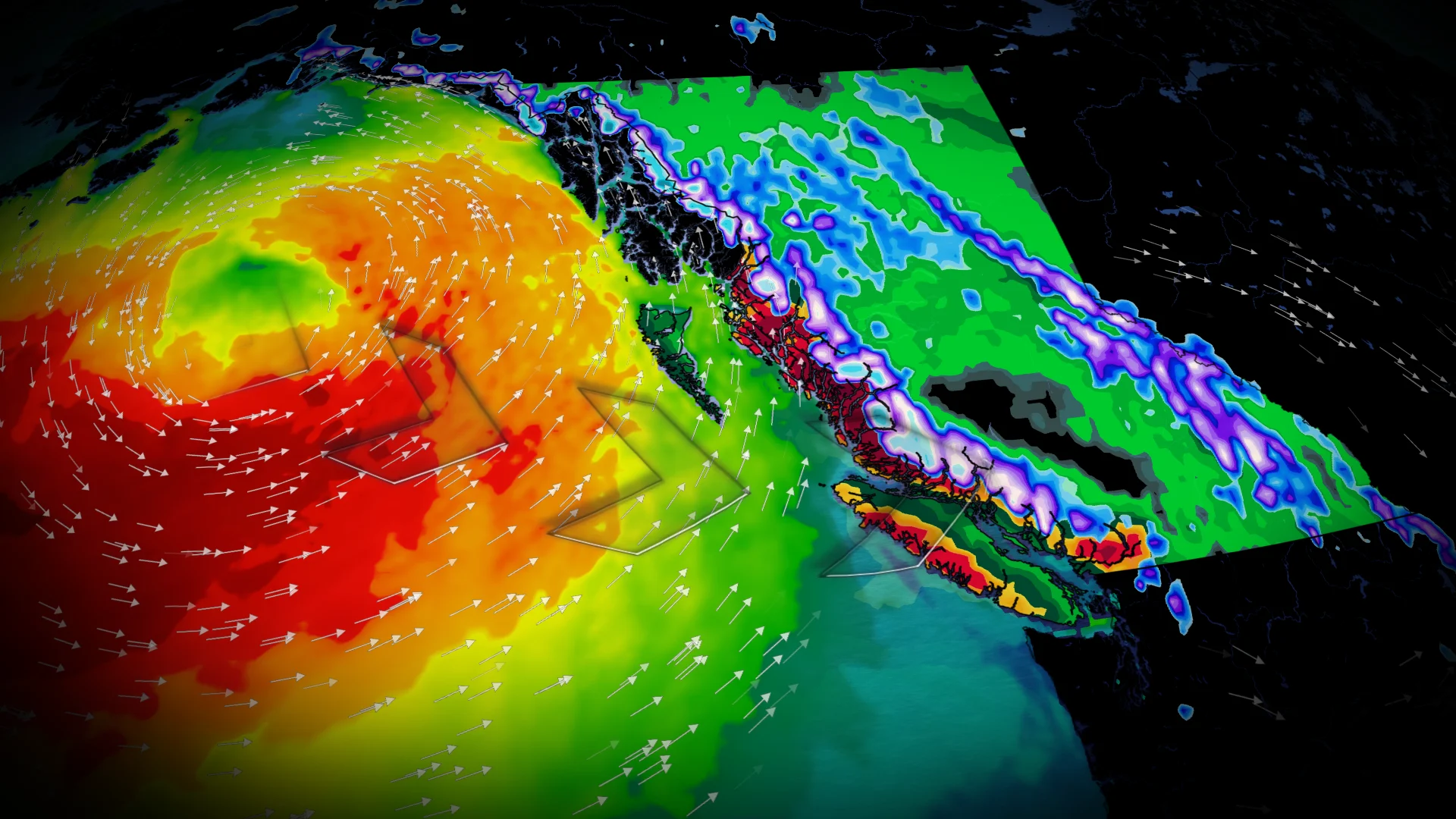
A wet weather system will impact B.C.'s South Coast this weekend, fuelled by the remnants of Typhoon Nakri. Rain will begin Saturday afternoon, intensify into Saturday evening and overnight, and persist into Sunday.
Heavy snow is expected in alpine regions, with snow levels dropping below 1500 metres Saturday night into Sunday. This will affect travel through higher mountain passes and bring significant snowfall to areas like Whistler.
DON'T MISS: What’s the difference between hurricanes, typhoons, and cyclones?
This will be the start of a much wetter pattern for the B.C. coast during the final two weeks of the month as a powerful Pacific jet will bring a parade of low pressure systems.
Heavy rain and high-elevation snow could impact travel plans
Rain will begin affecting B.C.’s coastline overnight Friday, spreading to the South Coast by Saturday morning. Heavier rainfall will move through the Sunshine Coast by Saturday afternoon.

RELATED: Why B.C.'s Coquihalla Highway is a danger in the fall and winter
Heavy high-elevation snow is forecast for the coastal mountains through Saturday afternoon. Freezing levels on the South Coast will range from 1100–1300 m Saturday into Sunday, while levels in the Interior will hover around 1300–1600 m. Snow accumulation is expected up to 200 m below freezing levels.
Areas including Rogers Pass, Kicking Horse, Crowsnest Pass, Kootenay Pass, Coquihalla, and Paulson Summit are likely to see snowfall. Additionally, substantial rainfall is anticipated for Whistler.

The approaching warm front will bring high-elevation snow, while valleys will experience rain by Saturday evening.
The Central Coastline is forecast to receive 75–100 mm of rainfall, with 30–50 mm expected in the Lower Mainland.

Gusty winds and rough waters arrive with the system
Windy conditions are also expected with this system.
Gusts of 70–90 km/h are anticipated for the central coast Saturday afternoon into evening. The Strait of Georgia could see gusts of 40–60 km/h, potentially impacting ferry schedules. Showers will persist intermittently into Sunday.

The primary concern remains rough waters. Wave heights off the west coast of Vancouver Island are forecast to range from 3–7 m. By Sunday evening, the Strait of Juan de Fuca may experience waves reaching up to 3 m.
Powerful Pacific jet will bring a stormy end to October
This will be the start of a much wetter pattern for the final two weeks of the month.
A powerful Pacific jet will bring a parade of low pressure systems for the rest of October, with above normal precipitation totals likely, including alpine snow. Vancouver averages 123.9 mm of rain in October and has recorded 25.9 mm so far this month.

Temperatures across most of the province are forecast to remain cooler than seasonal normals through the end of the month.