Slow and 'challenging' travel as heavy snow hits southern Ontario
Another clipper from the West will swing across southern Ontario with a fresh coating of snowfall through Wednesday, possibly adding up to 10-20 cm for many areas. Expect the morning and afternoon commutes to be slower than normal
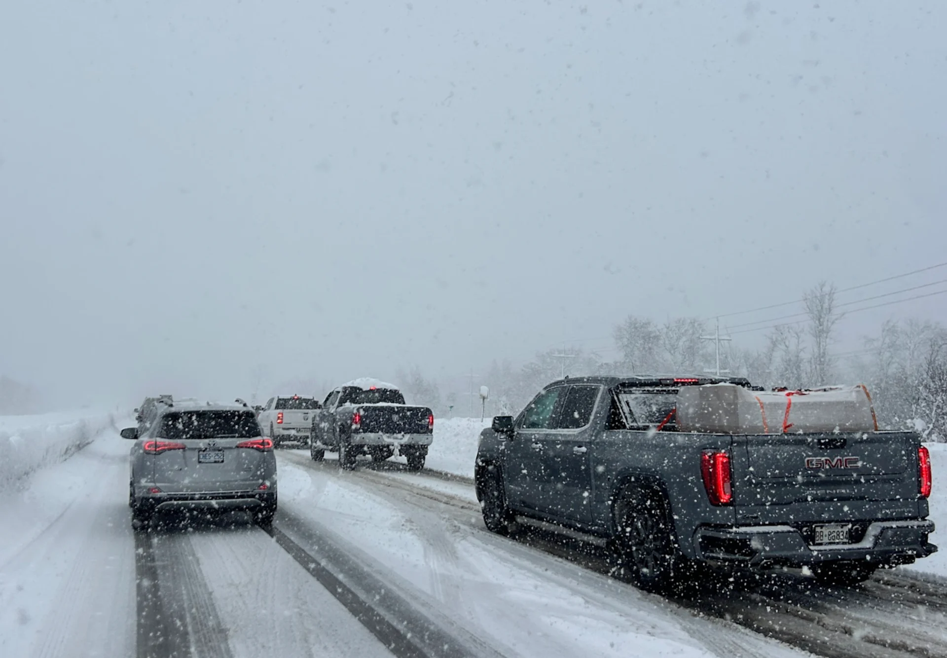
Drivers across southern Ontario are facing a challenging commute early Wednesday as a second clipper system brings a widespread coating of snow. Several school districts across the Greater Toronto Area (GTA) pulled buses from the roads first thing.
RELATED: Toronto braces for coldest temperatures in nine months
Snowfall warnings and special weather statements continue through Wednesday, with an additional 5-10+ cm expected in some areas. Before 7:30 a.m., nearly 5 cm had already fallen at Toronto's Pearson airport, with closer to 10 cm in Hamilton, and about 3 cm in London. Police officials are urging drivers to take it slow on the roads, and to adjust to the challenging conditions.
Behind the clipper system will be another round of lake-effect snow targeting communities southeast of Lake Huron and Georgian Bay Thursday and Friday.
Be sure to monitor the forecast for updates regarding snowfall amounts and impacts, as well as any alerts as conditions change or deteriorate.
Another healthy swath of snow hits Wednesday
A second clipper arrived Tuesday night, carrying abundant Pacific moisture, which will increase snowfall amounts and introduce slightly milder air.

Widespread snow will persist through Wednesday morning. Winter travel and slow commutes are likely from Windsor to Toronto.
Periods of 2-3 cm an hour snowfall rates are possible near London. Initially, widespread, accumulating wet snowfall is forecast.
RELATED: Toronto increases parking fines as snow hits the city

In the late morning to early afternoon, temperatures may climb above the freezing mark for communities in southwestern Ontario, long Lake Erie and Lake Ontario shorelines.
That may transition snowfall to a wintry mix or showers, limiting snowfall totals where above-the-freezing-mark temperatures occur.
A razor-thin freezing-mark line exists for the Golden Horseshoe, and adds some uncertainty to the snowfall accumulation forecast.

Locales away from the lakes and at higher elevations could see 10-20 cm of snowfall from this system.
"Travel will likely be challenging. Roads and walkways will likely be difficult to navigate due to accumulating snow. There may be a significant impact on rush hour traffic. Visibility will likely be reduced at times," Environment and Climate Change Canada (ECCC) warns in the snowfall warning.

Lake-effect snow picks up late week, risk of an additional 10 cm
Lake-effect snow will develop behind the passing clipper, impacting areas southeast of Lake Huron and Georgian Bay. Regions near London and Barrie could see an additional 10 cm of snow on Thursday due to lake-effect activity.
Another system is being monitored for the weekend, which may bring widespread, accumulating snowfall across the region.

DON'T MISS: Canada’s December outlook holds a strong, cold start to winter
Staying cold through the holidays
Below-normal temperatures are projected to persist next week, potentially lasting through the holidays, accompanied by additional rounds of lake-effect snow. No significant pattern shift is expected.
Any mild conditions will likely be brief and linked to low pressure systems passing north of the area.
Stay safe out there as hypothermia can be a real risk this time of year.