
Torrential rain and slight tornado risk with Monday's storms in Ontario, Quebec
Supercells are possible, with a slight tornado risk, on Monday across northeastern Ontario and western Quebec
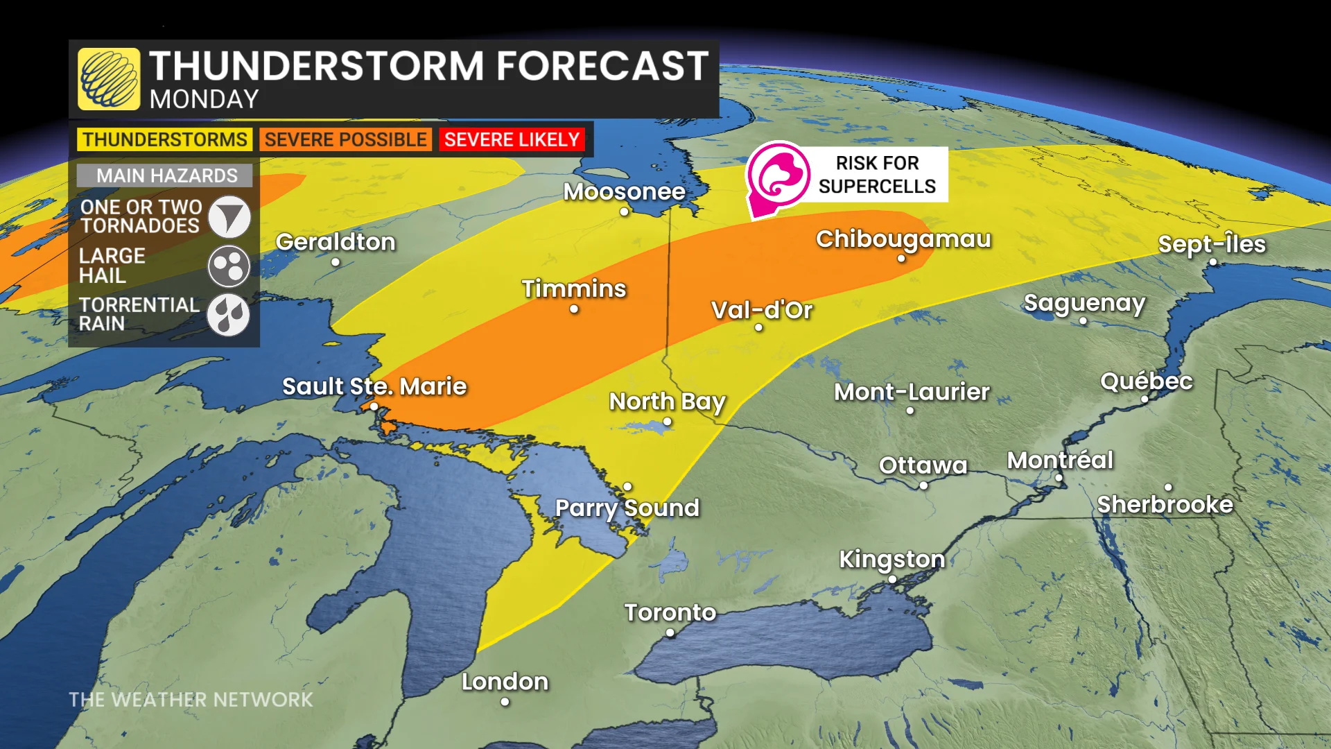
Supercells could develop Monday across parts of northeastern Ontario and western Quebec, posing threats of torrential rain, strong winds, hail, and a slight tornado risk.
SEE ALSO: How supercells grow to produce giant hail and intense tornadoes
A shortwave trough is interacting with a humid and energized air mass in the region, triggering thunderstorms by the afternoon.
Folks should pay close attention to the radar and monitor local watches and warnings amid rapidly changing conditions.
Monday: Slight tornado chance for some areas
Areas from Sault Ste. Marie to Timmins and north toward Chibougamau, Que., are expected to see storm activity.
Late Monday afternoon into the evening, some thunderstorms could intensify into supercells.
These storms may bring large hail (2-3 cm), wind gusts up to 90 km/h, and heavy rainfall within the humid airmass.

Additionally, there is a slight tornado risk if conditions align, particularly in areas from Timmins, Ont., to north of Val-d’Or, Que.
Storm activity is forecast to persist into Tuesday as the same slow-moving cold front continues its eastward progression.

Residents in impacted areas should stay weather-aware and monitor updates frequently.