
Storm threat continues after 8,000+ lightning strikes over the Prairies
Severe thunderstorms and frequent lightning observed Thursday morning could mark the beginning of a multi-day stretch of active weather across the Prairies
The southern Prairies face an increased thunderstorm potential Thursday and Friday, with watches and warnings already lining the region through Thursday morning. These may come and go as conditions develop.
Visit our Complete Guide to Fall 2025 for an in depth look at the Fall Forecast, tips to plan for it and much more!
Lightning activity has been significant, with over 8,000 strikes reported during a storm cluster early Thursday!
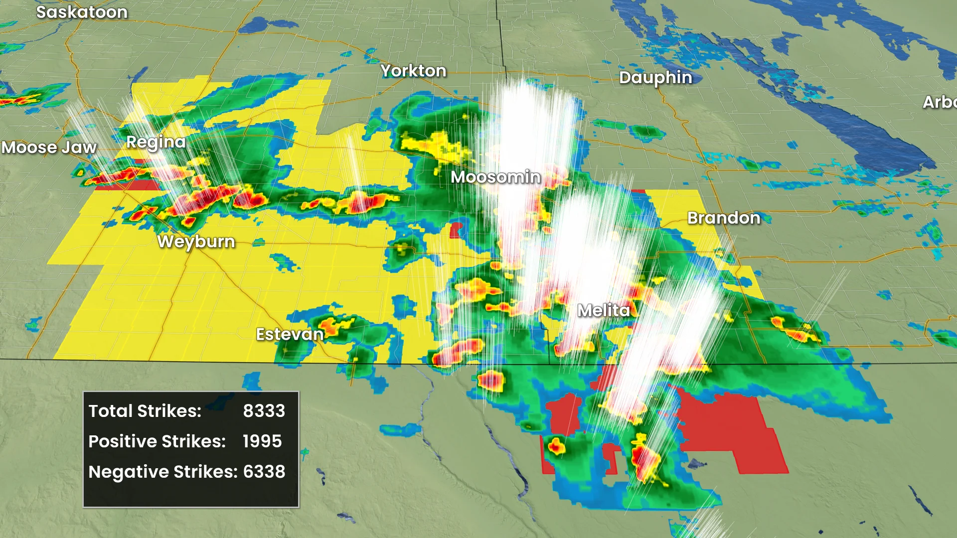
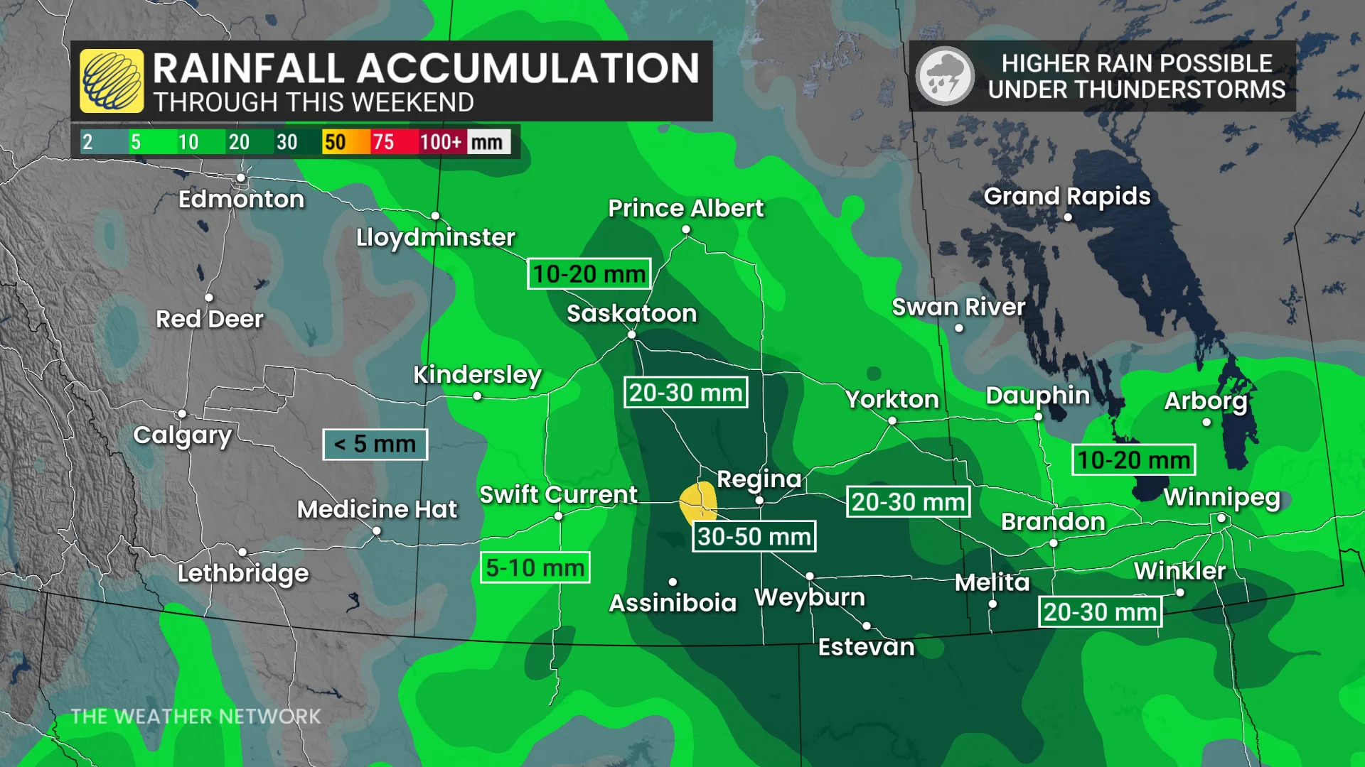
A slow-moving weather boundary pushing in from the U.S. is driving this storm activity. Thunderstorm risks are expected to continue into the weekend. Rainfall totals for some areas could reach 30-50 mm or more by Sunday. Residents should remain alert for localized flooding and monitor updates and warnings as conditions change.
Multi-day storm threat continues over the southern Prairies through Friday
Thunderstorms are forecast to move into Winnipeg by early Thursday afternoon, with weakening expected as they progress eastward. The primary threat with these storms is strong wind gusts exceeding 90 km/h, accompanied by periods of heavy rain.
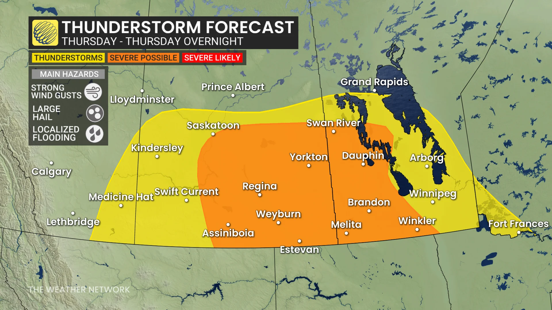
By Thursday evening and overnight, the focus of severe weather is expected to shift toward Saskatoon and areas near the Saskatchewan-Manitoba border, including regions along the U.S. border. These storms may produce hail up to 2 cm in size and strong winds, carrying the potential to reach severe levels.
RELATED: Keep your furniture from flying around in strong winds with this simple hack
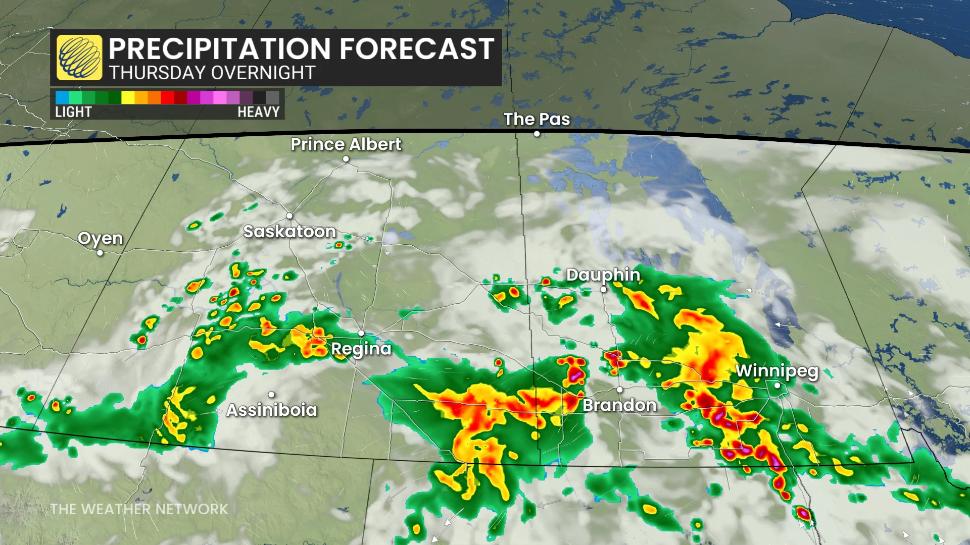
There is also concern for the storms slowing down overnight, which could increase the risk of localized flooding due to prolonged heavy rainfall. Residents in affected areas should stay updated on local weather alerts and be prepared for possible impacts.
Strong thunderstorms target southern and central Saskatchewan Friday
Thunderstorms are expected to develop across southern and central Saskatchewan again on Friday as a low pressure system moves through the region. Areas near Regina, Saskatoon, and locations eastward could see severe thunderstorm warnings by late afternoon and evening.

These storms may bring hail up to 2 cm in size, heavy downpours, and strong wind gusts.
Some regions could accumulate 30-50 mm or more of rainfall by the weekend, raising concerns for localized flooding in areas with slower-moving storm cells.
The southern Prairies are set to remain the most active weather hotspot in Canada heading into the weekend. In contrast, the majority of Canadians elsewhere can expect drier conditions with minimal precipitation expected over the next seven or more days.
Wondering how the season will play out this year across the Prairies? Be sure to check out the official 2025 Fall Forecast.