Thunderstorm, flood threat rises in southern Ontario from March warmth
Patchy dense fog to give way to southern Ontario's first widespread thunderstorm risk of 2026 on Saturday, with the region experiencing late-April warmth to kick off the weekend
The first weekend in March in southern Ontario is showcasing why the month can feature such volatile weather.
A surge of mild air has infiltrated the region, bringing a taste of early, spring-like weather that normally wouldn't be seen until late April. With that comes a bout of heavy rain and a far-reaching chance of thunderstorms on Saturday. The result also means an elevated flood risk due to the melting snowpack from the rain and mild temperatures.
SEE ALSO: Large and violent tornado hit Union City, Michigan and put counties on alert
And just south of the border, multiple fatalities were recorded after tornadoes and severe storms hit Michigan on Friday, with the spotlight on a particularly damaging twister in Union City.
While southern Ontario won't see that extreme of severe weather this weekend, the region is likely to see thunderstorms, with the chance of stronger cells in some regions.
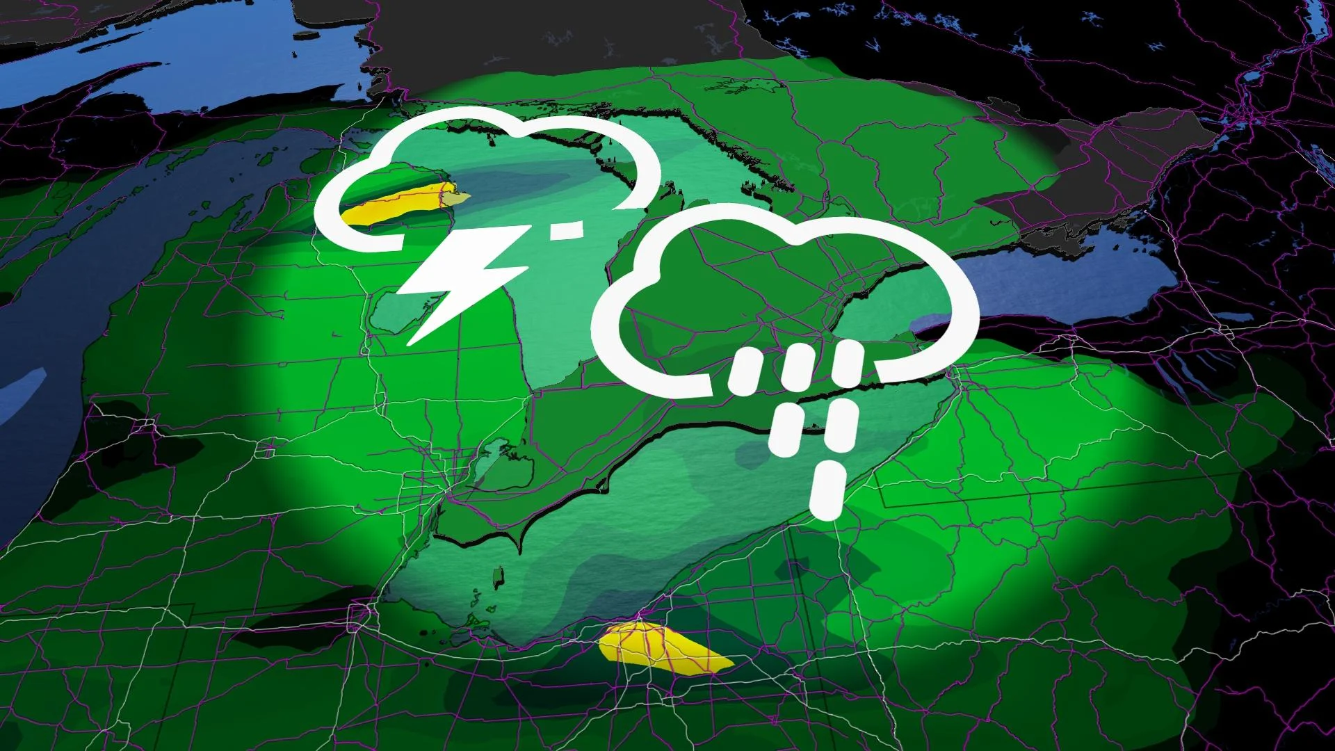
Rain, wind, and storms expected through the weekend
Flood watches are in effect for all areas south of the French River due to the increasing temperatures and forecast rainfall. The combination of melting snow, rain, and frozen ground is contributing to heightened water levels, significantly raising the risk of ice jams along rivers in the region. Residents are advised to monitor local updates and exercise caution near waterways.

By Saturday morning, winds will strengthen as a cold front pushes into the region. The Greater Toronto Area (GTA) could see multiple rounds of showers and thunderstorms between noon and 8 p.m., with the strongest storm potential during early-afternoon hours.
Some areas could still see severe storms into early Saturday afternoon, particularly in the Hamilton to Niagara region and eastern Ontario, where better daytime heating and dynamics exist.

A strong, low-level jet stream overhead and possible afternoon clear skies could increase severe weather ingredients. Risk for strong to severe wind gusts and small hail.
Wind gusts are forecast to peak at 60–80+ km/h, particularly atop the escarpment in areas such as Niagara, Kitchener, and Dundalk.

Brief spikes to 20°C in southwestern Ontario are possible just ahead of the front, but shouldn’t stay for long.
Sunday will bring cooler, but sunnier conditions, with temperatures remaining around 10°C above seasonal norms.
DON'T MISS: Two oceans fuel Ontario's thaw, and there's 200 mm of water locked in snow

Flood watches are in effect for areas south of the French River due to rain, melting snow, and frozen ground contributing to swollen rivers. The risk of ice jams remains high. There is a moderate risk of rover and overland flooding.
Additionally, there is a low chance of power outages from strong wind gusts and winter-related tree damage. Residents are encouraged to stay prepared and stay informed with the latest updates.

Can we officially say goodbye to the winter cold?
Late next week, temperatures are set to drop significantly, but the arrival of true Arctic air may be delayed until the following week. In the meantime, a couple of messy weather systems could impact the region late next week and into the weekend, bringing the potential for mixed precipitation.
RELATED: Canada to feel magnified March madness in the month ahead
The third week of March is shaping up to be wintry, with the possibility of significant snowfall in some areas. However, temperatures could begin to recover somewhat as the weekend approaches, providing a slight reprieve from the colder conditions.
WATCH: Winter's icy grip prompts OPP warning to stay off the lakes and rivers
Stay with The Weather Network for more information and updates on your weather across Ontario.