The pattern that’ll fuel a powerhouse low across Atlantic Canada
A rapidly intensifying storm will hit Newfoundland Tuesday, bringing strong winds, heavy rain and possibly snow.
After the remnants of Melissa enhanced a low-pressure system to create potent winds, heavy rainfall and rough seas into this weekend, Newfoundland will be welcoming in yet another wicked storm this week.
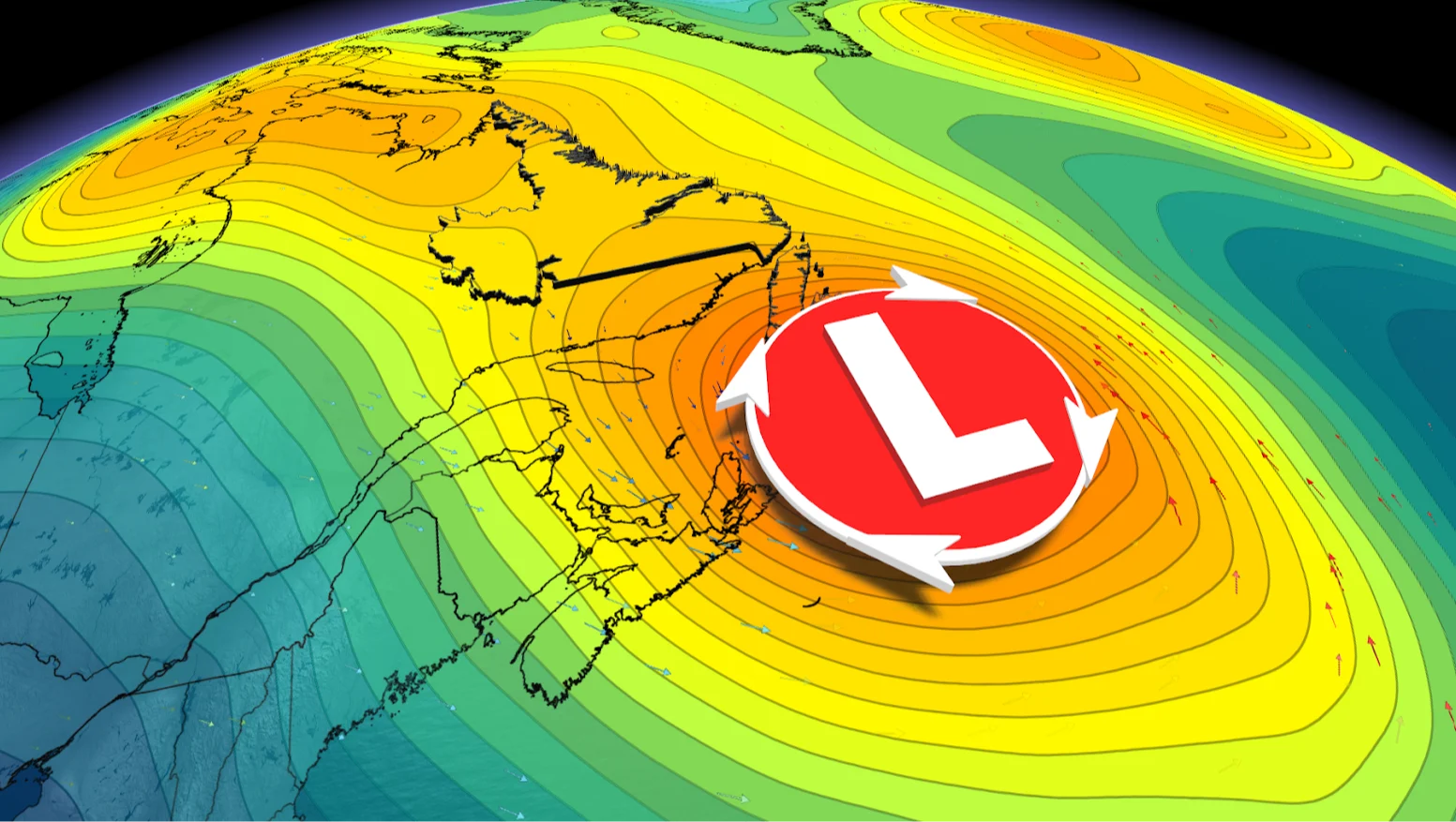
On Monday afternoon, a deep, cut-off trough slides over the Gulf Stream’s warm waters, creating a strong temperature contrast between the ocean and the air. Twenty-four hours later, a powerful low will be approaching Newfoundland.
RELATED: Are you ready for 'Snow'vember? Snowfall threat looms over Canada
As a result, the storm will undergo bombogenesis–-or weather bomb-–a rapid deepening that turns the storm into a formidable low as it approaches Newfoundland on Tuesday. The result will be intense wind gusts, heavy rainfall and maybe even some snow for some locales.

Ingredients coming together for powerful Newfoundland weather bomb
Low-pressure is expected to develop late Monday off the coast of the Mid-Atlantic states and rapidly intensify as it tracks to or just south of Atlantic Canada.
This region is the spark plug for the development of low pressure, but the secret ingredient is lurking upstream in Canada. The real intensification begins when energy from the southern trough starts to phase with a second trough diving towards the Maritimes. When those two upper-level systems merge, it creates a strong lift in the atmosphere, pulling air upward and deepening the surface low below.
Think of this as storm ventilation; the lift creates an opportunity to deepen the low at an explosive rate.
At the surface, this triggers rapid pressure falls south of the Maritimes Monday night. As the developing storm sits in a sweet pocket with ideal upper-level support, the pressure will continue to fall--all signs of an impressive nor’easter being born.
Sea surface temperatures along the northern edge of the Gulf Stream are remarkably warm for early November, hovering in the low 20°C range just offshore of Nova Scotia and Newfoundland.
As the cold upper trough passes over the ocean, the sharp contrast in temperatures triggers convection and grows the storm vertically. Mid-latitude storms thrive on this zone of Arctic air and tropical moisture farther south.

Explosive deepening recipe
Phasing upper troughs
Warm Gulf Stream waters (20°C to 22°C)
Cold air supply from Canada
Strong jet stream support aloft
When you overlap each of these unique ingredients, the storm will undergo bombogenesis––a rapid deepening that turns the storm into a formidable low as it approaches Newfoundland on Tuesday.
Stay tuned to The Weather Network for the latest forecast updates for Atlantic Canada.