Sunday sees favourable conditions again for severe storms on the Prairies
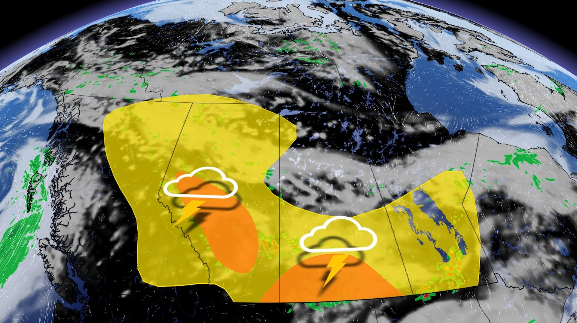
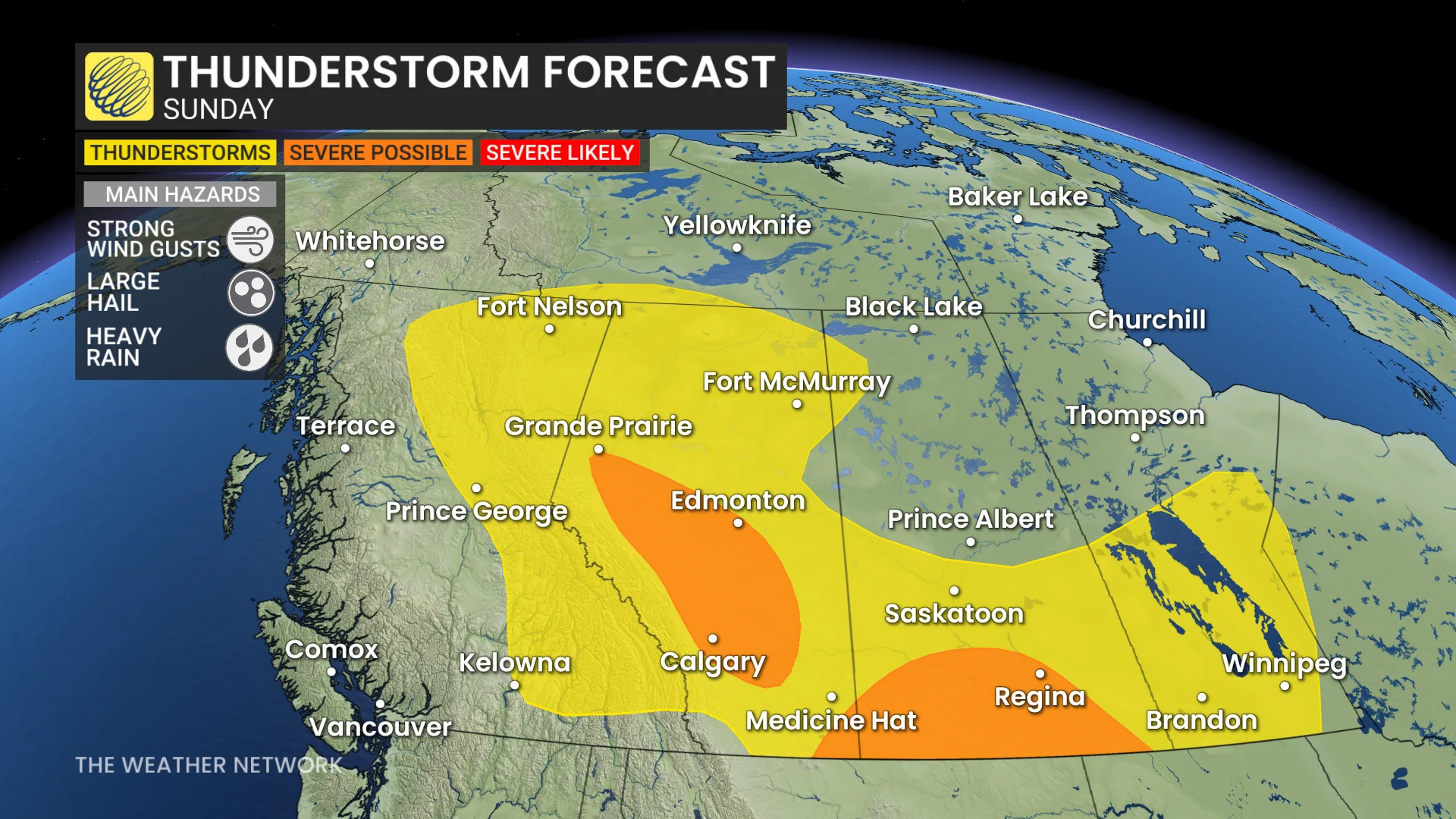
A third consecutive day of severe weather is possible for parts of the Prairies on Sunday, with locales along Alberta foothills and in southern Saskatchewan at most risk
Folks on the western side of the Prairies can expect another active day on Sunday as an expansive risk for thunderstorms covers much of the region.
That follows the previous two days of severe weather, with tornado-warned storms on Friday and Saturday. Saturday's severe weather included a spotter-reported tornado by storm chasers in the Saskatchewan communities of Hague and Hepburn.
DON'T MISS: PHOTOS: Funnel clouds sighted in tornado-warned storms in Alberta, Sask.
Sunday's storm threat will be focused on the Alberta foothill region and areas adjacent to it, as well as southern Saskatchewan. Large hail and damaging winds will be the main threats.
Pay close attention to watches and warnings in your area as isolated severe thunderstorms continue Saturday evening.
Sunday sees two areas of chance for severe storm development
Forecasters will monitor two areas for potential severe weather on Sunday.
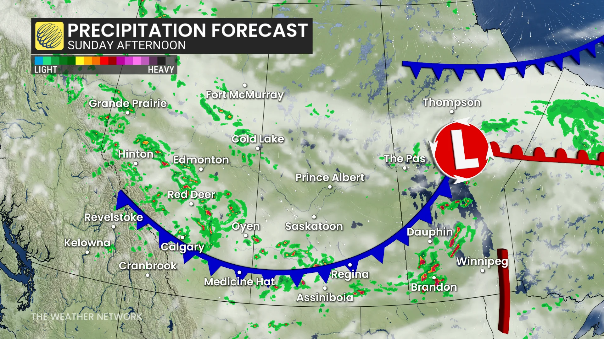
A shortwave trough crossing the Rockies and a formation of a protected trough will initiate storms in the early afternoon for Alberta foothills and central areas.
Thunderstorms that form across the aforementioned regions could turn severe as they move toward the QE2 during the late-afternoon or early-evening hours. That includes Calgary, Red Deer, and Edmonton. Large hail and damaging winds will be the primary threats in Alberta’s stronger storms.
A secondary area of severe weather could develop across southern Saskatchewan, including Regina. A low-pressure system stateside will bring instability and storm dynamics into southern Saskatchewan, possibly enhancing storms triggered by a weak cold front sinking south the region.
Clusters of thunderstorms developing into the evening hours will carry a risk for heavy rain and damaging winds. However, the major storm cluster will remain south of the border with a swath of more than 100 mm of rain expected from Montana to northern Minnesota.
Beyond, changeable temperatures are anticipated this week, but overall, a warmer-than-normal pattern will stay in place across southern areas while central locales see near normal. An active pattern will continue, as well, with a few systems tracking across the region with periods of rain and thunderstorms.
Rain totals will be quite substantial across much of the region, especially across central Alberta, including Edmonton, with 50-100+mm expected for many places. That will have a very positive impact on the wildfire danger, and help efforts to control and even extinguish the fires in the areas that see the heaviest rain.
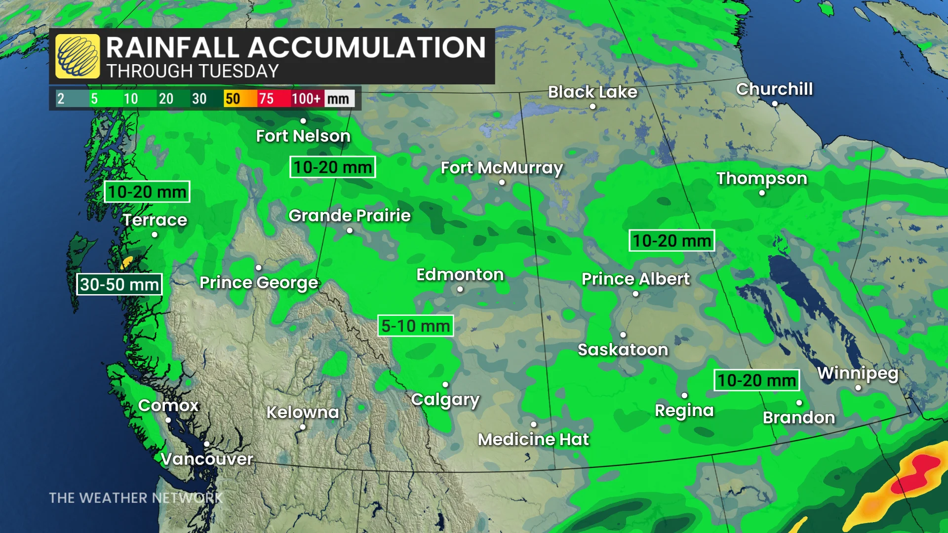
However, some of the wildfire areas will come up well short of what is needed. Beneficial rain is also likely for the southern agriculture regions.
A very warm and drier pattern is expected to return during the final few days of June.
Stay with The Weather Network for all the latest on conditions across the Prairies.