
Summer starts on ice for parts of Canada as heat builds east
The official start to summer will feel like anything but summer across a large swath of Canada
It’s been a long journey for warm-weather lovers, but the wait is almost over. Summer officially arrives in the northern hemisphere on Friday, June 20.
What can we expect across Canada as the season officially flips?
Some lucky areas will get a taste of summer-like weather by the end of the week—but much of the country will still feel like early or mid-spring. We’re even watching the potential for a few wet snowflakes in spots.
DON’T MISS: Canada’s 2025 summer forecast holds a heat dome, ring of fire storms
Western Canada starts summer without summery weather
Folks across the western half of the country will fall under the influence of a broad but deep troughing pattern just as we turn to summer. This will usher in a prolonged stretch of below-seasonal temperatures from the Yukon and British Columbia toward the Prairies.
Model guidance suggests that the first five days of summer will see temperatures 3-5 degrees below seasonal from southern B.C. through northern Manitoba.
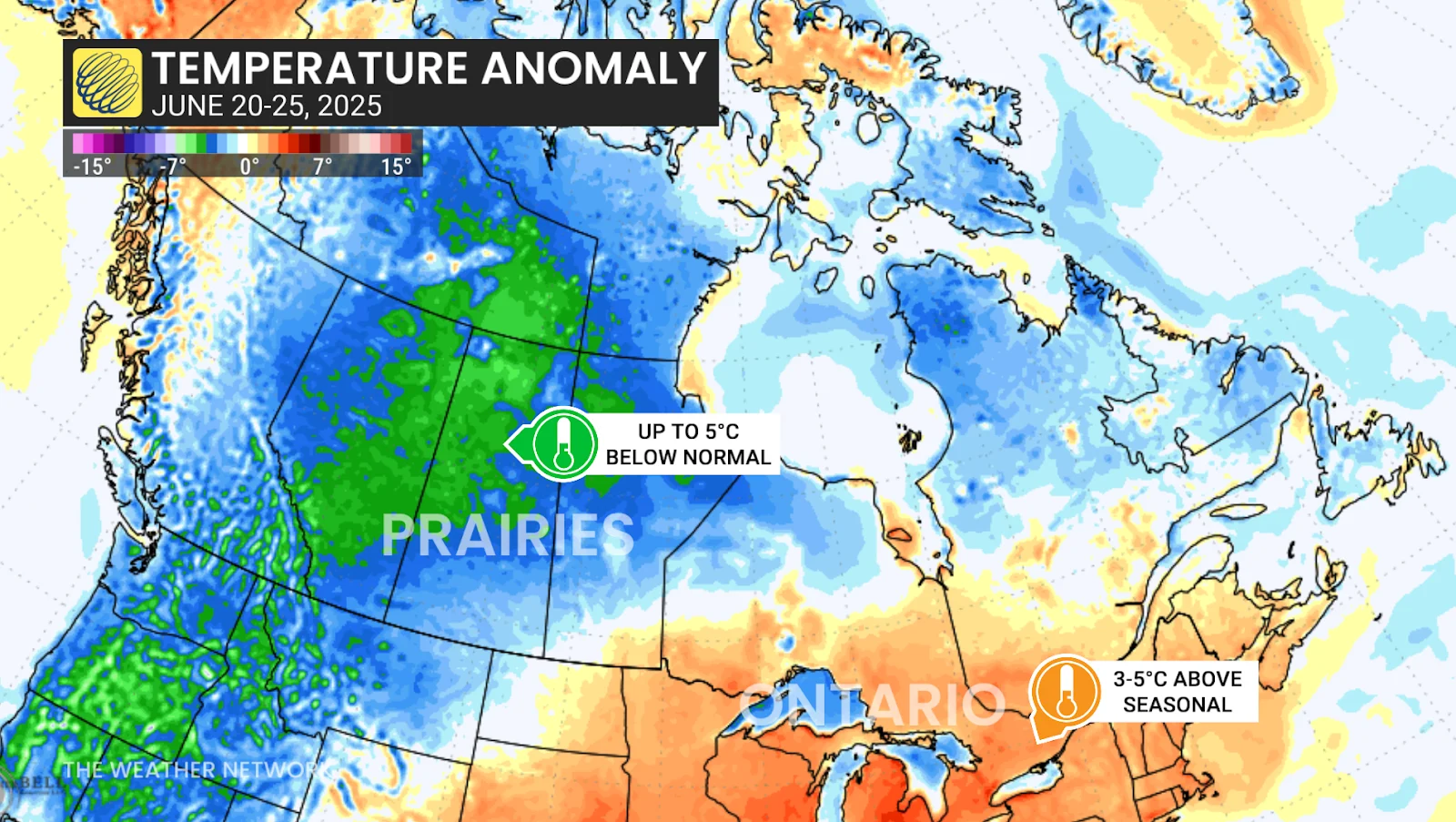
The chilliest temperature anomalies could fall over the heart of Alberta, where we may see temperatures falling 10+ degrees below seasonal.
A little bit of wet snow is also possible across higher elevations of the Rockies as freezing levels dip as low as 2000 metres by next weekend.
While the cool spell will disappoint those hoping to kick off summer with classic heat, this is a welcome change for fire officials and residents alike after an extremely aggressive start to the wildfire season.
Looking for warmth? Head east!
Below-seasonal temperatures in one area beget above-seasonal temperatures in another. The trough dipping over Western Canada will amplify a ridge of high pressure aloft as it moves toward the Great Lakes region.
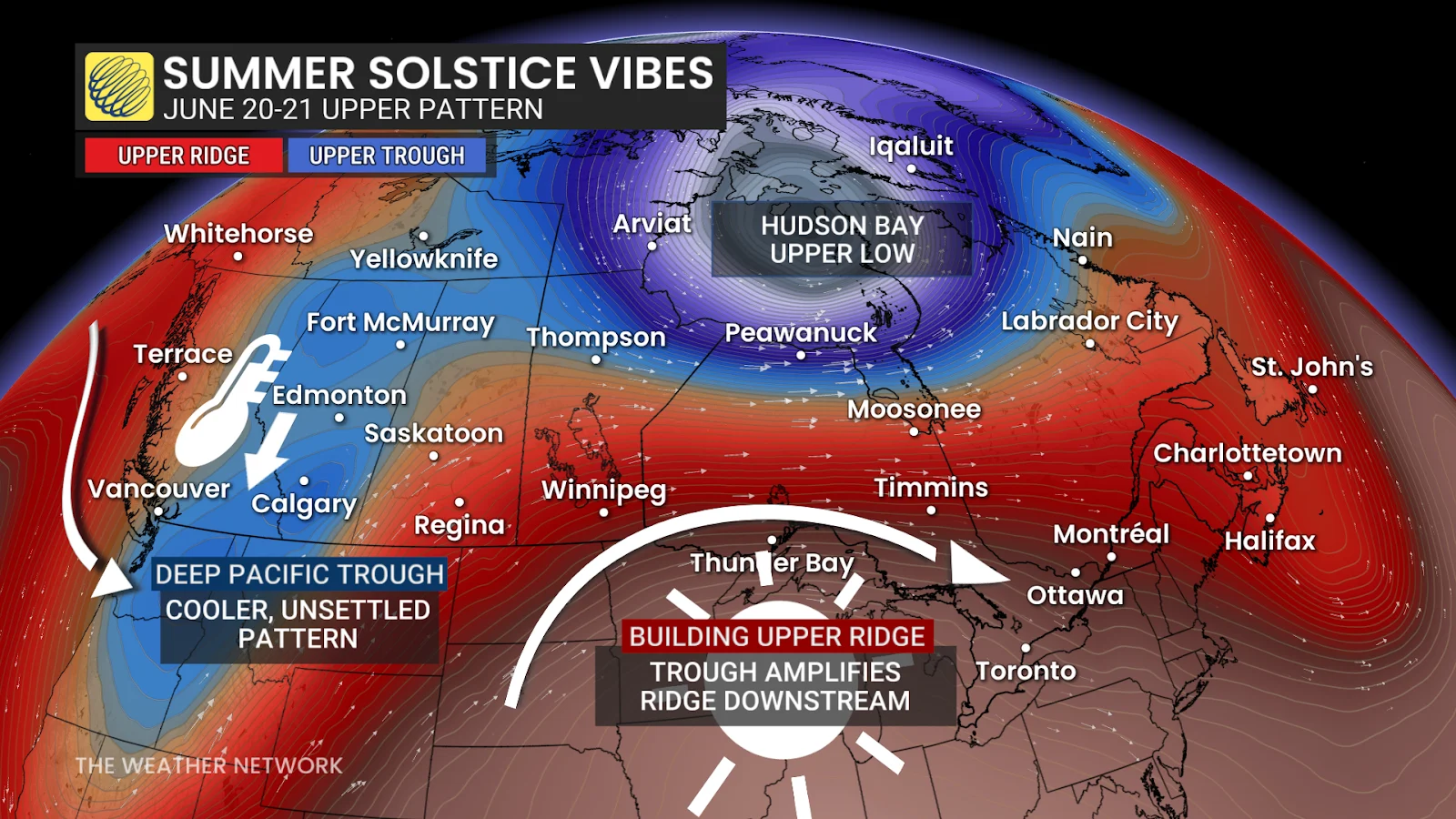
Ridges tend to push temperatures above the seasonal mark across communities under their influence. This setup will likely southern Ontario its warmest stretch of conditions all year.
It’s been a cool start to the warm season throughout the region. Toronto-Pearson Airport hasn’t recorded more than back-to-back days above 25°C all year.
This upcoming pattern could bring multiple days of 30-degree temperatures to parts of the region, but specifics are still a bit fuzzy this far in advance. Stay tuned through the week for the latest on this potential warmup.