October to kick off on the Prairies with unusual, summer-like heat
Even though October is nearly here, the Prairies will get another shot of summer-like weather as the month begins
A highly unusual fall weather pattern is building across the Prairies this week, pushing temperatures back into summer-like territory.
The southern Prairies will be especially warm this week, with many seeing temperatures in the mid-20s, even upper 20s for some locales. The focus of the highly unusual, warm weather will then shift east and west as the week progresses.
Visit our Complete Guide to Fall 2025 for an in depth look at the Fall Forecast, tips to plan for it and much more!
Summer-like weather will continue through at least Thursday for some areas, with warm overnight lows on Tuesday and Wednesday nights, as well, this week. With the warmth comes the risk for thunderstorms returning by Tuesday night and Wednesday for some locales.
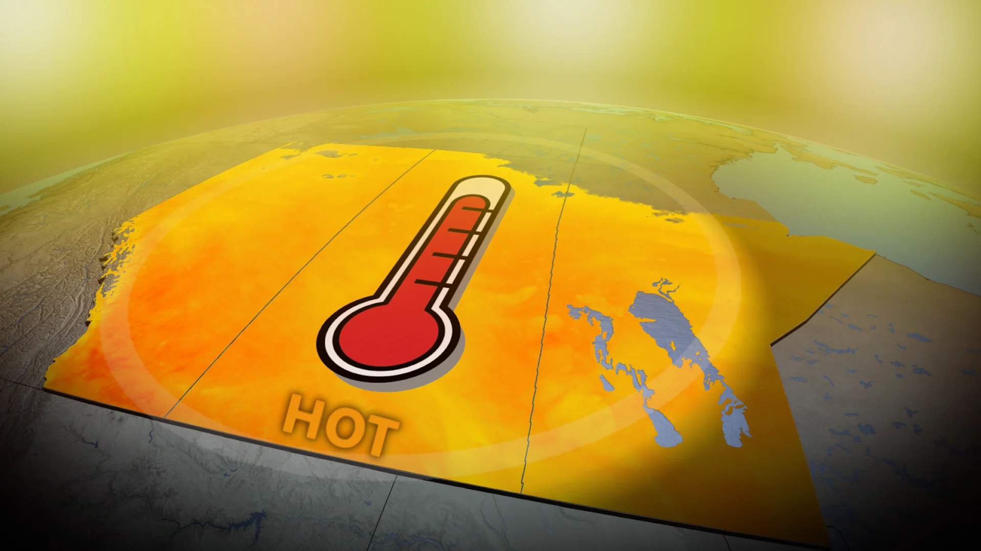
Summer-like heat returns to the Prairies this week
A deep trough in the Pacific Ocean is working to amplify a sizable ridge across the Prairies this week, building from the southern areas of the region, then sprawling north across Nunavut.

This stunning stretch of late-season heat is going to fuel a jaw-dropping temperature anomaly, not just day-by-day, but through the overnight hours, too.
DON'T MISS: Canada races to the end of summer as final 30-degree temperature nears
Overnight lows Tuesday and Wednesday nights are forecast to hover between 17°C to 19°C in parts of Saskatchewan and Manitoba, values more typical of mid-summer than early fall.
Forecast highs are expected to surge well into the upper 20s or even spilling to near 30s, challenging some warmth recorded in October 2021.
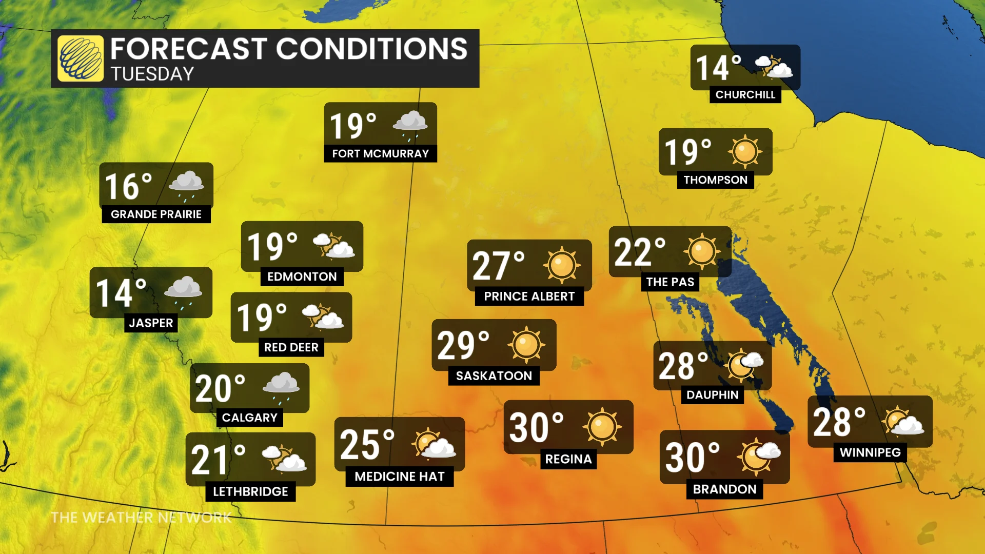
By Tuesday, the core of the warmth has slid across southern Saskatchewan and Manitoba, where several stations are forecast to climb above the 30-degree mark. That sets up an extremely mild Tuesday night across Saskatchewan and Manitoba (lows above 17°C).
With that setup, it will be ripe for thunderstorm development.
By Tuesday night, some storm clusters could be sweeping across central Saskatchewan, tapping into lingering instability, which will then shifts into Manitoba on Wednesday. Scattered thunderstorms will be possible in the province.

On Wednesday, temperatures cool by a few degrees across Saskatchewan, but the same isn’t true for Manitoba, where the warmth continues to spread north to Hudson Bay.
Thursday will be the final hot day across southeastern Saskatchewan and southern Manitoba. That is where temperatures will be close to 30° for daytime highs once again.
October heat records to beat: Saskatchewan and Manitoba
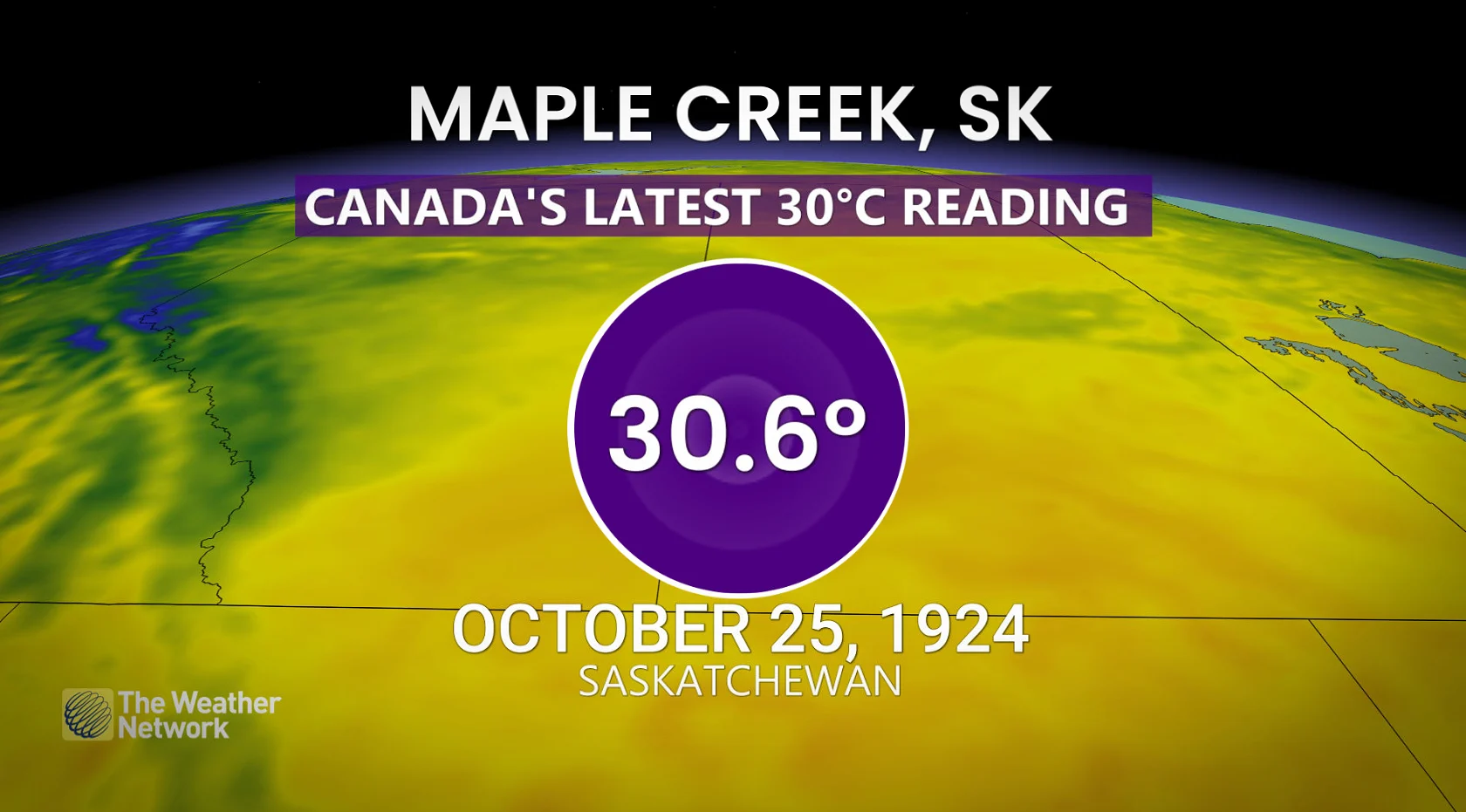
The latest occurrence of a 30-degree reading in Canada occurred in October (30.6°C), recorded on the 25th in 1924 in Maple Creek, Sask.
Below are some monthly records from a few communities on the Prairies that could be reached or broken in the first week of October.
Estevan, Sask.: 33.3°C on Oct. 1, 1992 (all-time October warmth for Estevan) and 32.3°C on Oct. 6, 2021
Yorkton, Sask: 28.8°C on Oct, 6, 2021
Brandon, Man: 31.7°C on Oct. 5, 2021 (all-time October record for Brandon)
Conditions will remain mostly dry for most of next week, especially south of the Yellowhead Highway. The pattern should become more active during early October.
WATCH: 'Fat Bear Week' is almost over! See some of the chonky contenders
Be sure to check back for the latest weather conditions across the Prairies.