Summer heat to fall into a classic rainy, snowy pattern across B.C.
After a bout of summer heat came back for one last hurrah in B.C., we're going to see a return to classic fall weather, including snow for some.
Sections of the British Columbia coastline have been basking in blistering summer temperatures, with daytime highs reaching near the 30s for some.
It is mid-September, however, and meteorological fall started at the beginning of the month, although it certainly hasn't felt like it. The official first day of fall starts on Monday, and we'll be seeing a pattern shift across the province just in time to greet the chilly season.
Visit our Complete Guide to Fall 2025 for an in depth look at the Fall Forecast, tips to plan for it and much more!
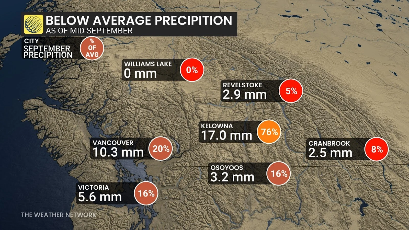
Fall in B.C. also tends to be one and the same with "rainy season." And rainy it will finally be, as we're looking at a long-range trend filled with precipitation and chilly temperatures. This may be a welcome change for folks living on the coast, who may have noticed there has been a lack of rain so far this month thanks to the current heat wave.
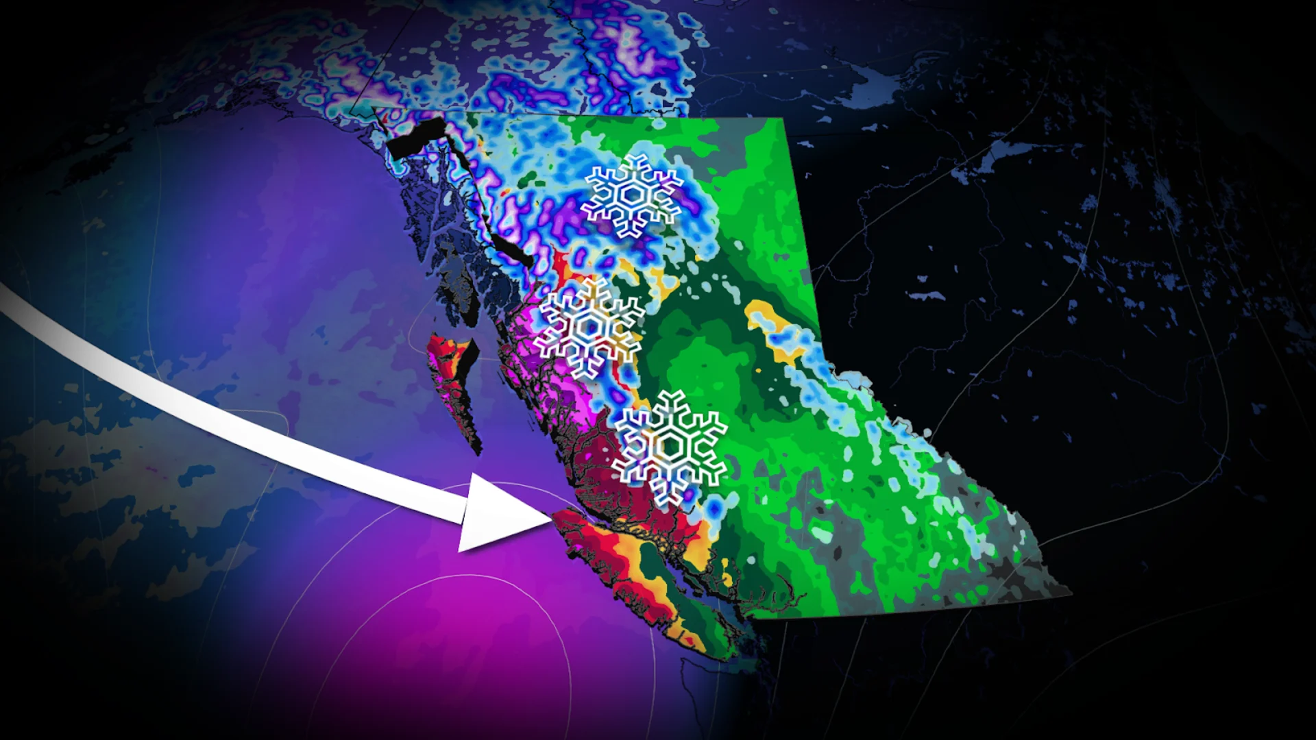
Atmospheric river kicks off the rainy season on Saturday
We're looking at an atmospheric river reaching B.C.'s central coastline by Saturday, bringing heavy rains to the region. Over 100 mm of rainfall is possible around Bella Bella and Prince Rupert.
The South Coast won't be seeing the heavy rains but won't be fully dry, either.

A cold front sweeping in from the north will bring cooler temperatures and widespread showers to the South Coast and lower mainland.
The front will also knock freezing levels down to 2,000 metres, bringing some early-season alpine snow to the coastal mountains and Rockies.
SEE ALSO: Fall arrives on Monday: Three things you need to know
The fall precipitation will stick around through the last full week of September.

September to end with a parade of systems
The centre of high pressure over the North Pacific, which has been helping to fuel this late-summer burst of heat, will finally begin to weaken, allowing for the jet stream to dip below B.C.
This does mean, however, that we will likely see a parade of low-pressure systems be pulled into the province's coastline for the final week of September.
September is only the start of rainy season. October through December is typically when we see precipitation really ramp up. The amount of precipitation we see over the coming months will determine the wildfire risk going into the 2026 season.

Stay with The Weather Network for more information and updates on your weather across B.C.