
Dreary setup puts southern Ontario on track to see 10-50 mm of rainfall
A stubborn trough of low pressure will pester southern Ontario over the coming days, providing unsettled weather at times––including a risk of thunderstorms
This won't be a good start to the week in southern Ontario if you are an outdoor person and/or don't like the sight and sound of rainfall.
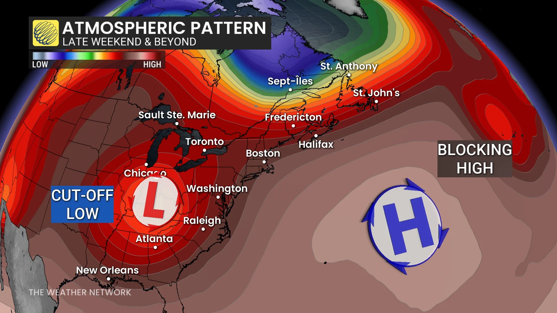
A centre of high pressure over the Atlantic Ocean will pump the brakes on the upper-level pattern across Ontario, forcing a low-pressure system to stall over the Great Lakes for the next few days.
DON'T MISS: Blocking pattern to dictate Canada’s weather into next week
Some locales could see 20-50 mm of rainfall through Wednesday--along with a thunderstorm chance--with the heaviest end of those totals expected in southwestern Ontario--raising the risk of localized, and river and stream flooding.
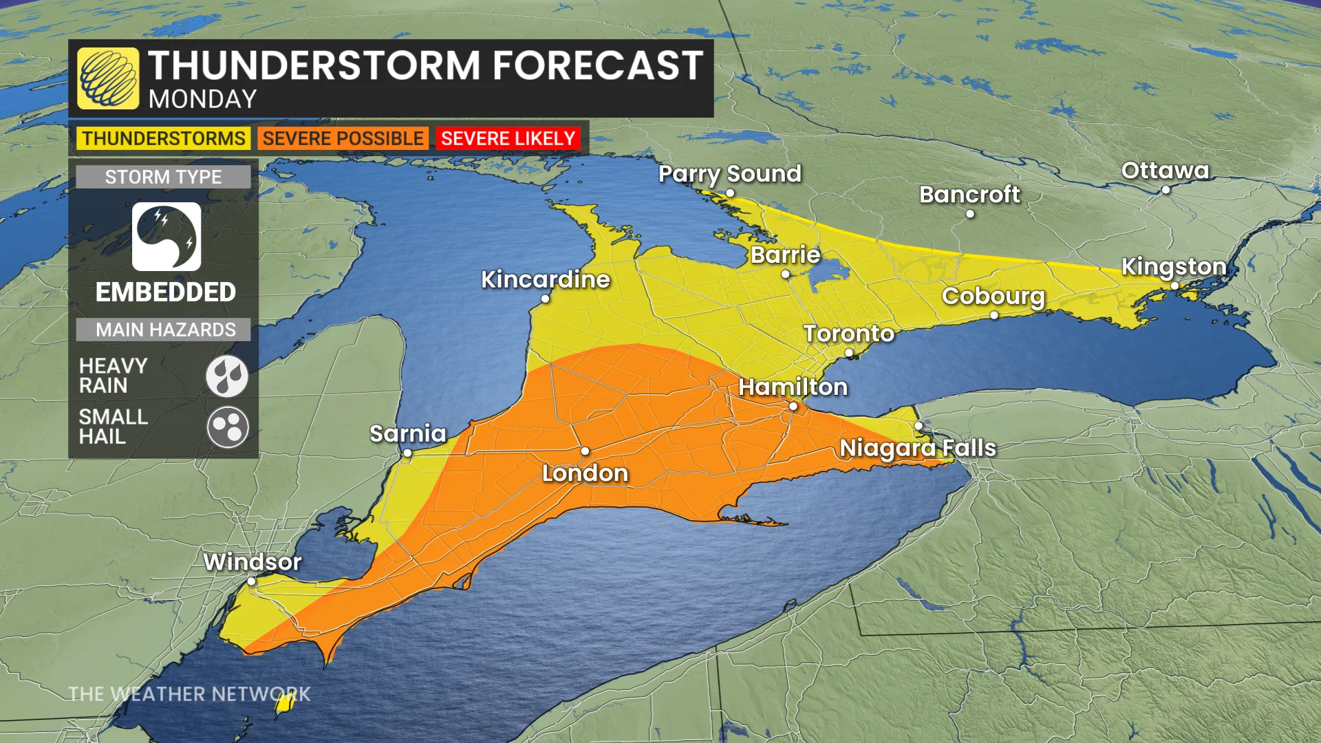
Monday and Tuesday: Rain, thunderstorm risk build
A narrow band of heavier showers wants to slice across the Greater Toronto Area (GTA) during the Monday morning commute, likely slowing the drive down.
The Monday evening commute isn’t much better, and arguably worse, with more widespread, heavier shower coverage all along Lake Erie and Lake Ontario.
We’ll introduce the risk of thunderstorms from cottage country to the shores of Lake Erie and Lake Ontario with instability brewing aloft.
Cooler conditions and cloud cover at the surface mean elevated instability dominates, and lots of moisture in the atmosphere means there is an increased threat of heavy rainfall and small hail.
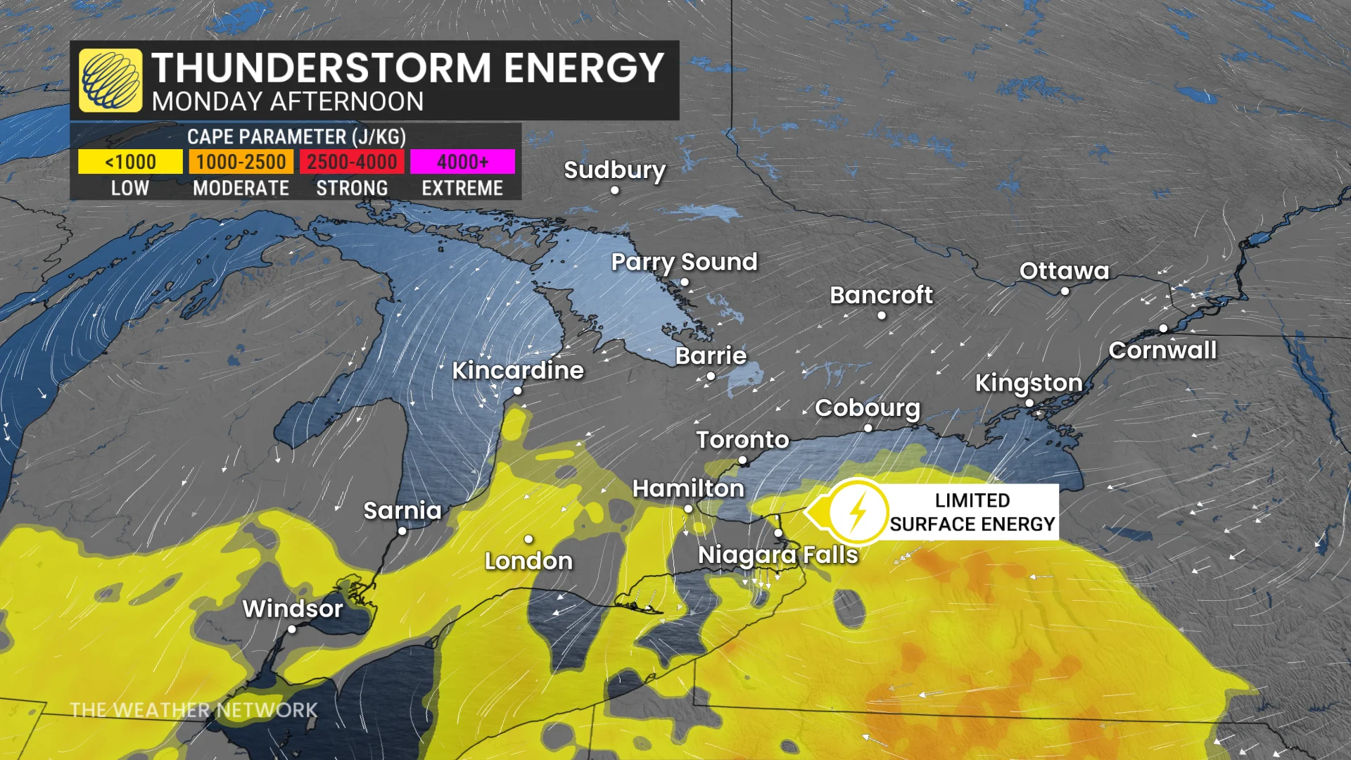
More organized updrafts and stronger storms are possible near Lake Erie, potentially producing some heavier rainfall and larger hail.
A brisk, easterly wind will play with our temperatures on the western end of Lake Ontario, creating a cool lake breeze along the shoreline.
For those wanting to view the cherry blossoms across southern Ontario and GTA, the weather will have to be monitored as blossoms are in peak bloom.
Cherry blossoms at High Park in Toronto are currently in peak bloom, similar to the 2022 season (peak bloom from May 5-12). It’s nowhere near the latest on record, which occurred in 2014, when Torontonians had to wait until May 12-21 to catch the blooms in action.
For those curious about the earliest on record, that occurred on April 10-17, 2012, bringing record-breaking, early-peak bloom conditions, thanks to record warmth early in the spring.
Much of the GTA and Niagara region was spared from rainfall after Tuesday morning, while more organized shower activity is forecast to persist across northeastern and eastern Ontario.
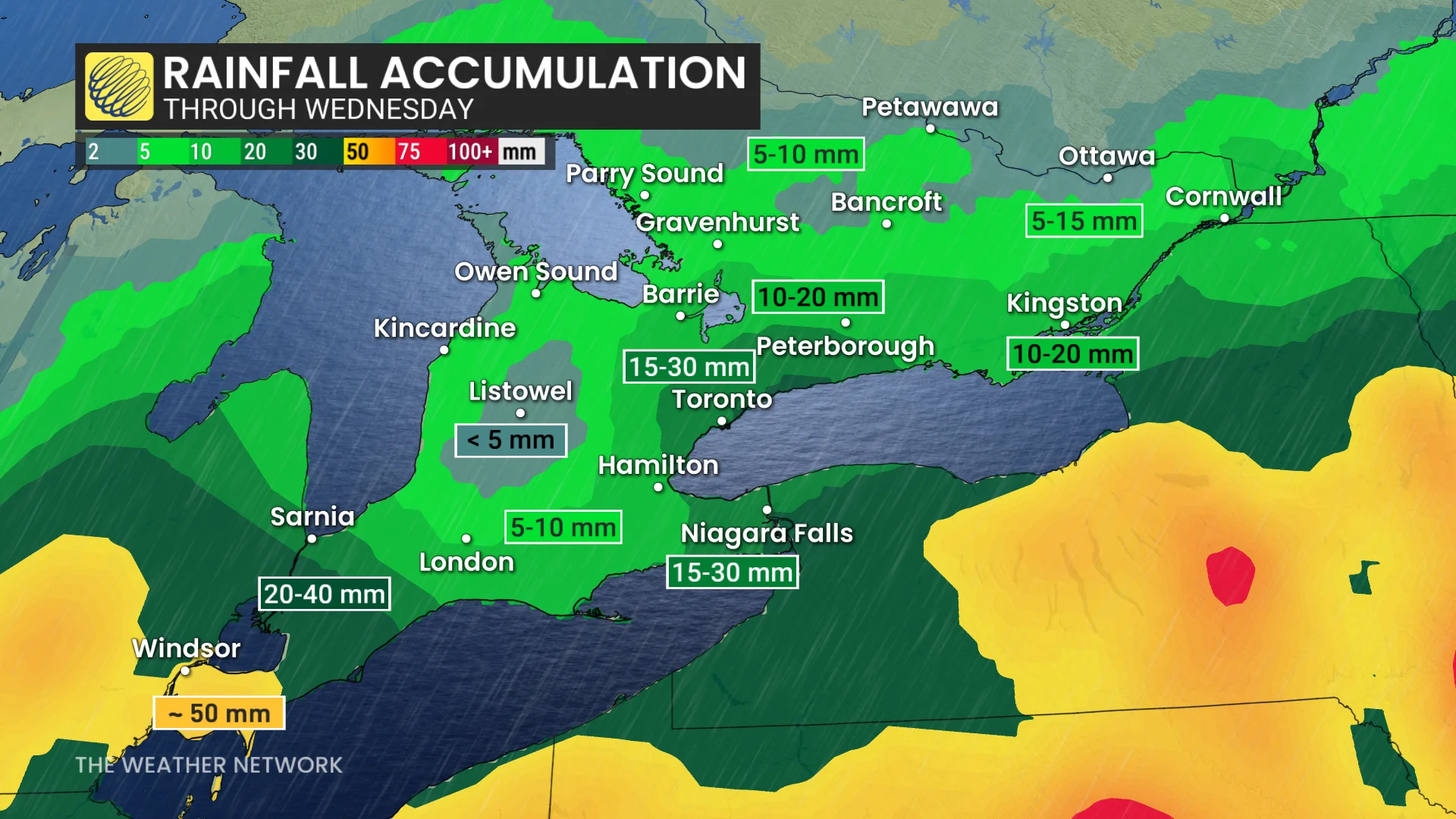
Rainfall amounts will vary depending on the position of the heaviest showers and thunderstorms. Because the system will be disorganized, lower confidence for exact rainfall totals can be expected.
Drier weather is expected late week and below-normal precipitation is expected for the second week of May. While temperatures could still be changeable, they should end up near seasonal or above seasonal for the second week of May.
Stay tuned to The Weather Network for the latest forecast updates for Ontario.
Thumbnail courtesy of Getty Images/BrianAJackson/iStock /Getty Images Plus. Creative #: 1757967583.