Stormy, smoky weather parades across Ontario to kick off June
A train of thunderstorms and wildfire smoke will travel across Ontario this week.
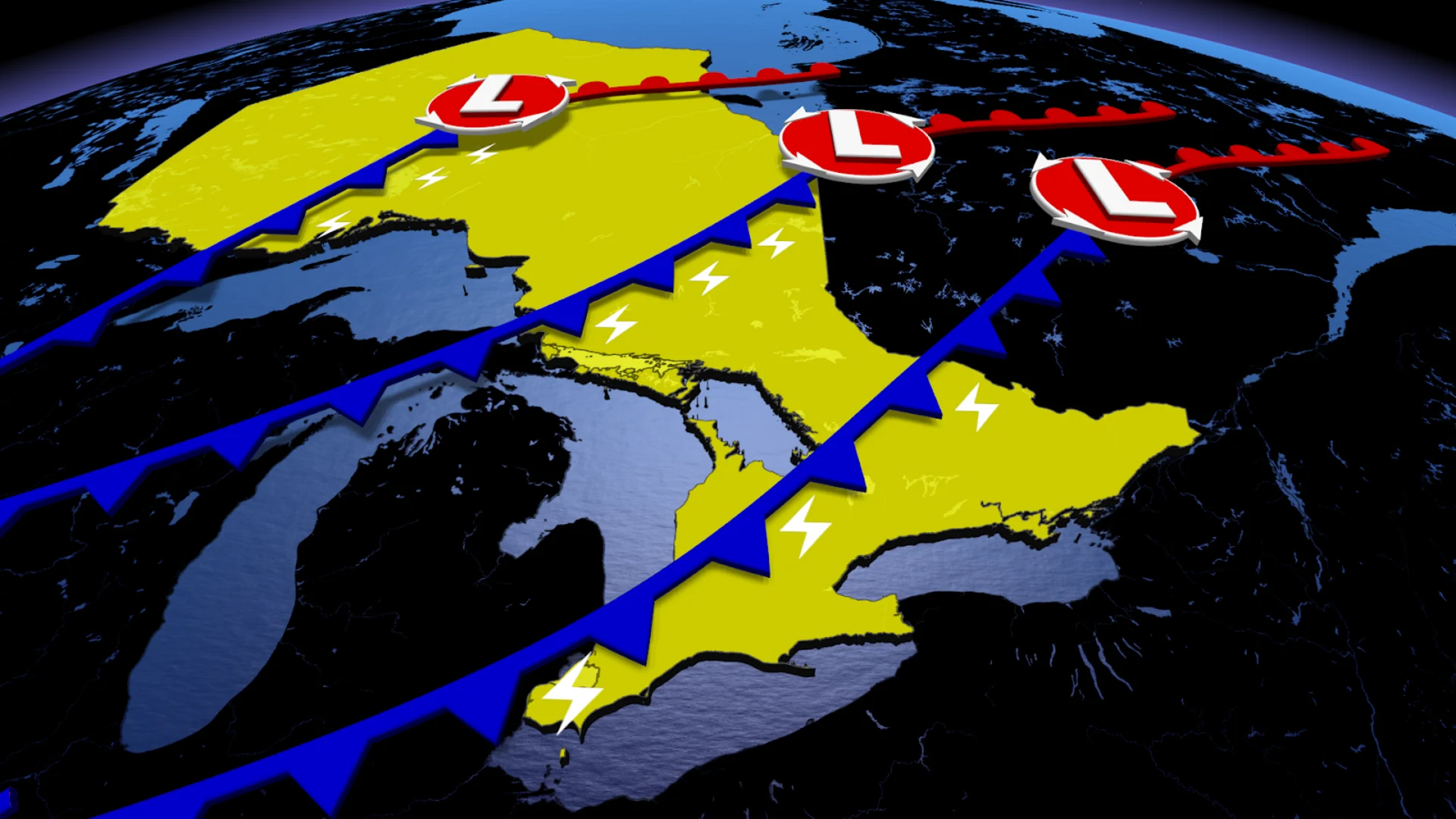
An approaching cold front will bring more than just stormy weather to Ontario this week as it also drags in smoke from Western Canada.
The stormy parade will kick off on Monday as the front meanders through northwestern Ontario, acting as the main trigger for a week of unsettled weather that will continue across the province.
While the smoke will serve to deteriorate air quality through the week, we could also see it limit thunderstorm development, which would be a welcome benefit for fire-prone areas in northern Ontario.
DON'T MISS: The Weather Network's wildfire hub
We'll also finally see temperatures heat up to summer-like levels across southern Ontario, where miserable, chilly conditions made the majority of May feel more like early April.
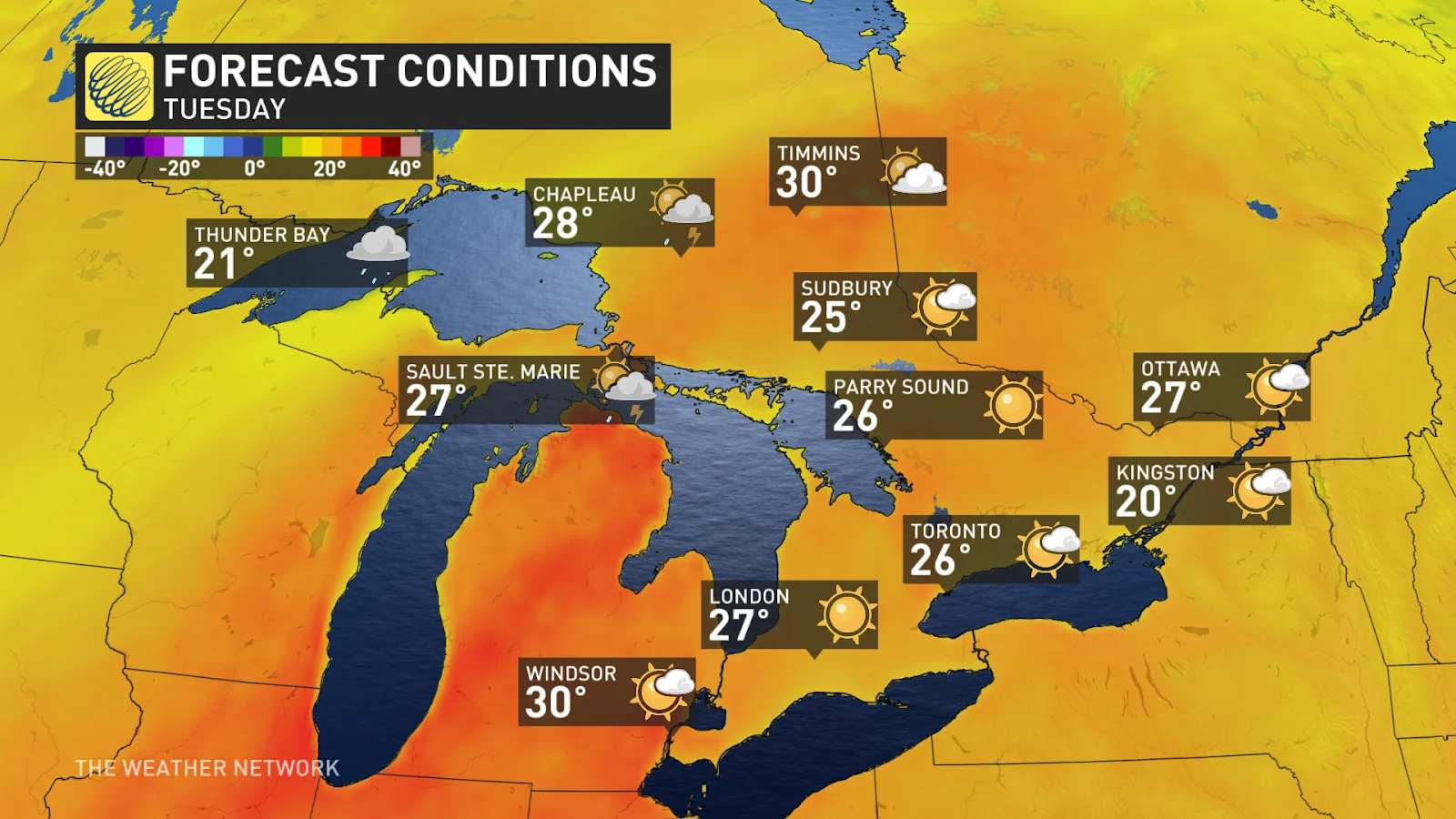
Temperatures heat up across the province ahead of sharp, stormy cold front
As temperatures continue to heat up into the 30s, we'll see the storm risk rise in northwestern Ontario on Monday as a strong cold front clashes with the warm air.
There's a slight risk of supercells developing early Monday evening, but the storms are more likely to cluster into messy squall lines instead. Heavy downpours, frequent lightning, and gusty winds exceeding 90 km/h are the main hazards to look out for in the strongest storms.
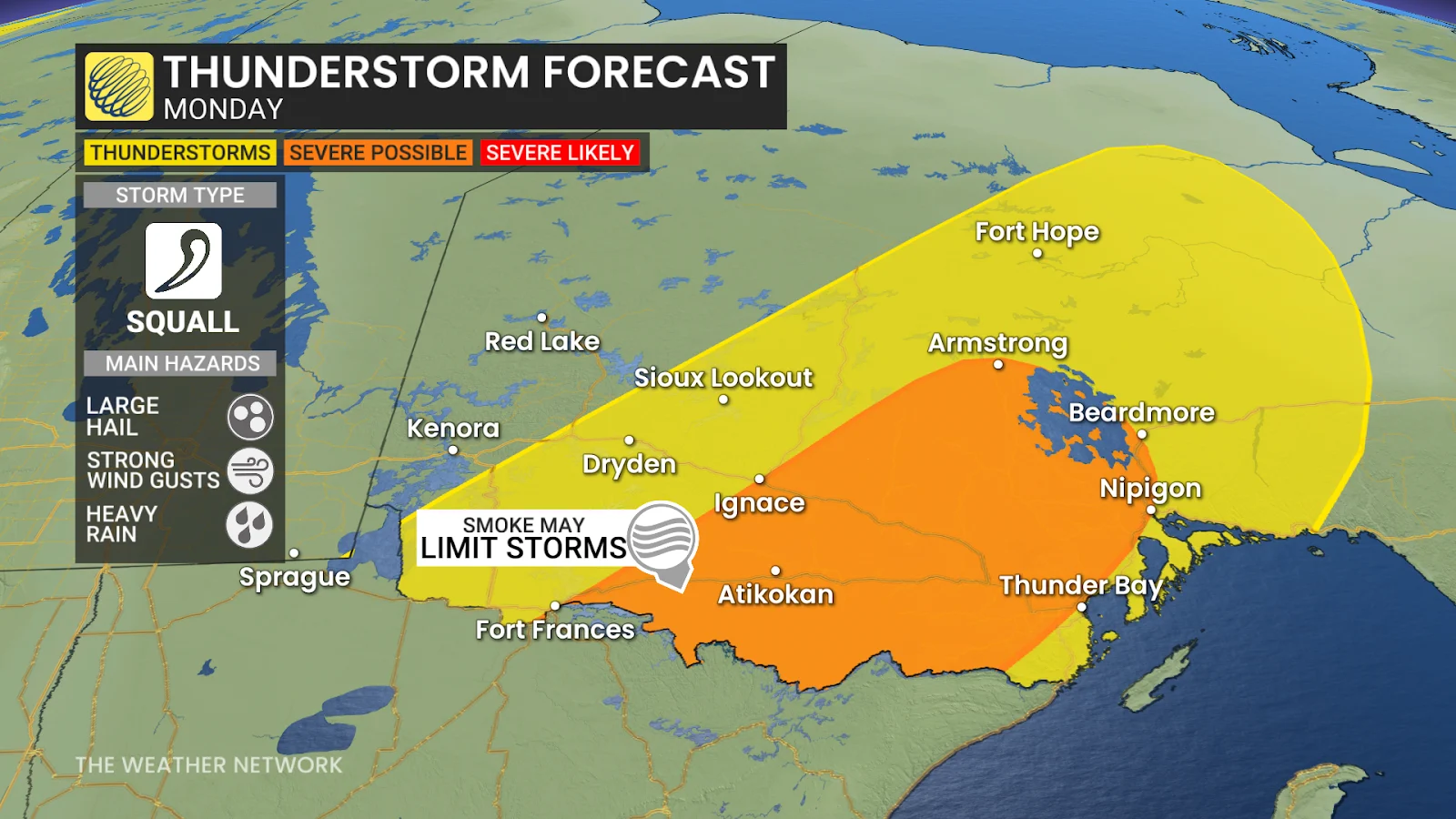
Dense pockets of wildfire smoke from nearby wildfires might actually act as a natural suppressant for some of the instability, though, potentially limiting the severity of active weather.
SEE ALSO: June can bring major heat waves, potent storms to Canada
While the presence of wildfire smoke does introduce some uncertainty by potentially dampening storm intensity, the cold front itself is a strong and clearly defined trigger. We could see temperatures plummet by over 10°C in just an hour or two on Monday evening as the front sweeps through.
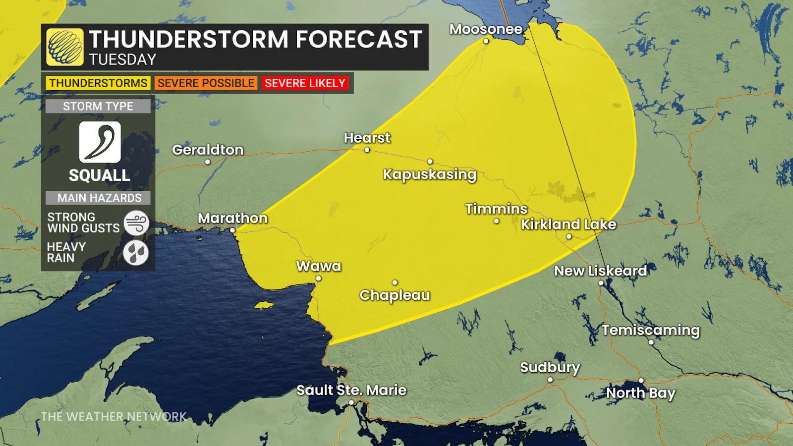
By Tuesday, the cold front will reach northeastern Ontario, where things will also be heating up toward the 30-degree mark, triggering showers and thunderstorms across the region. The main threat will be powerful wind gusts that could reach up to 80 km/h.
Wednesday, the storm risk shifts with the front into central Ontario. We could even see showers and thunderstorms spill into parts of southern Ontario as the region finally begins to creep out of its chilly rut.
Continue to follow The Weather Network for the latest weather updates across Ontario.