Storms possible Sunday as beneficial rains fall in Alberta
Prepare for widespread rain across southern Alberta heading into your Sunday
A risk for thunderstorms will continue into Sunday for portions of British Columbia and Alberta as an unsettled pattern lingers through this long weekend.
Expect widespread rainy conditions throughout the southern half of Alberta through Sunday, where the wet weather is welcome news after drought conditions have built into the region.
DON’T MISS: New blizzard warning kicks off Canada’s unofficial start to summer
Rain likely Sunday, a few storms possible
We’ll see widespread rain build into southern Alberta on Sunday, stretching as far north as the Calgary region.
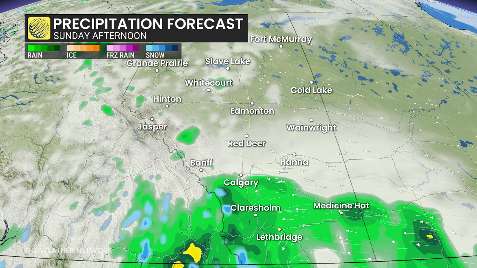
There’s still some uncertainty surrounding how far the northern extent of the rain will reach—persistent precipitation could stop just short of Calgary proper, which could lower rainfall amounts here.
Freezing levels between 2200 m and 2700 m will allow precipitation to fall in the form of snow above these elevations. How’s that for an unofficial kickoff to the summer season?
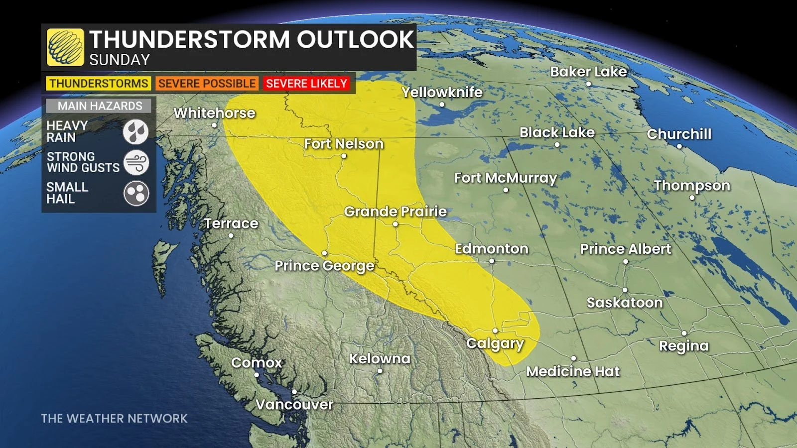
Isolated thunderstorms are possible on Sunday through the Elbow region into the Alberta foothills. Any of the stronger storms that bubble up could produce heavy rainfall, strong wind gusts, and small hail.
The heaviest rain will fall in southwestern Alberta, where some communities could see 20-30 mm as precipitation lingers into Monday morning. Forecasters expect around 10-20 mm of rain to fall in Calgary, but that’s dependent on the steady rain reaching the city.
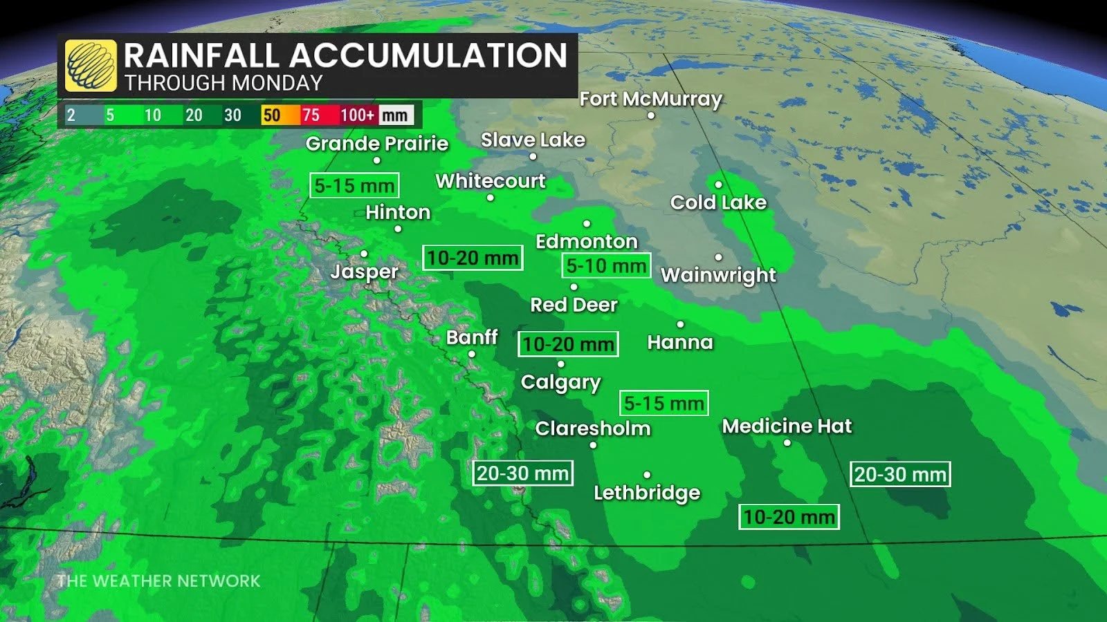
This rainfall is good news for drought-stricken portions of Alberta. The latest update of the Canadian Drought Monitor showed pockets of ‘severe’ to ‘extreme’ drought in the southwestern corner of the province—right where the steadiest rains are expected to fall this weekend.
Stay with The Weather Network for all the latest on conditions across Alberta.
Header image courtesy of Unsplash.