Storms and large hail to haunt Alberta going into Friday and move east Saturday
Large hail, strong winds and heavy rain are not the only risks this weekend for the Prairies
A severe storm risk will extend from southern to western Alberta on Friday, extending to other parts of the Prairies into Saturday.
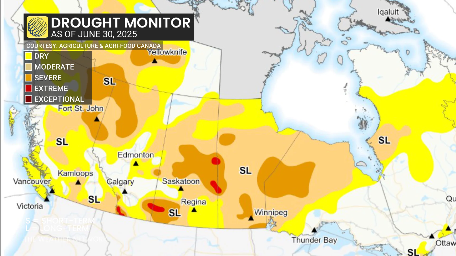
While the rainfall from the storms will be welcome in Saskatchewan, as parts of the province experience extreme drought during a dangerous wildfire season.
DON'T MISS: Wildfire spawned an intense fire-induced tornado, experts confirm.
Severe storms are possible for large parts of the province
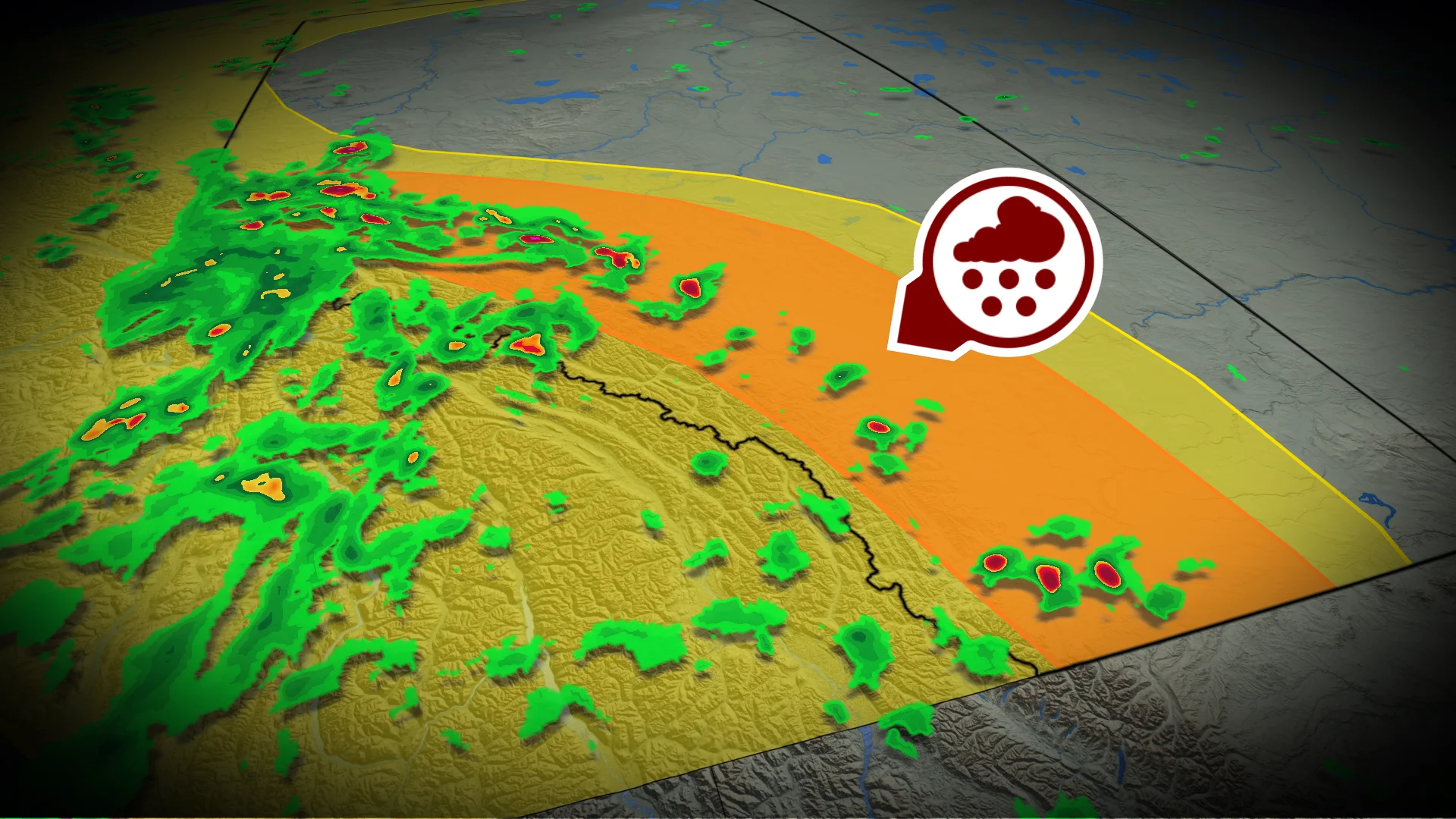
Heading into the late afternoon, an unstable air mass will trigger foothill hail-making thunderstorms across Alberta, which will track eastward through the evening.
RELATED: If you're camping, make sure you have a plan for severe weather
The current environment and these kinds of storms with mid-level rotation may create near 2 cm sized hail alongside heavy rain and strong winds. In these types of setups, it is also possible for a brief landspout tornado to form.
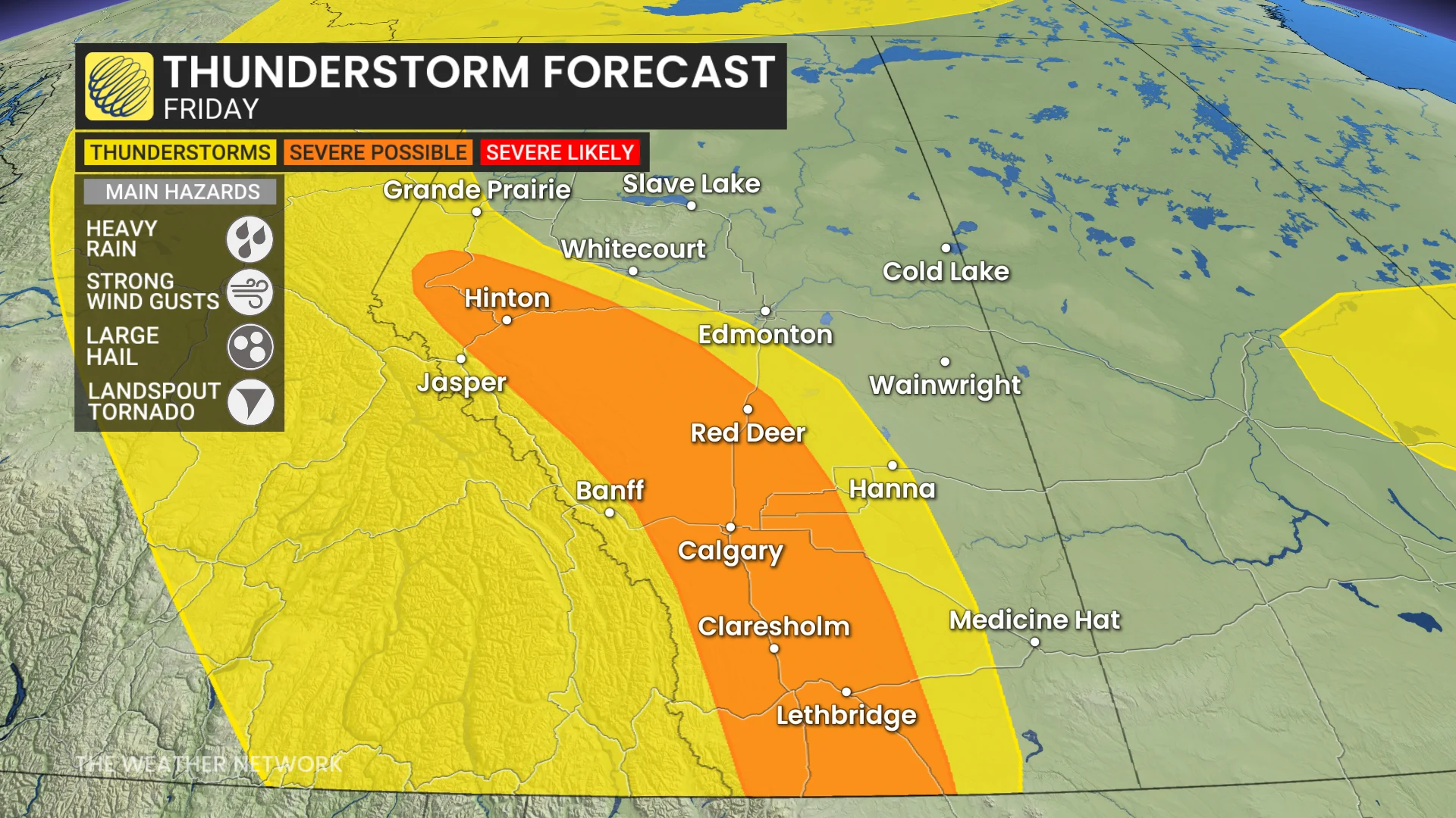
There is some uncertainty in exactly where the severe storms will trigger, as the threat remains widespread across the province, but the storms themselves are expected to be isolated.
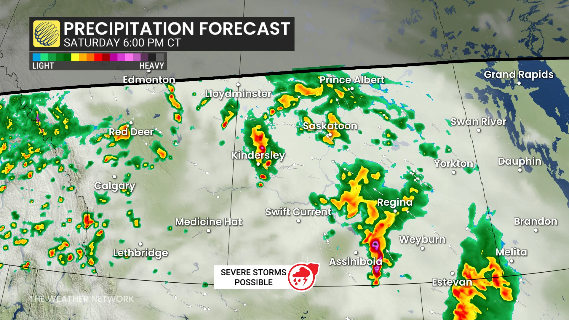
The developing low-pressure system is forecast to then bring steady rainfall and embedded thunder during the overnight through south and central Alberta. By Saturday morning, these showers will continue in Edmonton and track east into southwestern Saskatchewan.

The large coverage from the rainfall will come as the low-pressure system strengthens throughout the day.
READ MORE: Severe weather coming for southern Ontario and your Saturday night plans
We may see thunderstorms spread across the Prairies and into the northern territories, while the severe weather moves into southern Alberta and Saskatchewan.

By late Saturday afternoon, thunderstorm energy will peak and bring a severe weather risk to southern Saskatchewan, including Assiniboia, Regina, and the surrounding regions.
While an isolated severe storm is possible for the southern foothills, the highest threat will remain large hail, heavy rain, and strong winds of up to 90+ km/h.
Expect commuting impacts along the QE2 and the risk of strong winds and large hail to damage property, so please remain inside during thunderstorms if possible.
Forecasters are monitoring the risk of tornadoes forming, which currently remains uncertain, so stay with us for updates.