Storm risk threatens sluggish Monday commutes in southern Ontario
A stubborn, stalled low-pressure system will pester southern Ontario for a few more days
Conditions will remain gloomy and unsettled for the next couple of days as a blocking pattern in the upper-atmosphere forces a low-pressure system to spin near the Great Lakes for a little while longer.
A band of heavy rain in the morning, combined with a storm risk building by the evening, could throw a wrench into both of your commutes on Monday.
Keep a close eye on highway conditions and weather alerts in your area as you go through the day.
DON'T MISS: Blocking pattern to dictate Canada’s weather into next week
Heavy rain, storm risk builds Monday
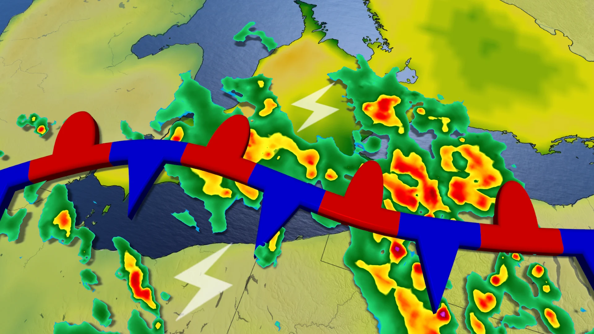
A cutoff low is a low-pressure system that stalls out because it’s severed from the jet stream. These systems are responsible for multiple days of gloomy weather—and the occasional strong to severe thunderstorm.
This is the setup we’ve got in place to start the week across southern Ontario as our cutoff low lingers around the Great Lakes.

We may start the Monday morning commute with a narrow band of heavy showers slicing across the Greater Toronto Area (GTA), likely slowing down traffic as you head out.
Your Monday evening commute isn’t looking much better—and it could even be worse, as more widespread showers and thunderstorms develop across Lake Erie and Lake Ontario.
Growing instability and ample moisture aloft will introduce the risk for thunderstorms from cottage country to the shores of Lake Erie and Lake Ontario. Given the dynamics at play, these storms could produce heavy rainfall and small hail, especially around Lake Erie.
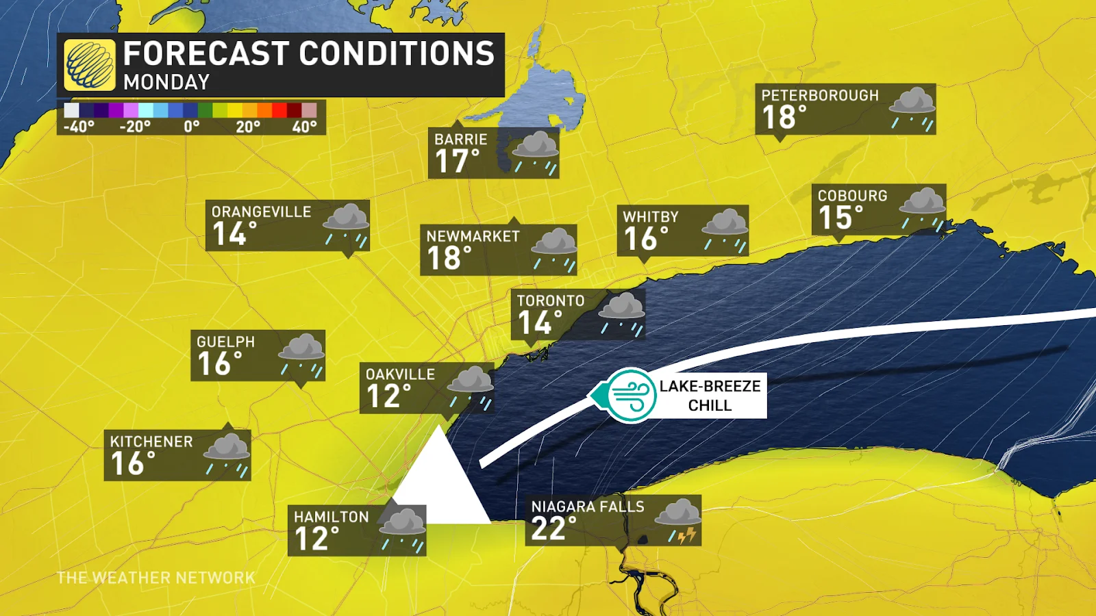
Temperatures will vary greatly depending on your proximity to the west end of Lake Ontario. A brisk easterly wind will lead to noticeably cooler temperatures along the western shores.
Tuesday looks to feature better conditions across the GTA and Niagara region, as the organized shower activity will persist across northeastern and eastern Ontario.
Rainfall totals throughout southern Ontario will vary significantly due to thunderstorm activity and showers forming into bands.
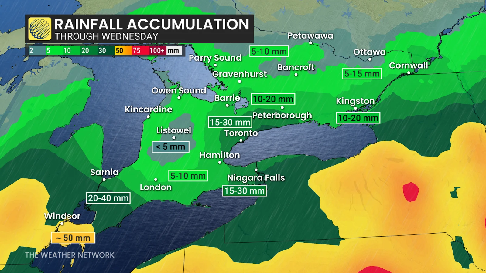
General totals of 10-20 mm are a good bet for most communities, with lower totals toward Lake Huron and amounts as high as 50 mm down toward Windsor.
Cherry blossoms are in peak bloom
Weather plays an important role in the cherry blossom season—both for the flowers themselves, and for folks hoping to see them in all their beauty.
Cherry blossoms in High Park are currently in peak bloom, which is similar to the 2022 cherry blossom season, which saw a peak bloom between May 5-12. This season’s bloom is nowhere near the latest on record, which saw a peak between May 12-21 back in 2014.
The earliest peak bloom on record occurred between April 10-17, 2012, thanks to record warmth early that spring.
Stay with The Weather Network for all the latest on conditions across Ontario.