
Storm risk looms over Sunday afternoon plans across Quebec
Stay alert for a risk for localized flooding in some of the heavier storms
The weekend looks to end on a stormy note for southern Quebec as a cold front slices across the region.
Plan your afternoon plans around the risk for storms, especially in the Eastern Townships. Thunderstorms repeatedly moving over the same areas could lead to a localized flooding risk, as well.
DON'T MISS: Surprising tornado deficit continues across Ontario, Quebec
Sunday storms develop in Quebec
Saturday’s active weather will follow a cold front east into southern Quebec on Sunday, sparking the risk for some afternoon thunderstorms.
Expect storms to develop by the late morning to early afternoon hours, continuing into the overnight hours for many areas.
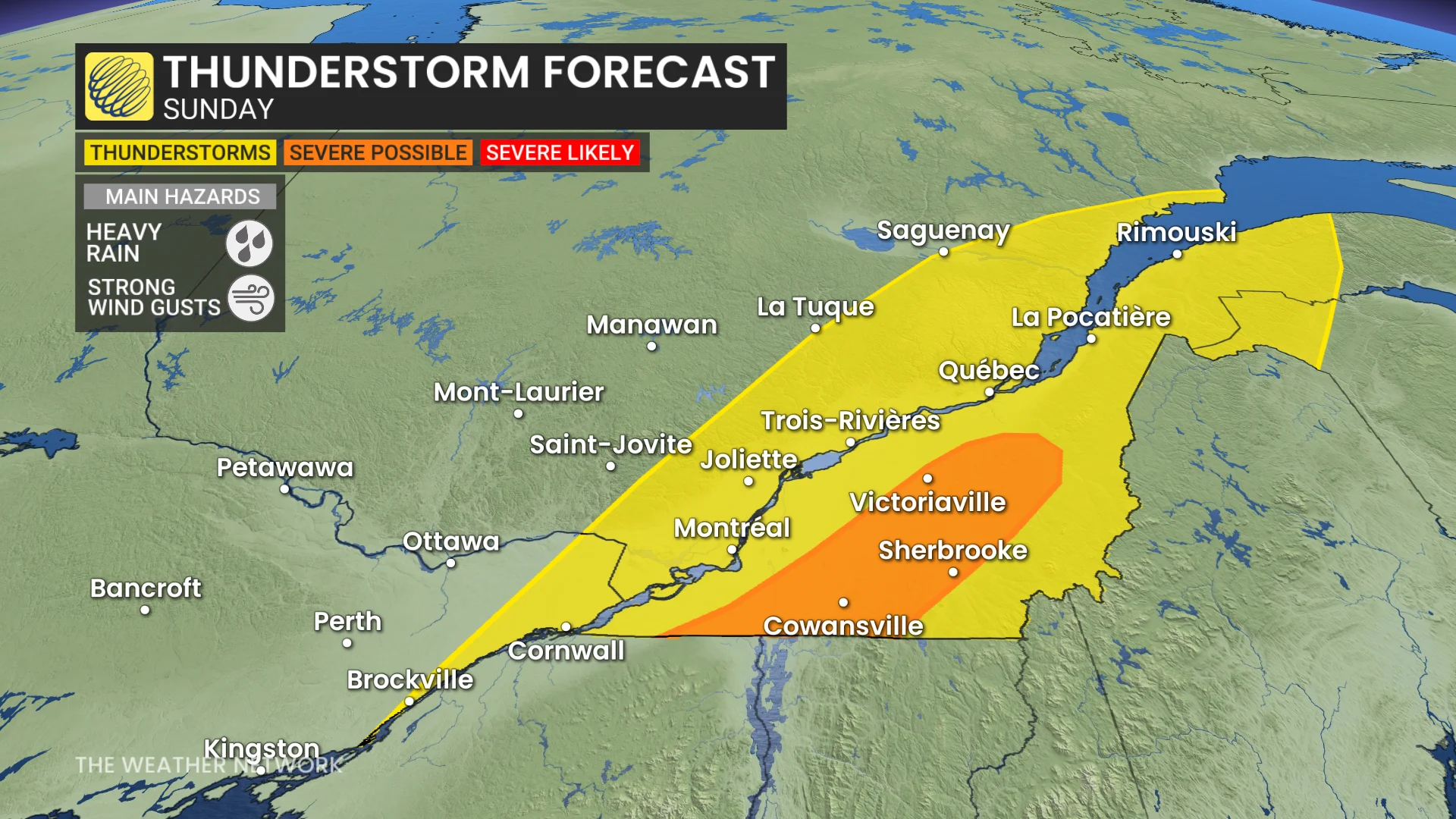
A few of the storms could reach severe limits in the Eastern Townships, including around Sherbrooke, Cowansville, and Victoriaville. The strongest storms may produce heavy rainfall and strong wind gusts.
Training thunderstorms—cells that move over the same locations one after the other—could lead to a risk for localized flooding in some areas. Never try to drive across a flooded roadway. It’s impossible to tell how deep the water is until it’s too late, and it only takes a small amount of water for a vehicle to lose traction.
Forecasters are tracking a fall-like airmass to arrive behind the cold front.
Stay with The Weather Network for all the latest on conditions across Quebec.