
Severe storms fire up in northwestern Ontario, prompting tornado warning
A severe thunderstorm capable of producing a tornado has been detected in northwestern Ontario. Residents in the affected regions should be in their shelters.
A tornado warning has been issued in northwestern Ontario as radar has indicated a severe thunderstorm is capable of producing a tornado, according to Environment and Climate Change Canada (ECCC). In addition to potentially producing a tornado and intense winds, large hail and locally intense rainfall are possible. See below for the details.
Current tornado warnings
Ear Falls - Perrault Falls - Western Lac Seul
7:33 PM CDT: Environment Canada meteorologists are tracking a severe thunderstorm that is possibly producing a tornado. Damaging winds, large hail and locally intense rainfall are also possible.
A severe thunderstorm capable of producing a tornado is located 10 kilometres southeast of Aerobus Lake, moving northeast at 35 km/h.
Hazard: Tornado and 90 km/h wind gusts.
Locations impacted include: Wabaskang Lake, Perrault Falls and Scout Lake.

Take cover immediately, if threatening weather approaches. If you hear a roaring sound or see a funnel cloud, swirling debris near the ground, flying debris, or any threatening weather approaching, take shelter immediately.
Go indoors to a room on the lowest floor, away from outside walls and windows, such as a basement, bathroom, stairwell or interior closet. Leave mobile homes, vehicles, tents, trailers and other temporary or free-standing shelter, and move to a strong building if you can. As a last resort, lie in a low spot and protect your head from flying debris.
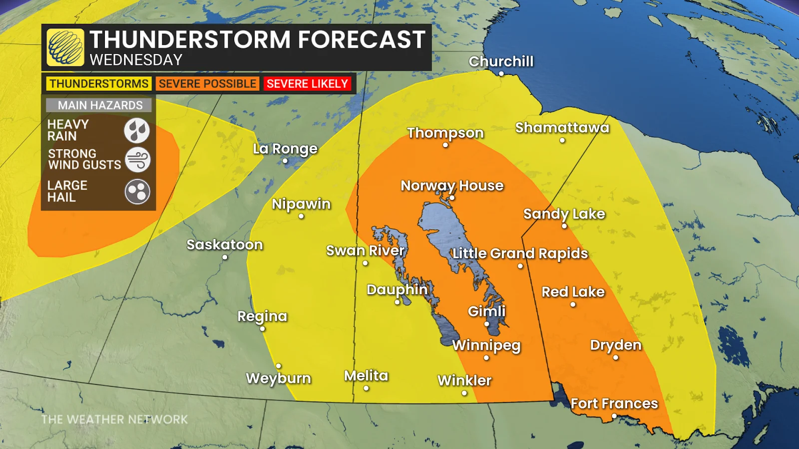
Wednesday: Rain and storms build across Manitoba
A low-pressure system swirling over Manitoba's Interlake region will likely dump heavy rain and bring thunderstorms Wednesday afternoon and evening.
Downpours, lightning and large hail are the main risks, with the majority of activity remaining north of Winnipeg until later in the day.
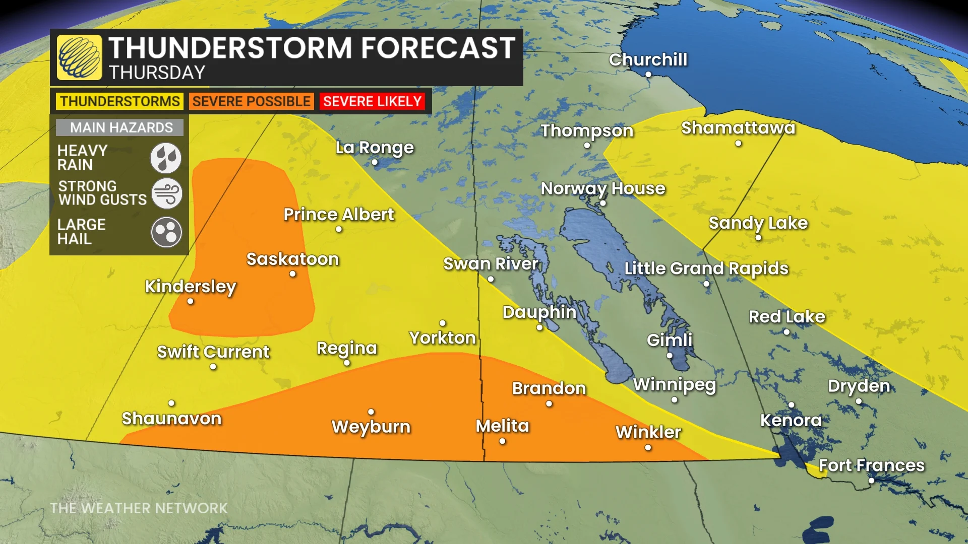
Thursday and Friday: Risk shifts west before expanding east
By Thursday, the threat has moved west into parts of Saskatchewan and southern Manitoba.
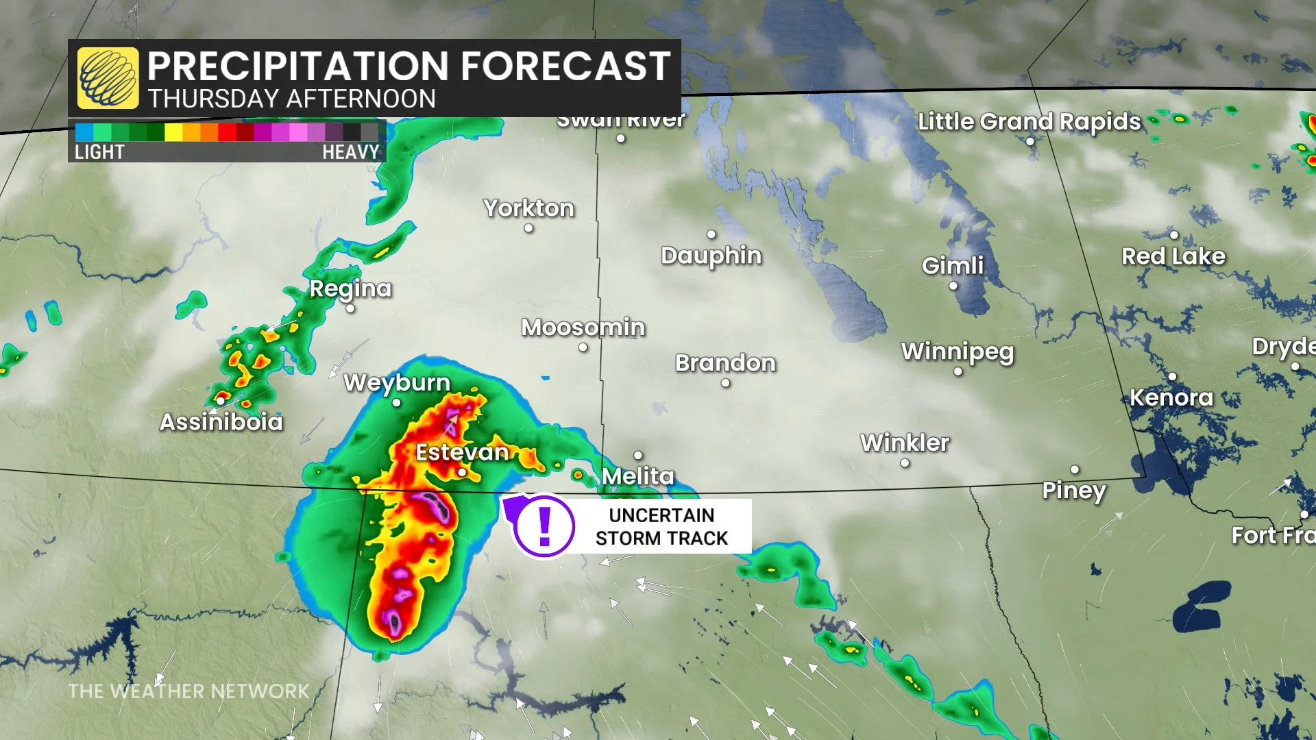
An active boundary that runs across the region could cause severe storms north and west of Saskatoon, Sask. Forecasters are also keeping an eye on the Canada-U.S border for a possible cluster of severe storms, but confidence remains low.
SEE ALSO: Are your tomatoes struggling to ripen? Blame the heat!
If it forms, the system could bring wind gusts approaching 100 km/h, large hail and the possibility of rotation.
Storm conditions are expected to worsen by Friday as a moisture-rich air mass moves in from the U.S. Northern Plains. Southern Manitoba and northwestern Ontario may be targeted for severe weather.
An incoming system will trigger thunderstorms stateside, tracking north of the border.

While the exact timing is uncertain, the environment appears to be ripe for widespread, severe thunderstorm development as a high amount of thunderstorm energy will build in by Friday afternoon.
Stay with The Weather Network for all the latest on conditions across the Prairies.
Thumbnail courtesy of Cindy Cairns, taken in Maryfield, Sask.